Earthquakes around the world

Strong earthquake in Philippines


M 7.0 - 13 km SE of Dolores, Philippines
2022-07-27 00:43:24 (UTC)
17.560°N 120.801°E
10.0 km depth
USGS earthquake alert
27 Jul, 2022

Published on Jul 27, 2022 (1:06)

Published on Jul 27, 2022 (5:32)
 
According to the research and experience of the SSGEOS (Solar System Geometry Survey) group, the past strong earthquake in the Philippines happened a bit early in the planetary alignment, so other large earthquakes should be expected.
Critical planetary geometry from 24 July to 1 August may result in major seismic activity. Most critical will be 29 July - 3 August when seismic activity may reach higher 7 to 8 magnitude after a convergence of critical geometry is followed by a high lunar peak.

 
EARTHQUAKE REPORT PAST 24HRS

Based on the averages of all earthquakes during the last 24 hours we had a very high seismic activity.
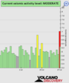
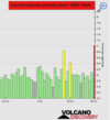
See Global seismic activity level chart

After 7.0 magnitude earthquake in the Philippines, 6 aftershocks were recorded in the region. The highest magnitude quake was 5.2

▪︎M 4.9 - 3 km NNW of San Ramon, Philippines
2022-07-27 01:29:06 (UTC)
17.441°N 120.689°E 10.0 km depth

▪︎M 4.7 - 6 km NNW of Bantay, Philippines
2022-07-27 02:50:57 (UTC)
17.491°N 120.725°E. 10.0 km depth

▪︎M 4.7 - 3 km SSW of Bantay, Philippines
2022-07-27 03:14:52 (UTC)
17.406°N 120.749°E. 10.0 km depth

▪︎M 4.9 - 14 km ESE of Dolores, Philippines
2022-07-27 03:28:40 (UTC)
17.584°N 120.826°E. 10.0 km depth

▪︎M 5.2 - 8 km E of Bantay, Philippines
2022-07-27 07:38:22 (UTC)
17.425°N 120.839°E. 10.0 km depth

▪︎M 5.1 - 103 km SE of Dicabisagan, Philippines
2022-07-27 09:04:20 (UTC)
16.402°N 123.088°E. 10.0 km depth

▪︎M 5.6 - 16 km ESE of Neiafu, Tonga
2022-07-27 09:36:51 (UTC)
18.728°S 173.852°W. 10.0 km depth

Two earthquakes within about an hour of each other hit the Fiji Islands. The larger quake was very deep (545.0 km depth)
▪︎M 5.7 - south of the Fiji Islands
2022-07-27 16:16:47 (UTC)
23.533°S 179.688°W
545.0 km depth

▪︎M 5.5 - south of the Fiji Islands
2022-07-27 17:29:20 (UTC)
26.938°S 176.416°W
10.0 km depth

▪︎Quakes in the past 24 hours:

~1 quake magnitude 7
~1 quake between magnitude 6 and 7
~8 quakes between magnitude 5 and 6
~39 quakes between magnitude 4 and 5
~139 quakes between magnitude 3 and 4
~282 quakes between magnitude 2 and 3
~467 quakes below magnitude 2 that people normally don't feel.
~937 quakes past 24 h. (813 earthquakes in the 24 hours prior to this report) Estimated combined seismic energy released: 2.2 x 10¹⁵ joules (610 gigawatt hours, equivalent to 5.2 x 10⁵ tons of TNT or 32.8 atomic bombs!)
Volcanodiscovery earthquake report 24h
 

Attachments

  • chrome_screenshot_1658960271083.png
    chrome_screenshot_1658960271083.png
    306.1 KB · Views: 0

Two strong earthquakes have hit northern Chile

M 6.2 - 52 km ENE of Calama, Chile
2022-07-27 18:58:57 (UTC)
22.196°S 68.498°W
96.8 km depth

M 6.1 - 30 km WNW of Tocopilla, Chile
2022-07-28 04:15:03 (UTC)
21.981°S 70.468°W
44.5 km depth


Strong earthquake hits Nicaragua

M 5.2 - 45 km SW of Jiquilillo, Nicaragua
2022-07-28 09:23:16 (UTC)
12.411°N 87.692°W
58.0 km depth
USGS earthquake alert
 
EARTHQUAKE REPORT PAST 24HRS

Based on the averages of all earthquakes during the last 24 hours we had a moderate seismic activity. See Global seismic activity level chart

▪︎Strong earthquake M 5.8 - 22 km NNE of Bulolo, Papua New Guinea
2022-07-28 18:28:22 (UTC)
7.033°S 146.744°E
10.0 km depth
USGS earthquake alert

▪︎M 5.4 - Izu Islands, Japan region
2022-07-28 19:52:27 (UTC)
32.482°N 142.471°E
10.0 km depth
USGS earthquake alert

Quakes in the past 24 hours:

~1 quake above magnitude 6
~3 quakes between magnitude 5 and 6
~35 quakes between magnitude 4 and 5
~120 quakes between magnitude 3 and 4
~350 quakes between magnitude 2 and 3
~514 quakes below magnitude 2 that people normally don't feel.
~1023 quakes past 24 h. (937 earthquakes in the 24 hours prior to this report) Estimated combined seismic energy released: 1.4 x 10¹⁴ joules (40.2 gigawatt hours, equivalent to 34554 tons of TNT or 2.2 atomic bombs!)

Volcanodiscovery earthquake report 24h
 

Attachments

  • chrome_screenshot_1659049382144.png
    chrome_screenshot_1659049382144.png
    310.4 KB · Views: 2
EARTHQUAKE REPORT PAST 24HRS

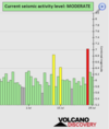
Based on the averages of all earthquakes during the last 24 hours we had a moderate seismic activity.
See Global seismic activity level chart

Strong earthquakes have hit Russia region

▪︎M 5.6 - 13 km E of Mugur-Aksy, Russia
2022-07-29 13:01:13 (UTC)
50.396°N 90.623°E
10.0 km depth
USGS earthquake alert

▪︎M 5.2 - 170 km SE of Kuril’sk, Russia
2022-07-29 16:39:16 (UTC)
44.028°N 149.220°E
10.0 km depth
USGS earthquake alert

▪︎M 5.6 - 260 km SE of Vilyuchinsk, Russia
2022-07-29 23:05:43 (UTC)
51.193°N 160.956°E
10.0 km depth
USGS earthquake alert

Earthquake swarm hit Izu Japan region the strongest M5+

▪︎M 5.3 - Izu Islands, Japan region
2022-07-29 18:00:57 (UTC)
32.464°N 142.304°E
11.4 km depth
USGS earthquake alert

▪︎M 5.2 - Izu Islands, Japan region
2022-07-29 19:49:33 (UTC)
32.550°N 142.329°E
10.0 km depth
USGS earthquake alert

M 4.4 - Izu Islands, Japan region
2022-07-29 18:11:28 (UTC)
32.631°N 142.435°E. 10.0 km depth

M 4.6 - Izu Islands, Japan region
2022-07-29 18:16:33 (UTC)
32.514°N 142.495°E. 10.0 km depth

M 4.3 - Izu Islands, Japan region
2022-07-29 18:21:13 (UTC)
32.503°N 142.308°E. 10.0 km depth

M 4.3 - Izu Islands, Japan region
2022-07-29 19:22:37 (UTC)
32.501°N 142.691°E. 10.0 km depth

M 4.3 - Izu Islands, Japan region
2022-07-29 20:19:03 (UTC)
32.755°N 142.514°E. 10.0 km depth

M 4.7 - Izu Islands, Japan region
2022-07-29 20:42:27 (UTC)
32.562°N 142.414°E. 10.0 km depth

▪︎M 4.8 - 299 km SSE of Katsuura, Japan
2022-07-29 21:17:25 (UTC)
32.828°N 141.979°E. 10.0 km depth

Quakes in the past 24 hours:

~9 quakes above magnitude 5
~39 quakes between magnitude 4 and 5
~129 quakes between magnitude 3 and 4
~306 quakes between magnitude 2 and 3
~449 quakes below magnitude 2 that people normally don't feel.
~ 932 quakes past 24 h. (1023 earthquakes in the 24 hours prior to this report) Estimated combined seismic energy released: 8.3 x 10¹³ joules (23 gigawatt hours, equivalent to 19754 tons of TNT or 1.2 atomic bombs!)

Volcanodiscovery earthquake report 24h
 

Attachments

  • chrome_screenshot_1659140204954.png
    chrome_screenshot_1659140204954.png
    310.7 KB · Views: 0
EARTHQUAKE REPORT PAST 24HRS

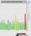
Based on the averages of all earthquakes during the last 24 hours we had a low seismic activity. See Global seismic activity level chart

Strongest quake M 4.9 - 261 km SE of Vilyuchinsk, Russia 2022-07-30 00:05:26 (UTC) 51.178°N 160.950°E. 10.0 km depth
USGS earthquake alert

▪︎Earthquake Forecast

▪︎Quakes in the past 24 hours:

Note: Volcano discovery reports a M5.4 earthquake in Colombia, however, there is no other means to verify that this was the case, USGS does not report it.

Strong mag. 5.4 earthquake - 84 km southwest of Obando, Inirida, Departamento del Guainia, Colombia, on Saturday, Jul 30, 2022 at 8:31 am (GMT -5) - 11 hours ago
Volcanodiscovery earthquake report

~43 quakes between magnitude 4 and 5
~135 quakes between magnitude 3 and 4
~436 quakes between magnitude 2 and 3
~1131 quakes below magnitude 2 that people normally don't feel.
~1745 quakes past 24 h. (932 earthquakes in the 24 hours prior to this report) Estimated combined seismic energy released: 2.1 x 10¹³ joules (5.92 gigawatt hours, equivalent to 5092 tons of TNT or 0.3 atomic bombs!)
Volcanodiscovery earthquake report 24h
 

Attachments

  • chrome_screenshot_1659224620101.png
    chrome_screenshot_1659224620101.png
    282.7 KB · Views: 0
Campi Flegrei / Phlegraean Fields, Pozzuoli - Napoli, Italy
30 July 2022

Bild_2022-07-30_091840690.jpg

Campi Flegrei with earthquake Md 2.7

A magnitude 2.7 earthquake occurred at night beneath the Italian caldera volcano Campi Flegrei (Phlegraean Fields), with a hypocentre at a depth of 2.2 km. The epicentre was located on the eastern edge of the Solfatara. The quake can be classified as the strongest earthquake of a small swarm quake, as there have been a total of 11 earthquakes since yesterday.

Last week's bulletin confirmed that the ground uplift has decelerated. Previously it was 13 mm per month. The new value could not be determined yet. During the observation period 18-24.07.22, 30 weak earth tremors were recorded. Fumarole temperatures remained stable at 95 degrees.


END OF ARTICLE
 
Last week saw no earthquakes reaching M6.0.
In the usual area, there were 1 out of 75 earthquakes worldwide equal to or greater than 4.5 and 1365 out of 1755 quakes of all sizes.
Percentage: 77.8%
Last week saw 1 M7.0 in the Philippines and 2 low M6, both in Chile.
In the usual area, there was 1 out of 103 earthquakes worldwide equal to or greater than 4.5 and 1334 out of 1689 quakes of all sizes.
Percentage: 79.0%
Earthquakes 7 days to July 31st  2022.gif
 
EARTHQUAKE REPORT PAST 24HRS

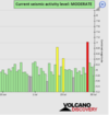
Based on the averages of all earthquakes during the last 24 hours we had a moderate seismic activity.
See Global seismic activity level chart

It should be noted that in the past 48 hours the Earth seems to be vibrating. 2848 earthquakes below Magnitude 2 have occurred around the world.

Earthquake swarm hit Izu Japan region again. Two M5+ earthquakes

M 4.5 - Izu Islands, Japan region
2022-07-31 07:30:51 (UTC)
32.675°N 142.431°E. 10.0 km depth

M 4.7 - Izu Islands, Japan region
2022-07-31 14:43:58 (UTC)
32.576°N 142.490°E. 10.0 km depth

M 4.5 - Izu Islands, Japan region
2022-07-31 15:24:12 (UTC)
32.531°N 142.444°E. 10.0 km depth

M 4.6 - Izu Islands, Japan region
2022-07-31 15:40:16 (UTC)
32.508°N 142.333°E. 10.0 km depth

M 4.4 - Izu Islands, Japan region
2022-07-31 16:07:54 (UTC)
32.788°N 142.435°E. 10.0 km depth

▪︎M 5.4 - Izu Islands, Japan region
2022-07-31 18:48:29 (UTC)
32.619°N 142.453°E. 10.0 km depth
USGS earthquake alert

▪︎M 5.4 - Izu Islands, Japan region
2022-07-31 18:50:13 (UTC)
32.547°N 142.498°E. 10.0 km depth
USGS earthquake alert

▪︎M 5.2 - 10 km SE of San Ramon, Philippines
2022-07-31 18:48:11 (UTC)
17.334°N 120.767°E. 10.0 km depth
USGS earthquake alert

▪︎M 5.4 - 1 km SE of Vogar, Iceland
2022-07-31 17:48:00 (UTC)
63.970°N 22.353°W. 10.0 km depth
USGS earthquake alert


▪︎Quakes in the past 24 hours:

~12 quakes above magnitude 5
~43 quakes between magnitude 4 and 5
~151 quakes between magnitude 3 and 4
~431 quakes between magnitude 2 and 3
~1717 quakes below magnitude 2 that people normally don't feel.
~2364 quakes past 24 h. (1745 earthquakes in the 24 hours prior to this report) Estimated combined seismic energy released: 8.9 x 10¹³ joules (24.6 gigawatt hours, equivalent to 21198 tons of TNT or 1.3 atomic bombs!)
Volcanodiscovery earthquake report 24h
 

Attachments

  • chrome_screenshot_1659310624329.png
    chrome_screenshot_1659310624329.png
    324.9 KB · Views: 0
More info behind the (M 4.7) Iceland earthquake

Vulkane.net wrote more about the Icelandic earthquake under the Reykjanes peninsula, as follow. Notice that it has been downgraded from M 5.4 to 4.7, while in this article from M 5.0 down to M 4.7, other media reported originally M 5.5


Earthquake M 4.7 on Iceland under Reykjanes
31 July 2022 by Marc Szeglat

220731_1805.jpg


Tonight there was an earthquake M 5.0 under the Icelandic Reykjanes Peninsula.

The hypocentre was located at a depth of only 300 m. The epicentre was located 3.1 km south of the Keilir volcano. The data are still very fresh and could still be corrected. Some media reports state that the magnitude was 5.5. If the low drift is correct, then cracks could have formed on the surface. Damage to infrastructure is also possible. The earthquake was clearly felt in the wider area.

The earthquake occurred in the course of the strong earthquake swarm that originated in the north of the Fagradalsfjall volcano and has since spread to the neighbouring fault systems. A magma intrusion is probably taking place under Fagradalsfjall. This changes the stress field of the region and faults are activated. In total, more than 2200 quakes were detected by 20:00.

Update: Crazy, even while I was writing the lines above, the data was corrected. The magnitude is now 4.7. The earthquake focus is at a depth of 1.1 km. The epicentre was 5.2 km west of Straumsvík, a town on the north coast of Reykjane. In addition, other green stars appeared at different locations. Two are in central Iceland, another star is near Katla. The quake there brought it to M 4.4. Possibly the automatic system is overstrained. I will keep you informed about the developments.


END OF ARTICLE


Edit:

The below chart is from an earlier article, before the M 4.7 quake - illustrating the onset of a swarm earthquake in the aforementioned area in SW Iceland during the past 24 hours, where over night 1460 earthquakes took place.

Bild_2022-07-31_100744891.jpg
 
Last edited:

Trending content

Back
Top Bottom