Earthquakes around the world

Last week saw 1 M7.0 in Vanuatu and 2 M6, both in Taiwan, being a M6.9 and a M6.5.
In the usual area, there was 1 out of 110 earthquakes worldwide equal to or greater than 4.5 and 1506 out of 1912 quakes of all sizes.
Percentage: 78.8%
Last week saw 4 M6 and again 1 M7, being a M7.6 in Mexico. One of the M6 was a M6.8 also in Mexico.
In the usual area, there were 4 out of 115 earthquakes worldwide equal to or greater than 4.5 and 1784 out of 2329 quakes of all sizes.
Percentage: 76.6%
Earthquakes 7 days to September 25th 2022.gif
 
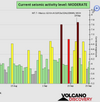
WORLDWIDE EARTHQUAKE REPORT SEPTEMBER 25

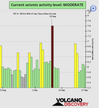
Based on the averages of all earthquakes during the last hours we had a MODERATE seismic activity level.
chrome_screenshot_1664148477702.png
Global seismic activity level chart

~3 quakes above magnitude 5
~42 quakes between magnitude 4 and 5
~78 quakes between magnitude 3 and 4
~198 quakes between magnitude 2 and 3
~382 quakes below magnitude 2 that people normally don't feel.
~703 quakes past 24 h. (798 earthquakes in the 24 hours prior to this report) Estimated combined seismic energy released: 3 x 10¹³ joules (8.33 gigawatt hours, equivalent to 7164 tons of TNT or 0.4 atomic bombs!)
Volcanodiscovery earthquake report 24h

▪︎M 5.0 - 59 km NNE of Bandar Abbas, Iran
2022-09-25 15:25:13 (UTC)
27.704°N 56.459°E. 10.0 km depth
USGS earthquake alert

▪︎M 5.1 - 138 km SSE of Sarangani, Philippines
2022-09-25 11:16:31 (UTC)
4.330°N 126.108°E. 134.9 km depth
USGS earthquake alert

Strong mag. 5.1 earthquake - Caribbean Sea, Honduras, 28 km northeast of Puerto Barrios, Guatemala, on Sunday, Sep 25, Estimated energy release 2.8 x 10¹² joules (783 megawatt hours, equivalent to 674 tons of TNT)

Data for the same earthquake reported by different agencies​

Info: The more agencies report about the same quake and post similar data, the more confidence you can have in the data. It takes normally up to a few hours until earthquake parameters are calculated with near-optimum precision.
Mag.DepthLocationSource
5.110 kmGuatemala: 22 Km NNW of Potrerillos, HondurasUSGS
5.143 kmGUATEMALAEMSC
5.110 kmGuatemala: HondurasRaspberryShake
5.72 km4 Km Al Sur De Puerto Barrios, GuatemalaINETER
4.610 kmNear Villanueva, Cortés, HondurasGFZ
5.110 kmGuatemala: HondurasIRIS
5.010 kmGuatemala: HondurasGeoAu

A magnitude-5.1 offshore earthquake occurred in the Gulf of Honduras, near the Guatemala-Honduras border, at around 15:30 CST Sept. 25. The epicenter was about 22 km (13 miles) north-northwest of Potrerillos, Honduras. The tremor occurred at a depth of about 10 km (6 miles), and light shaking was probably felt in parts of the Guatemala-Honduras border region and Belize. There have been no initial reports of damage or casualties as a result of the earthquake; significant damage is unlikely. It could take several hours until authorities can conduct comprehensive damage assessments, especially in remote areas. Aftershocks are likely over the coming days. The event has not prompted any tsunami advisories.

Officials may temporarily shut down transportation infrastructure in the tremor zone to check for damage. Minor disruptions could occur during shutdowns, but service will likely resume quickly if no damage is found. Utility outages are possible in areas where shaking occurred.
 
Saw this shared by dutchsinse on YT regarding the 7.6 earthquake in Mexico triggering a “desert tsunami” in an area of Death Valley:

Mexico earthquake triggers ‘desert tsunami’ 1,500 miles away in Death Valley cave​


About five minutes after the 7.6 magnitude earthquake hit near Mexico’s southwest coast Monday, typically calm water deep in a Death Valley National Park cave started sloshing against the surrounding limestone rock.

The reverberations from the earthquake more than 1,500 miles away created what experts have called a “desert tsunami,” which on Monday made waves erupt up to 4 feet high in the cave known as Devils Hole, a pool of water about 10 feet wide, 70 feet long and more than 500 feet deep, in Amargosa Valley, Nev.

The water in the partially filled cave has become an “unusual indicator of seismic activity” across the world, with earthquakes across the globe — as far as Japan, Indonesia and Chile — causing the water to splash up Devils Hole, according to the National Park Service website.

Video of the event on YT:

 
Earthquake swarm in Reykjanes Ridge on September 26. So far 12 earthquakes, the largest of magnitude 5.7

M 4.5 - Reykjanes Ridge 06:58:24 (UTC)
54.048°N 35.199°W. 10.0 km depth

M 4.9 - Reykjanes Ridge 07:41:00 (UTC) 54.096°N 35.118°W. 10.0 km depth

M 5.7 - Reykjanes Ridge 09:59:56 (UTC) 54.005°N 35.236°W. 10.0 km depth

M 4.8 - Reykjanes Ridge 10:06:54 (UTC) 54.052°N 35.243°W. 10.0 km depth

M 4.7 - Reykjanes Ridge 14:01:24 (UTC) 54.029°N 35.396°W. 10.0 km depth

M 4.7 - Reykjanes Ridge 14:07:10 (UTC) 54.246°N 35.095°W. 10.0 km depth

M 4.6 - Reykjanes Ridge 14:49:19 (UTC)
54.075°N 35.271°W. 10.0 km depth

M 4.7 - Reykjanes Ridge 14:54:51 (UTC)
54.053°N 34.874°W. 10.0 km depth

M 4.8 - Reykjanes Ridge 14:59:51 (UTC)
54.023°N 35.010°W. 10.0 km depth

M 4.8 - Reykjanes Ridge 15:18:47 (UTC) 53.769°N 35.007°W. 10.0 km depth

M 4.7 - Reykjanes Ridge15:45:12 (UTC) 53.958°N 35.244°W. 10.0 km depth

M 4.9 - Reykjanes Ridge 17:16:05 (UTC) 53.865°N 35.177°W. 10.0 km depth

 
WORLDWIDE EARTHQUAKE REPORT SEPTEMBER 26

Based on the averages of all earthquakes during the last hours we had a MODERATE seismic activity level. Global seismic activity level chart

~5 quakes above magnitude 5
~48 quakes between magnitude 4 and 5
~88 quakes between magnitude 3 and 4
~206 quakes between magnitude 2 and 3
~490 quakes below magnitude 2 that people normally don't feel.
~837 quakes past 24 h. (703 earthquakes in the 24 hours prior to this report) Estimated combined seismic energy released: 7.4 x 10¹³ joules (20.4 gigawatt hours, equivalent to 17569 tons of TNT or 1.1 atomic bombs!)
Volcanodiscovery earthquake report 24h

Strongest earthquake mag. 5.7 - Reykjanes Ridge. North Atlantic Ocean on Monday, Sep 26. Earthquake swarm continues. As of 23:05 UTC on September 26, 20 earthquakes had been recorded (so far, two large earthquakes: M5.7 and M5.3)

M 4.9 - Reykjanes Ridge 18:14:39 (UTC)
53.881°N 35.484°W. 10.0 km depth

M 4.8 - Reykjanes Ridge 18:21:57 (UTC)
53.962°N 35.251°W. 10.0 km depth

M 4.6 - Reykjanes Ridge 18:36:18 (UTC)
54.048°N 35.160°W. 10.0 km depth

M 4.7 - Reykjanes Ridge.19:32:17 (UTC)
53.869°N 35.240°W. 10.0 km depth

M 4.9 - Reykjanes Ridge 19:39:47 (UTC)
54.014°N 35.225°W. 10.0 km depth

M 5.3 - Reykjanes Ridge 20:30:16 (UTC)
53.865°N 35.265°W. 8.1 km depth

M 4.7 - Reykjanes Ridge 22:44:01 (UTC)
53.936°N 35.212°W. 10.0 km depth

M 4.7 - Reykjanes Ridge 23:05:45 (UTC)
53.923°N 35.078°W. 10.0 km depth

Is coming a strong earthquake in Reykjanes Ridge.? According to SSGEOS " Possibly, but not necessarily at that location. It could also be in adjacent regions."

▪︎M 5.5 - 112 km ENE of Luganville, Vanuatu
2022-09-26 13:58:02 (UTC) 15.234°S 168.164°E. 32.0 km depth
USGS earthquake alert

▪︎M 5.1 - 111 km W of Panguna, Papua New Guinea. 2022-09-26 21:11:32 (UTC)
6.493°S 154.494°E. 64.3 km depth
USGS earthquake alert

▪︎M 5.2 - Rat Islands, Aleutian Islands, Alaska. 2022-09-26 11:39:18 (UTC)
51.510°N 178.418°E. 76.9 km depth
USGS earthquake alert

▪︎M 4.5 - Carlsberg Ridge
2022-09-25 23:25:37 (UTC)
4.550°N 62.608°E. 10.0 km depth
USGS earthquake alert

When I saw this earthquake I started to compile data because there is a geologist in Mexico who assures that Mexico is the antipode of Carlsberg Ridge, then he foresees an earthquake of great magnitude, greater than 6 degrees in fact, between September and October of this year.

▪︎Carlsberg Ridge (between the horn of Africa and India) recorded three M4 earthquakes (4.7, 4.6 and 4.8) on August 28.
On August 30 the precursors began at 00:47 with a 4.7 magnitude earthquake and followed: M4.7 at 05:28:06 UTC, M4.8 at 05:35:58 UTC, M4.9 at 08:36:11 UTC and the M5.3 at 13:58:20 UTC

Twenty days after the 5.3 earthquake at Carlsberg Ridge, the M7.6 earthquake occurred in Mexico. Now On September 25 at 23:25:37 UTC another earthquake was recorded at Carlsberg Ridge:

The mexican geologist mentions that the antipode for Mexico is along the divide between the African plate and the Indian plate in the Indian Ocean
-1537725483.jpg
Hopefully there will not be another major earthquake in Mexico.

▪︎ Earthquake Forecast


Attachments

  • chrome_screenshot_1664236617447.png
    chrome_screenshot_1664236617447.png
    378.9 KB · Views: 0
On September 27th earthquake swarm continues in Reykjanes Ridge (USGS data)

M4.6 at 03:05:34 (UTC)
M4.6 at 04:34:29 (UTC)
M4.6 at 05:26:48 (UTC)
M4.6 at 06:01:16 (UTC)
M4.6 at 06:10:40 (UTC)
M4.5 at 06:45:07 (UTC)
M4.7 at 07:19:45 (UTC)
M4.5 at 08:13:58 (UTC)
M4.8 at 08:47:39 (UTC)
M4.6 at 10:34:57 (UTC)
M4.7 at 10:59:20 (UTC)
M4.9 at 11:59:49 (UTC)
M4.8 at 13:07:35 (UTC)
M4.8 at 13:21:36 (UTC)
M4.8 at 13:46:49 (UTC)

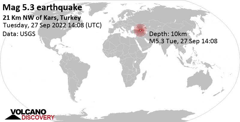
▪︎M 5.3 - 21 km WSW of Susuz, Turkey
2022-09-27 14:08:32 (UTC)
40.718°N 42.889°E. 10.0 km depth
USGS earthquake alert

Tuesday, September 27th, 2022, at 5:08 pm local time at a very shallow depth of 2 km. Shallow earthquakes are felt more strongly than deeper ones as they are closer to the surface. It might have caused light to moderate damage.

Moderate shaking probably occurred in Göle (pop. 11,900) located 15 km from the epicenter. In Kars (pop. 77,500) located 31 km from the epicenter, Ardahan (pop. 21,000) 40 km away, and Sarıkamış (pop. 23,700) 50 km away, the quake should have been felt as light shaking. Weak shaking might have been felt in Oltu (pop. 23,500) located 71 km from the epicenter, and Kağızman (pop. 25,200) 72 km away.

Estimated energy: 5.6 x 10¹² joules (1.56 gigawatt hours, equivalent to 1344 tons of TNT)

 
WORLDWIDE EARTHQUAKE REPORT SEPTEMBER 26

Based on the averages of all earthquakes during the last hours we had a MODERATE seismic activity level. Global seismic activity level chart

~3 quakes above magnitude 5
~63 quakes between magnitude 4 and 5
~88 quakes between magnitude 3 and 4
~261 quakes between magnitude 2 and 3
~496 quakes below magnitude 2 that people normally don't feel.
~911 quakes past 24 h. (837 earthquakes in the 24 hours prior to this report) Estimated combined seismic energy released: 3.6 x 10¹³ joules (9.95 gigawatt hours, equivalent to 8564 tons of TNT or 0.5 atomic bombs!)
Volcanodiscovery earthquake report 24h

New period of earthquakes in Reykjanes Ridge.

M4.6 at 15:55:52 (UTC)
M4.7 at 19:04:48 (UTC)
M4.6 at 19:39:29 (UTC)
M4.8 at 19:53:44 (UTC)
M4.8 at 21:09:53 (UTC)
M4.9 at 21:18:19 (UTC)
M4.6 at 22:28:52 (UTC)

As of 11:26 UTC on September 27th, 22 earthquakes have been recorded. The most recent and highest magnitude event was of 4.9

▪︎M 5.0 - northern Mid-Atlantic Ridge
2022-09-27 15:12:40 (UTC)
12.153°N 43.798°W. 10.0 km depth
USGS earthquake alert

▪︎M 4.7 - southern Mid-Atlantic Ridge
2022-09-27 16:45:15 (UTC)
20.501°S 11.684°W. 10.0 km depth
USGS earthquake alert

Energy flows to the southern hemisphere.

chrome_screenshot_1664318208669.png
View attachment main-qimg-6ae646ec53fbeab730c1bfab78e28c53.webp
As the map shows, the Atlantic Ocean principally lies across 4 plates that are moving apart.
 

Attachments

  • chrome_screenshot_1664319927097.png
    chrome_screenshot_1664319927097.png
    364.7 KB · Views: 1
The sabotage that triggered an earthquake


Weak mag. 2.2 earthquake - Baltic Sea, 61 km south of Karlskrona, Blekinge, Sweden, on Monday, Sep 26, 2022 at 7:03 pm (GMT +2) - 1 day 9 hours ago

A major gas leak appeared yesterday from 3 separate breaches of the Nord Stream 1 and 2 pipelines, which until the summer had been used to deliver gas from Russia to Central Europe, mainly Germany, before being shut down.

Given the scale of the event and the appearance of several leaks at the same time authorities assume it is the result of sabotage without so far being able to pinpoint further details.

Interestingly, a small quake was detected at about the same time last evening by the Norwegian NORSAR agency. It is unclear whether there is a connection of not, but if a violent hit or detonation at the pipeline is indeed the cause, it might very well have left the seismic signal attached, which is dominated by a short lateral (horizontal) movement.
Seismic signal of last evening's small quake in the Baltic Sea


seismic-signal-balticseaquake26sep22.jpg

Earthquake details​

Date & timeSep 26, 2022 17:03:50 UTC - 1 day 9 hours ago
Local timeMonday, Sep 26, 2022 at 7:03 pm (GMT +2)
StatusConfirmed
Magnitude2.2
Depth0.0 km
Epicenter55.63°N / 15.8°E
SE.png
(Baltic Sea, Sweden)
ShakingNot felt
Felt0 reports
Primary data sourceNORSAR
Nearby61 km (38 mi) SSE of Karlskrona (pop: 36,500) | Show on map | Quakes nearby
72 km (45 mi) SSE of Ronneby (pop: 12,600) | Show on map | Quakes nearby
84 km (52 mi) SE of Karlshamn (pop: 20,100) | Show on map | Quakes nearby
90 km (56 mi) ESE of Sölvesborg (pop: 8,970) | Show on map | Quakes nearby
91 km (56 mi) NE of Rønne (Denmark) (pop: 13,900) | Show on map | Quakes nearby
91 km (57 mi) E of Simrishamn (pop: 6,780) | Show on map | Quakes nearby
100 km (62 mi) ESE of Åhus (pop: 9,840) | Show on map | Quakes nearby
433 km (269 mi) SSW of Stockholm (pop: 1,515,000) | Show on map | Quakes nearby
Estimated energy1.3 x 108 joules (35 kilowatt hours) | about seismic energy
Quake info: Weak mag. 2.2 earthquake - Baltic Sea, 61 km south of Karlskrona, Blekinge, Sweden, on Monday, Sep 26, 2022 at 7:03 pm (GMT +2) - 23 user experience reports
 
Is coming a strong earthquake in Reykjanes Ridge.? According to SSGEOS " Possibly, but not necessarily at that location. It could also be in adjacent regions."
This release of energy could also trigger things in Iceland which in geological terms is next door, 3000 km, I would think. So it could trigger earthquakes or volcanoes on Iceland too. Iceland is already fairly active with frequent swarms of small earthquakes.
 
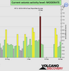
WORLDWIDE EARTHQUAKE REPORT SEPTEMBER 28

Based on the averages of all earthquakes during the last hours we had a MODERATE seismic activity level. Global seismic activity level chart

~11 quakes above magnitude 5
~54 quakes between magnitude 4 and 5
~94 quakes between magnitude 3 and 4
~268 quakes between magnitude 2 and 3
~472 quakes below magnitude 2 that people normally don't feel.
~899 quakes past 24 h. (911 earthquakes in the 24 hours prior to this report) Estimated combined seismic energy released: 6.6 x 10¹³ joules (18.3 gigawatt hours, equivalent to 15747 tons of TNT or 1 atomic bombs!)
Volcanodiscovery earthquake report 24h

▪︎Strongest earthquake: M 5.5 - northern East Pacific Rise
2022-09-28 22:34:47 (UTC)
8.542°N 102.733°W. 10.0 km depth
USGS earthquake alert

▪︎M 5.1 - 245 km NE of Saipan, Northern Mariana Islands
2022-09-28 21:41:07 (UTC)
16.946°N 147.180°E. 29.9 km depth
USGS earthquake alert

▪︎M 5.0 - Antigua and Barbuda region, Leeward Islands
2022-09-28 19:48:37 (UTC)
17.868°N 61.433°W. 27.8 km depth
USGS earthquake alert

▪︎M 5.1 - 239 km NE of Saipan, Northern Mariana Islands
2022-09-28 17:35:12 (UTC)
16.952°N 147.092°E. 32.7 km depth
USGS earthquake alert

▪︎On September 28th earthquake swarm continues in Reykjanes Ridge. According to USGS data 14 earthquakes so far. However, in the last 9 hours only one M4.7 earthquake has occurred.

M4.6 at 00:22:52 (UTC)
M4.9 at 00:55:09 (UTC)
M4.8 at 01:43:26 (UTC)
M4.5 at 02:22:36 (UTC)
M4.6 at 03:41:36 (UTC)
M4.7 at 06:09:46 (UTC)
M5.0 at 06:46:22 (UTC)
M4.9 at 07:59:37 (UTC)
M4.6 at 09:06:07 (UTC)
M4.7 at 09:50:58 (UTC)
M5.1 at 10:03:05 (UTC)
M4.6 at 12:30:44 (UTC)
M4.6 at 12:49:10 (UTC)
M4.7 at 21:11:18 (UTC)

This release of energy could also trigger things in Iceland which in geological terms is next door, 3000 km, I would think. So it could trigger earthquakes or volcanoes on Iceland too. Iceland is already fairly active with frequent swarms of small earthquakes.

Indeed, Reykjanes Ridge is connected to Iceland via the Mid-Atlantic Ridge.

The image below shows the spreading tectonic plates and where the Mid-Atlantic Ridge passes through Iceland. It enters the southwest on the Reykjanes Peninsula, going to the east and turning north. Red triangles show the main central volcanoes.
iceland-volcano-locations-and-tectonic-plates-separation-earthquake-swarm.png
 

Attachments

  • chrome_screenshot_1664406957485.png
    chrome_screenshot_1664406957485.png
    350.2 KB · Views: 1
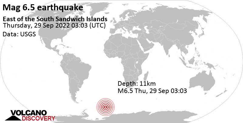
▪︎Strong earthquake M 6.5- east of the South Sandwich Islands
2022-09-29 03:03:24 (UTC)
60.804°S 20.017°W. 10.0 km depth
USGS earthquake alert


Estimated energy7.1 x 1014 joules (197 gigawatt hours, equivalent to 1.7 x 10⁵ tons of TNT or 10.6 atomic bombs!)

Data for the same earthquake reported by different agencies​

Info: The more agencies report about the same quake and post similar data, the more confidence you can have in the data. It takes normally up to a few hours until earthquake parameters are calculated with near-optimum precision.
Mag.DepthLocationSource
6.733 kmEast of the South Sandwich IslandsUSGS
6.52 kmEAST OF SOUTH SANDWICH ISLANDSEMSC
6.010 kmNear Mar Del PlataRENASS
6.60 kmEast of South Sandwich IslandsGeoAu
6.510 kmEast of South Sandwich IslandsGFZ
6.733 kmEast of South Sandwich IslandsRaspberryShake
 

Trending content

Back
Top Bottom