Earthquakes around the world

WORLDWIDE EARTHQUAKE REPORT JANUARY 09/2023

Everything was banging and shaking’: 7.6 magnitude earthquake off Indonesia rocks Darwin​

1104.jpg
Residents of Darwin and much of the Top End have reported “violent” shaking of their houses after they were jolted awake by a strong earthquake off Indonesia.

The 7.6 magnitude undersea quake struck near Indonesia’s Tanimbar Islands, east of Timor-Leste, early on Tuesday, with the epicentre at a depth of about 90km.

It was felt hundreds of kilometres away, particularly in Darwin (pop. 150,041)

BMKG reported the earthquake as M7.9 at a considerable depth of 131 km at 337 km (209 mi) WSW of Tual (pop: 39,500). Nila is the nearest volcano located at 95 km from epicenter. Nila stratovolcano forms a small 5x6 km island in the Banda Sea, Indonesia. It has a low caldera breached at sea level on the south and east.

Twenty-three minutes after the M7.6 earthquake, the first aftershock of magnitude 5.4 was recorded.

M 5.4 - Kepulauan Tanimbar, Indonesia
2023-01-09 18:09:53 (UTC)
7.087°S 130.076°E. 107.6 km depth
USGS earthquake alert


● M 5.2 - Vanuatu
2023-01-09 01:46:10 (UTC)
14.832°S 166.831°E. 10.0 km depth
USGS earthquake alert

● M 5.0 - Vanuatu
2023-01-09 01:48:01 (UTC)
14.977°S 166.779°E. 10.0 km depth
USGS earthquake alert

● M 5.2 - 156 km SE of Kokopo, Papua New Guinea
2023-01-09 06:24:17 (UTC)
5.246°S 153.353°E. 36.3 km depth
USGS earthquake alert

● M 5.2 - 126 km SSW of Trenggalek, Indonesia
2023-01-09 12:26:31 (UTC)
9.057°S 111.121°E. 55.4 km depth
USGS earthquake alert

● M 5.0 - 65 km W of Luganville, Vanuatu
2023-01-09 21:21:54 (UTC)
15.480°S 166.558°E. 24.6 km depth
USGS earthquake alert

● Summary

Seismic activity level has been at extreme levels in the last 24 hours. This is the last chart posted by Volcanodiscovery at 01:20 UTC on January 10 Global seismic activity level chart
~1 quake above magnitude 7
~6 quakes between magnitude 5 and 6
~40 quakes between magnitude 4 and 5
~105 quakes between magnitude 3 and 4
~275 quakes between magnitude 2 and 3
~430 quakes below magnitude 2 that people normally don't feel.
~857 earthquakes in the past 24h (758 earthquakes in the 24 hours prior to this report) 1.1 x 10⁷ tons of TNT or 668 atomic bombs
Volcanodiscovery earthquake report 24h
 

Attachments

  • chrome_screenshot_1673313158153.png
    chrome_screenshot_1673313158153.png
    333 KB · Views: 0
New island appears in Indonesia after earthquake M7.6 residents asked to be alert

A new island suddenly appeared after an M7.6 earthquake struck in and around Maluku, Indonesia, on Tuesday, January 10, 2023.

The island is known to be located at sea level in Teineman Village area, Wuar Labobar district, Tanimbar Islands regency.

Junus Frederick Batlayeri, Head of the Tanimbar Islands District Information and Communication Service (Kominfo) confirmed this phenomenon.

"We saw that there were oddities after the earthquake," Frederick said, quoted by Tribun Ambon.

"So, maybe the earthquake was big enough, so this weird thing appeared," he continued.

IMG-20230110-WA0082.jpg

The Maluku Tribune reported that the man claimed to be the person in charge of the Teineman Village area.

"This is a strange incident that originated from last night's earthquake in our village, Teineman Village. That is why I am responsible for taking alternatives, I instruct the whole community to evacuate temporarily," said the man who was not identified.

Meanwhile, according to information gathered by Maluku Tribune, the new island that emerged after the earthquake was named Batu Arang by the residents of Teinamam village.

They suspect that Batu Arang Island, which is located between Kabawa Island and Desa Karatat Island, has existed for a long time, but is invisible to the naked eye because it is in the sea. :huh: They are investigating.


'Island' sighted near Tanimbar Islands after 7.5M quake​


The veracity of the information regarding the island’s emergence has not been confirmed as it needs more in-depth study, Coordinator for Data and Information at the Ambon Geophysical Station of the Meteorology, Climatology, and Geophysics Agency (BMKG) Luthfy Pary said.

The phenomenon could point to the formation of a mud volcano, but this case needs more investigation, Pary added.

"The information we obtained is not complete; whether the phenomenon is purely caused by the earthquake or not, so far we have not received accurate information," he said.
 
WORLDWIDE EARTHQUAKE REPORT JANUARY 10/2023

Moderate mag. 5.7 earthquake - Coral Sea,
18 km (11 mi) ENE of Port-Olry (pop: 1,950) and 58 km north of Santo, Luganville (pop. 13, 400) Sanma Province, Vanuatu, on Tuesday, Jan 10, 2023 at 4:24 pm local time.
This quake was likely an aftershock of the 7.0 quake Coral Sea, 72 km northwest of Santo, Luganville, Sanma Province, Vanuatu, Jan 8, 2023.

M 5.7 - 18 km ENE of Port-Olry, Vanuatu
2023-01-10 05:24:48 (UTC)
15.004°S 167.236°E. 109.9 km depth
USGS earthquake alert

● M 5.0 - 28 km E of Lata, Solomon Islands
2023-01-10 08:21:24 (UTC)
10.693°S 166.060°E. 172.1 km depth
USGS earthquake alert

● M 5.0 - 201 km SE of Perryville, Alaska
2023-01-10 19:42:03 (UTC)
54.669°N 156.837°W. 25.2 km depth
USGS earthquake alert

● Earthquake Forecast (updated 10 January 2023, 22:00 UTC)

Planetary and lunar geometry with Saturn on 10 January may cause larger seismic activity 11-14 January.

Magnitude Probability

M 6.0-6.4M 6.5-6.9M 7.0-8.4M 8.5+
70%70%60%50%

4 minutes video

3 minutes video

● Summary

Seismic activity level has been at moderate levels in the last 24 hours. This is the last chart posted by Volcanodiscovery at 00:20 UTC on January 11 Global seismic activity level chart
~3 quakes above magnitude 5
~35 quakes between magnitude 4 and 5
~96 quakes between magnitude 3 and 4
~321 quakes between magnitude 2 and 3
~422 quakes below magnitude 2 that people normally don't feel.
~877 earthquakes in the past 24h (857 earthquakes in the 24 hours prior to this report)
Volcanodiscovery earthquake report 24h
 

Attachments

  • chrome_screenshot_1673395811813.png
    chrome_screenshot_1673395811813.png
    372.3 KB · Views: 0
Very strong mag. 6.0 earthquake - South Pacific Ocean on Wednesday, Jan 11, 2023 at 8:17 am local time

M 6.0 - southern East Pacific Rise
2023-01-11 16:17:45 (UTC)
49.861°S 114.304°W. 10.0 km depth
USGS earthquake alert

Data for the same earthquake reported by different agencies

Mag.DepthLocationSource
6.010 kmSouthern East Pacific RiseUSGS
5.910 kmSOUTHERN EAST PACIFIC RISEEMSC
6.010 kmSouthern East Pacific RiseRaspberry
Shake
5.110 kmNear Puerto MonttRENASS
5.910 kmSouthern East Pacific RiseGFZ
6.010 kmSouthern East Pacific RiseIRIS
5.410 kmSouthern East Pacific RiseGeoAu
Volcanodiscovery
 
WORLDWIDE EARTHQUAKE REPORT JANUARY 11/2023

Strong magnitude 5.8 earthquake - 86 km northwest of Santo, Luganville (pop: 13,400) Sanma Province, Vanuatu, on Wednesday, Jan 11, 2023 at 7:39 pm local time.
This quake was likely an aftershock of the 7.0 quake Coral Sea, 72 km northwest of Santo, Luganville, Sanma Province, Vanuatu, Jan 8

M 5.8 - 40 km WNW of Port-Olry, Vanuatu
2023-01-11 08:39:53 (UTC)
14.855°S 166.749°E. 10.0 km depth
USGS earthquake alert

Strong magnitude 5.6 earthquake - South Pacific Ocean, 231 km south of Nukalofa, Nuku'alofa, (pop. 1,240) Tongatapu, on Thursday, Jan 12, 2023 at 12:30 am local time

● M 5.6 - Tonga region
2023-01-11 11:30:27 (UTC)
23.213°S 175.340°W. 10.0 km depth
USGS earthquake alert

● M 5.0 - 193 km SW of Tual, Indonesia
2023-01-11 11:53:27 (UTC)
6.773°S 131.426°E. 24.9 km depth
USGS earthquake alert

Two earthquakes recorded off the coast of Oregon within seconds of each other.

● M 4.5 - off the coast of Oregon
2023-01-11 10:11:03 (UTC)
43.668°N 128.303°W. 10.0 km depth
USGS earthquake alert

● M 5.0 - off the coast of Oregon
2023-01-11 10:17:18 (UTC)
43.960°N 128.739°W. 10.0 km depth
USGS earthquake alert

chrome_screenshot_1673485796846.png

Light magnitude 4.1 earthquake - North Pacific Ocean, 45 mi southwest of Eureka, Humboldt County, California, USA, on Wednesday, Jan 11, 2023 at 9:21 am local time.

● M 4.1 - 57km W of Ferndale, CA
2023-01-11 17:21:42 (UTC)
40.521°N 124.932°W. 17.9 km depth
USGS earthquake alert
quakemap7316484.jpg

● Summary

Seismic activity level has been at moderate levels in the last 24 hours. This is the last chart posted by Volcanodiscovery at 00:40 UTC on January 12 Global seismic activity level chart
~1 quake above magnitude 6
~4 quakes between magnitude 5 and 6
~26 quakes between magnitude 4 and 5
~97 quakes between magnitude 3 and 4
~243 quakes between magnitude 2 and 3
~492 quakes below magnitude 2 that people normally don't feel.
~843 earthquakes in the past 24h (877 earthquakes in the 24 hours prior to this report) 29658 tons of TNT or 1.9 atomic bombs
Volcanodiscovery earthquake report 24h
 
WORLDWIDE EARTHQUAKE REPORT JANUARY 12/2023

● Chile was shaken 5 km (3 mi) SW of Ovalle (pop: 77,100), Limarí, Coquimbo Region, by an earthquake of magnitude 5.5. The quake hit at a moderately shallow depth of 44 km beneath the epicenter near Ovalle, early morning on Thursday, January 12th, 2023, at 3:19 am local time.

M 5.5 - Near the coast of Coquimbo, Chile
2023-01-12 06:19:11 (UTC)
30.636°S 71.229°W. 56.7 km depth
USGS earthquake alert

● Very deep earthquake in Fiji Islands, South Pacific Ocean

M 5.5 - south of the Fiji Islands
2023-01-12 16:28:51 (UTC)
21.908°S 179.752°E. 596.4 km depth
USGS earthquake alert

● Tonga region in the South Pacific Ocean, was shaken by two strong magnitude 5.3 earthquakes. The quake hit at 241 km south of Nukalofa, Nuku'alofa (pop. 22,400), Tongatapu, on Friday, Jan 13, 2023 at 1:28 am local time

M 5.3 - Tonga region
2023-01-12 11:11:55 (UTC)
23.234°S 174.723°W. 10.0 km depth
USGS earthquake alert

M 5.3 - Tonga region
2023-01-12 12:28:33 (UTC)
23.275°S 174.788°W. 10.0 km depth
USGS earthquake alert
chrome_screenshot_1673573063976.png

● M 5.1 - Pacific-Antarctic Ridge
2023-01-12 05:38:43 (UTC)
55.381°S 127.005°W. 10.0 km depth
USGS earthquake alert

● M 5.1 - 103 km NNW of Finschhafen, Papua New Guinea
2023-01-12 10:21:50 (UTC)
5.659°S 147.584°E. 75.5 km depth
USGS earthquake alert

● Summary

Seismic activity level has been at moderate levels in the last 24 hours. This is the last chart posted by Volcanodiscovery at 01:20 UTC on January 13 Global seismic activity level chart
~6 quakes above magnitude 5
~35 quakes between magnitude 4 and 5
~94 quakes between magnitude 3 and 4
~226 quakes between magnitude 2 and 3
~532 quakes below magnitude 2 that people normally don't feel.
~893 earthquakes in the past 24h (843 earthquakes in the 24 hours prior to this report) 12483 tons of TNT or 0.8 atomic bombs.
Volcanodiscovery earthquake report 24h
 
WORLDWIDE EARTHQUAKE REPORT JANUARY 13/2023

A magnitude 5.3 earthquake 137 km (85 mi) SSW of Pagar Alam (pop: 70,400) South Sumatra, Indonesia. The earthquake occurred at a moderately shallow depth of 35 km beneath the epicenter early morning on Saturday, January 14th, 2023, at 5:40 am local time. Patah is the nearest volcano located at 112 km from epicenter. Patah volcano is currently dormant.

M 5.3 - 136 km SSW of Pagar Alam, Indonesia
2023-01-13 22:40:57 (UTC)
5.226°S 102.973°E. 35.0 km depth
quakemap7320882.jpg

● Summary

Seismic activity level has been at low levels in the last 24 hours. This is the last chart posted by Volcanodiscovery at 01:00 UTC on January 14 Global seismic activity level chart
~1 quake above magnitude 5
~33 quakes between magnitude 4 and 5
~84 quakes between magnitude 3 and 4
~217 quakes between magnitude 2 and 3
~454 quakes below magnitude 2 that people normally don't feel.
~789 earthquakes in the past 24h (893 earthquakes in the 24 hours prior to this report) 4590 tons of TNT or 0.3 atomic bombs
Volcanodiscovery earthquake report 24h


Long Duration M-flare currently on the sun.. Earthquake activity kicking up.. Saturday 1/14/2023
TheEarthMaster Jan 14, 2023
Solar Weather Updates.. Solar flares and sunspots..
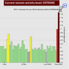
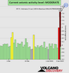
Volcano and earthquake updates.
Current World Earthquake Map https://earthquake.usgs.gov/earthquak...
Recent California and Nevada Earthquakes http://scedc.caltech.edu/recent/


WORLDWIDE EARTHQUAKE REPORT JANUARY 14/2023

Second day with a low level of seismic activity.

Strong magnitude 5.0 earthquake in Coral Sea, 83 km northwest of Santo, Luganville (pop: 13,400) Sanma Province, Vanuatu, on Sunday, Jan 15, 2023 at 1:31 am local time.

M 5.0 - 56 km W of Port-Olry, Vanuatu
2023-01-14 14:31:27 (UTC)
15.064°S 166.545°E. 10.0 km depth
USGS earthquake alert

● Summary

Seismic activity level has been at low levels in the last 24 hours. This is the last chart posted by Volcanodiscovery at 01:00 UTC on January 14 Global seismic activity level chart
~1 quake above magnitude 5
~35 quakes between magnitude 4 and 5
~83 quakes between magnitude 3 and 4
~231 quakes between magnitude 2 and 3
~425 quakes below magnitude 2 that people normally don't feel.
~775 earthquakes in the past 24h (789 earthquakes in the 24 hours prior to this report) 4590 tons of TNT or 0.3 atomic bombs
Volcanodiscovery earthquake report 24h
 
Last week saw 1 M7 being a M7.0 in Vanuatu.
In the usual area, there was 1 out of 103 earthquakes worldwide equal to or greater than 4.5 and 1376 out of 1834 quakes of all sizes.
Percentage: 75.0%
Last week saw 1 M7, being a M7.6 in Indonesia and 1 M6 (M6.0).
In the usual area, there were 4 out of 87 earthquakes worldwide equal to or greater than 4.5 and 1209 out of 1569 quakes of all sizes.
Percentage: 77.1%
Earthquakes 7 days to January 15th 2023.gif
 
A magnitude 6.0 earthquake 42 km (26 mi) S of Singkil (pop: 46,800) Aceh, Indonesia, The earthquake occurred at a shallow depth of 48 km beneath the epicenter early morning on Monday, January 16th, 2023, at 5:29 am local time.
M 6.0 - 48 km SSE of Singkil, Indonesia
2023-01-15 22:30:00 (UTC)
1.878°N 97.939°E. 48.1 km depth
USGS earthquake alert

Data for the same earthquake reported by different agencies

6.223 kmIndonesia: Di Laut 47 Km Tenggara Kab. Aceh SingkilBMKG
6.180 km6.2 NIAS REGION, INDONESIAEMSC
6.048 kmNorthern Sumatra, IndonesiaRaspberry
Shake
6.010 kmIndonesia: Near MedanRENASS
6.220 kmNorthern Sumatera, Indonesia [Sea: Indonesia]INGV
6.210 kmNorthern Sumatra, IndonesiaGFZ
6.255 kmNorthern Sumatra, IndonesiaGeoAu
6.010 kmNorthern Sumatra, IndonesiaIRIS
6.030 kmIndonesia: 印尼苏门答腊岛北部海域CEIC
6.048 km48 Km SSE of Singkil, IndonesiaUSGS

This earthquake coincides with the SSGEOS forecast published in its social networks yesterday.
 
WORLDWIDE EARTHQUAKE REPORT JANUARY 15/2023

● Earthquake in Indonesia was updated to magnitude 6.2. Moderate shaking probably occurred in Singkil (pop. 46,800) located 46 km from the epicenter. In Sibolga (pop. 79,700) located 90 km from the epicenter, Kabanjahe (pop. 57,200) 142 km away, and Berastagi (pop. 44,800) 152 km away, the quake should have been felt as light shaking given the earthquake depth.

M 6.2 - northern Sumatra, Indonesia
2023-01-15 22:29:58 (UTC)
2.004°N 98.014°E. 37.0 km depth
USGS earthquake alert

● A moderately shallow magnitude 5.6 earthquake was reported 21 km (13 mi) WNW of Port-Olry (pop: 1,950) Santo, Luganville, Sanma Province, Vanuatu, the quake hit on Sunday, January 15th, 2023, at 11:04 pm local time at a moderately shallow depth of 32.4 km.

M 5.6 - 21 km WNW of Port-Olry, Vanuatu
2023-01-15 12:04:17 (UTC)
15.001°S 166.880°E. 32.4 km depth
USGS earthquake alert

● M 5.2 - 94 km NE of Norsup, Vanuatu
2023-01-15 05:32:28 (UTC)
15.560°S 168.103°E. 24.6 km depth
USGS earthquake alert

● An earthquake magnitude 5.2 hit El Salvador, 10 km (6 mi) N of Ahuachapan (Ahuachapán) (pop 34,100) The earthquake hit in the afternoon on Sunday, January 15th, 2023, at 5:07 pm local time at a shallow depth of 10 km. Apaneca Range is the nearest volcano located at 15 km from epicenter.
chrome_screenshot_1673829902814.png

M 5.2 - 10 km N of Ahuachapán, El Salvador
2023-01-15 23:07:54 (UTC)
14.013°N 89.847°W. 10.0 km depth
USGS earthquake alert

● Very deep earthquake magnitude 5.2 at
435 km (270 mi) NW of Futami (pop: 897) Japan

M 5.2 - Izu Islands, Japan region
2023-01-15 04:42:14 (UTC)
29.961°N 139.194°E. 396.2 km depth
USGS earthquake alert
chrome_screenshot_1673830774198.png

● Very deep earthquake in South of Fiji Islands
M 5.0 - south of the Fiji Islands
2023-01-15 17:09:38 (UTC)
22.847°S 179.190°E. 573.4 km depth
USGS earthquake alert

● Earthquake Forecast: Potential for stronger seismic activity in or near the purple band 1-2 days. This is an estimate. Other regions are not excluded.

● Summary

Seismic activity level has been at moderate levels in the last 24 hours. This is the last chart posted by Volcanodiscovery at 00:00 UTC on January 15 Global seismic activity level chart
~1 quake above magnitude 6
~5 quakes between magnitude 5 and 6
~29 quakes between magnitude 4 and 5
~94 quakes between magnitude 3 and 4
~240 quakes between magnitude 2 and 3
~470 quakes below magnitude 2 that people normally don't feel.
~839 earthquakes in the past 24h (775 earthquakes in the 24 hours prior to this report) 41264 tons of TNT or 2.6 atomic bombs.
Volcanodiscovery earthquake report 24h
 
Strong and deep earthquake again in Izu Islands, Japan region. 352 km (219 mi) NW of Futami (pop: 897) Philippine Sea, Japan, on Monday, Jan 16, 2023 at 1:49 local time

M 6.3 - Izu Islands, Japan region
2023-01-16 04:49:52 (UTC)
29.001°N 139.347°E. 409.1 km depth
USGS earthquake alert

Data for the same earthquake reported by different agencies

Mag.DepthLocationSource
6.3409 kmNear Hatiozi, Tokyo Prefecture, JapanUSGS
6.3429 kmIZU ISLANDS, JAPAN REGIONEMSC
6.3409 kmSoutheast of Honshu, JapanRaspberry
Shake
5.9413 kmJapan: Near YokohamaRENASS
5.8420 kmIzu Islands, Japan RegionGFZ
6.1410 kmJapan [Sea]INGV
6.310 kmSoutheast Of Honshu, JapanIRIS
6.4412 kmBonin Islands, Japan RegionGeoAu
5.8400 kmJapan: 日本小笠原群岛地区CEIC

 
Back
Top Bottom