WORLDWIDE EARTHQUAKE REPORT DECEMBER 02_2023
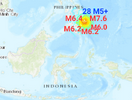
Extreme levels of seismic activity occurred in the past 24h. What happened today was crazy. Imagine 5 hours of seismic activity that started with a powerful M7.6 earthquake and subsequent aftershocks ranging from M4+ to M6+... Well, that happened in the Mindanao and Barcelona regions of the Philippines and at the Philippine-Pacific plate boundary. At least 28 aftershocks with magnitudes above 4.5 were registered over the next 5 hours. The strongest were M5.8 at 15:06 UTC, M6.4 at 16:03, M6.2 at 17:40, M6.2 at 18:09, and M6.0 at 20:52.
This M7+ earthquake was expected to occur closer to the Taiwan region and southern Japan but not with the extraordinary number of aftershocks.
According to
Jesus Ramos Ka-tet latest analysis It is possible that we may see an M7+ earthquake in the region comprising Taiwan and southern Japan, as well as the Kamchatka Peninsula while for China (the Xinjiang region is having M4+ seismic activity) an M6+ and in the worst case M6.5 earthquake is possible.
The USGS issued a Green alert for shaking-related fatalities. There is a low likelihood of casualties. 1 240 000 people are estimated to have felt very strong shaking, 2 865 000 strong, 7 028 000 moderate and 19 275 000 light.
The estimated energy released from this M7.6 earthquake according to
Volcanodiscovery was 236.7 atomic bombs. This energy will move toward Central America, especially toward southeastern Mexico in the next few days.
It is a fact that the month of December starts with great seismic activity. In South America, Chile recorded a strong M5.8 and a moderate M5.1 earthquake while in the South Atlantic Ocean a M5.0 foreshock occurred. East Asia Bangladesh was shaken by an M5.5 earthquake, in Southeast Asia Indonesia recorded three M5+ earthquakes, the Solomon Islands an M5.1 earthquake. The Macquarie Islands in southern Australia had an M5.1 earthquake. The energy is also moving towards the Caribbean and the region of the island of Guadeloupe was shaken by an M5.2 earthquake.
There are many questions as to why this happened.
Is this a consequence of the severe G3 geomagnetic storm of December 1?
The geomagnetic field has been at quiet to severe storm levels for the past 24 hours. On December 1 Solar wind speed reached a peak of 567 km/s (Moderately high speed) at 14:43 UTC. Total IMF reached 28 nT at 19:22 UTC
● Minor G1 geomagnetic storm (Kp5) threshold reached at 01:03 UTC
● Moderate G2 geomagnetic storm (Kp6) threshold reached at 01:05 UTC
●
Strong G3 geomagnetic storm (Kp7) threshold reached at 01:11 UTC
● Minor G1 geomagnetic storm (kp5) threshold reached at 23:35 UTC
Why didn't the same thing happen in similar and past geomagnetic storms? Or after X-class flares? It is a shame that SSGEOS no longer publishes its planetary and lunar geometry analysis as a protest against what is happening in Gaza. I suspect that the cosmic environment together with the
very strong impact of the solar magnetic field with the Earth's magnetic field that reached 28 nano Teslas had a lot to do with it. (Under normal conditions, the value is less than 9 nT.)
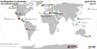
The total number of earthquakes recorded in the last 24 hours have decreased to 800 despite the extreme seismic activity. According to
Volcano earthquake report the volcanoes with the highest seismic activity (>10 eq) were:
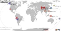
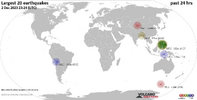
Recent quakes worldwide map shows the distribution of the last 20 large earthquakes. It is clear that the activity was concentrated in the Philippines region with isolated earthquakes in Chile, Bangladesh and Macquarie Islands.
●
M 7.6 - Mindanao, Philippines
2023-12-02 14:37:03 (UTC)
8.527°N 126.449°E. 32.8 km depth
USGS earthquake alert
● M 5.3. Mindanao, Philippines at 15:00:08 UTC
● M5.8. Barcelona, Philippines at 15:06:46 UTC
● M5.1 Santa María, Philippines at 15:21:00
UTC
● M5.4. Barcelona, Philippines at 15:22:04 UTC
● M5.0. Barcelona, Philippines at 15:29:32 UTC
● M5.5. Mindanao, Philippines at 15:31:27 UTC
● M5.3. Barcelona, Philippines at 15:42:48 UTC
● M5.3. Mindanao, Philippines at 15:46:25 UTC
● M5.2, Hinatuan, Philippines at 15:50:41 UTC
● M 6.4 - 47 km NE of Barcelona, Philippines
2023-12-02 16:03:43 (UTC)
8.415°N 126.776°E. 64.3 km depth
USGS earthquake alert
● M5.2. Barcelona, Philippines at 16:13:22 UTC
● M5.6. Mindanao, Philippines at 16:17:01 UTC
● M5.7. Barcelona, Philippines at 16:19:47 UTC
● M5.1. Barcelona, Philippines at 16:34:26 UTC
● M5.4 Mindanao, Philippines at 16:34:58 UTC
● M5.7. Barcelona, Philippines at 16:53:09 UTC
● M5.3. Barcelona, Philippines at 17:02:02 UTC
● M5.1 Mindanao, Philippines at 17:31:38 UTC
●
M 6.2 - 44 km NE of Barcelona, Philippines
2023-12-02 17:40:12 (UTC)
8.412°N 126.746°E. 18.0 km depth
USGS earthquake alert
● M5.0, Mindanao, Philippines at 17:49:43 UTC
● M5.7, Mindanao, Philippines at 17:55:26 UTC
● M5.2, Mindanao, Philippines at 18:01:23 UTC
●
M 6.2 - 62 km ENE of Barcelona, Philippines
2023-12-02 18:09:26 (UTC)
8.444°N 126.919°E. 54.9 km depth
USGS earthquake alert
● M5.4, Mindanao, Philippines at 18:29:41 UTC
● M5.1, Barcelona, Philippines at 19:54:28 UTC
● M5.3 Hinatuan, Philippines at 19: 57:09 UTC
● M5.4, Mindanao, Philippines at 20:39:30 UTC
●
M 6.0 - Mindanao, Philippines
2023-12-02 20:52:22 (UTC)
8.353°N 126.843°E. 49.1 km depth
USGS earthquake alert
● M5.1 Barcelona, Philippines at 21:07:50 UTC
● M5.1 Mindanao, Philippines at 21:46:42 UTC
● M5.4 Barcelona, Philippines at 22:35:44 UTC
● M5.0 Hinatuan, Philippines at 22:45:21 UTC
● M 5.8 - Tarapaca, Chile
2023-12-02 07:55:40 (UTC)
19.196°S 69.059°W. 105.8 km depth
USGS earthquake alert
● M 5.1 - 96 km S of Antofagasta, Chile
2023-12-02 09:31:32 (UTC)
24.521°S 70.415°W. 40.2 km depth
USGS earthquake alert
● M 5.5 - 10 km ENE of Rāmganj, Bangladesh
2023-12-02 03:35:32 (UTC)
23.124°N 90.945°E. 38.5 km depth
USGS earthquake alert
● M 5.5 - west of Macquarie Island
2023-12-02 14:02:10 (UTC)
55.720°S 147.018°E. 10.0 km depth
USGS earthquake alert
● M 5.5 - Kepulauan Babar, Indonesia
2023-12-02 12:01:01 (UTC)
7.022°S 129.691°E. 121.3 km depth
USGS earthquake alert
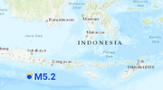
● M 5.2 - 185 km S of Dampit, Indonesia
2023-12-02 05:37:25 (UTC)
9.873°S 112.508°E. 48.4 km depth
USGS earthquake alert
● M 5.0 - 100 km ENE of Masohi, Indonesia
2023-12-02 18:28:36 (UTC)
2.868°S 129.762°E. 21.0 km depth
● M 5.1 - Solomon Islands
2023-12-02 03:51:24 (UTC)
8.445°S 158.378°E. 159.5 km depth
● M 5.1 - Maug Islands region, Northern Mariana Islands
2023-12-02 11:58:17 (UTC)
20.023°N 145.403°E. 10.0 km depth
USGS earthquake alert
● M 5.0 - South Sandwich Islands region
2023-12-02 05:03:54 (UTC)
56.202°S 27.801°W. 143.6 km depth
USGS earthquake alert
● M 5.2 - 43 km NE of Anse-Bertrand, Guadeloupe
2023-12-02 08:48:24 (UTC)
16.700°N 61.180°W. 41.3 km depth
USGS earthquake alert
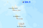
● M 4.9 - 58 km NE of Beauséjour, Guadeloupe
2023-12-02 03:00:45 (UTC)
16.735°N 60.748°W. 36.9 km depth
USGS earthquake alert
Other light earthquakes occurred in Iñapari, Peru (M4.9) Beauséjour, Guadeloupe (M4.5) Jujuy Argentina (M4.5) Bengkulu, Indonesia (M4.7) Barcelona, Philippines (M4.9, M4.9, M4.7, M4.9, M4.9, M4.5, M4.9, M4.7, M4.5, M4.6, M4.6, M4.8) Fiji region (M4.9) Unimak Island region, Alaska (M4.6)
● Summary
Seismic activity has been at
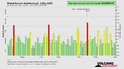
extreme levels in the last 24 hours. This is the last chart posted by Volcanodiscovery at 23:14 UTC on December 02
Global seismic activity chart
- 1 quake above magnitude 7
- 4 quakes between magnitude 6 and 7
- 44 quakes between magnitude 5 and 6
- 56 quakes between magnitude 4 and 5
- 119 quakes between magnitude 3 and 4
- 216 quakes between magnitude 2 and 3
- 360 quakes below magnitude 2 that people normally don't feel.
In the past 24 hours, there were 800 quakes of magnitudes up to 7.6
| Last five days | Highest record |
| Nov. 28 - 775 eq. | Nov. 11 - 3056 eq. |
| Nov. 29 - 743 eq. | Due to volcanic |
| Nov. 30 - 792 eq | Activity in Iceland |
| Dec. 01 - 914 eq. | |
| Dec. 02 - 800 eq. | |
Estimated combined seismic energy release equivalent to 4663 gigawatt hours, equivalent to 4 x 10⁶ tons of TNT or
250.8 atomic bombs
Volcanodiscovery

