Earthquakes around the world

Strong 6.0-Magnitude Earthquake Hits Northeast Papua New Guinea – EMSC
https://sputniknews.com/world/201712011059590203-earthquake-papua-new-guinea/

A 6.0-magnitude earthquake hit the northeast coast of Papua New Guinea on Friday, the European-Mediterranean Seismological Center (EMSC) said.

The epicenter of the earthquake was located 64 kilometers (40 miles) to the north of the town of Finschhafen at a depth of 80 kilometers.

Earlier reports suggested that the quake's magnitude stood at 6.3, with no tsunami warning being issued.
 
A 6.0-magnitude earthquake hit Ecuador about 20 kilometers (12 miles) northeast of Bahia de Caraquez, the US Geological Survey (USGS) said on Sunday.

Magnitude 6.0 Quake Hits Ecuador - US Geological Survey
https://sputniknews.com/latam/201712031059654700-ecuador-earthquake-usgs/

Tremors were registered at 11:19 GMT with the epicenter located at the depth of 24.7 kilometers (over 15 miles).

No tsunami threat has been declared due to the earthquake. No information on the victims or destruction has emerged so far.

This is the second quake in Ecuador within a few days, with the first one's epicenter almost 20 miles northwest from the coastal city of Bahia at a depth of 6.2 miles.
 
Central Italy has been hit by an earthquake, there have been no reports of damages or victims yet.

Earthquake of 4.1 Magnitude Hits Central Italy
https://sputniknews.com/environment/201712041059663201-earthquake-hits-italy/

An earthquake with the magnitude of 4.1 struck the central Italy, about 65 miles northeast of Rome, European-Mediterranean Seismological Centre said Monday.

The earthquake was registered at 23:34 GMT on Sunday (00:34 a.m. Monday local time) with the depth of estimated at zero miles. There have been no reports of damages or victims yet.

A quake of the same magnitude hit hit the popular Italian holiday destination of Ischia, in the Bay of Naples several months ago, killing at least two people, injuring up to 40 and wreaked havoc on the age-old architecture of the volcanic island. The natural disaster hit Ischia just three days before the first anniversary of the earthquake that struck the central Apennines around Amatrice and Accumoli on August 24, 2016, killing 299 people.
 
M 6.5 - 82km WNW of Bouvet Island, Bouvet Island

Time
2017-12-13 18:03:42 (UTC)
Location
54.216°S 2.148°E
Depth
10.0 km

Source
 
Magnitude 6.4 Quake Hits Indonesia's Java Island: at Least Two Killed (PHOTOS) 16.12.2017
https://sputniknews.com/asia/201712161060052521-indonesia-java-earthquake-victims/

​On December 15, 16:47 GMT (11:47 p.m. local time), the 6.4-magnitude earthquake hit; its epicenter was located at a depth of 104 kilometers (64.6 miles).

During the earthquake, at least two people were killed and dozens of homes were severely damaged near the epicenter, local media reported on December, 16, citing authorities.

A 62-year-old man and an 80-year-old woman were killed in building collapses, said National Disaster Mitigation Agency spokesman Sutopo Purwo Nugroho, noting that more than 40 houses collapsed and about 65 suffered severe damage.

The initial reports said that one person was killed and five were injured. According to The Jakarta Post newspaper, seven people were injured as a result of the natural disaster and dozens of houses were destroyed.

M 6.5 - 0km ESE of Cipatujah, Indonesia
https://earthquake.usgs.gov/earthquakes/eventpage/us2000c4v8#origin

Magnitude
6.5 mww
± 0.1

Location
7.734°S 108.023°E
± 8.5 km

Depth
91.9 km
± 6.6

Origin Time
2017-12-15 16:47:56.930 UTC


M 5.2 - 7km NE of Miyako, Japan
https://earthquake.usgs.gov/earthquakes/eventpage/us2000c4yj#origin

Magnitude
5.2 mb
± 0.0

Location
39.681°N 142.022°E
± 5.9 km

Depth
44.8 km
± 6.1

Origin Time
2017-12-15 17:58:43.310 UTC
 
TEHRAN: A pregnant woman died and nearly 100 people were injured as a 5.2 magnitude earthquake sparked panic in the Iranian capital and neighboring areas late on Wednesday, officials said.

Pregnant woman dies in Iran quake panic Thursday 21 December 2017
http://www.arabnews.com/node/1212476/middle-east

The epicenter of the quake, which struck shortly before 11:30 p.m., was just 40km west of the capital, according to the seismological center of the University of Tehran.

The woman died as she ran out of her home in the city of Malard, close to the epicenter, the county’s prefect said.

“Ninety-seven people were injured — 50 in Alborz, 34 in the capital and 12 in Saveh,” said Morteza Salimi, head of the Iranian Red Crescent’s Relief and Rescue Organization.

The quake caused no major damage but tens of thousands of people spent the night outside for fear of aftershocks.

Many of them did so in their vehicles with the engines switched on for warmth in the wintry conditions, exacerbating the thick smog that has enveloped the capital all week.

Petrol purchases in the six hours after the quake reached 10 million liters (2.64 million gallons), more than double the average full day sales even though it was in the middle of the night, the national fuel distribution company said.

Average airborne concentration of the finest and most hazardous particles (PM2.5) rose to 170 microgrammes per cubic meter, with peaks of 194 microgrammes in some neighborhoods, Tehran municipality said.

That is some seven times higher than the World Health Organization recommended maximum of 25 microgrammes per m3 over a 24-hour period.

Iran sits atop several fault lines, and Wednesday’s quake is the latest in a series to have hit the country in recent weeks.

A 6.2-magnitude earthquake struck the southeastern province of Kerman on Dec. 13, leaving at least 18 people injured. On Nov. 12, the western province of Kermanshah was hit by a 7.3-magnitude quake that killed 620 people.

Iran’s deadliest quake in recent years was a 6.6-magnitude tremor that struck the southeast in 2003, decimating the ancient mud-brick city of Bam and killing at least 31,000 people.

In 1990, a 7.4-magnitude quake in northern Iran killed 40,000 people, injured 300,000 and left half a million homeless, reducing dozens of towns and nearly 2,000 villages to rubble.
 
The US Geological Survey has reported an earthquake near the coast of the Solomon Islands, no tsunami alert has been declared.

Solomon Islands Hit by 5.3-Magnitude Earthquake
https://sputniknews.com/environment/201712261060318444-solomon-islands-earthquake/

The 5.3-magnitude earthquake occurred not far from the coast of the Solomon Islands, the US Geological Survey (USGS) said.

The tremors were registered at 17:56 GMT, 179 kilometers (111 miles) northeast of the town of Auki. The epicenter was located at the depth of 16.4 kilometers.

There are no reports about any victims or damages caused by the earthquake. No tsunami alert has been declared.

The Solomon Islands are located in a seismically active zone known as the Ring of Fire and regularly suffer from powerful earthquakes. The zone is basically a strip of volcanoes and tectonic faults in the Pacific basin which has one of the highest levels of volcanic and seismic activity in the world.
 
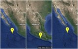
25 December, the seismic alarm was heard in Mexico City due to an earthquake at/near Acapulco, Gro. Mexico of 5.0 +/- magnitude depending on the source ... from national seismologic
5 km al ESTE de ACAPULCO, GRO 5.0
2017-12-25 14:23:10 Lat: 16.86°, Long: -99.85° Prof: 26 km

_https://www.ctvnews.ca/world/christmas-earthquake-strikes-near-acapulco-mexico-no-damage-reported-1.3735209 said:
Christmas earthquake strikes near Acapulco, Mexico; no damage reported

The Associated Press
Published Monday, December 25, 2017 4:19PM EST
ACAPULCO, Mexico -- A Christmas day earthquake has shaken southern Mexico. There are no immediate reports of damage.

Monday's temblor was centred near the Pacific coast resort city of Acapulco, where the shaking was felt strongly and many people left their homes.

Civil defence chief Sabas de la Rosa Camacho said some shopping malls were evacuated but no damage had been reported.

The U.S. Geological Survey reported that the quake had a magnitude of 4.7 and its epicenter was 26 miles (42 kilometres) north-northeast of Acapulco.

It also triggered the seismic alarm system in Mexico City, where nerves are still raw from a Sept. 19 quake that killed 369 people including 228 in the capital. Another deadly earthquake hit farther south in Mexico earlier that month.

Moments later, another ones were registered, as aftershocks but at different states, although +- 4.0 magnitude ...
_https://www.informador.mx/mexico/Tras-sismo-se-registran-replicas-en-Oaxaca-BCS-y-Jalisco-20171225-0041.html said:
-usign google tradutor-

The National Seismological Service (SSN) reported that after the 5-degree earthquake registered this Monday afternoon with the epicenter in Acapulco, three other earthquakes have occurred in different parts of the country.

According to the organism, the three movements have been less than 5 degrees. The first occurred southeast of Salina Cruz, Oaxaca, at 3:24:08 and its magnitude was 4.2 degrees.

The second was recorded south of Cabo San Lucas in Baja California Sur , with an intensity of 4.1 degrees at 3:37:48.

And finally in Puerto Vallarta , Jalisco, at 3:37:52 the third movement of 4.3 degrees could be perceived.
Althoug, if one goes to the site _http://www.ssn.unam.mx/sismicidad/ultimos/ there are more above 4.0 and many of 3.0+

Even if there were equal or below 5.0, one needs to pay attention to this ones mostly because the mayority are/were in the area of Guerrero's Gap https://www.sott.net/article/361421-Magnitude-8-0-earthquake-hits-off-Mexican-coast-tsunami-warning-UPDATES
 

Attachments

  • befunky_collage.jpg_1970638775.jpg
    befunky_collage.jpg_1970638775.jpg
    60.4 KB · Views: 166
A 4.9-magnitude earthquake occurred on Sunday near the Greek capital of Athens, the European Mediterranean Seismological Center (EMSC) said.

Greece Hit by 4.9-Magnitude Earthquake - European Seismological Center
https://sputniknews.com/europe/201712311060441261-greece-earthquake-athens/

The tremors were registered on 6:02 a.m. local time (04:02 GMT) with the epicenter of the earthquake located 81 kilometers (50 miles) west of Athens at the depth of 10 kilometers.

There are no reports about any victims or damages caused by the earthquake.

Greece is located in a seismically active zone, which lies in a boundary area between three tectonic plates: Eurasian, African and Aegean ones. Earthquakes in the region are caused by the Aegean Sea Plate's movement southwestward and the African Plate's subduction beneath the Aegean Sea Plate.
 
A 5.1-magnitude earthquake occurred on Tuesday in northern Greece, the US Geological Survey (USGS) said.

Northern Greece Hit by 5.1-Magnitude Earthquake – US Geological Survey
https://sputniknews.com/europe/201801021060470088-greece-earthquake-usgs/

The tremors were registered at 04:24 GMT with the epicenter of the earthquake located 12 kilometers (about 7.5 miles) west of the town of Rodopoli at a depth of six kilometers.

There are no reports of any victims or damage caused by the earthquake.

The last significant earthquake in Greece happened on Sunday when 4.9-magnitude tremors were registered 81 kilometers west of the country’s capital of Athens.

Greece is located in a seismically active zone, which lies in a boundary area between three tectonic plates: the Eurasian, African and Aegean. Earthquakes in the region are caused by movements in the Aegean Sea Plate in a southwesterly direction and the African Plate's subduction beneath the Aegean plate.
 
M 4.6 - Izu Islands, Japan region

2018-01-05 03:53:36 UTC

29.576°N 140.625°E

57.4 km depth


M 4.9 - 10km NW of Ichihara, Japan

2018-01-05 15:54:14 UTC

35.583°N 139.993°E

69.4 km depth

A new quake has hit near the east coast of the Japanese island of Honshu on Friday. Japan is a part of the so called Ring of Fire in the Pacific Ocean, a region which is prone to frequent volcanic eruptions and earthquakes.

'Strong Earthquake' Shakes Japan, Tsunami Warning Reportedly Issued (PHOTOS)
https://sputniknews.com/asia/201801051060538592-earthquake-japan-tsunami/

The Japanese Meteorological Agency has reportedly issued a tsunami warning after a "strong" tsunami (earthquake) shook the country. The nature's rage was felt in the Japanese capital of Tokyo, among other locations. People took to social media to share their emotions and accounts.
 
Strong Earthquake Hits India-Myanmar Border, Scale of Damage Unclear 07.01.2018
https://sputniknews.com/asia/201801071060567336-earthquake-india-myanmar-manipur/

A 5.5 magnitude quake has hit to the east of Imphal, the capital of the Indian northeastern state of Manipur, according to the US Geological Survey service. Earlier, the Islamic Republic of Iran had suffered from an earthquake which left over 20 individuals injured.

The earthquake struck some 100 kilometers from the city at the depth of approximately 30 kilometers. There have been no immediate reports of casualties and property damage caused by the natural phenomenon.


At least 21 people have been injured in an earthquake in the Iranian western province of Kermanshah, local media reported on Sunday.

Dozens Injured in 5.1 Quake in Western Iran - Reports
https://sputniknews.com/middleeast/201801071060563515-iran-quake-casualties-reports/

According to the IRNA news agency, 17 individuals have suffered wounds in urban areas, while four others have sustained injuries in rural areas.

A major 5.1-magnitude earthquake hit Iran on Saturday. Five aftershocks of magnitude ranging from 2.7 to 5.1 on the Richter scale have struck the province, the broadcaster added.

Iran has faced several powerful quakes recently. In November, a disastrous 7.2-magnitude earthquake left hundreds killed and wounded.
 
Source: http://www.dutchnews.nl/news/archives/2018/01/groningen-hit-by-strongest-earthquake-in-five-years/

Rural Groningen hit by strongest earthquake in five years

January 8, 2018

Parts of Groningen were shaken by an earthquake measuring 3.4 on the Richter scale on Monday afternoon. The tremor was the biggest in the region since 2012 and the third strongest ever recorded, the KNMI said.

The epicenter of the quake was in the village of Zeerijp near Loppersum, but it was also felt in the provincial capital of Groningen, including at the city’s main hospital. According to provincial television station RTV Noord, the quake is the sixth to hit Zeerijp within a month.

On Twitter locals described the way homes in the region shook and creaked but police said no major problems were reported.

The quakes are caused by ground settling following the extraction of natural gas from under the province.

Last year the government reduced the volume of gas from 27 billion cubic meters to almost 22 cubic meters but locals say much more still needs to be done. Locals were also quick to describe the latest quake as a wake-up call to national government which had for years ignored the problem.

Economic affairs minister Erik Wiebes, who is responsible for natural gas extraction, is due to visit the province on Wednesday.

Court

At the end of last year, the Council of State gave Wiebes one year to come up with proper arguments to support his decision to cap the extraction of gas from under Groningen province at 21.6 billion cubic meters a year.

The case was brought by a group of Groningen residents and green group Milieudefensie who say the safety of locals is more important than providing income for the treasury. They wanted gas production to be drastically reduced or stopped altogether.

The biggest quake, in 2012, measured 3.6 on the Richter scale and led to hundreds of reports of damage. Since the quakes began, some 75,000 complaints have been made about damage and the bill for research, shoring up property and damages claims has reached an estimated €1.3bn so far.

Similar coverage here: https://nltimes.nl/2018/01/08/hardest-earthquake-five-years-hits-groningen
 
Groningen earthquake updates:

https://nltimes.nl/2018/01/09/earthquake-update-dutch-look-stop-gas-extraction-faster
https://nltimes.nl/2018/01/09/300-damage-reports-latest-groningen-earthquake
http://www.dutchnews.nl/news/archives/2018/01/over-300-reports-of-quake-damage-minister-to-cut-gas-production/
 
From USGS
M 7.6 - 44km E of Great Swan Island, Honduras

_https://www.accuweather.com/en/weather-news/breaking-76-magnitude-earthquake-shakes-the-caribbean-sea-tsunami-advisories-issued/70003790 said:
BREAKING: 7.6 magnitude earthquake shakes the Caribbean Sea, tsunami advisories issued
By Brian Lada, AccuWeather meteorologist and staff writer
By Faith Eherts, AccuWeather meteorologist
January 09, 2018, 10:48:56 PM EST

A magnitude 7.6 earthquake shook the Caribbean Sea early Tuesday night with hazardous tsunami waves possible.

The earthquake occurred west of Jamaica at a depth of just 6.2 miles (10 km).

According to the National Tsunami Warning Center (NTWC), hazardous tsunami waves are possible within 621 miles (1,000 km) of the quake's epicenter.

Tsunami waves up to 3.3 feet (1 meter) above tide level are possible for some coasts of Mexico, Cuba, Jamaica, Belize, Honduras and Cayman Islands, according to the NTWC.

Hazardous tsunami waves up to 1 foot are possible for Puerto Rico, the U.S. Virgin Island and the British Virgin Islands.


People near the coast should seek higher ground immediately.

No tsunami is expected along the United States' Gulf and East Coasts.
 
Back
Top Bottom