Crazy Storm Weather and Lightning - Global

California atmospheric river and bomb cyclone update

Two dead as ‘bomb cyclone’ brings heavy winds and rain to California​


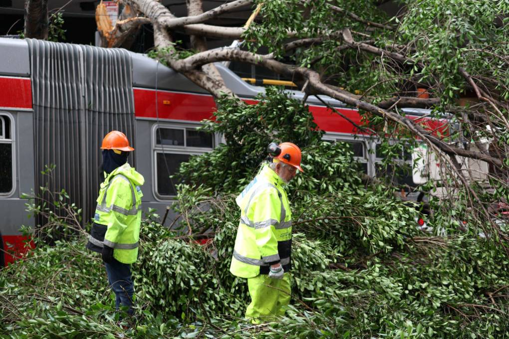
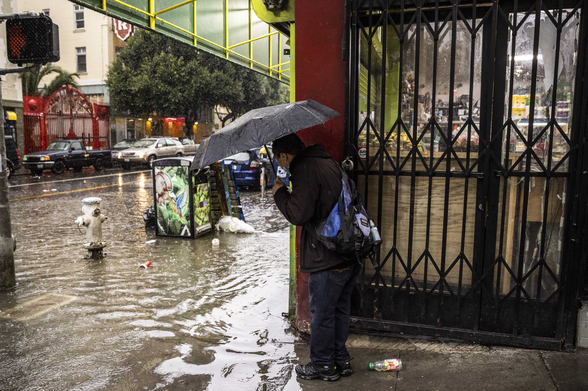
It has been a deadly and destructive start to the year in California, as a series of severe storms slammed the state this week, toppling trees, submerging streets and sending water cascading into homes and businesses.

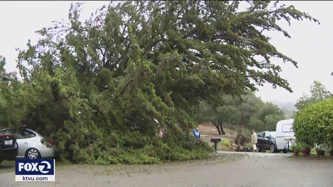
The latest storm hit hard on Thursday – a powerful “atmospheric river” that brought with it hurricane-force winds and torrents of rain. At least two deaths have been reported in connection with the latest storm, including a child whose home was hit by a falling tree in Sonoma county. By Thursday morning, more than 163,500 people were without power, with little reprieve in sight.
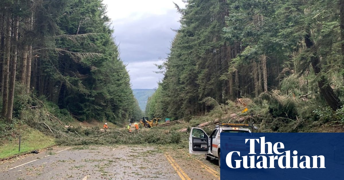
The rain event left considerable damage in its wake as the saturated soils and inundated systems struggled to contain several consecutive deluges. Trees and infrastructure were rocked by heavy winds, while strewn debris and rock slides closed highways and roads in several areas. Gusts topped 100 mph in some parts of the state as waves churned to historic heights, surging up to 60ft in Point Reyes. Flood watches covered a staggering 90% of California’s population – 35 million people – on Thursday.

Bomb Cyclone: Chaos in California transformers explode, trees down, torrential rains, thousands without power.
One death already reported due to a fallen tree
 
Living through it over here. Currently a “lull” day with light showers, but three more ARs on the way:


At least three more atmospheric river storms are set to hit California from this weekend through next week. The FOX Forecast Center warned that it's becoming increasingly likely that the flooding from the strongest storm will be far more serious than anything experienced so far.


Rainfall could become hazardous and lead to scattered instances of flash flooding. The consistent stream of moisture being funneled out of the tropical Pacific Ocean will continue into Saturday as the rain gradually expands southward to Central California by Sunday.

An additional 3 to 6 inches of rain, with locally higher amounts, are possible and could worsen flooding concerns throughout what has become a very saturated region.

Additionally, the higher elevations of the Sierra Nevada mountain range and Northern California will see more rounds of heavy snow. The heaviest snowfall is forecast to remain over the Northern California mountains on Saturday before eventually spreading south by Sunday.

An even stronger atmospheric river storm expected early next week​

Another extremely impactful atmospheric river will bring even more rain to California from Sunday night through Tuesday.

"We have this ridge of high pressure that is pretty much off of Baja in Mexico, and that is helping funnel in all of this tropical moisture from the Pacific, but also, it's acting as a conveyer belt to throw all of these areas of low pressure from the Pacific into the Northwest," FOX Weather meteorologist Britta Merwin said.

Another article:


FDE0CC50-A826-4E4C-931C-E9347DD6B0CE.jpeg
Bracing for the worst, hope the trees stay up around us 😬 In the meantime, I’ll be digging drainage lines to move water away from our house…
 

Screenshot 2023-01-06 at 18-54-04 NWS Sacramento (@NWSSacramento) _ Twitter.png


'Bomb cyclone' causes street flooding in Southern California; rain totals impressive
Jan 6, 2023
Torrential rainfall hit Southern California Thursday morning as a “bomb cyclone” delivered as expected. Rain totals exceeded 2 inches in some areas of Los Angeles County by mid-morning with higher totals in the mountains and coastal valleys of Ventura County. The National Weather Service said the storm produced up to 1.25 inches of rain per hour in some locations. Details: https://ktla.com/news/local-news/bomb...

Rock slides, trees down as flooding and snow hammer the west coast for the next ten days!


Somewhere in the Sierras
 
The third Wave of chaos (from the atmospheric river) slams California as Solar Cycle 25 goes forward into 2023.
Crews are working to reopen the roads, including:
  • New Avenue from Leavesley to Buenavista due to wires on road
  • Mt. Charlie due to tree down with power lines
  • Idylwild due to tree down with power lines
  • Gist Road due to tree down with power lines
  • Bear Creek Road due to two slip outs
  • Castro Valley Road from Santa Teresa to Highway 101 due to flooding
  • Frazer Lake at Highway 152 to the San Benito County line due to flooding
  • Uvas Road from Watsonville Road to the Uvas Reservoir boat ramp
  • Bolsa Road from Highway 25 to Bloomfield due to flooding
  • Bloomfield Road from 152 to Frazer Lake due to flooding
  • Black Road from Thompson to Skyline due to mudslide
  • Santa Teresa Blvd. from Highland to California due to flooding
  • Calaveras Road from Felter Road to Alameda County line
  • Mines Road from Del Puerto Road to Alameda County line due to two washouts
  • Sierra Road from Skyview Drive to Felter Road due to slide/storm debris
  • Mesa Road from Santa Teresa to Highway101 due to flooding
  • Mt. Madonna Road (dirt section) from 1.75 miles east of Redwood Retreat Road to Summit Road in Gilroy

BART restoring Richmond service
Heavy Snow Warning issued for Northern California
Flood advisory for Northern Sonoma County
Highway 101 reopened in Ventura-Santa Barbara areas
Barrage of storm-related work for S.F. roofing contractors
If a tree falls in the forest: “Don’t be in a redwood forest during a storm”
Power now out for 40,407 PG&E customers in Bay Area
Wednesday will see rains ebb in some areas
GoFundMe lists help campaigns for storm victims across the state
Lake Oroville has room for coming storms
Sierra snowfall at 215% of average
Tax filing extension for storm victims
Storm linked to uptick in carbon monoxide poisoning, says East Bay hospital
At least three more atmospheric river storms expected in state, governor says
Watsonville farmworker site to provide shelter for 400 to 500 people
Eastbound Highway 50 near Placerville reopens, but with long delays
Federal emergency declaration expands to 31 California counties
Fallen tree blocks traffic at Broadway Tunnel in Chinatown
Power outage, possibly from lightning at BART yard, causes delays | 3:45 p.m.
Apparent lightning strike at BART in Richmond
Several more feet of snow heading to Tahoe
Highways around Truckee and Lake Tahoe remain closed
34,000 Californians under evacuation orders
Tree falls on bus in downtown S.F
Screenshot 2023-01-11 at 06-46-24 California storm At least 17 dead as thunderstorms thrash st...png
And on and on it continues with more to come.
Another X-Flare! - California Buried In Global Warming Goodness - Ozone Hole Fixed - Roman Concrete

Northern California Storm Coverage: Jan. 10 at noon

 
Take care, maxwell! Keep us posted on how you are doing.

And wishing well to all other members who are living in these areas!

Thank you both! The rain has stopped for now. We were fortunate as there was quite a bit less rain fall in my area than forecasted this week - basically no historic flooding along the River, some thunder lightening and wind on one the nights.

Still, everything is water logged - fields look like lakes - another big AR could make the for some historic water levels!

In the meantime, l’ll be cleaning up the yard tomorrow - probably in the rain ☔🙄
 
Line-1
Storm Fien started in the Pyrénées-Atlantiques. There are already 108 km/h in Biarritz and 137 km/h at Pointe de Socoa! Stormy showers are also observed. ( © Alexis Berthelot)
Line-2
And this gust that I measured at 138km/h (anemometer)! Just below the grain line.


TRUCKEE, Calif. (KGO) -- New drone video shows what the winter white looks like in Truckee.
The roads, rooftops, trees and hillsides are all covered in snow.
Ski resorts received several more inches early Monday.
MORE: California snowpack off to great start amid a severe drought
Palisades reported nine inches in the last 24 hours.
Over the weekend, drivers dealt with whiteout conditions so bad that stretches of Interstate 80 were shut down.
Chains are required on both I-80 and Highway 50.


Meanwhile:
 
Back
Top Bottom