Crazy Storm Weather and Lightning - Global

Another affect of the rain on California’s coastline:

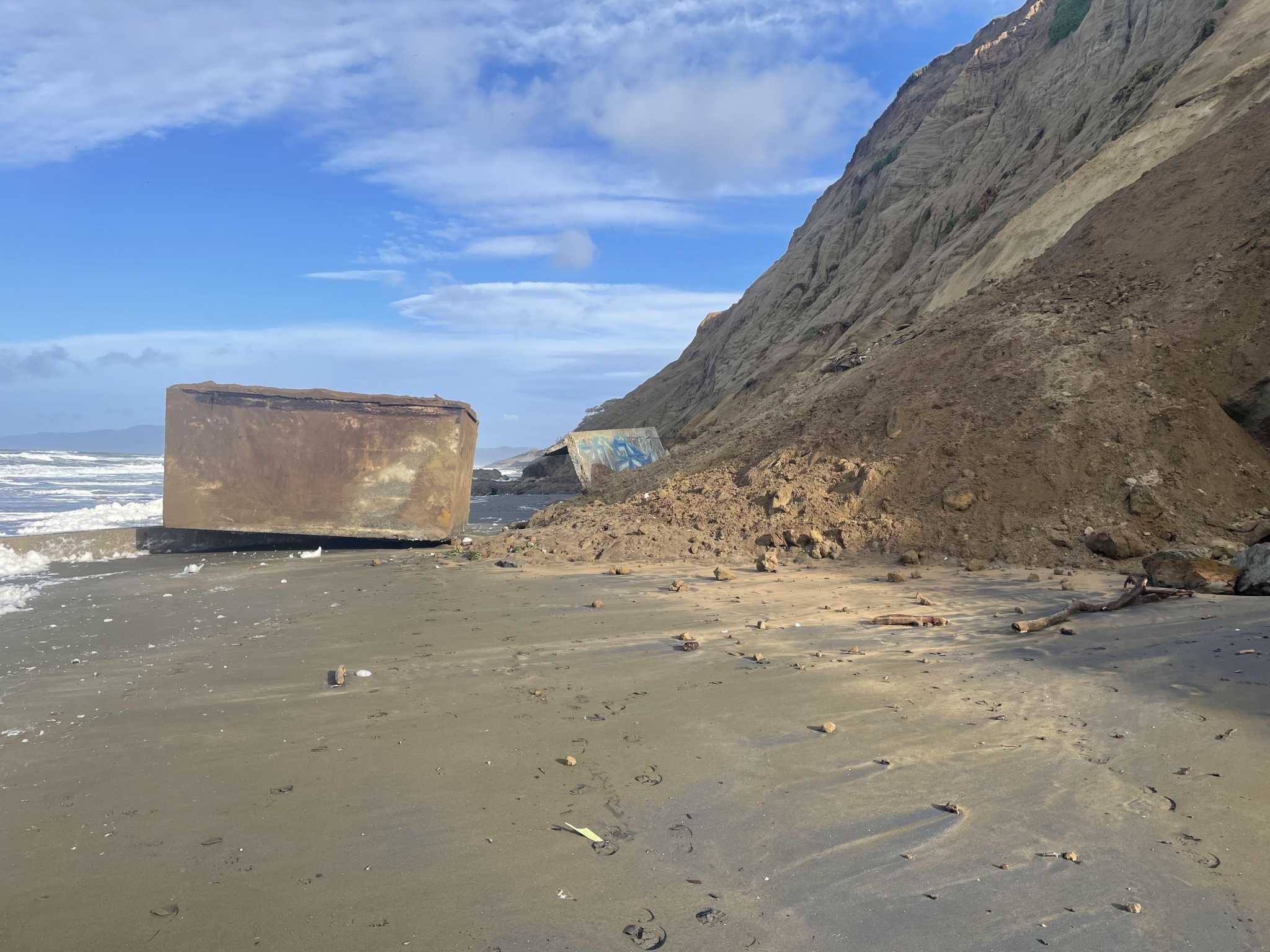
Fort Funston visitors beware: A World War II era structure fell off a cliff and landed on the beach​


A military structure slid down a rain-drenched bluff at Fort Funston Monday morning and dropped onto the beach below, according to the Golden Gate National Recreation Area.

In a photo posted by park officials to Twitter, a block structure appears to have landed upside-down in the sand below the cliffs, deposited there by a slide of dirt and rock.

The structure tumbled off the cliff around 10 a.m. Monday and slid about 200 feet, according to the San Francisco Fire Department, which responded to the incident. There were no injuries.

Symbolism 🤔
 
It is not a Russian missile but "Soyouse".
In full takeoff, the Soyuz rocket is struck several times by lightning
 

Pacific storms will once again reach the West Coast of the United States after a hiatus over the last couple of weeks.
Updated Feb 3, 2023 3:10 AM CET By Alex Sosnowski, AccuWeather senior meteorologist
Pacific storms will once again reach the West Coast of the United States after a hiatus over the last couple of weeks. AccuWeather forecasters say that the upcoming storms won’t pack quite the same punch as storms in early January.

A change in the weather pattern will bring more of a west-to-east flow in the jet stream, which will usher in a string of quick-moving storms from the Pacific Ocean. In general, the storms will deliver moderate amounts of rain and mountain snow compared to the extreme amounts unleashed by powerhouse storms earlier last month.

Systems will also take aim a bit farther north than previous storms, mainly aiming at Northern California and the Pacific Northwest, as AccuWeather meteorologists have been predicting since early in January.

Episodes of rain and snow over the Sierra Nevada and Cascades could cause travel slowdowns and delays at times. Incidents of flash flooding and debris flows will still be possible, but they are unlikely to be widespread. Road washouts will be much less likely with the upcoming storms.

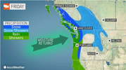
The first of these storms will be on the weaker end of the spectrum and will spread some rain showers from Central California northward to western Washington on Friday and Friday night.
Screenshot 2023-02-02 at 20-36-25 Pacific storm train to resume along West Coast.png

"The approximate southern cutoff from the meaningful rain will probably be around or just north the San Francisco Bay region," AccuWeather Senior Meteorologist Heather Zehr said. From 0.50 of an inch to 1 inch of rain can fall on the west-facing Coast Ranges north of San Francisco from Friday to Friday night.

Because this storm will tend to lift northward as it nears the coast, very little or only spotty rain will reach the interior valleys of the state, as well as across much of Southern California.

"This storm will bring very little snow overall as it largely misses the Sierra Nevada," Zehr said, "but it will bring several inches of snow to the higher terrain of interior Northern California and Oregon."

The second storm, which will be a bit stronger, will track farther south and will spread meaningful precipitation much farther inland this weekend.

"The storm from Saturday to Sunday will bring more substantial rain and mountain snow to more of the state, compared to Friday's system," Zehr said.

"Rainfall totals with the weekend storm will be 1-2 inches in the Coastal Ranges near and north of San Francisco as well as in the foothills of the Sierra Nevada," Zehr said. "There is also a better chance for at least a half an inch of rain in the Bay Region and perhaps even the Sacramento Valley."

Rainfall will be limited in much of Southern California. However, there will still be a small amount and enough to make roads slick in many locations, especially from Saturday night to Sunday.

"The Sierra Nevada will get snow out of this storm, but it will not approach the staggering totals from many storms during early January. Snow levels will start around 6,000 feet but lower to 4,000 feet as the storm progresses. Where the storm is all snow, 1-2 feet will pile up," Zehr said.

Additional storms will move onshore along the Pacific coast in the coming weeks. Some will track into the Northwest, but some will tend to focus more on California.

"One storm that could have a more significant impact on Southern California, compared to this weekend's storm, will be the following weekend of Feb. 11-12," AccuWeather Lead Long-Range Meteorologist Paul Pastelok said. "Depending on the exact track, there could be substantial rain for Los Angeles."

AccuWeather Chief On-Air Meteorologist Bernie Rayno said that the anticipated pattern for the next couple of months is a good sign.

"This [pattern] will bring more meaningful rain to California," Rayno said. "If there can be more normal rainfall in California during February and March, instead of the complete shutoff like which occurred last year, then further improvement of the drought is likely."
Screenshot 2023-02-02 at 20-22-37 Pacific storm train to resume along West Coast.png
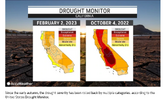
The storms from December to the first half of January have already had a tremendous impact on the long-term drought in California. In a matter of weeks, the two highest categories of drought -- extreme and exceptional -- completely disappeared, according to the United States Drought Monitor.

Many reservoirs in the state had water levels close to or above their average levels for early February, and that represents a tremendous boost from extremely low levels at the start of the winter.

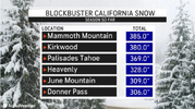
Even though there have not been any big snowstorms over the southern Sierra Nevada since the middle of January, snowfall on the slopes ranges from 170% of normal in the north to nearly 250% of normal for the season to date.

As long as periodic storms, even of average nature, continue in the region through the end of the wet season, the snowpack and reservoir levels will be largely preserved and may climb even higher.
Screenshot 2023-02-02 at 20-24-22 Pacific storm train to resume along West Coast.png
As the snow over the intermediate and high country gradually melts in the spring and summer, runoff helps to fill out streams, which then fill lakes and reservoirs for use during the growing season and for drinking purposes year-round.

La Niña is weakening -- what's next?

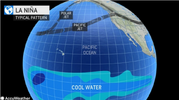
A weakening La Niña pattern and other factors helped produce the surge of strong storms and moisture into California from late December to early January. La Niña is a climate pattern defined by persistent lower-than-average water temperatures in the tropical Pacific and the jet stream pattern along the West Coast of North America.
Screenshot 2023-02-02 at 20-27-28 Pacific storm train to resume along West Coast.png

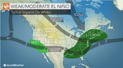
On the other hand, when waters in the tropical Pacific trend and remain warmer than average, an El Niño is declared. During an El Niño, the southern branch of the jet stream sometimes directs many storms and moisture into California.

While the gradual weakening of La Niña to a neutral state is forecast to continue into the summer, there is the potential for an El Niño pattern to evolve from the late summer to the autumn. Depending on other atmospheric and Pacific Ocean conditions, such a pattern could bring more frequent and moisture-laden storms to California and the Pacific Coast states in general next wet season.

"Based on how things have gone this year, it is obvious that California weather is impacted by more than just La Niña or El Niño," Pastelok said.
Screenshot 2023-02-02 at 20-33-04 Pacific storm train to resume along West Coast.png

"A change to El Niño can help the chances for a stronger southern storm track into California next winter, but much may depend on water temperatures over the north-central and eastern Pacific," Pastelok said. "This far out, there is still some uncertainty to whether El Niño will maintain through the fall and winter or stay weak or perhaps fall back to neutral."


Groundhog Day 2023 - Northeast Braces For Record Cold - Global Temps Fall - Solar Cycle 25 Update
Premiered 7 hours ago
 
Screenshot 2023-02-04 at 07-09-57 Tobey Crawford Connor on Twitter.png


Steam devil' forms over chilly lake in Vermont
Screenshot 2023-02-04 at 08-02-46 'Steam devil' forms over chilly lake in Vermont.png

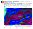
Winter weather in Northern Europe this week! A high pressure high over the North Atlantic combined with a strongly undulating jet stream picks up a piece of polar vortex. Low pressure circulation under blockage to follow: risk of thermal conflict with snow
Line-2
Typical situation of a NAO- with cold anomaly envisaged throughout the week over Northern Europe, wintry, contrary to the South, under the mildness. Beware of air mass conflicts. France, Germany, Poland in the crosshairs of potential snowy episodes (2/3)
Screenshot 2023-02-04 at 08-13-20 Alexis Vandevoorde - La Chaîne Météo on Twitter.png
Naturally, one models a fall of reliability on the zone of thermal gradient. Uncertainty on its location / and on its humid character depending on the oceanic influence and the resistance of the cold intensity of winter disturbances to be confirmed! (3/3)
 

Thousands without power after storm hits Texas with heavy rain, tornadoes​


Tornadoes touched down in Texas and Louisiana as a powerful storm system that dumped heavy snow in California moved eastward Thursday, knocking out power to tens of thousands of people and forcing the cancellation of hundreds of flights into and out of Dallas.

Tornado warnings issued for Dallas, Fort Worth and surrounding areas of Texas expired by late afternoon but strong winds and hail continued, according to the National Weather Service.

About 100 miles east of Dallas, a twister that hit the ground near the small town of Fouke moved northeast toward Texarkana at 55 mph, the weather service said.

The NWS Storm Prediction Center reported that a severe thunderstorm watch was in effect through midnight Thursday for parts of southeast Texas, including Houston and College Station.

Further east in Louisiana, a tornado touched down near Louisiana State University in Shreveport.

More than 338,000 utility customers in Texas had no electricity as of Thursday night, according to the utility tracking website poweroutage.us.

The Federal Aviation Administration briefly issued a ground stop at Dallas-Fort Worth International Airport Thursday afternoon due to the severe weather, CBS Texas reported, but it was later lifted.

"Normal operations are resuming after heavy winds and rains moved through our area," the airport told CBS News in a statement Thursday night.

According to flight tracker FlightAware.com, Dallas-Fort Worth International Airport and Dallas Love Field had tallied more than 400 cancellations total, either to or from the airports.

Several school districts, including Dallas and Fort Worth, canceled after school activities and events because of the forecast.

"This is the same system that struck California and it's now in New Mexico and will be crossing Texas and then Arkansas," said Rich Thompson, lead forecaster for the Storm Prediction Center in Norman, Oklahoma.

He said high winds and large hail posed the greatest threats.

Meteorologists say the storm produced a "once-in-a-generation" snow in California and Oregon with up to 7 feet accumulating in spots.


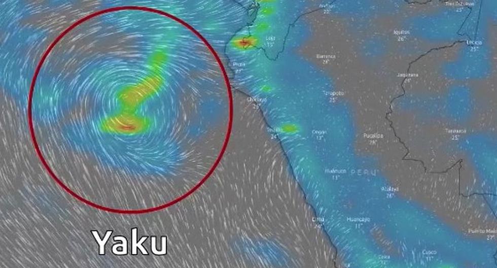
An unusual "cyclone of unorganized tropical characteristics". This is how the Peruvian National Meteorological and Hydrological Service (Senamhi) has described Cyclone Yaku, which is currently present in the Peruvian sea off the northern and central coast.

What is the Yaku cyclone recorded in Peru?

A strange meteorological phenomenon
is registered in northern and central Peru. It is the Yaku cyclone that would have its origin due to the intense rains registered in regions such as Piura, Lambayeque and Tumbes. According to the National Service of Meteorology and Hydrology of Peru (Senamhi) this event would have unorganized tropical characteristics. What is known about this?

Specialists have considered that cyclone Yaku has a direct influence on the rains that have been occurring in some northern regions of the country, such as Lambayeque, Piura and Tumbes. During the last weeks, intense rainfall has been registered in different localities of the national territory.

Likewise, according to Senamhi, in the next few days this could be repeated in regions such as Libertad, Lima and Ancash, according to Meteorological Advisory N°44. The entity specifies that this could be seen especially in the middle basins of the Pacific slope, generating increased flows and activation of streams.


UNUSUAL! For the first time in history, the presence of a tropical hurricane has been detected off the Pacific coast of South America.

⚠️El cyclone has been named "Yaku" in Peru and is expected to affect the desert coast of that country in the coming days.

My beloved Guayaquil is suffering the worst floods in the last 5 years and we are only in the middle of winter and all this was aggravated after the presence of cyclone yaku on the border between Ecuador and Peru.

Cliclon YAKU is generating disturbances throughout the border area between Ecuador and Peru and has even strongly affected all of Guayas and Manabí, the rains have caused flooding.

At approximately 10 p.m. today, March 8, 2023, winds and thunderstorms will intensify around the storm (yaku) located between Ecuador and Peru in the Pacific Ocean, which is affecting several places in the coastal area with precipitation.
 
I am a bit confused

About the cyclone "Yaku", or the phenomena of a proposed tropical storm like feature.

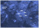
As i just checked Windy.com, watching how the clouds moved over and near Peru (and southern Ecuador) ... I couldn't discern any circular motion of cloud masses there. Instead I found that dense thunderstorm clusters where popping up over Northern Peru inland region - likely causing torrential rainfalls - but steadily drifting out of sea by moving uniformly in one direction; towards the ocean.

_-2023-03-09-at-04.58.25.jpg

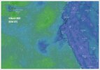
When looking at Windy's wind pattern model, there was a hint of circulation shown - but nothing dramatic in any way. It is far off the Peruvian Coast (to the left) in the below illustration map - where you can spot a weak pattern of circulation.

Yet, the corresponding cloud patterns above the circulation, didn't show much activity nor movement really (other than a layer of mainly low and mid-level clouds). I don't really see any visible relation to the T-storm activity over land - the latter which i assume is real cause for torrential rains over Peru and Southern Ecuador in the first place.

But, how does this relate to the aforementioned, proposed tropical-storm like, circulating, "Yaku" phenomena, I mean in this case ? (I am not saying the phenomena doesn't exist - I only wonder, how the current weather situation at the coastal regions really is connected to a "Yaku" tropical storm phenomena ?)

I don't see one.

I see heavy T-storm activities being primarily responsible for the heavy, rainy weather and floods in parts of Peru and Ecuador.

_-2023-03-09-at-04.58.39.jpg

A pity is, that Windy.com has no limited the satellite animation from 24 hours down to only 2 hours, which makes it more difficult to follow a weather development backwards in time.
 
I couldn't discern any circular motion of cloud masses there. Instead I found that dense thunderstorm clusters where popping up over Northern Peru inland region - likely causing torrential rainfalls - but steadily drifting out of sea by moving uniformly in one direction; towards the ocean.

Peruvian meteorologists actually see what you see and that is why they call it an "unorganized tropical cyclone" and something rare. (Is it possible that Peruvian meteorologists have no idea what is happening?)

#News Unorganized tropical cyclone "Yaku" develops off the Peruvian sea. This low pressure system influences extreme rainfall on the north coast gob.pe/en/n/721545

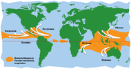
Common cyclone and hurricane zones in the world.
20230308_233458.jpg
cyclone_map_large.sp_.sp_.gif
 
Still, I couldn't see a direct relation between the phenomena of the swirl, vs the rainfalls over land/coastlands. Partially because the supposed "swirl" wasn't anything strong nor even anything pronounced. Especially the satellite images didn't show any connection (in my opinion).

The major direction of influence, are the winds that come from inland driving out of sea - but those are all uniform into ONE direction, creating numerous thick thunderstorms on their pathway over the mountains of Peru and Ecuador (forced lifting) - which of course generate the necessary dynamics for torrential rainfalls along the coast and mountain regions (collecting water, going down towards the coast)

But - maybe I fail to see the less visible mechanism here. Maybe the swirl even when weak, kind of creates a "barrier" of flow along the Upper Peruvian / Ecuadorian coast ? But there is another problem: The winds which are beautifully rendered at Windy.com are MODELED, and not based on observations, which poses a problem. Models may show something, trying to indicate something, but not necessarily show, what's really going on with the true winds in that area (which after all is way off shore from the cost - and i doubt they surveil that area, with many sondes sent into the sky)

So, instead i continue to observe what's going on there. With both the off shore weak 'swirl', as well the thunderstorm development over Peru in the near future.

Thank you anyway, Puma :flowers:
 
Last edited:
Tropical cyclone Freddy has broken the record for the longest lasting tropical system.

Here's what Higgins Storm Chasing has to say about it:

FREDDY continues to SMASH records... this time, becoming the LONGEST LIVED tropical system in the WORLD!

FREDDY is amassing a number of records as the system continues with the 'never say die' attitude. FREDDY is currently situated over the Mozambique channel between Madagascar and Mozambique, with all models in agreement that the system will meet its demise over the coming days... but we will wait and see on that.

* FREDDY is one of four systems to traverse the entirety of the Indian Ocean (LITANNE 1994, LEON-ELINE 2000 & HUDAH 2000 were the other 3).
* FREDDY is the ONLY known tropical cyclone to achieve 6 seperate rapid intensification cycles
* FREDDY reached Category 5 strength twice, and even spent a period of time at Category 5 US strength (Cat 5 in the US is stronger than Cat 5 in AUS) with peak sustained winds of 265km/h and gusts much higher than 300km/h.
* FREDDY is now the longest lived tropical system - surpassing Hurricane JOHN at 34 days. Its expected that FREDDY will get to at least 37 or 38 days before finally dissipating.

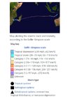
A picture of the path that Freddy has followed from wiki:

Screenshot_20230309-194052_Samsung Internet.jpg
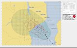
Zooming in on latest activity and forecast from wiki:

Screenshot_20230309-194450_Samsung Internet.jpg
 
Now that's interesting/curious

I mean, that they associated the disturbance (remnants) left behind, after the first landfall of "Freddy" on the African continent - with a new disturbance, but going by the same name, insisting that those were / are still "Freddy". When I looked at satellite charts a couple days after Freddy's landfall on Mozambique, there wasn't really much left worth to name "Freddy" or tropical disturbances. They were remnants, thunderstorm rests dissolving - and that was it.

Yet, they decided, that when new disturbances flared up in the region, moving out over the warm sea water and starting to rotate into a tropical storm - to attribute it to the same "Freddy..."

Well - that's a way to make headlines, isn't it ? Perfectly fitting in the psycho-unruly times under the spell of Climate Change headlines.

The normal procedure would have been to call the new disturbance with a new name / as a new entity. But then this would not have created an-all-time-new-record-for-the-longest-lasting-tropical-system...
 
Back
Top Bottom