I'm going to take this as confirmation that the eruption was indeed heard in Alaska:
You are using an out of date browser. It may not display this or other websites correctly.
You should upgrade or use an alternative browser.
You should upgrade or use an alternative browser.
Major Eruption of Undersea Volcano in Tonga
- Thread starter sToRmR1dR
- Start date
Hi_Henry
The Living Force
Impressive to see this shock wave move as it does.
Here is a Chinese view of the same
Nature is the ultimate power.
Here is a Chinese view of the same
Nature is the ultimate power.
Last edited:
mrtn
Dagobah Resident
You can kind of play the event here (in satellite view, wind off, correct datetime)

 www.ventusky.com
After you clicked in the timeline you can use left/right cursor keys to step through time.
www.ventusky.com
After you clicked in the timeline you can use left/right cursor keys to step through time.
Ventusky - Live Weather Forecast & Radar Maps
See the weather like never before – live weather maps powered by the most accurate models.
Still little news from Tonga itself. However, a British woman was reportedly killed by the tsunami there:

 www.gbnews.uk
British woman Angela Glover dies after trying to rescue dogs in Tonga tsunami
Angela Glover, from Brighton, died after an undersea volcano erupted near the Pacific nation on Saturday
www.gbnews.uk
The shockwave(s) travelled around the planet more than once. Here's the 'western' end of a shockwave passing over the US after the nearer 'eastern' part of the wave had already done so:
Exactly, and I'd expect to see some sort of an interference (pattern) after 1st shockwave front had passed (interfering with itself coming from other directions), which can be seen in some AS measurements (smaller disturbances in pressure between 9 PM and 2 AM).
I'm surprised by 'pronounced end' of the phenomenon, sharp and sudden drop (~ minutes) in pressure which then slowly (over 2h) returned to the baseline.
This sudden drop and slow relaxation to normal looked strange/weird to me, as if somehow some of the air was abruptly sucked out of and then slowly released back to lower atmosphere (at the sea level).

Chad
The Living Force
Some quality before and after satellite images showing the damage the tsunami and ash caused to Tonga. As well as a before and after shot of the caldera.
The images use the scroll feature to show the before and after so best to visit the page to see: Before and after images show extent of destruction from Tonga volcano
The images use the scroll feature to show the before and after so best to visit the page to see: Before and after images show extent of destruction from Tonga volcano
The island of the Hunga Tonga-Hunga Haapai volcano, which registered a violent eruption on January 15, has practically completely disappeared. This area no longer exists, as can be seen by comparing an image taken by the EU's Sentinel 2 satellite on January 2, with another from Sentinel 1 acquired 12 hours after the big eruption.
XPan
The Living Force
The island of the Hunga Tonga-Hunga Haapai volcano, which registered a violent eruption on January 15, has practically completely disappeared. This area no longer exists, as can be seen by comparing an image taken by the EU's Sentinel 2 satellite on January 2, with another from Sentinel 1 acquired 12 hours after the big eruption.
That is fascinating.
I mean the very latest satellite image shows that there is indeed not much left of the island - and clearly less compared to the image I had uploaded to the forum (which states having been taken on 15 Jan 2022 3:25 p.m. but unknown what kind of timezone). It makes me assume that the first image below was perhaps taken after the initial large eruption of 13 Jan 2022, but right before the final blast of 15 Jan 2022 ??
The destruction of the last image does make (more) sense given how extreme powerful the last eruption was. It looks to me, that the ground of the island (being a caldera after all) sank a bit, too (given that the oldest parts of the island, the two peaks, where of more robust, older origin).
15 January 2022 15:25 (but what local time ?)
15 January 2022 ??:?? (but what local time ?)
An update today from the New Zealand Air Force:
And some more from this media report:

I guess things can't be so bad there if they're more afraid of Covid. Then again, that's what one of their government people says...
17 January, 4.30pm: A Royal New Zealand Air Force P-3K2 Orion aircraft left RNZAF Base Auckland today at about 0820hrs. The crew’s plans were to fly first over the Ha’apai group of islands, and then fly over Tongatapu to check the status of the runway and port. The aircraft is not landing in Tonga and is scheduled to arrive back at RNZAF Base Auckland this evening. So far, we haven’t had a formal request from the Kingdom of Tonga to provide further support, apart from this initial reconnaissance flight but, as always, we remain ready to respond if asked to do so.
And some more from this media report:
Australia and New Zealand on Monday sent flights to Tonga to survey the damage after the eruption of an undersea volcano left the tiny Pacific kingdom covered in ash and caused a tsunami.
Australia’s Minister for the Pacific Zed Seselja said Saturday’s eruption at the Hunga Tonga Hunga Ha’apai volcano and subsequent tsunami did not cause mass casualties but authorities had toured beaches and saw “significant “damage with “houses thrown around.”
“We know there is some significant damage, and know there is significant damage to resorts,” he said in an interview with an Australian radio station, adding that Tonga’s airport appeared to be in relatively good condition and that a British woman was reported missing.
Curtis Tu’ihalangingie, the Tonga’s deputy head of mission in Australia, said Tonga is concerned about aid delivery workers bringing a wave of COVID-19 to the coronavirus-free South Pacific island. Aid workers dispatched to Tonga would be required to be quarantined, and it was likely no foreign personnel would be allowed to disembark aircraft, according to Tu’ihalangingie.
I guess things can't be so bad there if they're more afraid of Covid. Then again, that's what one of their government people says...
Last edited:
Yeah, I don't think the first image is showing the aftermath of the most recent eruption. There was a big eruption there a month ago on December 19th, so it's probably that. This guy thinks the photo was actually taken on January 14th, the day before the latest (bigger) eruption:That is fascinating.
I mean the very latest satellite image shows that there is indeed not much left of the island - and clearly less compared to the image I had uploaded to the forum (which states having been taken on 15 Jan 2022 3:25 p.m. but unknown what kind of timezone). It makes me assume that the first image below was perhaps taken after the initial large eruption of 13 Jan 2022, but right before the final blast of 15 Jan 2022 ??
The destruction of the last image does make (more) sense given how extreme powerful the last eruption was. It looks to me, that the ground of the island (being a caldera after all) sank a bit, too (given that the oldest parts of the island, the two peaks, where of more robust, older origin).
View attachment 53729
15 January 2022 15:25 (but what local time ?)
View attachment 53730
15 January 2022 ??:?? (but what local time ?)
XPan
The Living Force
There was a bigger eruption on 13-14 Jan 2022
Hunga Tonga-Hunga Ha'apai volcano, which was the first eruption after two weeks of silence (30 Dec 2021) - and created a smaller tsunami arriving at Tonga island with wave height close to 55 cm - but that was two days before the final, majestic eruption on 15 Jan 2022.
In the past 12 hours, I have not seen any ash puffs coming from the volcano, but there have been a few small ones yesterday.
Vulkane.net writes about Hunga Tonga-Hunga Ha'Apai Volcano
Expanding a bit the above: Partial history of the emerging land, with pictures, starting Dec 2014 and followed with a brief note on Dec 2021- 3 Jan activity.
Global Volcanism Program | Hunga Tonga-Hunga Ha'apai
The small andesitic islands of Hunga Tonga and Hunga Ha'apai are part of the western and northern remnants of the rim (~6 km diameter) of a largely submarine caldera located about 30 km SSE of Falcon Island. The topmost sequence of welded and unwelded ignimbrite units from a caldera-forming...
volcano.si.edu
December 2014 to January 2015 eruption at submarine caldera builds new land above water
This 2014-2015 eruption followed 5 years of quiescence, the previous eruption having occurred in 2009. That 2009 eruption formed new land above water and deposits destroyed vegetation on neighboring Hunga Tonga and Hunga Ha'apai islands. The 2009 eruption added land at the S end of Hunga Ha'apai island. [...]
3D imagery showing how small is the part of the volcano that's visible:
Huge amounts of lightning strikes detected
Lightnings presented as a GIF :)
Sulphur Dioxide cloud over NE Australia as of yesterday
OK, this sounds bad. Tweeted by Dr Janine Krippner - Kiwi Volcanologist at SmithsonianGVP
More quotes from that thread below.
Linked to:

 www.rnz.co.nz
More quotes from that thread below.
https://t.co/oiqB5u4nJGWe can't zip out and put sensors on the volcano to understand what is happening below the surface - that is how we monitor and forecast eruptions. We only have satellites and they only shows us the surface, the top of an ash plume and now the ocean.
We can use what we know about global volcanic eruptions, what researchers know about this volcano in particular, what it has been doing over the past few years. We do know a lot about how volcanoes work, we simply do not know what will happen next.
This is an unfolding disaster and Tongan communities are suffering. If you are wondering whether or not this is worth covering, it is.
It's hard to see disasters ignored past a day or so when it's not a rich, white country being impacted. With the lack of communication the local voices are muted. This is still an unfolding disaster and a bloody awful situation for Tongans everywhere.
This is a very difficult thread to post. In this situation we follow the word of the official volcano monitoring agency because they truly do have the best knowledge and data, that is not the case this time. This is different.
This shows how serious the situation in Tonga is. A disaster should not be measured by known loss of life alone.
[link]
Linked to:
Distress signal prompts UN concern after Tonga volcanic eruption
A distress signal has been detected in an isolated, low-lying group of islands in the Tonga archipelago following Saturday's massive volcanic eruption and tsunami, the United Nations says.
www.rnz.co.nz
A distress signal has been detected in an isolated, low-lying group of islands in the Tonga archipelago following Saturday's massive volcanic eruption and tsunami, the United Nations said, prompting particular concern for its inhabitants.
Initial reports suggested no mass casualties on the main island of Tongatapu, but two people were reported missing and the capital Nuku'alofa was badly damaged, as were resorts and homes along the island's western beaches, it said.
"Further volcanic activity cannot be ruled out," the UN Office for the Coordination of Humanitarian Affairs (OCHA) said in the update on Monday, reporting only minor injuries but emphasising that formal assessments, especially of the outer islands, had yet to be released with communications badly hit.
The uninhabited volcanic island of Hunga Tonga-Hunga Ha'apai all but disappeared following the blast, according to satellite images from around 12 hours later. The Pacific archipelago was blanketed in ash and volcanic ash clouds spread to countries thousands of kilometres to the west.
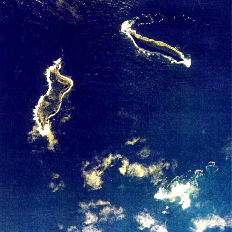
The OCHA said there had been no contact from the Ha'apai group of islands and there was "particular concern" about two small low-lying islands - Fonoi and Mango, where an active distress beacon had been detected.
According to the Tonga government, 36 people live on Mango and 69 on Fonoi.
Experts said the volcano, which last erupted in 2014, had been puffing away for about a month before rising magma, superheated to around 1000 degrees Celsius, met with 20-degree seawater, causing an instantaneous and massive explosion.
The unusual "astounding" speed and force of the eruption indicated a greater force at play than simply magma meeting water, scientists said. [...]
Trending content
-

-
Thread 'Coronavirus Pandemic: Apocalypse Now! Or exaggerated scare story?'
- wanderingthomas
Replies: 30K -
-
