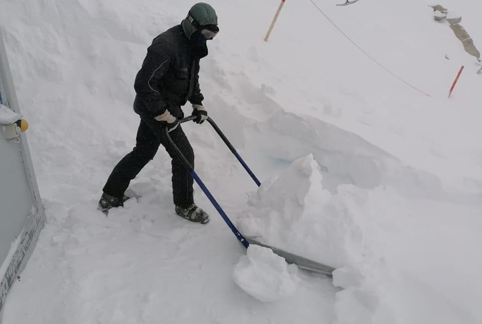
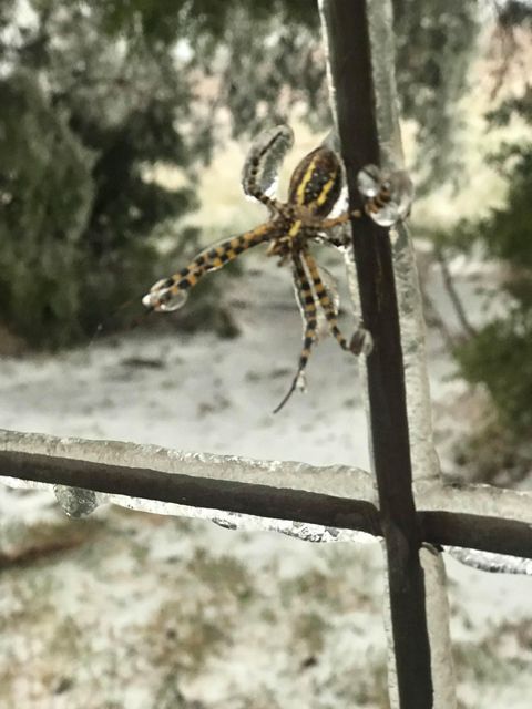
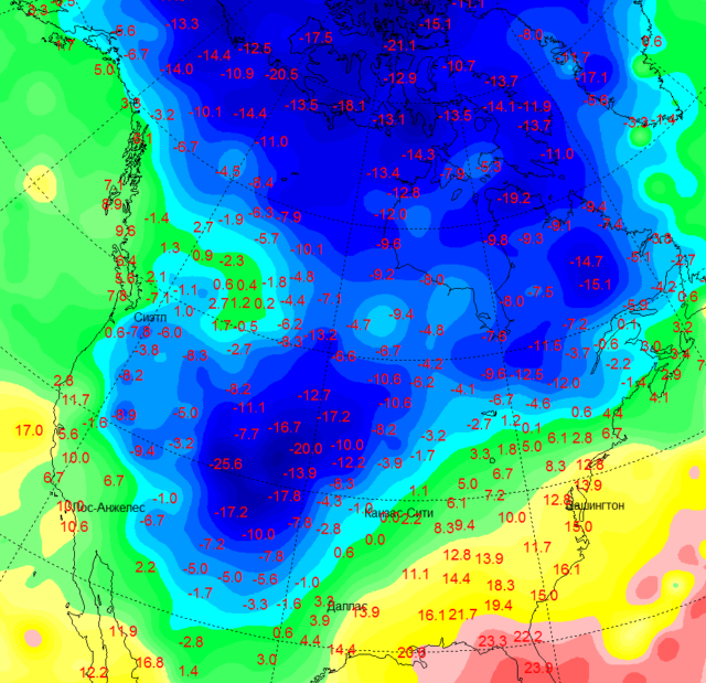
The invasion of the Canadian cold has turned the head of the American winter. Without waiting for November, she bound a huge territory in the middle of the United States with ice and frost. For example, in Denver, the temperature dropped to -15. Although a week ago in the capital of Colorado it was +25.
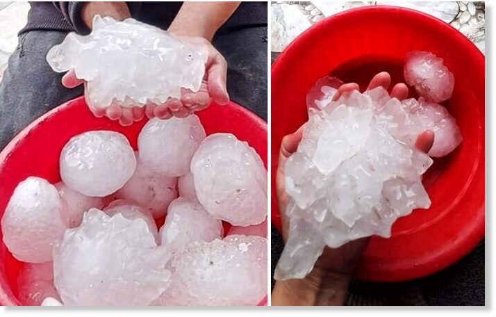
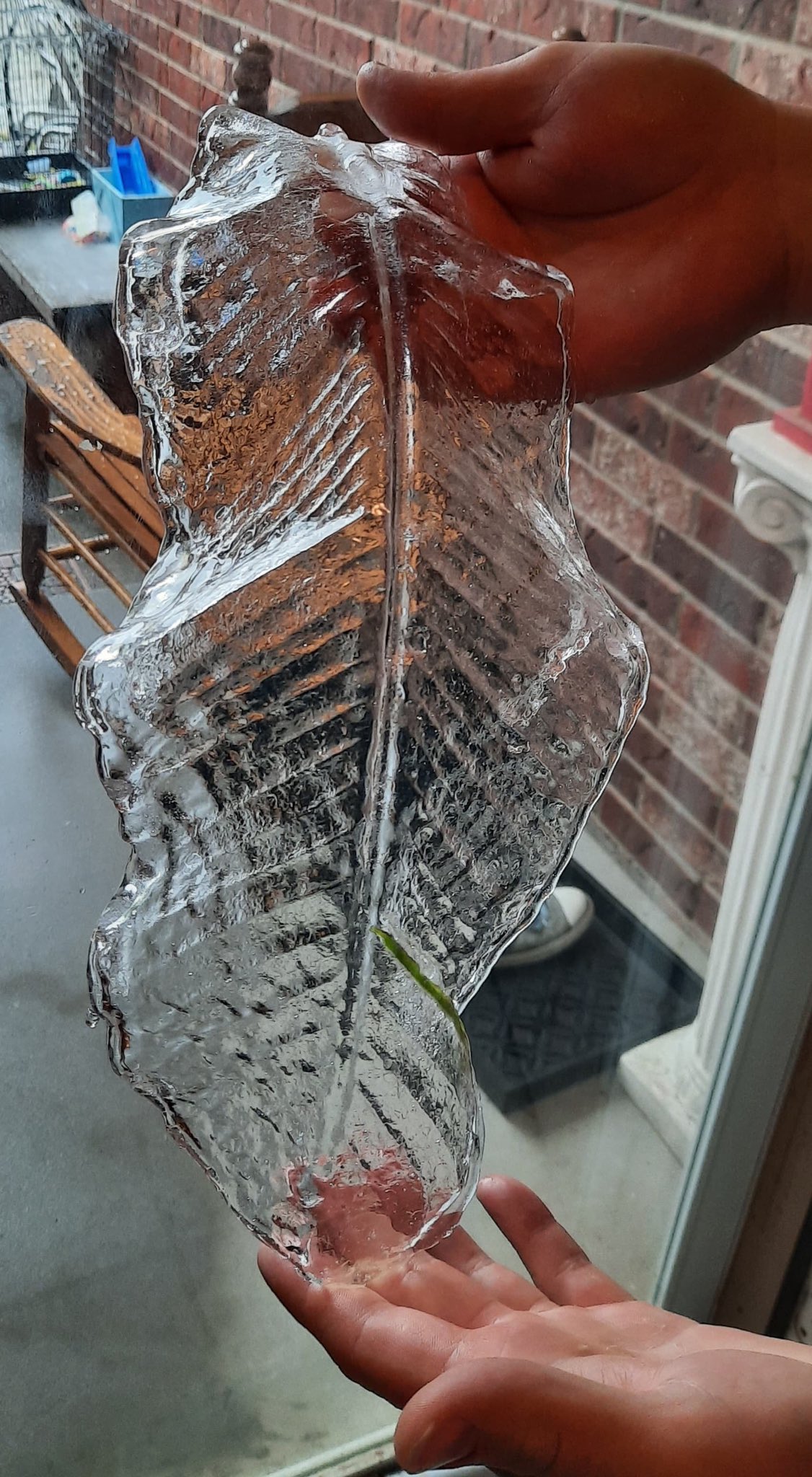
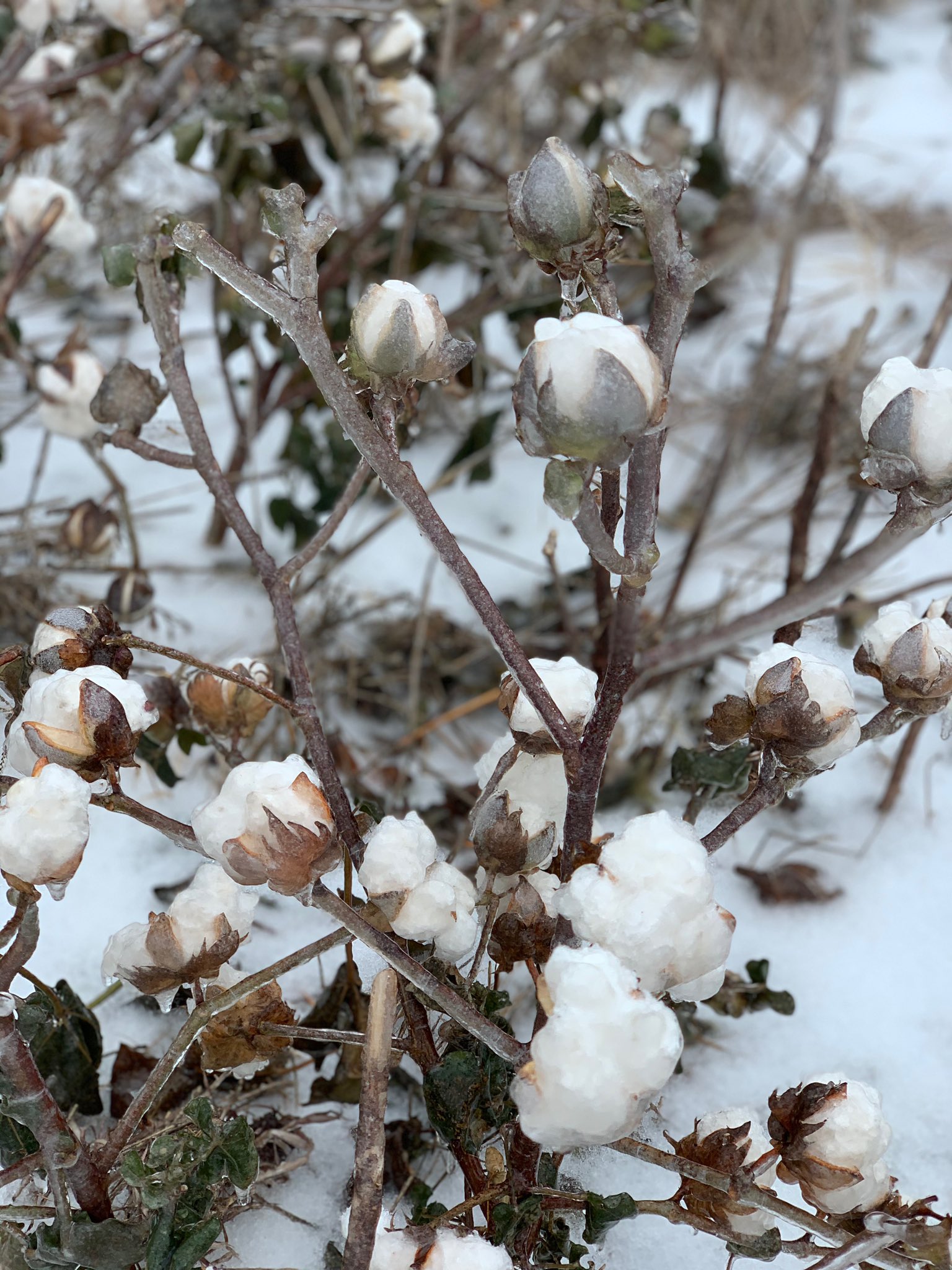
It's hard to believe, but at the end of October, the states with subtropical climates were hit by 20-degree frosts! In the town of Pueblo, Colorado, the thermometer showed −22.2. Frosts similar in strength were noted in Nebraska, Wyoming, Idaho and Utah. The small town of Craig in Moffat County, Colorado, where the temperature was -25.6 in the early morning of October 28, became the "pole of cold" of the United States these autumn days.

 www.gismeteo.ru
In addition, yesterday there was news that
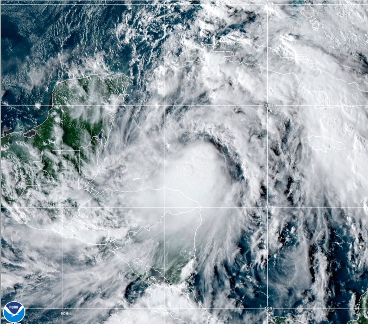
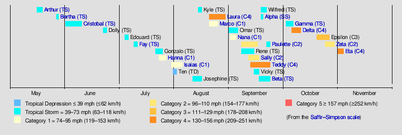
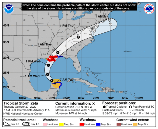
Hurricane Zeta hits Yucatan and moves towards Louisiana
Hurricane Zeta entered the territory of the Yucatan Peninsula, known all over the world for its resorts. The weather system is located northwest of the city of Tulum and moves northwestward at a speed of about 22 km / h. The wind speed reaches 112 km / h.
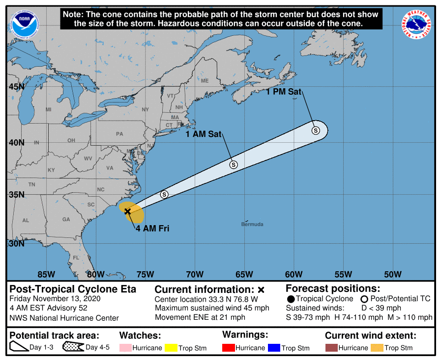
In the north and north-east of the peninsula, there are showers, strong gusts of wind blowing away roofs and trees, a storm warning has been announced. Waves in coastal areas reach 7 meters in height. Already today, Zeta will enter the Gulf of Mexico, moving towards the south of the United States. Tomorrow the weather system will enter the United States near the border of Louisiana and Mississippi.
Louisiana Governor John Bel Edward has declared an emergency in the state. He urged residents to prepare for the disaster, paying particular attention to the correct handling of generators. The disaster is expected to have the greatest impact on Louisiana on October 28 and 29.
 www.gismeteo.ru
PS We see that almost SIMULTANEOUSLY two forces hit the US territory, a cold from the north and a hurricane coming from the south. This is a bit like The Day After Tomorrow. I wonder what will happen on the planet this winter?
It's hard to believe, but at the end of October, the states with subtropical climates were hit by 20-degree frosts! In the town of Pueblo, Colorado, the thermometer showed −22.2. Frosts similar in strength were noted in Nebraska, Wyoming, Idaho and Utah. The small town of Craig in Moffat County, Colorado, where the temperature was -25.6 in the early morning of October 28, became the "pole of cold" of the United States these autumn days.
В субтропических штатах ударили 20-градусные морозы
Огромная территория скована льдом и нетипичным морозом.
www.gismeteo.ru
In addition, yesterday there was news that
Hurricane Zeta hits Yucatan and moves towards Louisiana
Hurricane Zeta entered the territory of the Yucatan Peninsula, known all over the world for its resorts. The weather system is located northwest of the city of Tulum and moves northwestward at a speed of about 22 km / h. The wind speed reaches 112 km / h.
In the north and north-east of the peninsula, there are showers, strong gusts of wind blowing away roofs and trees, a storm warning has been announced. Waves in coastal areas reach 7 meters in height. Already today, Zeta will enter the Gulf of Mexico, moving towards the south of the United States. Tomorrow the weather system will enter the United States near the border of Louisiana and Mississippi.
Louisiana Governor John Bel Edward has declared an emergency in the state. He urged residents to prepare for the disaster, paying particular attention to the correct handling of generators. The disaster is expected to have the greatest impact on Louisiana on October 28 and 29.
Ураган «Зета» обрушился на Юкатан и движется к Луизиане
Завтра погодная система выйдет на территорию США у границы Луизианы и Миссисипи.
www.gismeteo.ru
PS We see that almost SIMULTANEOUSLY two forces hit the US territory, a cold from the north and a hurricane coming from the south. This is a bit like The Day After Tomorrow. I wonder what will happen on the planet this winter?