The Ice Age Cometh! Forget Global Warming!

The storm delivered accumulations measured in the feet across Greenland, totals that pushed the island's SMB balance into record breaking territory. Once again, and as we have witnessed numerous times already this summer, snow and ice gains are annihilating previous benchmarks, and, once again, the mainstream media are refusing to inform the wider population.

And that looks like it is to be our fate... not being informed because the media is totally under the thumb of the idiots who think they are running the show.
 
And that looks like it is to be our fate... not being informed because the media is totally under the thumb of the idiots who think they are running the show.
Recently they had a "special" in the news about "" global warming "" and how they expect the temperature rise 2 degrees worldwide ... I really could only tolerate 5 minutes, their arguments were the increase in methane in the air caused by man-made instability ... hearing that directly i had to turn off the tv.
The most "depressing" thing is that, with whom i speak, they repeat absolutely the same thing: "the climate is crazy, the human being is destroying the world" (I think they have been infected by the greta virus). In short, yes, things are getting worse and worse, we will see how everything unravels, but just in case, it does not hurt to accumulate blankets.

Due to the obviousness of how things develop, blind is who does not want to see.


Hurricanes are known for their destructive wind, rain, and storm surge. Hurricane Larry delivered more than that. On September 12, 2021, the storm’s remnants dropped abundant snowfall on Greenland just as the summer melt season was coming to an end.

Snowfall amounts on that day are visible in the map above, as represented by the Goddard Earth Observing System (GEOS) model. Snowfall amounts are shown as millimeters of water, as opposed to snow depth, for the 24-hour period. Fifty millimeters of water is equivalent to about 200 millimeters (8 inches) of snow, assuming the snow has a density of 250 kilograms per cubic meter.

Like other weather and climate models, GEOS uses mathematical equations that represent physical processes (like precipitation and cloud processes) to calculate what the atmosphere will do. Actual measurements of physical properties, like temperature, moisture, and winds, are routinely folded into the model to keep the simulation as close to measured reality as possible.

Through early September, Hurricane Larry traveled northwest across the Atlantic Ocean reaching a peak strength of category 3 on the Saffir-Simpson wind scale. It weakened as it turned north, staying well offshore of the U.S. East Coast, and then made landfall as a category 1 storm over Newfoundland in eastern Canada on September 11.

Next, Larry reached Greenland on September 12 as a post-tropical storm, delivering high winds and copious snowfall to the island’s southeast and interior. Kulusuk and Tasiilaq saw winds gusts topping 90 miles (145 kilometers) per hour and blizzard conditions were reported at Summit Station.

“Such storms are quite rare,” said Lauren Andrews, a glaciologist with NASA’s Global Modeling and Assimilation Office. “They generally dissipate well before reaching as far north as Greenland. Though there have been similar storms, including Noel in 2007 and Igor in 2010.”

Andrews also noted that it is unusual to see such a high rate of snowfall so soon after the end of the summer melt season, which occurs each year from around May to early September. In fact, the recent snowfall from ex-hurricane Larry could potentially balance out losses from melting during the summer, which included three notable melting events—two in July and one in August.

“It is a dramatic end to a season of extreme events across the Greenland ice sheet,” Andrews said.

Once the satellite data are fully processed, scientists will be able to gauge the state of Greenland’s mass balance. A positive mass balance means that more snow was gained than was lost through processes such as melting and runoff. So far, Andrews said, “It looks like 2021 will end up having an above average surface mass balance.”

Over the span of decades, however, Earth’s ice-covered regions have been losing more mass than they have been gaining. Such losses are a major contributor to global sea level rise.

NASA Earth Observatory image by Joshua Stevens, using GEOS-5 data from the Global Modeling and Assimilation Office at NASA GSFC. Story by Kathryn Hansen.

Premiered 11 hours ago

Flashback: August 19th:
Alta Ski Area Utah
First snowfall of the summer at Alta
Hey Mother Nature, what took so long?
 

Bismarck ND

Lord Vignemale this morning (France)


Onset of winter at the Furka Pass 09/19/2021 Of course, that doesn't stop us in the slightest from normal operations Hotel Glacier du Rhone

1632087869624.png

Seattle storm-scape from this afternoon. #wawx #seattle
2:23 AM · Sep 19, 2021 from Renton, WA

Updated: 1 day ago Published: 1 day ago
Snow. It is inevitable — and coming soon.

It is almost a certainty that the Alaska Range will get snow this weekend along the Denali Highway. It has been a warm fall thus far, but “normal” is about to strike.

I can recall many years with snow earlier than mid-September. The earliest snow that stayed, on the Maclaren, was in 1992. There were only a couple of inches until about Sept. 10, but it was cold. The Maclaren was running ice every morning, enough so you couldn’t run a jet boat on the river until afternoon. By mid-month there was enough snow to run air boats in the parking lot at Maclaren Lodge. One hit lodge owner Red Cooney’s pickup.

For those who would rather not see snow quite yet, this early snow isn’t likely to stick.

The forecast says “rain and snow.” Daytime temperatures should remain in the high 30s or low 40s. The high temperature on Thursday was 38 degrees at Maclaren Lodge. Not yet winter, but close.

A little snow will move caribou, but with only the federal subsistence hunt open, that won’t affect many.

Moose season will close Monday. The few brave souls who have stuck out the season may get one decent day of visibility to spot moose. Moose hunting in the upper parts of Unit 13 has been dismal this season. The few moose that have been spotted have been mostly cows, with a few sub-legal bulls. There have been some legal moose harvested, and some not-so-legal.

Wildlife troopers have been a no-show along the highway this fall — a lack of hunters led to a dearth of enforcement. Fortunately most folks are conscientious hunters and do their best to stay within the regulations.

The quiet hunting season will lead into an even quieter late-September. Traffic normally drops considerably after the Sept. 20 close of moose season.

Normally there will be a scattering of bear hunters and a few guys chasing birds as long as the Denali stays open. Snow will bring out the dog mushers.

The highway is maintained until the end of September, but if there is snow that amounts to anything on the ground, a good wind will shut things down quickly at Milepost 7 and along 13-Mile Hill.

I stuck a truck in the middle of the road at Mile 31 not many years ago. I was pushing snow as high as my headlights. Luck was with me — it was Sept. 29. A DOT road grader released me just after noon. There have been other winters when you could drive to Maclaren in December.

Should you choose to travel the Denali, remember that services are extremely limited.

Alpine Creek at Mile 68 will be open, and Maclaren will be open until mid-October. There are a few occupied spots on the west end of the highway.

The eastern side, the snowiest end, is pretty blank. Paxson Lodge does not exist. Meiers Lake, 15 miles south of the eastern terminus of the Denali on the Richardson, has limited hours. There is a DOT facility just north of the old Paxson Lodge that can possibly provide emergency help.

Come prepared to care for yourself. A lot of folks are opting for Inreach satellite communications these days, and they are a good idea and cheap insurance should a breakdown occur. But don’t let these new electronics trump preparedness. You should not expect to have someone else bail you out of a situation you could have prevented with a bit of forethought.

Don’t let the snowy, damp weather catch you by surprise. If you’re traveling out of Anchorage or the Mat-Su, look up at the mountains. See that termination dust? That is what will be on the ground as you travel into the high country along the Alaska Range.

In the early 1970s, I stuck a truck in the road near Tangle Lakes trying to drive a 2-wheel drive Ford to Maclaren. It was there until May. Don’t let that be you.

John Schandelmeier is a lifelong Alaskan who lives with his family near Paxson. He is a Bristol Bay commercial fisherman and a two-time winner of the Yukon Quest.
 
Last edited:
"Napoleon was defeated by the Mini Ice Age."
Napoleon was Defeated by Volcanoes
Posted Sep 5, 2018 by Martin Armstrong

QUESTION: I recently read that the weather defeated Napoleon created by a Volcanic Winter in 1815. It seems to have lined up with your chart on the decline in the energy of the sun and sunspot activity. Would you agree with that?

PH

ANSWER: Oh yes. The theory that Napoleon lost at Waterloo was the result of weather because he delayed the use of his canons. I agree with that theory which has been reported by the BBC. However, that is Waterloo and its relation to the eruption of Tambora. Our computer also in correlating war and weather with the economy revealed that Napoleon also lost when he invaded Russia because of volcano eruptions.

Napoleon began his invasion of Russia on the 24th of June 1812. He was no fool. He waited for winter to be over. He was planning to take the city of Moscow in July. Instead, his army was devasted by winter and global cooling thanks to a volcano. The Russians abandoned Moscow and set it ablaze. When Napoleon entered Moscow, he assumed he would get an offer of peace. Nothing came. He eventually retreated and that was devastating. Napoleon had invaded with 680,000 men and retreated by November 1812 with only 27,000 effective soldiers remaining.

There is no question about it. When we correlate everything, you begin to see history in a whole new light. Napoleon was defeated by the Mini Ice Age. The Hunger Stones also marked the year 1811 as a drought. While this is one year prior to the eruption in the West Indies in 1812, there is what has been called the 1808/1809 Mystery Volcanic Eruption which seems to have set in motion a Mini Ice Age during the early 1800s. This was a monumental volcanic eruption in the VEI 6 range which appears to have taken place in late 1808. This event preceded the 1815 eruption of Mount Tambora (VEI 7) which produced the Year Without a Summer in 1816. Napoleon was defeated really by Volcanoes. This is my concern for the future going into 2024.
 
Napoleon began his invasion of Russia on the 24th of June 1812. He was no fool. He waited for winter to be over. He was planning to take the city of Moscow in July. Instead, his army was devasted by winter and global cooling thanks to a volcano. The Russians abandoned Moscow and set it ablaze. When Napoleon entered Moscow, he assumed he would get an offer of peace. Nothing came. He eventually retreated and that was devastating. Napoleon had invaded with 680,000 men and retreated by November 1812 with only 27,000 effective soldiers remaining.

This theory is definitely full of crap because:
- The capital of Russia from 1712 to 1918 was Petersburg, not Moscow. There was no point in the campaign against Moscow (if the "official" history is to be believed), since at that time it was an ordinary regional city. Why did Napoleon not immediately attack St. Petersburg?
It's like trying to take Marseille to force Paris to surrender.
Everything more or less falls into place if we throw the "official version" into the trash and assume that in the first stages of the war of 1812, St. Petersburg and Napoleon fought JOINT against Tartary (with the capital in Moscow).
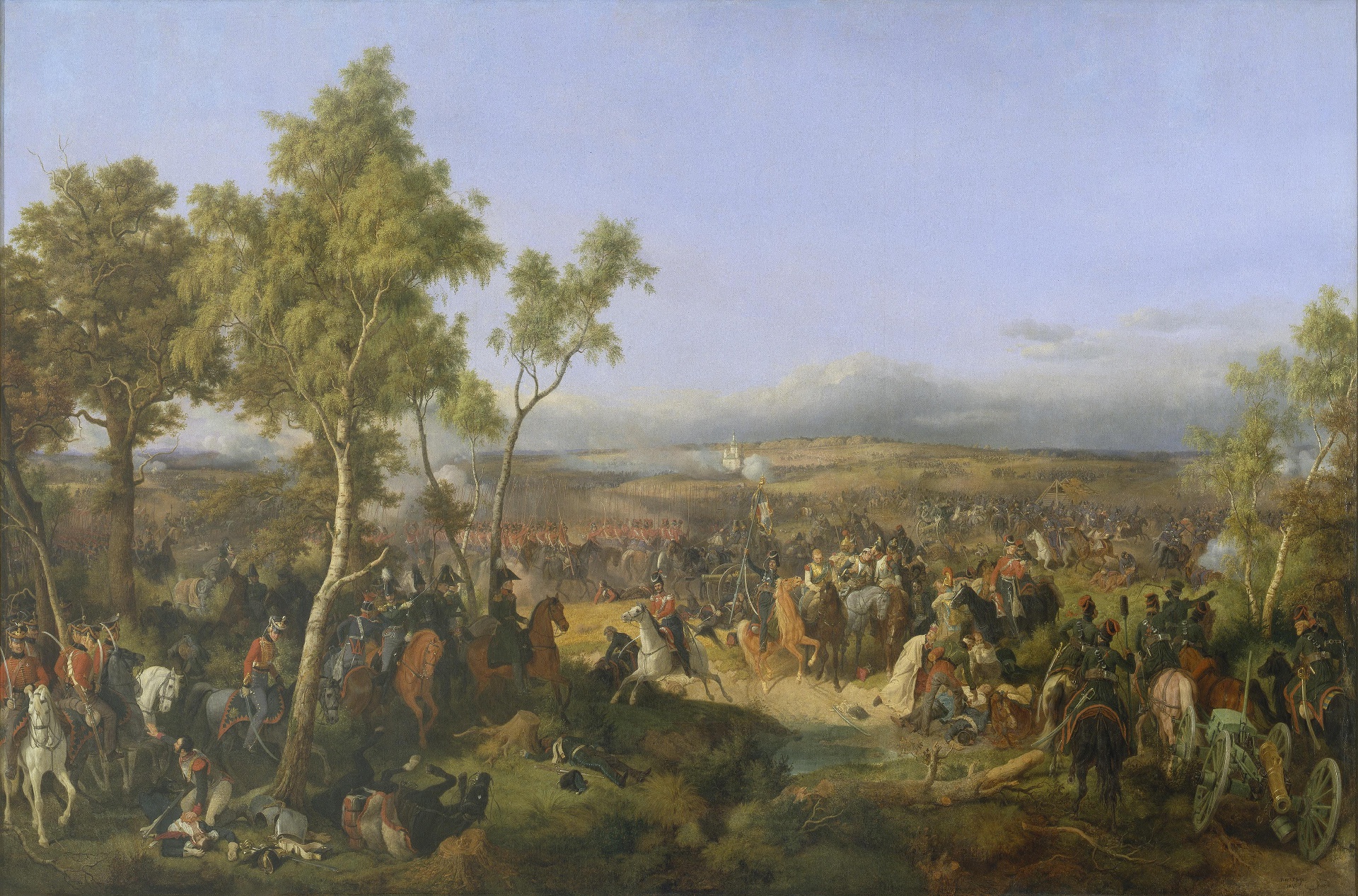
- Autumn (September and October) 1812 was warm enough. In the painting "The Battle of Tarutino" (and other paintings) by Hess, we see leaves on trees (October 18) -
Tarutino.jpg

We also have data from meteorologists about the weather in St. Petersburg for 1812:
and there are other data by city (Moscow, Kazan, Warsaw, Kiev)

From this it is clear that it really got very cold only in December - when Napolene's army had already been defeated.
At the same time, the cooling was very strong, but not a record one (in 1788, 1814, 1817 and 1819 there were even more severe frosts in winter).


There is no question about it. When we correlate everything, you begin to see history in a whole new light. Napoleon was defeated by the Mini Ice Age
Well, yes, and the Russians used it against Napoleon's cavalry
war mammoths))
lednikovyj-period-6-kadr-iz-multfilma-2.jpg
 
Were definitely seeing some early cooling here from the side effect's of the current LaPalma emissions. And obviously with other derivatives at play.
I also wonder of the current reflective property's of the global volcanic ash is at this time.

Presently it's eleven point five degrees Celsius this morning at 06:13 on 9-27-21.


-22.8 ° C at Anaktuvuk Pass this 09/25/2021 at 693 m in the Brooks Range in #Alaska . According to
@Alaskawx, the lowest temperature recorded in September in Alaska was -30 ° C at Lake Galbraith (east of Anaktuvuk Pass) on9/3/1992.(c)
: FAA webcam


The 35 ° C from June 12, 1977 to #Calvi were the maximum, all stations of the main MF network combined, for the whole of the summer of 1977 in metropolitan France. 1977, a particularly cool summer. In 2021 we reach 35 ° C in Calvi on September 26 (the latest crossing)!

By Morgan Rehnberg 12 July 2021
A translation of this article was made by Wiley. 本文由Wiley提供翻译稿
The Sun constantly emits a stream of energetic particles, some of which reach Earth. The density and energy of this stream form the basis of space weather, which can interfere with the operation of satellites and other spacecraft. A key unresolved question in the field is the frequency with which the Sun emits bursts of energetic particles strong enough to disable or destroy space-based electronics.

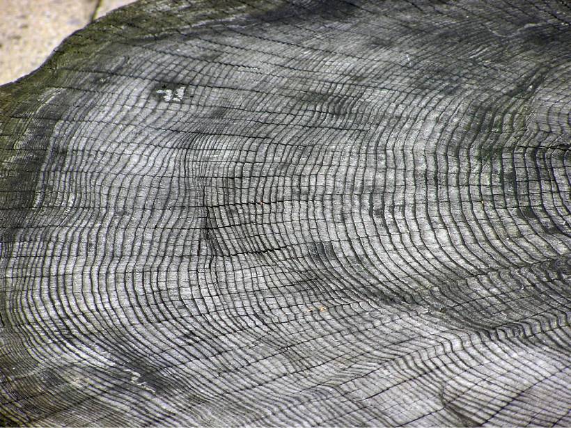
One promising avenue for determining the rate of such events is the dendrochronological record. This approach relies on the process by which a solar energetic particle (SEP) strikes the atmosphere, causing a chain reaction that results in the production of an atom of carbon-14. This atom subsequently can be incorporated into the structure of a tree; thus, the concentration of carbon-14 atoms in a tree ring can indicate the impact rate of SEPs in a given year.

To date, three events of extreme SEP production are well described in literature, occurring approximately in the years 660 BCE, 774–775 CE, and 992–993 CE. Each event was roughly an order of magnitude stronger than any measured in the space exploration era. Miyake et al. describe such an event, which occurred between 5411 BCE and 5410 BCE. Because of this burst, atmospheric carbon-14 increased 0.6% year over year in the Northern Hemisphere and was sustained for several years before dropping to typical levels.

The authors deduced the presence of this event by using samples collected from trees in three widely dispersed locales: a bristlecone pine in California, a Scotch pine in Finland, and a European larch in Switzerland. Each sample had its individual tree rings separated, and material from each ring underwent accelerator mass spectrometry to determine its carbon-14 content.

Using statistical methods, the researchers identified a pattern of small carbon-14 fluctuations consistent with the Sun’s 11-year solar cycle; the event recorded in the tree ring occurred during a time of solar maximum. Notably, other evidence suggests that the Sun was also undergoing a decades-long period of increasing activity.

If an extreme SEP burst is indeed the cause of the additional carbon-14, then these observations could aid in forecasting future events. However, tree ring measurements cannot rule out other extraterrestrial causes, such as a nearby supernova explosion. Confirmation will require isotopic measurements of beryllium and chlorine taken from ice cores, according to the authors. (Geophysical Research Letters, https://doi.org/10.1029/2021GL093419, 2021)—Morgan Rehnberg, Science Writer

Citation: Rehnberg, M. (2021), Tree rings show record of newly identified extreme solar activity event, Eos, 102, Tree Rings Show Record of Newly Identified Extreme Solar Activity Event. Published on 12 July 2021.


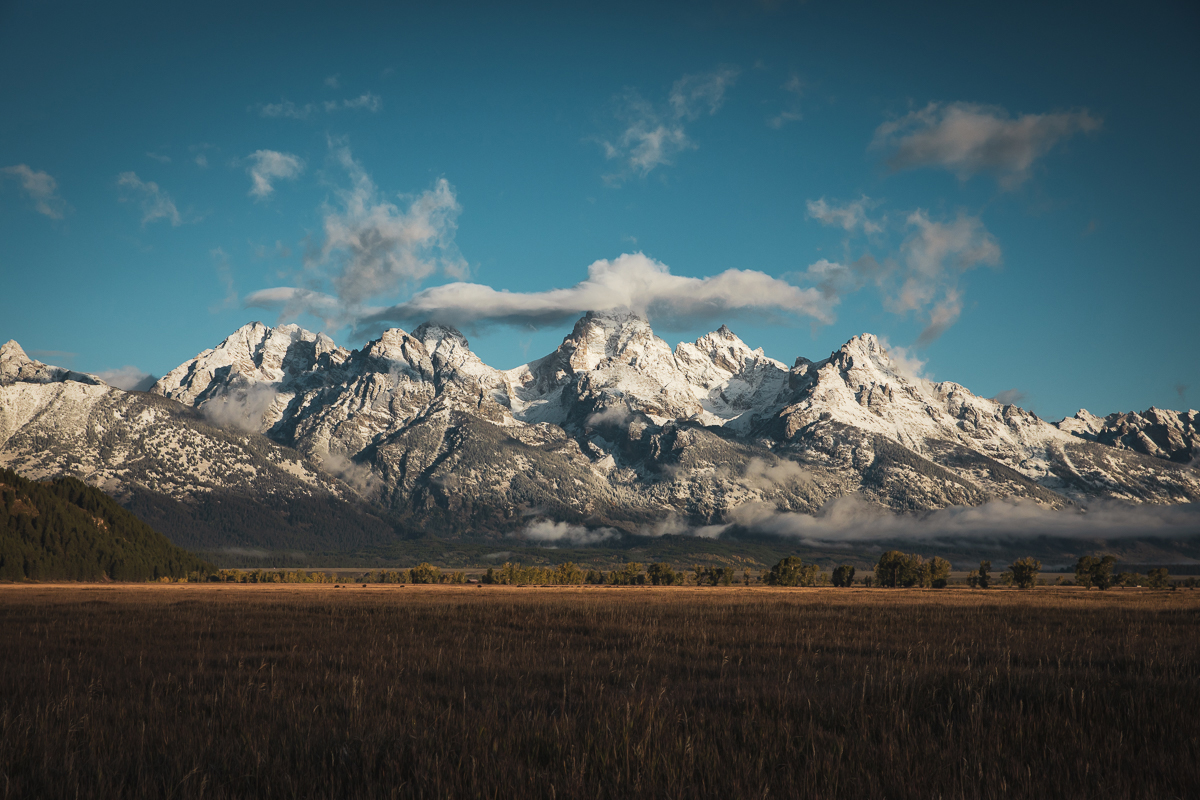
Autumn Snowfall In The Tetons

E_wsH0oVEAYb7o4

September 21 2021 / Pic's

Climate change in the Arctic linked to Texas' severe winter weather
By Lauren Fox, AccuWeather staff writer Updated Sep. 24, 2021 3:36 AM CEST
The state of Texas battled a devastating deep freeze last winter that resulted in up to $155 billion in damages and economic loss, according to AccuWeather estimates, and a new study published in the journal Science reveals connections between the weather disaster that occurred in Texas last year and climate change in the Arctic.

The study, which was published in early September, revealed a connection between Arctic temperatures and the Valentine's Week Freeze that inundated Texas this past February. The severe winter weather led to at least 210 fatalities, according to the Texas Department of State Health Services.

"Clearly an extreme event like this is very unusual in a place like Texas, so it is hard for many people and policymakers to react and take the threat seriously," AccuWeather Meteorologist Brett Anderson said. "The biggest dangers people faced were a lack of heat in homes that had no backup power or heat sources."

Many homes in Texas are not properly insulated to handle the level of extreme cold that gripped Texas that week back in February. Homes were flooded when pipes burst due to the extreme cold, and some residents even had icicles form in their homes and apartment buildings, including one from Dallas, Texas, who shared a photo to social media of icicles hanging from a ceiling fan on Feb. 15.

At the worst of the historic cold snap, the temperature at Dallas-Fort Worth International Airport bottomed out at 2 degrees below zero in the early-morning hours on Feb. 16 as Arctic air from the polar vortex rushed into the region.

The polar vortex is a band of strong westerly winds that sits about 10-30 miles above the North Pole and traps extremely cold air. Rising temperatures in the Arctic can cause an area of strong high pressure to develop in the atmosphere surrounding the North Pole, which can "push" the polar vortex farther south, into places like North America or Europe and Asia, Anderson explained.

"Think of the strengthening high-pressure area over the polar region as an expanding balloon and a pocket of air outside the balloon as the polar vortex," Anderson said. "As the balloon fills up with air the pocket of air outside of the balloon -- the polar vortex -- gets pushed farther away, and, in this case, it is being pushed farther south into the mid-latitudes."

Judah Cohen, the lead author of the study, told AccuWeather in an interview that the research revealed that the severe weather in Texas was due to what the scientists described as a stretched polar vortex event.

PolarVortex_Feb2021_620.jpeg

Cohen explained that sometimes stretched polar vortex events can make the polar vortex appear to be the shape of a dumbbell, with one spot of energy focused in North America and another in Asia.

While the February cold snap in Texas was a memorable one, Cohen said there are many modern-day examples of stretched polar vortex events in recent memory, and that at least one event happens practically every year, although not every event reaches the caliber that the one in Texas did.

“The poster child for these types of events is the winter of 2013-14," Cohen said. “It happened repeatedly that winter. It really led to the extreme cold, especially in the Great Lakes.”

The study published in Science also provided some more insight into these polar vortex events that may leave some reason for concern because they are becoming more and more frequent. According to Cohen, the paper shows that the frequency of these events has nearly doubled since the 1980s.

"I believe there will continue to be an increasing trend in extreme events as the planet continues to warm," Anderson said. "That does not mean every year will be worse. There will be periods of more normal weather," he added, pointing out that some years will bring fewer extremes. "But the long-term trend is very likely to continue to rise."

According to Anderson, policymakers will need to get on board with climate change legislation and infrastructure, which he said, in many cases, are very outdated and need to be upgraded in order to properly prepare for more incidents like the one in Texas.

The study goes against many people's assumptions of what climate change is, Cohen explained, as it is typically associated with warm weather.

“Climate change can lead to more heat waves, more flooding events, more drought, wildfires in the West," Cohen said. "A lot of extreme weather events that we’re seeing this summer."

Pointing out what may be proving to be a misconception about climate change, Cohen said, “The assumption was that climate change can lead to milder winters, less snowfall -- it intuitively makes sense. So our study comes to this counterintuitive conclusion," Cohen continued. "This Arctic change can lead to more extreme winter weather events, like the Texas cold wave.”

Cory Reppenhagen @CReppWx
5:07 PM · Sep 26, 2021·
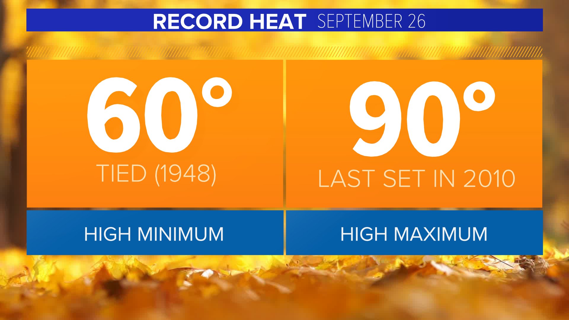
Denver tied a record high minimum this morning, last set in 1948. More record heat possible later today. The high max is 90 degrees last set in 2010. #9wx #COwx
FAOFmJ6VgAghApv


Posted at 7:35 AM, Sep 26, 2021 and last updated 5:29 PM, Sep 26, 2021 Video
This first weekend autumn has been a warm one and today will be about 10 to 12 degrees above normal. We'll see highs top out in the upper 80s during today's at-home Broncos game.

If you're heading west to see the leaves change, you'll find highs in the 70s through the central mountains, with highs on the Western Slope.

The aspen trees will be full-on gold over the central and northern mountains and nearing their peak over the southern mountain areas.

This warm weather will continue into the first of next week. We'll see 80s on Monday and Tuesday. Our next cold front will usher in some cool and wet weather starting Wednesday.

1632715179002.png

 
Another heads up - the last couple of days has seen severe (and early) wintry conditions in Iceland.


------------------------------------------------------------------------------
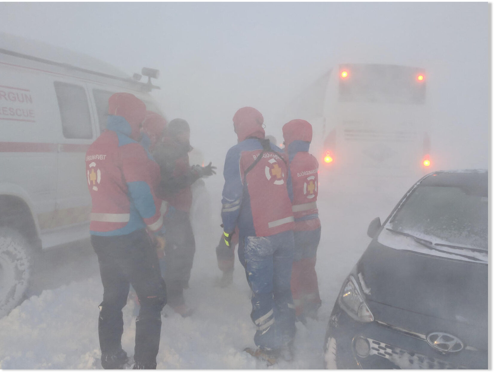
Rescue workers were called out more than 100 times yesterday in the northern and western parts of Iceland, Morgunblaðið reports. A severe storm with heavy precipitation hit those areas with wind gusts in excess of 45 m/sec. Most of the calls involved drivers whose vehicles were stuck in snow.

"We would have liked to see people heed the repeated warnings yesterday, stressing that no travel was advised," states Davíð Már Bjarnason, media representative for ICE-SAR, the Icelandic Association for Search and Rescue. "In the afternoon, there were reports of drivers in the most surprising of places," he adds. There was, for instance, one vehicle stuck on Kjalvegur road in the central highlands. "We didn't expect people to be traveling in the highlands in this kind of weather," he explains.


In Hrútafjörður fjord, Northwest Iceland, a passenger bus was blown off the road near the Heggstaðanes exit. All 37 passenger on board escaped without injury and were quickly transported to safety at a nearby hotel.

In Siglufjörður, North Iceland, firefighters and rescue workers were called out when basements flooded. Trees were uprooted in some areas, and power went out on three power lines in North Iceland.

According to meteorologist Einar Sveinbjörnsson, at the Icelandic Met Office, yesterday's storm was unusual in two ways: "What is special and unusual is that the low pressure area traveled from east to west. It is not unheard of, but much more commonly, they travel the other way, from the southwest and across the country." The other unusual thing about the severe weather is how early in the fall it hit, he adds.

The unusually early snowfall this year resulted in a total of five avalanches in Iceland on Monday and Tuesday, in addition to another six avalanches the nine previous days. None of them resulted in injury or property damage.
 
FATM4LXUYAATzH2


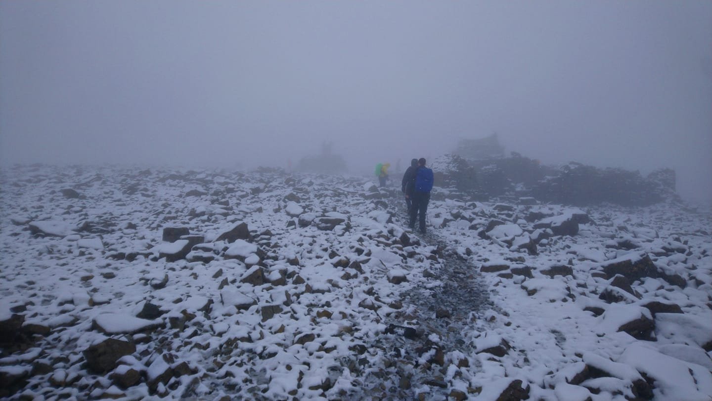
From Electroverse: Snow on Ben Nevis in Scotland: it seems winter has arrived in the UK. After a relatively mild month, September in the UK is being capped-off with freezing lows and rare snows — another example of the ‘swings between extremes‘ expected during times of reduced solar output.
On Wednesday, temperatures in Kilbrace, Scotland plunged to -0.7C (30.7F) and delivered the first frost of the season.

Accompanying the cold has been rare September snow, most notably across the higher elevations — both Ben Nevis and the Cairngorm plateau have registered totals of between 5 to 10cm (2 to 4 inches)–incredibly rare totals for September.
Myself and my ex husband walked up Ben Nevis on New Years day 1992...the scattering of walls and the small building you can see in the above picture were completely covered in snow and ice...all that was visible was the cairn point seen on the left...I only realised this when we walked it again in August 1997!
 
New article from Electroverse.net on October 4.

In these days of "Catastrophic Global Warming," the South Pole just suffered its coldest 'Winter' in recorded history


The meat of the matter:
--------------------------------------------------------------------------------------
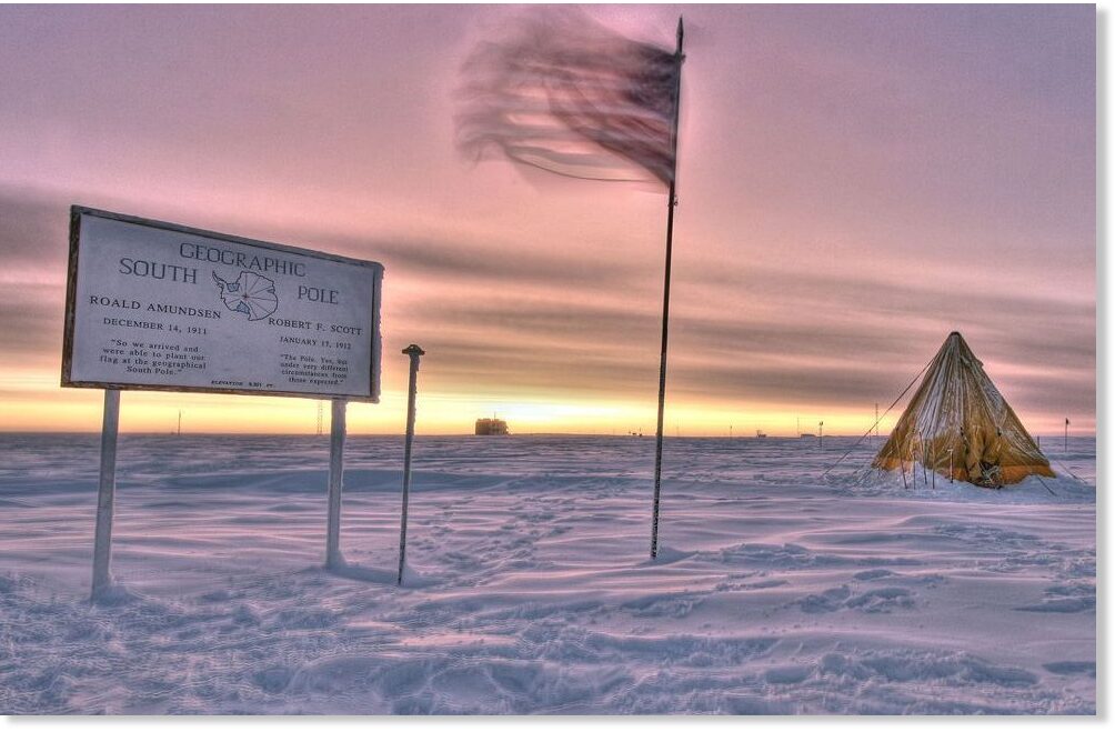
Contrary to the MSM's agenda-driven narrative, the South Pole has been suffering unprecedented cold this year.

Between the months of April and September, the South Pole averaged a temperature of -61.1C (-78F).

Simply put, this was the region's coldest 6-month spell ever recorded, and it comfortably usurped the previous coldest 'coreless winter' on record — the -60.6C (-77F) set back in 1976 (solar minimum of weak cycle 20).

This incredible and AGW-destroying reality is confirmed by Antarctica climatology journalist Stefano Di Battista who has closely watched and published research on Antarctic temperatures for many years:

1/1 Extraordinary coreless winter (April - September) at South Pole Station. The average as been -61.1 °C the coldest ever recoded. This value set -2.2 °C on the reference 1981-2010 and -2.5 °C on 1991-2020. Previous record -60.6 °C in 1976 pic.twitter.com/m8uWF5mt0c

— Stefano Di Battista (@pinturicchio_60) October 1, 2021

Battista also points out that for June, July, August and September the average temperature for each of these month finished-up below -60C (-76F) — a phenomenon that has occurred on just 3 previous occasions: in 1971, 1975 and 1978.
 
Last edited:

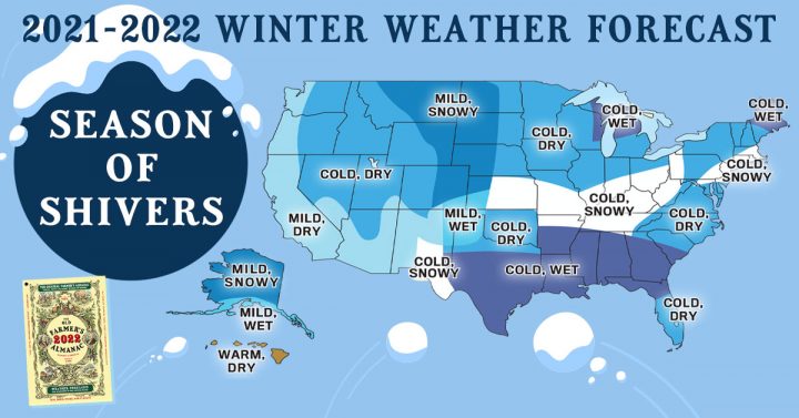
The Old Farmer’s Almanac has been making yearly long-term weather forecasts for 230 years. We pay attention to them because they are normally 80% accurate. They did not do as well last winter but were 72% in predicting the direction of temperature change, and 78% accurate in the change in precipitation. This is pretty remarkable because while the U.S. weather forecasts are 90% accurate five days in advance, they are only 80% accurate seven days out. The Old Farmer’s Almanac forecasts are far less specific, they only predict the direction of change, but their forecasts are for twelve months in the future, quite impressive. Figure 1 is their forecast for the lower 48 United States, for this winter.

2021_2022_Old-Farmers-Almanac_weather-720x377.jpg
Figure 1. The Old Farmer’s Almanac forecast for the winter of 2021-2022. Source: here.


The Old Farmer’s Almanac has been making yearly long-term weather forecasts for 230 years. We pay attention to them because they are normally 80% accurate. They did not do as well last winter but were 72% in predicting the direction of temperature change, and 78% accurate in the change in precipitation. This is pretty remarkable because while the U.S. weather forecasts are 90% accurate five days in advance, they are only 80% accurate seven days out. The Old Farmer’s Almanac forecasts are far less specific, they only predict the direction of change, but their forecasts are for twelve months in the future, quite impressive. Figure 1 is their forecast for the lower 48 United States, for this winter.

I talked to a big firewood seller yesterday here and he told me that they are completely booked out with deliveries scheduled for every day till the end of november. I asked whether that's normal for this time of the year, and he said no, it's "bizarre" how big the demand is this year. Maybe the local farmers/people are familiar with such predictions (or some are and then it's a psychological effect à la toilet paper crisis), or maybe there is some "signaling" going on unconsciously... Found it interesting.
 
I talked to a big firewood seller yesterday here and he told me that they are completely booked out with deliveries scheduled for every day till the end of november. I asked whether that's normal for this time of the year, and he said no, it's "bizarre" how big the demand is this year. Maybe the local farmers/people are familiar with such predictions (or some are and then it's a psychological effect à la toilet paper crisis), or maybe there is some "signaling" going on unconsciously... Found it interesting.
There is also the fact that the price of energy like gaz or fuel is increasing sharply pushing people to rely more heavyly on wood.
 
Back
Top Bottom