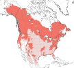
This may be related to the bear stories but, a friend of mine had said that he knew a few people who hunted moose and they had noticed that the moose have a LOT more body fat on them this year. According to the hunters this is a good indication that this winter will be long and cold.
The bears and moose are probably as equipped as some cows, as this example shows, though it is not from this season:
Can Animals Predict the Weather?
Farmers in the Midwestern U.S., who recently experienced the coldest weather in a generation, are saying they knew the extreme weather was coming before it was officially predicted. This foresight was not due to meteorology, but to the way their animals were behaving.
Reuters spoke with Deanna Brennecke, an Iowa cow-calf farmer who said she knew the cold was coming days before because of the behavior of her cattle. They were eating far more feed than usual, putting on weight to help keep warm before temperatures plummeted.
“They were meeting us at the gate, filling themselves full, and we just knew,” said Brennecke.
Below are more thoughts on what one may be able to learn from observing nature in relations to changes of the weather and climate.
When I enter a forest for a brisk walk, the birds and animals pick up the disturbance and even warn each other. It is known that plants can react to people, animals, or insects harming them. Likely, there will be a lot we do not know or notice about the communications that take place in nature and within nature. If one took a really large perspective, animals also have protein antennas. Understood in this way, a group of cattle might have more antenna power than just one member of the herd. Maybe the species and its family, genetically speaking, have still more.
It could also be that the animals have system sensors for survival. Our mobile phones for instance have several, and some are used or integrated into other apps in ways that make them invisible. Birds and animals have senses and sensors too. We have discovered that some species can orient themselves along long migration routes. Are there still more abilities, more difficult for us to discover, that are rarely used or noticed, but which are also included in the system of some members?
While one can think of birds, animals and nature in general reacting to changes in their environment whether local or cosmic, if the future is open, wouldn't there sometimes be more than one trend? How long in advance would some animals or some groups of animals be able to pick up a trend? And if one says the Canadian moose is fatter on average this year in some areas, is it more than a reaction to the short-term prospects? Still they are tendencies interpreted and attributed a meaning. The interpretations of such signs in terms of weather leads to the ancient ways of understanding meteorology and augury. The
Wiki about meteorology mentions:
Early attempts at predicting weather were often related to prophecy and divining, and were sometimes based on astrological ideas.
The
Wiki on augury, considered as a Roman religious practice, describes various types:
ex caelō [
from the sky]This auspice involved the observation of thunder and lightning and was often seen as the most important auspice.
[15] Whenever an augur reported that Jupiter had sent down thunder and lightning, no
comitia (a gathering deemed to represent the entire Roman population) could be held.
And add to this ex avibus, from birds, ex quadrupedibus [
from quadrupeds], ex dīrīs [
from portents]. These auspice signs are in two groups:
There were two classifications of auspice signs,
impetrative (
impetrativa, sought or requested) and
oblative (
oblativa, unsought or offered). Signs that fall under the category of
impetrativa were signs that resulted due to the actions performed by the augur during the reading of the auspice.
[13] The other category of signs,
oblativa, were momentous events which occurred unexpectedly, while the magistrate was either taking auspices or participating in public debate.
[13]Ex Caelo ("from the sky") signs of thunder and lightning or other natural phenomena, would be considered an "offered" sign. Unless the magistrate was accompanied by an augur it was up to them to decide whether or not the “offered” sign was significant.
[13]
Being familiar with the idea of augury, one can even wonder if signs of an approaching ice age would show up as extra appetite among some animals preparing for a cold winter? The millions of mammoth, enjoying the sunshine and chewing flowers and herbs prior to their flash freeze, 13000 years ago, probably went about their business as usual.
Even if the mammoths died suddenly, maybe it was as it should be. Moving to philosophical point of view, one can think of these quotes from the New International Version of the Bible regarding
"sparrow" which certainly is a much smaller than a mammoth:
Psalm 84:3 Even the
sparrow has found a home, and the swallow a nest for herself, where she may have her young— a place near your altar, Lord Almighty, my King and my God.
Luke 12:6 Are not five
sparrows sold for two pennies?
Yet not one of them is forgotten by God. Luke 12:7 Indeed, the very hairs of your head are all numbered. Don’t be afraid; you are worth more than many
sparrows.
And
"hour":
Ecclesiastes 9:12 Moreover, no one knows when their
hour will come: As fish are caught in a cruel net, or birds are taken in a snare, so people are trapped by evil times that fall unexpectedly upon them.
Mark 13 The Day and Hour Unknown
32 “But about that day or
hour no one knows, not even the angels in heaven, nor the Son, but only the Father. 33 Be on guard! Be alert[
e]! You do not know when that time will come. 34 It’s like a man going away: He leaves his house and puts his servants in charge, each with their assigned task, and tells the one at the door to keep watch.
35 “Therefore keep watch because you do not know when the owner of the house will come back—
whether in the evening, or at midnight, or when the rooster crows, or at dawn. 36 If he comes suddenly, do not let him find you sleeping. 37 What I say to you, I say to everyone: ‘Watch!’”
In the following chapter the "hour" comes up again:
Mark 14 Gethsemane
32 They went to a place called Gethsemane, and Jesus said to his disciples, “Sit here while I pray.” 33 He took Peter, James and John along with him, and he began to be deeply distressed and troubled. 34 “My soul is overwhelmed with sorrow to the point of death,” he said to them. “Stay here and keep watch.”
35 Going a little farther, he fell to the ground and prayed that if possible the
hour might pass from him. 36
“Abba,[
f] Father,” he said, “everything is possible for you. Take this cup from me. Yet not what I will, but what you will.”
37 Then he returned to his disciples and found them sleeping. “Simon,” he said to Peter, “are you asleep? Couldn’t you keep watch for one
hour? 38 Watch and pray so that you will not fall into temptation. The spirit is willing, but the flesh is weak.”
39 Once more he went away and prayed the same thing. 40 When he came back, he again found them sleeping, because their eyes were heavy. They did not know what to say to him.
41 Returning the third time, he said to them, “Are you still sleeping and resting? Enough! The
hour has come. Look, the Son of Man is delivered into the hands of sinners. 42 Rise! Let us go! Here comes my betrayer!”
A reader of cards may do a spread with a question in mind and pick up ideas from the images that show up. A mere player of cards would look at the selection and see random cards. Is it similar with some of the more subtle changes that precede sudden, drastic and dramatic changes of the Earth environment prior to the onset: subtle changes will be denied until a denial is no longer relevant. For a parallel, what happened prior to March 2020 that heralded a change of the political climate? If someone had stood up in December 2020 and told about the world 12 months from then, 15 months from then, 18 months from then 21 months from then, ... what would people have thought?
In the process of writing this post, I learned about possible sources of information for the future:
World Weather Information Service. There is a world map and when you zoom in, you can click the local forecast which has a link to the local service. Later in the season, these services might be helpful with ice warnings.
There is also a severe weather page:
Severe Weather Information Centre which has an upcoming feature, at present in beta, that highlights all the areas of the globe subject to warnings.