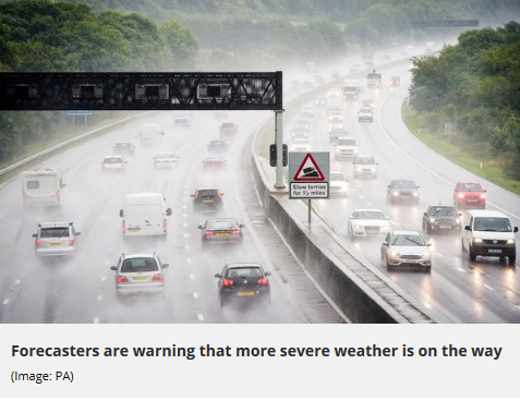
Flash floods, rising rivers and mudslides are possible across Northern California as a storm that’s more January than April barrels in from the Pacific, the National Weather Service warns.
“This is not the time of year when we see these big precipitation events,” said Daniel Swain, a climate scientist at UCLA.
“This storm will be comparable to some of the big storms we’ve seen over the past couple of years.”
Wednesday, forecasters issued a
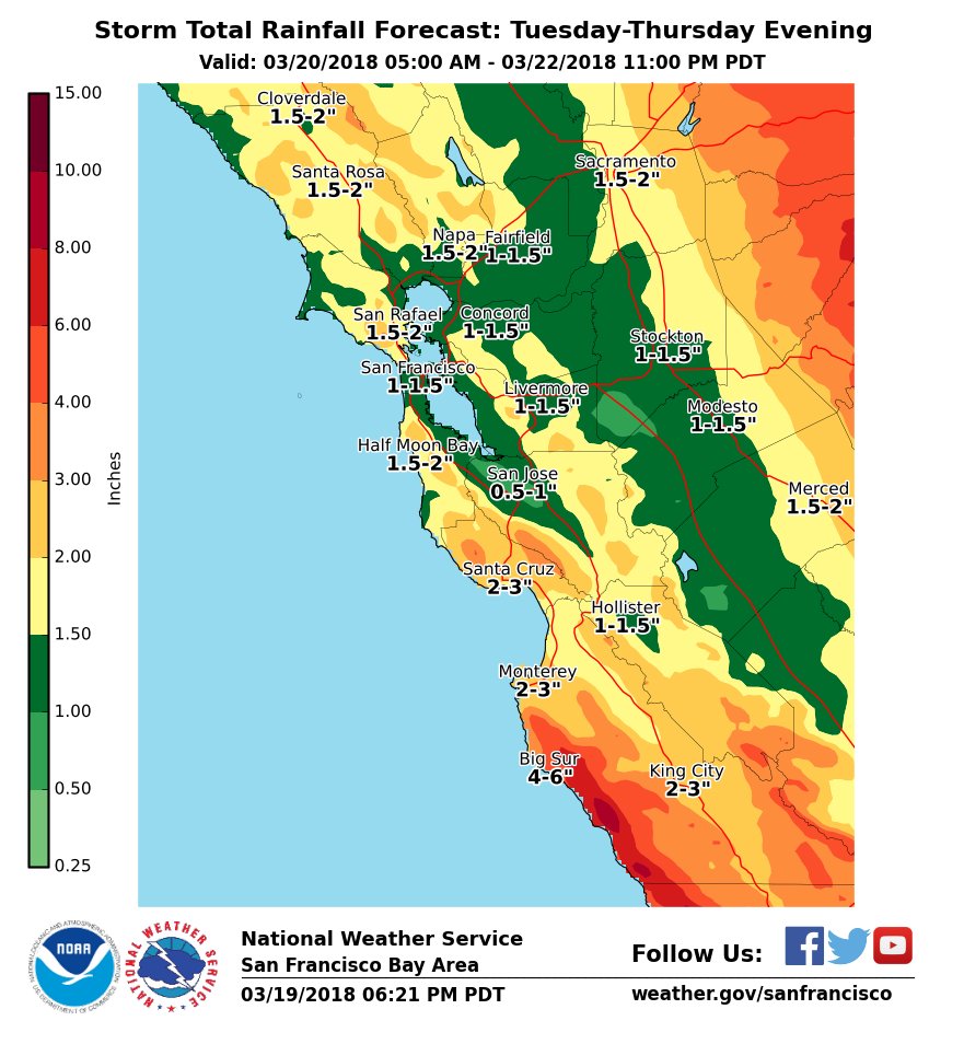
hazardous weather alert from Big Sur to the Oregon border in anticipation of as much as seven inches of rain in the coastal mountains and
Sierra foothills through the weekend, courtesy of an atmospheric river drawing its moisture from the remnants of a typhoon that hit the Philippines more than a week ago.
Low-lying parts of the Bay Area, including San Francisco and Oakland, are expected to receive one to three inches of rain. The upper end of that range is double what the cities typically get during the entire month of April.
The system is forecast to arrive in the North Bay late Thursday and spread across the region by early Friday.
The worst of the storm is due Friday night.
While this year has been much
drier than average for most of
California, even renewing concerns about drought
in many parts of the state, the past month has brought a series of storms that has provided at least a small boost to water supplies. The incoming front is expected to be the largest of the bunch.
And it’s going to be warm, with a snow level above 8,000 feet — which is not ideal for late-season skiers, water officials and anyone living along a Sierra river.
“This is going to kick off a lot of snowmelt,” said Dave Rizzardo, chief of the snow surveys for the state Department of Water Resources. “You got a lot of water that’s going to come down in a short amount of time in the higher-elevation streams. We’re going to be monitoring that real tightly.”
The Merced River in Yosemite National Park, Truckee River near Lake Tahoe and Cosumnes River in El Dorado County are predicted to surge above their banks and cause local flooding Friday and Saturday.
The state’s big reservoirs, which collect the mountain runoff, are expected to absorb the influx of water without having to make larger-than-average releases.
Many, though, will be watching the situation at Lake Oroville, the nation’s tallest dam.
Its spillway, which partially collapsed last year and led to concerns about water flowing uncontrollably from the reservoir, may be put into use for the first time since it was rebuilt.
State officials who operate the dam were hoping to keep lake levels low enough to avoid using the spillway until next year. That’s because final construction of the half-mile chute isn’t scheduled to be completed until summer, though dam operators say it’s ready to carry water should the incoming storm fill the lake.
Inspectors will be on site around the clock to monitor the spillway’s performance should the floodgates open.
In the Bay Area, major waterways such as the Russian River and Napa River are
expected to swell but not overrun their banks, according to the California Nevada River Forecast Center. But flooding could take place on smaller streams along the coast, and runoff could prompt erosion of hillsides, forecasters say.
“We’re not going to have rapid rain coming through really quick, but a prolonged event,” said Steve Anderson, forecaster for the National Weather Service in Monterey.
“With that comes the threat of mudslides, and rocks and debris on the roads.”
Authorities in the Bay Area will be watching areas burned in the Wine Country fires, where the slopes are less stable and more vulnerable to sliding. Public works crews have been grading hillsides, putting out straw bales and reseeding wooded areas for months in an effort to prevent erosion.
While landslides in Sonoma and Napa counties are possible,
Anderson said the threat remains minimal.
“It’s been pretty dry this winter, so there’s plenty of room in the soil for the water to soak in,” he said.


 in many parts of the state, the past month has brought a series of storms that has provided at least a small boost to water supplies. The incoming front is expected to be the largest of the bunch.


