Volcanoes Erupting All Over

Shiveluch Volcano Eruption in Russia’s Kamchatka Sends Ash Plume 3.4 Miles Into Sky
03.09.2019
PETROPAVLOVSK-KAMCHATSKY (Sputnik) - The Shiveluch volcano, located in Russia’s Kamchatka Territory, spewed a column of ash 5.5 kilometers (3.4 miles) above sea level into the sky on Tuesday morning, the Kamchatka Volcanic Eruption Response Team said.

"On Tuesday morning, Shiveluch volcano was registered to spew a column of ash to the altitude of 5,500 meters above the sea level. The ash cloud is stretching 83 kilometers to the southeast of the volcano," the agency said.

According to the local branch of the Russian Emergencies Ministry, no ash fallout has been registered in nearby settlements.

Shiveluch is the northernmost active volcano in Kamchatka. The volcano has been active since November 2018.
 
Geez, and the one from last week did not exactly happen:

Tuesday Aug 27, 2019 22:23 PM | BY: T

The recently reported eruption on 25 Aug alerting of an ash plume as high as 70,000 ft (21300 m) did not take place.
There is no data (satellite-based, direct observations etc) to confirm an eruption of this magnitude.
The report was based on an erroneous alert from the Anchorage VAAC. An eruption did take place, observed by a group of people staying nearby and who sent us images on social media, but it was "only" producing an ash column rising approx. 23,000 ft (7 km) - something not unusual for Shiveluch which has been having eruptions of this size for decades at irregular intervals.

I did check the ash cloud going NW, it was not impressive. But maybe very high i thought.
Are we going to have to get used to officials giving false reports?
Nooa, nasa making fake climate graphs (see tony heller, yt)
Dutchsinse asking USGS why there are never earthquakes in russia, india, brazil, or oregon,
and ten times more 4.9s than 5.0 EQs
Repression on alt sources escalating plus personal attacks
All this talk about how nasty a cat 5 can be, while its a 2
Repression on alt sources escalating plus personal attacks
 
🌋 #Ñuble ⚠️ Nevados de Chillán volcanic complex, does not want to be behind Villarrica. In the last hours the frequency of explosions has increased, staying between low to medium energy. Facebook: https://m.facebook.com/story.php?story_fbid=3138767479499


Erupting Volcano on Russia's Paramushir Island
Friday, August 16th 2019, 3:17 pm - The island lies along the basin of the Pacific Ocean

The next Grand Solar Minimum, Cosmic Rays and Earth Changes (an introduction)
9:51 PM · Sep 3, 2019 from Hamilton, Ontario


Damage control


https://twitter.com/USGSVolcanoes/status/1172588483132547072
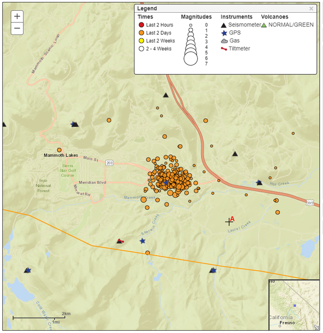
A M3.0 earthquake occurred on the E outskirts of Mammoth Lakes (CA) in Long Valley Caldera last night at 7:52 PM PT. A series of smaller EQs followed w/~200 events by 11:45 AM PT today. The swarm is gradually diminishing & there is NO volcanic threat. MTM USGS: Volcano Hazards Program California Volcano Observatory News Archive
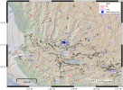
Map of 12 September 2019 earthquake swarm epicenters on the margin of the Long Valley Caldera near Mammoth Lakes. ~200 earthquakes are visible.
9:10 PM · Sep 13, 2019
 
https://spaceweather.com/ said:
A SUMMER WITHOUT SUNSPOTS: Could summer 2019 go down in history as "the summer without sunspots"? From June 21st until Sept 22nd, the sun was blank--no sunspots--more than 89% of the time. During the entire season only 6 tiny sunspots briefly popped up, often fading so quickly that readers would complain to Spaceweather.com, "you've labeled a sunspot that doesn't exist!" (No, it just disappeared.) Not a single significant solar flare was detected during this period of extreme quiet.
 
Also, the + - same day Tropical Storm Karen causes severe flooding in Trinidad and Tobago
https://watchers.news/2019/09/22/loud-explosion-at-piparo-mud-volcano-cracks-appearing-across-roads-trinidad-and-tobago/ said:
Loud explosion at Piparo mud volcano, cracks appearing across roads, Trinidad and Tobago

Residents living near Piparo mud volcano, Trinidad and Tobago reported they heard a loud explosion at 22:08 local time, September 21, 2019 (02:08 UTC, September 22). In May 2019, geologists said pressure is building up under the volcano, raising fears another eruption is imminent. A devastating eruption took place at the volcano 22 years ago. Piparo has a cyclicity of large eruptions every 25 to 30 years.


There are cracks appearing across roads and homes at 22:20 LT across Pancho Trace, Trinidad and Tobago Weather Center said, adding that some residents have already self-evacuated.

It's still not clear what's taking place, but cracks are appearing across the roads, some homes were already damaged and residents say there is a high sulfur scent in the air.

The first news of the eruption came from Piparo Village Council:

Trinidad and Tobago Guardian said officials are on their way to the community to get a better understanding of what took place.


In May 2019, geoscientists warned pressure is building up under Piparo, raising fears that another eruption is imminent. At the time, Xavier Moonan, Senior geoscientist at Touchstone Exploration, said recent studies done over the past year at the Piparo volcano confirm that the volcano is showing active changes.

The volcano has a cyclicity of large eruptions every 25 to 30 years, Moonan said. "As such, one can interpret that an eruption can be imminent."

"We can confirm that the vent is rising but during the rainy season the muds are being eroded at a faster rate than it is rising," Moonan said."We can approximate that had there been no erosion of the mud volcano over the past couple years, the central vent area would have been at least 3 m (10 feet) higher," he said.

A devastating eruption took place at Piparo on February 22, 1997. Villagers were warned by tremors and rumbling and were able to evacuate at the last minute before mud flooded their homes up to ceilings. "Cars and homes were buried under a 2.5 km3 (1 mi3) of mud that quickly hardened into a concrete-like clay. Though no one was killed, 31 families were permanently displaced from their homes."


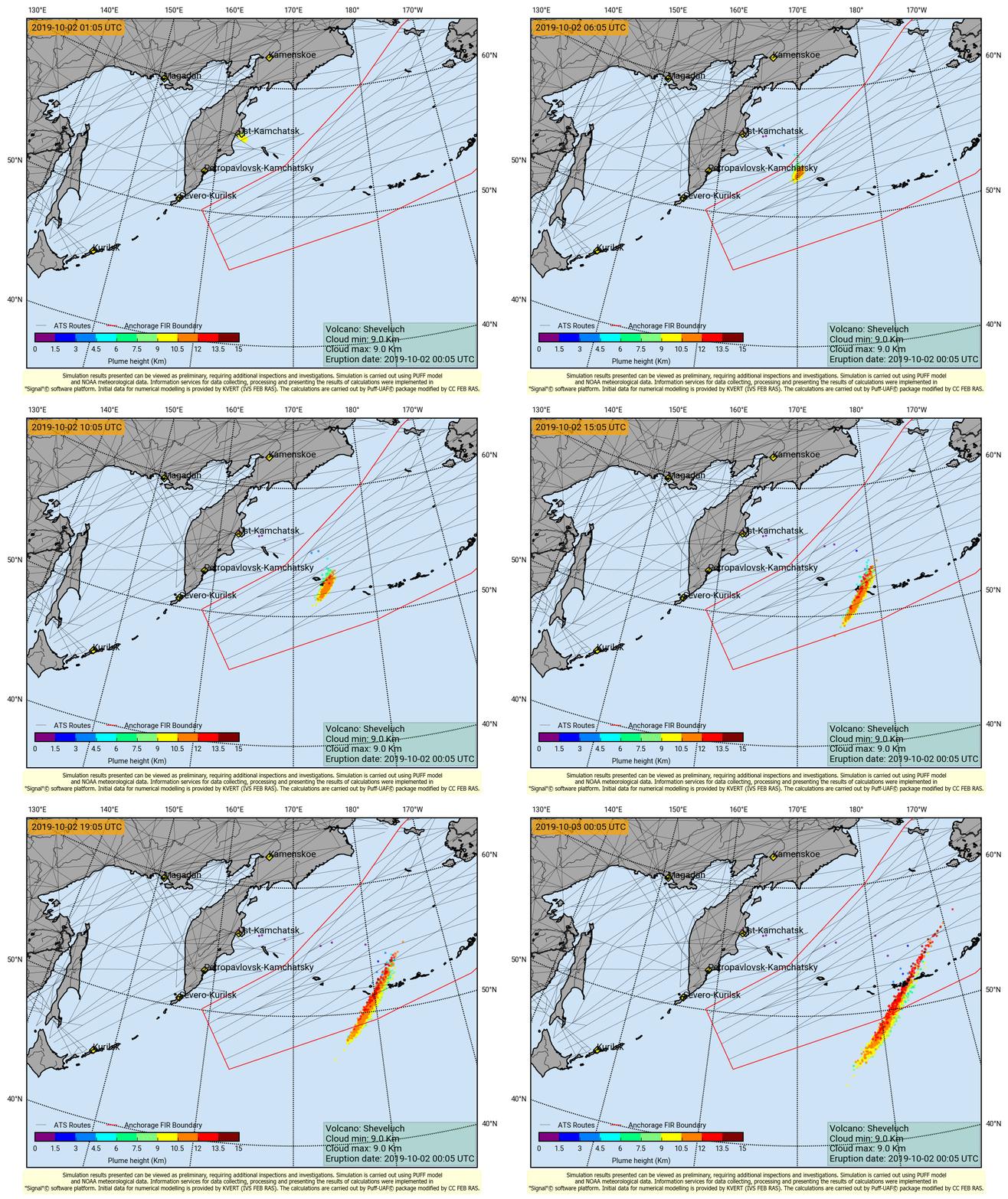
KVERT/Volcano Observatory Notifications to Aviation (VONA)
Sheveluch_201910020005.gif

 
https://watchers.news/2019/10/01/aviation-color-code-red-ash-emissions-intensifying-at-etna-volcano-italy/?utm_source=dlvr.it&utm_medium=twitter said:
Ash emissions at Italy's Etna volcano are intensifying on October 1, 2019, INGV reports. The Aviation Color Code has been raised to Red.

Images of the surveillance cameras are showing and intensification of the ash emission since 08:50 UTC on October 1.

The volcanic tremor amplitude does not show significant variations compared to the previous days.

The photos below show the explosive activity at the Northeast Crater and at the Voragine crater on the afternoon of September 30 from airplane and at daybreak on October 1 from Tremestieri Etneo, on the south flank of the volcano.


Snips:
The explosive activity of Sheveluch continues, with a plume of ash on October 6 at 03hZ at a height of 10,000 meters asl., located by the satellite Himawari-8. The extension of the ash cloud over 430 km. to NE then E, and continuing emissions....

At Sakurajima, ash falls are announced on the cities of Kagoshima and Tarumi following the Sakurajima broadcasts this October 6, 2019.
Source: JMA

The Santiaguito volcano, in Guatemala, has a white degassing that rises to a height of 3,000 meters above sea level and disperses to the southwest. Fifteen low explosions in 24 hours were recorded, generating ash columns at 3,300 meters above sea level....


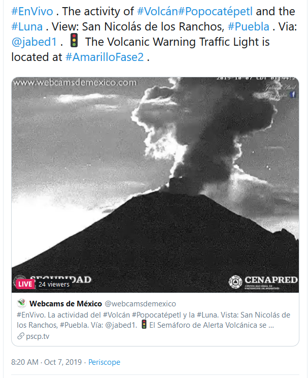
#EnVivo . The activity of #Volcán#Popocatépetl and the #Luna . View: San Nicolás de los Ranchos, #Puebla. Via:
@jabed1. The Volcanic Warning Traffic Light is located at #AmarilloFase2 .
2a9a114c1fe8014333a5022c502055cc.png
 
Italy’s Mount Etna Bursts Into Volcanic Activity – Volcanology Institute
11.10.2019
ROME (Sputnik) – Mount Etna's volcanic activity has increased, sending plumes of ash and smoke into the sky, the National Institute of Geophysics and Volcanology said on Friday.

An eruption was registered at some 04:30 GMT by special cameras. The eruption included small eruptions and releases of ash. The grey smoke is currently visible over the mountain.

Experts from the National Institute of Geophysics and Volcanology assess the situation as stable. However, the incident resulted in a partial closure of airspace over the city of Catania.


Etna is a part of a seismic active zone that lies along the border between the Eurasian and African tectonic plates, whose movement sometimes results in significant earthquakes. The previous eruption of Etna took place on July 14.

There are two more active volcanoes in the Mediterranean region: Stromboli and Vesuvius. However, the most powerful eruption in the region is linked to the extinct volcano of Santorini, Greece, whose so-called Late Bronze Age eruption in the 2nd millennium BC caused huge tsunami waves and resulted in the decline of the Minoan civilization.

 
Big note: after reading the study -posted below- in which The Watchers and National Geographic articles are based "Active Crustal Deformation in the Trans‐Mexican Volcanic Belt etc...", I have to tell you that most of the earthquakes mentioned in it, does not come from "Aztec records" ... (the red stripe of the image below, just +- 1/4 (left) was part of Aztec Empire). In fact, it was just one earthquake, the "19 February 1575" that obtained data from the "Anales de Tlatelolco".

https://en.wikipedia.org/wiki/Anales_de_Tlatelolco said:
The Anales de Tlatelolco (Annals of Tlatelolco) is a codex manuscript written in Nahuatl, using Latin characters, by anonymous Aztec authors. The text has no pictorial content. Although there is an assertion that the text was a copy of one written in 1528 in Tlatelolco, only seven years after the fall of the Aztec Empire, James Lockhart argues that there is no evidence for this early date of composition, based on internal evidence of the text.[1] However, he supports the contention that this is an authentic conquest account, arguing that it was composed about 20 years after the conquest in the 1540s, and contemporaneous with the Cuernavaca censuses.[2][3] Unlike the Florentine Codex and its account of the conquest of Mexico, the Annals of Tlatelolco remained in indigenous hands,[4] providing authentic insight into the thoughts and outlook of the newly conquered Nahuas.

https://watchers.news/2019/10/16/ancient-aztec-records-uncover-hidden-earthquake-threats/ said:
Ancient Aztec records uncover hidden earthquake threats

1571193696987.png

Scientific observations of Aztec historical accounts suggest that up to 40% of the population in Mexico resides along a zone that is more seismically active than expected, according to the Anales de Tlatelolco (Annals of Tlatelolco). The report was published by the National Geographic on October 13, 2019.


The codex manuscript said the Earth cracked open in the central part of Mexico on February 19, 1575. Written around the time the Aztec Empire lost to Spanish conquerors, the codex features an account of a turmoil that lasted for five days, resulting in landslides and opening up a crack in the ground measuring about 5 km (3 miles).

The story is part of a newly released series of scientifically undocumented earthquakes that occurred over the past 450 years in Mexico, according to seismologists in the current issue of the Tectonics journal.

The grumbles took place along a 998 km (620 miles) stretch of volcanoes called the Trans-Mexican Volcanic Belt. It is a region of snowy peaks and fiery explosions that spreads from the Gulf of Mexico to the Pacific Ocean. Only several powerful quakes have been recorded along this belt since the beginning of instrumental seismology in the early 20th century. This led a lot to suspect that the area was not seismically dangerous.

However, research co-author Gerardo Suarez of the National Autonomous University of Mexico explained if a region's quake record is like a feature-length film, the period of modern recording is just a blip on the screen. "Hundred years of seismicity is like watching just two or three seconds of the movie," Suarez stated.

By diving into historical records as well, scientists can "try to see a few more frames." This is why Suarez and the rest of the team used the Aztec codex as a basis, as well as the accounts of Spanish missionaries. The research suggested that Mexico is more or less quake-ready along the total length of the volcanic belt. This means the sleeping seismic area poses a threat.

In the present time, 40% of Mexico's population (about 52 million) people, live along the belt and are not aware of the restless geological risks below the ground.

From Popocatepetl to Paricutin, the Trans-Mexican Volcanic Belt's volcanoes owe their existence to subduction, a process in which the Rivera and Cocos tectonic plates dive beneath the North American plate.

The confrontation and water leakage from the plates produced a zone of intense melting deep within the planet, which then created chains of magma reservoirs within the crust that formed volcanoes.

Suarez and the team spent eight years studying the historical accounts to gather numerical data on old quakes in Mexico as accurate as possible.

The reason behind earthquake triggers from the belt is still up for discussion, according to F. Ramón Zuñiga, a UNAM seismologist. Still, the new study's extraction of quake magnitudes and epicenters help point out that the belt is not one fault, but a tangle of smaller ones. It is also now clearer that crustal earthquakes occur along the belt, even in areas where the faults to blame have not yet been named.

Luis Quintanar, a UNAM seismologist, said getting a better picture of this seismic study is important since the records said the seismic threats along parts of the volcanic belt is worse than previously suspected.
Major quakes in the belt happen on timescales of thousands of years, so they don't take place in individual areas typically. However, if a moderately strong crustal quake happens on one of these faults in a place that is greatly populated, it may cause huge damage. Residents will not be prepared for the next quake, Zuniga said, hoping that news of these historical accounts will feature the hidden risk. --not, we are not

For now, efforts to reveal earthquake records from written accounts continue. Seismologists and historians are perusing the General Archive of the Indies, held in Seville City, Spain. It holds information about Spanish governance in some parts of the Americas from the 1500s to the 1800s.

Scientists hope that these documents will unveil more past quakes spread across the belt and anywhere else in Mexico.

https://agupubs.onlinelibrary.wiley.com/doi/full/10.1029/2019TC005601 said:
Active Crustal Deformation in the Trans‐Mexican Volcanic Belt as Evidenced by Historical Earthquakes During the Last 450 Years

...
Plain Language Summary

The subduction of an oceanic plate results in the creation of a volcanic arc that is normally parallel to the coastline, where the subduction process takes place. In the case of the Trans‐Mexican Volcanic Belt (TMVB), its orientation is unique: It is oblique to the subduction zone to the south. Also, many active geological faults are distributed throughout the volcanic belt. The presence of these faults suggests that the TMVB is geologically active and under continuous deformation, albeit at a slow rate. Earthquakes are rarely recorded in the TMVB. However, in the last 500 years of written history, there is clear evidence of very large earthquakes that occurred on these faults. Some of these earthquakes are apparently as large as magnitude 7.3. During the past five centuries, at least seven earthquakes larger than magnitude 6.5 have taken place in these shallow geological faults in the crust of the TMVB. The presence of these earthquakes is evidence that the TMVB is under extension, in a manner which is not observed in other volcanic arcs. These earthquakes also occur near the more important population centers, posing an important seismic hazard that frequently is not taken into account.

1571196142218.png
Figure 1

The Trans‐Mexican Volcanic Belt is delineated with a black line and active volcanoes depicted as red triangles. The black circles represent earthquakes from January 1960 to July 2019 with magnitude mb > 5 (Servicio Sismológico Nacional catalog).

...
Historical Earthquakes in the Western TMVB
...
The 1568 Temblor Grande
On 27 December 1568, a large earthquake was felt in the western part of the TMVB (Suárez et al., 1994). The number of detailed reports of damage and soil effects in several towns and parishes is unusual for an earthquake of this time. Most of the accounts stem from writings of Franciscan friars. The more detailed descriptions are in the memoirs of Fray Antonio Tello, who called this shock the Temblor Grande (the Big Earthquake). His memoir is signed in 1653 and was reprinted recently (Tello, 1942). The 1568 earthquake caused widespread destruction in the buildings recently constructed in the region by the Franciscan order (García‐Acosta & Suárez, 1996). Besides the damage to churches and convents, the earthquake caused landslides, liquefaction, widespread cracking of the ground, and a disruption of the water table, resulting in artesian wells drying up and new ones to flow (Suárez et al., 1994).

Based on the extent of the felt reports, Suárez et al. (1994) qualitatively estimated the magnitude of the 1568 earthquake to be M > 7. Suter (2015) interprets the 60‐km‐long fissure described by Ciudad Real (1976) at the base of the Sierra de Ameca as the fault scarp.
...

The results show an error minimum, interpreted as the approximate location of the epicenter, to the NW of Lake Chapala, at the SE end of the Tepic‐Zacoalco graben (Figure 3).
1571197481957.png
Figure 3
Results of the inversion of the macroseismic data for the 1568 earthquake in western Mexico. The best fitting intensity epicenter (blue square) is interpreted as the area with the smallest errors (dotted blue lines). The best fitting magnitude determined from the inversion is MI 7.2 (red contour lines). Abbreviations of cities are: GDL, Guadalajara and CO, Colima.
...

The 14 and 15 April 1611 Earthquakes
On 14 and 15 April 1611, 43 years after the 1568 earthquake, two strong earthquakes are reported again in the western TMVB (García‐Acosta & Suárez, 1996). Munguía Cárdenas (1976) reports that the first earthquake on 14 April destroyed the temple in the town of Sayula, rebuilt after the 1568 event. Pérez Verdía (1910), citing Tello (1942), mentions that the following day a second strong aftershock was felt. According to Pérez Verdía (1910), the earthquake also destroyed the Franciscan convent of Zapoltitic and the recently rebuilt church in Zapotlán (today Ciudad Guzmán; Figure 4). Bárcena (1875) reported a long sequence of aftershocks that continued until 1613.
1571197681326.png
Figure 4
Map of the western Trans‐Mexican Volcanic Belt with mapped faults shown as black lines. The black circles indicate the cities of Sayula, Zapoltitic, and Zapotlán (today Ciudad Guzmán) together with their reported Mercalli intensities. The 1611 earthquake apparently took place within the central part of the Colima graben. +- 20 km, where Colima's volcano is by the way.
...

The 22 and 23 October 1749 Earthquake
Large earthquakes were reported again in the western TMVB in October 1749 (Table 1). Several sources give detailed accounts of the damage (Biblioteca Pública del Estado de Jalisco (U.de G.), n.d.; Torres, 1750; Palacio y Basave, Fray Luis del Refugio, 1951; García‐Acosta & Suárez, 1996). Río de la Loza (1863) apparently inverted the last two digits of the year and reports an earthquake in this region in 1794; here we assume he refers to the 1749 event. The first earthquake is reported in the afternoon of 22 October 1749; the following day a stronger earthquake destroyed the churches and convents of the towns of Amacueca and Sayula in the northern part of the Colima graben (Figure 5), where many buildings “were ruined.” In Ciudad Guzmán, to the south of these two localities, the earthquake was felt strongly but no casualties are reported, and no details are given of material damage.

1571198091623.png
Figure 5
Map of the western Trans‐Mexican Volcanic Belt (Symbols as in Figure 4). Cities from north to south: Guadalajara (G), Zacoalco (Zc), Amacueca (A), Sayula (S), and Zapotlán (Z). The 1749 earthquake (M 6.4 ± 0.2) apparently took place in the northern part of the Colima graben.
...
The 12 December 1771 Event and Earthquakes Near the City of Guadalajara
There is a brief historical account of an earthquake that was strongly felt in the city of Guadalajara on 12 December 1771 (Table 1; García‐Acosta & Suárez, 1996). The earthquake was felt in the evening and aftershocks followed through the night. Although the reports indicate that many government buildings suffered, it is clear that no major structural damage was endured in Guadalajara.
...

The 11 February 1875 Earthquake
This earthquake took place in an isolated mountainous region of the Sierra Madre Occidental, in the northwestern TMVB (Figure 6). A scientific commission visited the area a few days after the earthquake and reported that the town of San Cristobal de la Barranca virtually disappeared (Iglesias et al., 1877). The commission also reported numerous landslides, cracks, and deformation of the ground, variations in the water table of existing wells and the birth of new water sources. These observations suggest that the local acceleration of the ground was very strong. The reports are reminiscent of the effects observed during the 1568 earthquake. The Commission also reported a long sequence of aftershocks lasting until early March.
...

1571199045192.png
https://agupubs.onlinelibrary.wiley.com/doi/full/10.1029/2019TC005601 said:
Figure 6
Results of the inversion of the macroseismic data for the 1875 earthquake in the western part of the Trans‐Mexican Volcanic Belt. The best fitting magnitude is MI 7.2. Symbols shown are as in Figure 3. Abbreviations of cities: TE, Tepic; GDL, Guadalajara; CO, Colima; AG, Aguascalientes; Z, Zacatecas; MO, Morelia; G, Guanajuato.

The city of Guadalajara is located 45 km to the southeast of the town of San Cristobal de la Barranca. Despite the distance, the earthquake was very strongly felt and damaged many houses and buildings in the city. Archival records document large cracks and openings in walls, displaced vaults, and columns and small collapses in several churches: the Cathedral, Aranzazú, La Merced, Santa Mónica, and Mexicalzingo (García‐Acosta & Suárez, 1996). No major damage was sustained in public buildings, although several private houses were damaged also.

...
Historical Earthquakes in the Central Part of the TMVB

The 19 June 1858 Earthquake
In the morning of 19 June 1858, a large earthquake was felt over a very large area of central Mexico, causing severe damage in many inland towns and cities. The 19 June event is known as the St. Juliana earthquake, following the tradition of naming large and destructive shocks after the saint celebrated on that day. Most of the damage was concentrated inland in the state of Michoacán, about 200 km from the subduction zone and to the west of Mexico City. The most affected localities were those near the capital city of Morelia, within the TMVB (Figures 7 and 8).

1571199418919.png
Figure 8
Results of the inversion of the macroseismic data for the 1858 earthquake in the central part of the Trans‐Mexican Volcanic Belt. The best fitting magnitude is MI 7.6. Symbols shown are as in Figure 3. Red star is the epicenter proposed by Singh et al. (1996). Abbreviations of cities are CU, Cuernavaca; DF, Mexico City; P, Puebla, Q, Queretaro; MO, Morelia; PAT, Patzcuaro; other abbreviations as in previous figures.

The earthquake was felt also very strongly in Mexico City, where some buildings and churches suffered damage. Gómez de la Cortina (1859) witnessed the earthquake in Mexico City and reports that it was one of the stronger events ever felt in the city. He points out, however, that during the 1858 event, the intensity and duration of the strong shaking were less than those observed during the 7 April 1845 earthquake, a large subduction earthquake in the Guerrero gap to the south of Mexico City (Nishenko & McCann, 1981; Nishenko & Singh, 1987; Singh et al., 1984).
...
The Macroseismic Data of the Santa Juliana Earthquake
The more important and widespread damage was concentrated in an area with a radius of about 100 km, centered in the city of Morelia (Figure 7). In the town of Patzcuaro, the earthquake left many houses and buildings in ruins and many lives were reportedly lost. The sixteenth century cathedral suffered substantial damage; the façade and the frontal tower collapsed. Similarly, substantial damage was reported in churches, public buildings, and private houses, in the nearby towns, to the west of the capital city of Morelia, such as Charo, Indaparapeo, Ario, Tacámbaro, Uruapan, Apatzingán, and Los Reyes (Figure 7). The churches of the towns of La Huacana, Pamatácuaro, Sicuicho, Tacáscuaro, and Zirahuén reported also major damage (Figure 7). In Morelia, the capital of the state of Michoacán, the cathedral and the churches and convents of La Compañia, San Agustín, and many other churches reported serious damage due to shaking that lasted “one minute and a half” (García‐Acosta & Suárez, 1996; Garduño‐Monroy et al., 2009).

In Mexico City, witnesses of the earthquake report that shaking was one of the strongest felt in their experience. Several buildings, such as the central government building (Palacio), the City Hall (Ayuntamiento), Teatro Principal, and many others were damaged. Also, convents and temples, such as those of San Fernando, Santo Domingo, Sagrario, San Hipólito, and Jesús Nazareno were closed off to the public. Several aqueducts conveying water into the city were also damaged. Cracks in the ground were reported and in some sidewalks the pavement was lifted. An interesting phenomenon reflecting the strong ground motion felt in the capital is the fact that out of 175 artesian wells in the city, 60 increased their rate of flow.
The historical archive of the city of Mexico (Archivo Histórico de la ciudad de México) maintains detailed information of inspections conducted in the city by the authorities after the earthquake. The reports describe the damage sustained by private houses in the various districts (cuarteles) of the capital (García‐Acosta & Suárez, 1996). As a preventive measure, the circulation of private carriages was forbidden until the city officials were able to assess the danger posed by damaged structures. Thus, it is clear from the observed groundwater changes, soil deformation, and from the damage observed in buildings, that shaking in the city was very strong and that high accelerations were sustained for a long time

Inversion of the 1858 Earthquake
The results of the inversion, following Bakun and Wentworth (1997), show an error minimum in the vicinity of 19.5°N, 101°W (Figure 8). The epicentral location is to the southwest of the city of Morelia and of the towns in Michoacán, where the strongest effects and the largest destruction were observed. The corresponding best fitting magnitude is approximately MI 7.6 ± 0.3 (Figure 7; Table 1), making it the largest event in the TMVB. The intensity epicenter determined from the inversion suggests that the 1858 earthquake may have occurred on one of the normal faults mapped in this area (Garduño‐Monroy et al., 2009).

A Crustal or an Intraslab Earthquake Within the Subducted Cocos Plate?

Singh et al. (1996) discarded a crustal source near the city of Morelia for the 1858 earthquake based on the premise that if the earthquake occurred near the city of Morelia, the high seismic attenuation in the volcanic arc would fail to explain damage in Mexico City. In their interpretation, a deeper, in‐slab event, near the location of the 6 July 1964 (Mw 7.3) earthquake, would explain better the damage and strong shaking observed in Mexico City.

If the 1858 event were an in‐slab earthquake at the epicentral location suggested by Singh et al. (1996), it is difficult to explain that the areas of severe damage are far removed from this relatively deep hypocenter (Figures 8). The distance from the epicenter suggested by Singh et al. (1996) to the city of Patzcuaro, for example, is about 200 km. Cities at similar or closer distance, like Chilpancingo, Iguala, Toluca, or Puebla, for example (Figures 7 and 8), report only minor damage corresponding to MMI V and VI.

It may be argued that soil amplification of the cities located in central Michoacán, where the strongest damage is concentrated, were responsible for the strong shaking. Although many of these towns and cities are built on sedimentary basins, there is no evidence of important ground amplification in the case of other large earthquakes. For example, according to Figueroa (1987), the intensities observed in central Michoacán during the 6 July 1964 earthquake, used by Singh et al. (1996) as a reference for this type of events, ranged from IV to VI. Likewise, the great 19 September 1985 earthquake (Mw 8.1), located at a distance of ~200 km to the south of the city of Morelia, produced intensities in this region of only MMI IV to VI. In contrast, Mexico City, located 400 km away from the 1985 earthquake, suffered intensities as high as X or XI, due to the local soil conditions.

Further evidence supporting a crustal source for the 1858 earthquake in the vicinity of Patzcuaro (+ - 80 km where Paricutin's volcano is) is the report of rapid changes observed in the water level of Lake Patzcuaro after the 1858 earthquake (O'Hara, 1993). A 2‐m‐high seiche wave induced by this earthquake on Lake Patzcuaro, caused the collapse of 120 adobe buildings (Garduño‐Monroy et al., 2011; Israde‐Alcántara et al., 2005). Probable evidence of the tsunami was found also in a deposit in the southern part of Lake Patzcuaro that shows a 10‐cm‐thick layer of highly heterogeneous sands and lithoclasts, with abundant remains of fish bones, scales, and bivalves (Garduño‐Monroy et al., 2011). The unit is a poorly sorted and the chaotic deposit suggests a catastrophic depositional process. Overlaying the tsunami deposits, there is a 20‐cm‐thick layer of organic material, with minimal sand content and abundant organic life that suggests a postseismic, lacustrine sedimentation environment.

According to Garduño‐Monroy et al. (2011) the tsunami may have been caused by either the collapse of the southwestern flank of the island of Janitzio in Lake Patzcuaro or by slip on one of the two normal faults observed in the bathymetry, which separate the northern deep water basin from the shallow southern part of the lake. Pola et al. (2014) suggested the presence of two collapses associated with the E‐W Patzcuaro fault at the southern shore of the lake; the oldest of the events occurred after 28,000 years BP. These same authors suggest the avalanches may have been induced by seismic events.

Mexico City is built on the super saturated clay deposits of an ancient lake that was dried up in colonial times. These soft clay deposits strongly amplify incoming seismic waves producing large and prolonged ground accelerations, as was the case of the 19 September 1985 earthquake (e.g., Bard et al., 1988; Chávez‐García & Bard, 1994; Kawase & Aki, 1989; Ordaz & Singh, 1992; Reinoso & Ordaz, 1999). The closest large crustal earthquake to Mexico City is the Acambay event of 19 November 1912, located ~80 km to the northwest of the city. Suter (2014) suggested that 1912 Acambay earthquake induced strong ground motion in Mexico City resulting in intensities MMI VII to VIII. Unfortunately, there are no instrumental data of ground amplification in Mexico City induced by large crustal events in the TMVB. Thus, the seismic attenuation of the TMVB and the amplification of seismic waves in the Mexico City basin soft sediments caused by large crustal earthquakes are not well understood (Chen & Clayton, 2009; García et al., 2005).
...

The 19 February 1575 Nopalucan Earthquake
A large earthquake is reported on 19 February 1575, shortly after the Spanish conquest, and located ~45 km to the east of the city of Puebla, in central Mexico (Figure 9). The earthquake affected the towns of Nopalucan, Acatzingo, and Tecamachalco in the Puebla basin (Figure 9). Churches were damaged in those three locations. However, no building collapses are mentioned (García‐Acosta & Suárez, 1996). The macroseismic data comes from the Anales de Tlatelolco, one of the surviving pre‐Hispanic manuscripts. The reports mention that the seismic activity lasted for 4 to 5 days. One of the locations mentioned, where the earthquake was strongly felt is Zacateotlán. There is no town listed today in the national register with this name. Aguilera (1984, 2012) interprets the Anales de Huamantla, a manuscript written shortly after the Spanish conquest in 1521 and suggests that Zacateotlán was a pre‐Hispanic settlement located to the southeast of the La Malinche Volcano. An approximate location for Zacaetotlán is assumed based on this description (Figure 9).

1571200343102.png
Figure 9
The three locations where damage was reported during the 1575 earthquake are Nopalucan, Zacateotlán, and Acatzingo. The exact location of Zacateotlán is not known. Here we propose a site to the southeast of La Malinche volcano, as suggested by Aguilera (1984, 2012). The city of Puebla and La Malinche Volcano are shown as geographical references.

The Anales de Tlatelolco mention that a surface ¨crack¨ measuring 2,800 brazas appeared as a result of the earthquake. The Spanish braza was used to measure water depth and is equivalent to the length of two extended arms or 1.67 m. Thus, the length of the presumed fault would be ~4.7 km. Assuming a normal faulting mechanism and this surface fault length, the earthquake would be Mw 5.7 (Wells & Coppersmith, 1994). Admittedly, it is uncertain whether the fault observed on the ground is truly the seismic rupture, although the length appears to be too long to be due to soil failure. The importance of this historical earthquake is that it represents the only example of a moderate‐sized event in this part of the TMVB, where there are no mapped active faults. The magnitude estimated from the length of the presumed fault, qualitatively agrees with the damage observed within an area of about 15 km in diameter.
...
The 26 November 1887 Pinal de Amoles Earthquake
The 1887 earthquake shows a maximum intensity in Pinal de Amoles MMI VII (Figure 10), where it is reported that the earthquake was felt strongly for over 30 s and that many houses and the local church were severely damaged. The earthquake took place near the boundary between the east west oriented Quaternary faults in the northern TMVB and the north south faults of the southernmost extension of the Basin and Range (Suter et al., 1996)
1571200683019.png
Figure 10
Results of the inversion of the macroseismic data for the 1887 earthquake in the central part of the Trans‐Mexican Volcanic Belt. The best fitting magnitude is MI 6.2. Abbreviations of cities are: PI, Pinal de Amoles; PA, Pachuca; SA, San Luis Potosí. Other symbols as in previous figures.

Discussion of Results
Although the rate of background seismicity in the TMVB is low, at least seven earthquakes with Mw ≥ 6 have occurred in this highly populated tectonic province during the last 450 years (Figure 11 and Table 1). These seismic events occur throughout the TMVB and, in many cases, they are not directly associated to a specific mapped fault.

image
Figure 11
Summary of moderate to large earthquakes in the Trans‐Mexican Volcanic Belt (TMVB) during the past 450 years. The TMVB is shown as the shaded area, where the lines represent mapped faults based on the catalog compiled by L. Ferrari. Black circles indicate the location of the earthquakes together with the dates and magnitudes. The two letter abbreviations refer to cities. From east to west: XA, Xalapa; PU, Puebla; CM, Mexico City; CV, Cuernavaca; TL, Toluca; QR, Queretaro; MR, Morelia; GD, Guadalajara; CL, Colima and TP Tepic.

...

Here are several historic earthquakes of Mexico, the catalogue start with one of 1469, some have data, others not Historical Earthquakes


Attachments

  • 1571199012093.png
    1571199012093.png
    5.6 MB · Views: 1
  • 1571199012950.png
    1571199012950.png
    5.6 MB · Views: 1
Video, supposedly of an eruption today of Anak Krakatau (the son of Krakatoa) in Indonesia. However, I can't find anything else on the news - so either it wasn't that big or it's the wrong volcano.

I think it's the same volcano.

Wikipedia
Anak Krakatoa or Anak Krakatau (Indonesian: Anak Krakatau), is an island in a caldera[1] in the Sunda Strait situated between the islands of Java and Sumatra in the Indonesian province of Lampung. On 29 December 1927, Anak Krakatau, or "Child of Krakatoa", emerged from the caldera formed in 1883 by the explosive volcanic eruption which destroyed the island of Krakatoa. There has been sporadic eruptive activity at the site since the late 20th century, culminating with a large underwater collapse of the volcano which caused a deadly tsunami in December 2018. Due to its young age, the island is one of several in the area which are of considerable interest to volcanologists, and the subject of extensive study.

Volcano Discovery
Last update: 17 Oct 2019 (Volcanic Ash Advisory)
Typical eruption style: Explosive. Construction of a cinder cone island (Anak Krakatau) inside the caldera formed by the 1883 eruption. Frequent strombolian activity.
Krakatau volcano eruptions: 1530, 1680-81, 1684, 1883 (Plinian eruption), 1927-30, 1931-32, 1932-34, 1935, 1936, 1937, 1938-40, 1941, 1942, 1943, 1944, 1945, 1946, 1946-47, 1949, 1950, 1952, 1953, 1955, 1958-59, 1959-63, 1965(?), 1969(?), 1972-73, 1975, 1978, 1979, 1980, 1981, 1988, 1992-93, 1994-95, 1996, 1997, 1999, 2000, 2001, 2007-8, April 2009-early 2010, Oct 2010 - March 2011, July-Oct 2011, Jan-May + Sep 2012, 2015(?), 2017, 2018 (22 Dec
 
I think it's the same volcano.

Yes, Anak Krakatau is really the same as Krakatoa. It's called like that because in the earlier explosion the cone was destroyed, but then a new volcano grew on the same spot, something which apparently has happened many times before. What I meant was that I wasn't sure if the video was of Krakatau or not, since I couldn't find other sources about a recent eruption there. :-)
 
Yes, Anak Krakatau is really the same as Krakatoa. It's called like that because in the earlier explosion the cone was destroyed, but then a new volcano grew on the same spot, something which apparently has happened many times before. What I meant was that I wasn't sure if the video was of Krakatau or not, since I couldn't find other sources about a recent eruption there. :-)

Confirmed.
Just about to take a selfie, it suddenly erupts. Shocked. --using google traductor
---I was shocked that he almost caught it ...but, he was shocked;-)
 

Trending content

Back
Top Bottom