Volcanoes Erupting All Over

Kliuchevskoi, Russia
4 Sep 2022


kli.jpg

6 dead climbers on Kliuchevskoi
by Marc Szeglat via Vulkane.net

State: Russia | Coordinates: 56.05, 160.64 | Eruption: Fumarolic

A mountaineering drama has occurred on the highest active volcano in Eurasia. A group of 10 Russian climbers and 2 guides, wanted to climb the 4835 m high Kiluchevskoi, but they were not to reach the summit. The group began their ascent on Tuesday and set up 2 camps on the volcano's flank to acclimatise and ascend in stages. One camp was at an altitude of 3,300m, another at 4,000m. For reasons that are still unclear, 6 people fell yesterday at 4,000 m altitude. It is possible that they passed an icy cliff in a rope team. 4 persons were killed on the spot. 2 climbers died a short time later. A mountain guide suffered a broken leg. It is assumed that only the people in the lower camp survived the accident. Due to bad weather conditions, the climbers could not be rescued yet. However, on the LiveCam (picture) you can see that the weather is better today.

Climbing the Kliuchevskoi volcano is demanding

Climbing Kliuchevskoi is considered very demanding. I have visited the volcano twice before and was able to deny myself a climb. However, the volcano was also erupting at the time. The most recent eruptions occurred in March 2021.

Some indigenous peoples live in the Kliuchevskoi area. Therefore, the area is a UNESCO World Heritage Site. Kliuchevskoi is part of the central volcanic group of the Siberian peninsula of Kamchatka. The other volcanoes are Bezymianny (which erupted last month), Kamen and Ushkovsky. The well-known Tolbatchik is also in sight, but does not belong to the volcano group. Shiveluch joins it to the north. It can be said without doubt that this is one of the most volcanically active zones on earth. Moreover, the area is sparsely populated and thus an El Dorado for adventurers and nature lovers. There are few prohibitions, but also no immediate help in case of emergency. In addition to the volcanoes, there are extensive forest areas, lakes and rivers full of salmon and, of course, brown bears.


END OF ARTICLE

_-2022-09-04-at-14.42.57.jpg klyuchevskaya-sopka-eruption-most-beautiful-picture-1557696652n8k4g-2095277157.jpg
YrSprYS3nErhurWrY79W0ZrvG0Z7QHJfUuwgS7vZ8-0-2049510966.jpg
 
Merapi, Indonesia
4 Sep 2022


Seismicity and dome growth at Merapi in September
by Marc Szeglat

merapi.jpg


Country: Indonesia | Coordinates: -7.541, 110.445 | Eruption: Dome

Merapi on Java has been relatively inconspicuous for the past two months

but last week its seismicity increased again and a significant increase in volcanotectonic earthquakes was observed. Within one week, 589 tremors were recorded. Their hypocentres were a good 1500 m below the crater. Yesterday, more than 100 of these earthquakes were recorded. They testify to the movement of magmatic fluids in the subsurface. This is probably rising magma making its way through the conveyor system and exiting at the lava dome. The PVMGB published new data on the volumes of the two domes: while the dome in the southwest of the crater is growing and has a volume of 1,624,000 cubic metres, the central lava dome has a volume of 2,772,000 cubic metres. The rate of uplift at the GPS station at the summit is 4 mm per day. During the week, 15 incandescent debris avalanches went down, sliding up to 2 km through the valley of the Bebeng River.

The alert status is "orange"

and there is an asymmetric exclusion zone based on the sliding distance of potential pyroclastic flows through the river valleys. The shortest distance is 3 km along the Woro River. The longest distance is 7 km in the Krassak and Bebeng valleys in the south of the volcano. Here, all activity is prohibited, which, admittedly, hardly anyone adheres to.

Pyroclastic flows are often produced

during eruptive phases of Merapis. They usually occur when parts of the dome collapse. In extreme cases, they can travel over 20 km and destroy everything in their path. The last time deadly pyroclastic flows were generated was in 2010. At that time, more than 350 people died in the pyroclastic clouds. Currently, the domes are still comparatively small and the probability of large pyroclastic flows is low. Nevertheless, there is a residual risk and one should follow the recommendations of volcanologists.

END OF ARTICLE
 
Awu, Indonesia
6 Sep 2022


Indonesia_relief_location_map.jpg


awu.jpg

Awu with steaming lava dome
by Marc Szeglat

Country: Indonesia | Coordinates: 3.67, 125.50 | Eruption: Seismic

Mount Awu is located on the island of Sanghie, in the north of the Indonesian archipelago. For several months, seismicity has been registered there. Up to 40 earthquakes are registered daily, half of which are volcanic in origin. The alert status is "2". Otherwise, little information has been shared, but a 3 km exclusion zone has been established around the crater. The Magma-Indonesia website says that the population should follow instructions from the authorities and not listen to rumours. Now a picture of a steaming lava dome has been shared in our FB group, which of course is causing speculation.

The fact is that the dome is not new. On the one hand you can see vegetation at the left edge of the picture, on the other hand there are pictures that go back to 2005 and already show a lava dome. The dome grew during the last major eruption in 2004 and measured 250 x 300 m and was 40 m high. What seems to be relatively new, however, is the steam coming from the central area of the dome, bearing in mind that the visibility of steam is often meteorological. It is possible that magma collected in the volcano's underground, which is responsible for the steam development, but I do not assume dome growth. What is not, may yet become.

Awu is often referred to as one of the deadliest volcanoes in Indonesia. Since 1640, it has undergone 18 eruptions that caused relatively many deaths, especially considering that it is a comparatively small volcanic island. Since 1711, a total of 11 048 deaths have been recorded. Most of the people were victims of lahars. So it is not surprising that the volcano is closely monitored and that the increased seismicity is causing concern among residents.


END OF ARTICLE

PS. I found an old image of the Awu lava dome from 2004, with a person in front - giving you an interesting comparison between the size of a human being, and the dome.

2905_03s-1709361493.jpg

The second photo shows the peak of the Awu volcano, but without lava dome. I don't know from which year that photo was taken, but clearly it must be older than 2004.

2910awu2-3153575822.jpg

th-1813951394.jpg
 
Tonga, Pacific Ocean
16 Sep 2022

A new island appeared about 200 km north of the Hunga-Tonga former eruption site. Vulkane.net wrote following article.


Fcrs3EjXEAAQTDQ.jpg

Tonga: New volcanic island emerged
by Marc Szeglat

New volcanic island at submarine Home Reef volcano

A new volcanic island has appeared in the archipelago of Tonga. It originates from the submarine Home Reef volcano, which is located north of Hunga Tonga-Hunga Ha'api. The newly surfaced volcanic island was spotted on satellite photos processed and published by Planet-Labs.


The island has a diameter of 70 m and rises 10 m above the water level. A first photo taken in early August already showed water discolouration indicating submarine volcanic activity. As no ash clouds have been reported from the area, it seems that the eruption is effusive. To me, the circular island looks like a lava dome. Already on land, domes are not very stable and tend to collapse. Whether the new island will have a long, overseas life is therefore uncertain. The Home Reef volcano has produced small volcanic islands before, which proved unstable and sank again. First eruptions were reported in the 19th century.

In 1984, there was a major eruption that formed a 1500 x 500 m island, which eroded after some time. The last eruption to date occurred in 2006, when pumice carpets were produced.

Contrary to what is shown in the Twitter message below, the Home Reef volcano is not located in the Hunga Tonga area, but about 200 km to the north. Thus, the eruption is not associated with the Hunga Tonga-Hunga Ha'api, as I initially assumed. In January, this volcano caused a sensation. Whether the Home Reef volcano can also produce such large eruptions is uncertain.


END OF ARTICLE
 
Ol Doinyo Lengai, Tanzania
17 Sep 2022

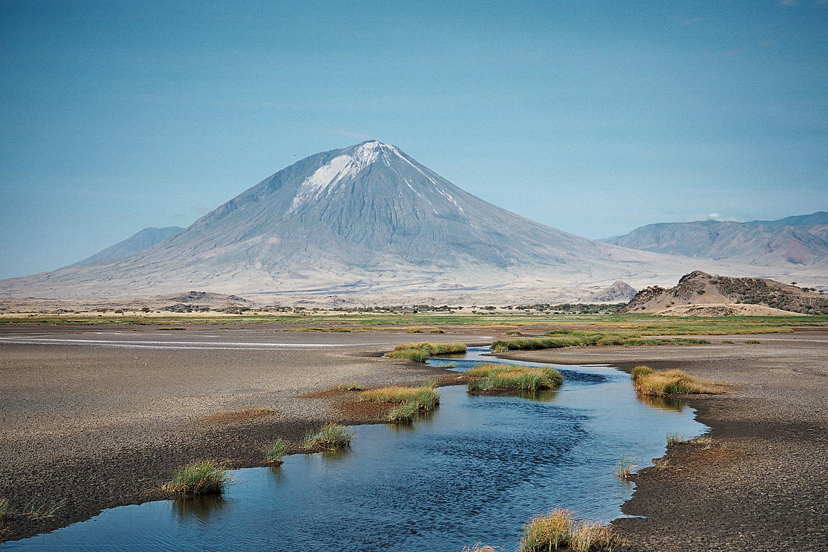
It is not the first time I read about "thermic anomalies being detected" at this volcano during the past year, but didn't think it was worth mentioning, given that this volcano is often is mildly active, filling up the crater after the major eruption back in 2007. Ol Doinyo Lengai is known for the Masai people as "The Mountain of God".


A Unique Volcano

When I read about this volcano around 2002-2003 for the first time, I thought it was by far one of the most fascinating volcano in existence - and it is really unique, due to it's "cold" lava merely reaching 500°C, and being extremely fluid, quickly turning into light ash. I believe this volcano is the only in existence, which has this type of cold lava


Vulkane.net had an article about the Ol Doinyo Lengai volcano:


Bild_2022-09-17_102254759.jpg

Thermal anomaly at Ol Doinyo Lengai
by Marc Szeglat

Ol Doinyo Lengai in Tanzania is currently very active. MIROVA detects a moderate thermal anomaly in the volcano's crater. It has a power of 15 MW. While this value would not be sensational for a normal volcano, it is for the coldest volcano in the world. The sodium carbonate lava at Ol Doinyo Lengai is only about half as hot as ordinary basalt melt and as flowable as thin mud. This type of lava is only produced recently at Ol Doinyo Lengai, so it is not an exaggeration to describe the volcano as unique. The anomaly can also be seen in a recent Sentinel satellite image. In the normal light spectrum, you can see the black of fresh lava coming from the central hornito complex. For once, we don't have to rely only on remote analysis of satellite images, but there is a great video shot in June.


Video shows lava pool

The video was put online by the French expedition provider "80 Jours Voyages" and documents very nicely what is going on. In the central hornito complex, one of the hornitos collapsed. A lava pool is bubbling inside it, as is typical for Ol Doinyo Lengai. I have witnessed the collapse of hornitos on Lengai several times. At that time, the crater was still accessible and one quickly got into hot water when something like this happened. Because of the proximity to the action, there were often serious accidents at Lengai in the past when it came to a duel of "man versus lava". Since the 2007 eruptions, a new crater cone has been created with vertically sloping crater walls, so the crater floor is no longer accessible. As a result, the volcano had lost a lot of its attractiveness, but since the crater is filling up more and more and the floor is moving upwards, observing the eruptions has become easier again. Therefore, trips to the volcano are taking place more often again.

The video shows not only the bubbling lava pool, but also lava spattering from various openings in intact hornitos. The spouting lava makes the hornitos grow and fills the crater further. A special feature of sodium carbonatitic lava is that it quickly disintegrates into a white powder on contact with moisture.

The makers of the video actually succeeded in documenting the faint red glow of the lava. This is now possible thanks to modern, light-sensitive camera sensors.


END OF ARTICLE

_-2022-09-18-at-20.45.24.jpg


Older photos of the volcano:

ol-doinyo-lengai-volcano-eruption-1024x683-1930073400.jpg
I assume this is from the beginning of the explosive 2007-(2008) eruption phase

E3800550-Ol_Doinyo_Lengai_volcano-1473312182.jpg

The photo is from before the 2007-2008 eruption showing the crater was entirely filled. If you make longtime exposures during the night of the "cold" 500°C lava, it shows with a very deep red glow.


Before the 2007 eruption

Strangely I don't seem to find many old night time lava photos from this strange volcano - but luckily, I have an old volcano image archive myself since 25 years, and can gather some of those images from around year 2000-2003. They are small, but I'll enlarge them with Gigapixels.

One Scene in the Lara Croft movies

was made on top of this very volcano (with Angelina Jolie). I can't rememeber which movie, but i believe it was the one with "Pandoras Box" in it as a theme.

old139kl---Ol-Doinyo-Lengai.jpg
lengai_nacht.jpg
Ol-Doinyo-Lengai,Lava-Fountains-and-Ash-Eruptions.-August-2003-(2).jpgodl177kl.jpgold1kl---Ol-Doinyo-Lengai.jpg
t58_2.jpgt58_4.jpg
Ol-Doinyo-Lengai,Lava-Fountains-and-Ash-Eruptions.-August-2003.jpg

filling---Ol-Doinyo-Lengai.jpg

In 1998 the lava begun to flow over the rim of the volcano.


51516sommetlengai.jpga260 - Ol Doinyo Lengai.jpg2011-OldoinyoLengaiAir.jpg
This is what the crater looked like in year 2011.
 
Well, after the earthquake it seems it is the turn of the Popocatepetl volcano.

Authorities in #Mexico issue an ash fall alert throughout Mexico City due to recent intense activity of Popocatépetl Volcano
This is in addition to the strong earthquake that hit the country this afternoon.

Special Notice for the activity of the Popocatepetl Volcano

CENAPRED reports today at 11:00 am that in the last 24 hours, through the monitoring systems of the Popocatepetl volcano, 42 exhalations accompanied by steam, volcanic gases and light amounts of ash were detected. Eighty-six minutes of high frequency tremor were recorded.


Mexico City: ash could fall due to activity of Popocatepetl volcano

The government of the capital city asked the population to take precautionary measures due to the activity of the great volcano.
EWJA2FRZPBEMVFHZKERFFFHNOI.jpeg

The Secretariat of Risk Management and Civil Protection of Mexico City (SGIRPC) informed that due to the recent activity of the Popocatepetl volcano, ash fall is expected in all the municipalities of Mexico city. At 5:05 p.m. on Monday, September 19, phase two of the volcanic alert traffic light was activated.

Likewise, he urged the population to take precautions such as keeping informed through official channels; cover nose and mouth with a handkerchief or use masks; clean eyes and throat with pure water; as well as wearing glasses and avoiding contact lenses to reduce eye irritation.

The National Civil Protection Coordination (CNPC) asked people to take extreme precautions in case of ash fall generated by the great volcano, also emphasized the importance of knowing what effects are generated in the body.

"Ashes are particles produced by fragmentation of rocks during eruptions and have a size less than 2mm. Their effects can go unnoticed and last for a long time, even after the eruption has ended," he said.
WJUQF7EWTBDTHBMPVQLIYLQAVA.jpg

Particles smaller than 4 microns lodge in the alveoli of the lungs, and the body encapsulates the particles as a defense mechanism of the lung and a scar forms, causing inflammation and reducing breathing capacity.

Frequent exposure to volcanic ash can cause acute eye and respiratory tract irritation; irritative conjunctivitis or corneal abrasions; gastrointestinal disorders; severe forms of respiratory exhaustion; pre-existing mucus hypersecretion and the potential to develop obstructive diseases, as reported by Civil Protection.
 

Taupō volcano alert level raised for first time after hundreds of small quakes​

GeoNet has increased the alert level for the volcano below Lake Taupō, which caused the largest eruption on Earth in the past 5000 years when it last exploded about 1800 years ago.

In a statement, geological agency GeoNet said it had detected almost 700 small earthquakes below Lake Taupō, the caldera created by the giant volcano, and had raised the volcanic alert level to 1 from 0.

The volcanic alert system is based on six escalating levels of unrest, but Geonet noted that eruptions could occur at any level, and levels might not move in sequence as activity could change rapidly.

The Taupō volcano spewed more than 100 cubic kilometres of material into the atmosphere when it last erupted around 200 BCE, devastating a large area of New Zealand's central North Island in a period before human habitation. Geonet said the eruption was the largest on the planet in the past 5000 years.

GeoNet added this was the first time it had raised the Taupō Volcano alert level to 1, but this was not the first time there had been unrest and said the chance of an eruption remains very low.

"The earthquakes and deformation could continue for the coming weeks or months," it said.

Team leader Nico Fournier said level 1 indicated "minor unrest" but with the earthquakes and deformation it was considered the "appropriate" setting.

He said only two of 29 eruptions at Taupō have been large, the rest have been small, probably similar to what happened at Ruapehu in 1995-96.

Lake Taupō not only has a large volcano, it is also crossed by some large faults which cut across the whole region - known as the Taupō volcanic zones.

"When we do have earthquakes occurring inside the lake they are either occurring along some of those faults or they are occurring around the body of magma - those molten rocks which we know are under the surface at depth since the last eruption."

Scientists were trying to understand where they were occurring and which faults they were crossing, Furnier said.

Scientists were also keeping an eye on Whakaari / White Island after volcanic ash and strong gas was detected in the crater, RNZ reported yesterday.

In 2019, Whakaari suddenly erupted, spewing steam and ash, killing 22 people and seriously injuring 25, mostly tourists.


Wikipedia as an entry for this volcano, as well as this chart showing the main events until -10,000 years ago:

a913jnzhbhfeoq833v0vjpvop3n82ox.png

The event mentioned 1,800 years ago is known as the year 233 Hatepe eruption:
The eruption ejected some 120 km3 (29 cu mi) of material,[2] of which just over 30 km3 (7.2 cu mi) was ejected in a few minutes. This makes it one of the largest eruptions in the last 5,000 years, comparable to the Minoan eruption in the 2nd millennium BCE, the 946 eruption of Paektu Mountain, the 1257 eruption of Mount Samalas, and the 1815 eruption of Mount Tambora.
 
Laguna de Maule (Chile)Taupo (New Zealand)Yellowstone (USA)
20 Sep 2022

Leaning onto the latest entries of @Puma and @MK Scarlett regarding unrest under the major caldera volcano Taupo in New Zealand, Vulkane.net just recently wrote an article about swarm earthquakes occurring under three of such large caldera volcanoes. The article states following:


1e2075ad1e8d3ff1482163407c07408e-3320766295.jpg

laguna.jpg

Laguna del Maule with swarm quakes

Laguna del Maule is a large caldera in the heart of Chile and is part of a large volcanic complex. It measures 25×15 km and is partly filled with a lake. For years, scientists have been recording - in part enormous - ground deformation in the form of uplift. The ground uplift was recorded and scientifically studied for the first time in 2007. The annual rate of uplift is 25 cm. It is assumed that the ground uplift is caused by magmatic fluids and postulated a magma body with a volume of 6 cubic kilometres already 8 years ago. Currently, it is likely to have become much larger.

Yesterday, SERNAGEOMIN reported that a swarm quake was detected in the western part of the volcanic complex. There were 120 weak tremors detected, which were of volcanotectonic origin and caused by rock fracturing due to fluid movements. The hypocentres were located at a depth of 5 km. Now, a swarm quake does not immediately mean that a volcanic eruption will occur, but with each volcanotectonic quake sequence the risk of eruption increases a little.

Each volcano behaves differently in terms of its predictability and the more eruptions of a volcano have been scientifically documented, the more accurate the forecasts become. With regard to Laguna del Maul, however, this means that its signs cannot be read accurately, because the last eruptions took place in pre-Christian times. It is unclear how strong swarm quakes will be here before a volcanic eruption occurs. Generally, one would expect swarms lasting for days with thousands of earthquakes, but with some volcanoes there are only small swarms with a few hundred earthquakes before an eruption. In rare cases, there is no seismic crisis at all, or only a few quakes before an eruption occurs.

At the end of December 2021, there were already swarm quakes along with inflation and the alert status was raised to "2". Currently it is at "1". At that time, in addition to inflation and swarm quakes, an increased emission of carbon dioxide was also detected. All indications of magma rise.

In fact, no modern human has ever documented the eruption of a supervolcano.

So we don't know what the signs of such a powerful eruption are. Speculatively, there will be extremely strong swarm quakes and large ground deformations before such an eruption. It is also possible that a series of smaller eruptions could occur beforehand. However, even if an eruption were to occur in a large caldera volcano, it does not automatically mean that a VEI 7-8 eruption will occur. But new research shows that such eruptions are more common than previously believed. They are also thought to have been frequently involved in mass extinctions.

Laguna del Maule is not the only caldera volcano that is currently seismically unsettled.


_-2022-09-22-at-01.29.04.jpg


Taupo: Warning level raised

MicrosoftTeams-image__14_.jpg

After more than 700 earthquakes were recorded under New Zealand's Taupo caldera in recent weeks, GeoNet researchers have now raised the warning level to "1". This means that there is slight volcanic unrest related to magmatic activity in the subsurface. In addition to the earthquakes, a slight ground uplift was detected. It is the first time that this warning level has been declared for Taupo, although there have already been several phases with swarm earthquakes. GeoNet justifies this by saying that the volcano is now better understood. Nevertheless, the risk of an eruption is considered low. Similar to the Laguna del Maule, no eruption of the Taupo volcano has ever been documented. The last eruption took place around the year 232 BC.


Yellowstone with more earthquakes

Bild_2022-09-20_125431178.jpg

Only yesterday I reported on a comparatively weak swarm quake under the Yellowstone caldera. But since then there have been more tremors. Including yesterday, a good 20 quakes have been recorded. The strongest quake today had a magnitude of 2.9 and an earthquake focus at a depth of 8 km. The swarm manifests itself 7 km northwest of the Norris Geyser Basin. The YVO reported a weak ground uplift in its last update on 1 September. It was just over 1 cm and is thought to have been caused by meltwater entering the hydrothermal system. Since 2015, an overriding subsidence (ground subsidence) has been detected. It remains exciting to see whether the trend will reverse.


END OF ARTICLE


Additionally, here is the other article Vulkane.net had written only day earlier, 20 Sep 2022


yellow.jpg

Yellowstone: Earthquake Ml 3.9
Earthquake near Norris Geyser Basin in Yellowstone
by Marc Szeglat


Date: 18 Sep 2022 | Time: 12:55:20 UTC | Location: 44.80 N ; 110.81 W | Depth: 10 km | Ml 3.9

Yesterday, Yellowstone National Park was shaken by a magnitude 3.9 earthquake. The earthquake focus was located at a depth of 10 km. The epicentre was located 28 km northeast of West Yellowstone. The notorious Norris Geyser Basin is located about 7 km southeast of the epicentre. The quake did not occur alone, but was accompanied by another earthquake of magnitude 2.4. In addition, there was (and still is) a lot of microseismicity. In the area, tremors have manifested themselves frequently in recent weeks and one can speak of an increase in seismicity.

The earthquakes do not necessarily mean that the Yellowstone volcano will erupt. Rather, they are related to the volcano's hydrothermal system. Nevertheless, if an eruption were to occur in Yellowstone, the area around Norris would be one of the areas I would favour as a possible eruption point.

Norris Geyser Basin is also home to the world's largest geyser: Steamboat. In fact, it erupted again yesterday after a comparatively long break. It lasted 89 days. The jump started at 15:17 and the main phase lasted a good 10 minutes. The M 3.9 earth tremor manifested itself at 06:55:20 local time. It is therefore possible that the earthquake triggered the geyser's jump.

The Yellowstone caldera is medially classified as a "supervolcano". In the last 2 million years it has produced 3 of these gigantic volcanic eruptions, which are suspected of triggering global winters. But beyond that, the Yellowstone volcano has been responsible for a number of normal eruptions. The last eruption occurred about 70,000 years ago. Although the volcano is considered extinct by definition, volcanologists believe new eruptions are possible. But it is uncertain when this will happen.


END OF ARTICLE
 
Kilauea, Hawai'i
21 Sep 2022

More swarm earthquakes as well lava pouring out (inside the Kilauea crater) has been reported, increasing its activity a lot. Vulkane.net wrote following about this event


Kilauea with swarm quake
by Marc Szeglat

• A swarm quake started under Kilauea around 3 pm local time.
• The level of the lava lake dropped sharply
• Subsequent ground uplift occurred
• Lava flows erupted in the crater
• Swarm quake and lava flows in Halema'uma'u crater


State: USA | Location: 19.42, -155.29 | Eruption: Hawaiian

hawaiisch.jpg

Tonight (afternoon in Hawaii), seismic activity under the Kilauea summit caldera and Halema'uma'u crater increased significantly. So far, over 100 quakes manifested. 52 had magnitudes in the 2s range and were recorded by the EMSC. The quakes were at sea level. Shortly after the onset of the swarm quake, Kilauea began to emit more lava and lava flows within the crater. The activity, of course, called HVO's volcanologists to action. They wrote an update saying that the activity was confined to the summit caldera and that there were no signs of it moving into either of the rift zones. Access to the national park was closed for a short time.

Details of what happened at Kilauea

The quakes began at around 15:00 local time. The strongest shaking brought it to M 2.9. At 16:20, a rapidly increasing ground uplift was detected. At the same time, the level of the lava lake dropped by about 7 m. The subsidence spread to the entire crater floor, which lowered by several metres. Subsequently, lava breakthroughs occurred in the west and north of the crater, lava flows began to flow. At the same time, the ground began to rise again. The ground inclination was 12 µrad. Volcanologists assume that there was a temporary blockage in the conveyor system.

summit_caldera_gps_year.jpg

We also saw similar swarming earthquakes in the weeks leading up to the big Leilani eruption in 2018, when the action was also initially confined to the summit crater. What is striking is that the long-lasting inflationary trend already got a damper a few days ago. One has to wonder whether less magma suddenly rose from the depths, or whether it sought a different path? The lava lake activity did not decrease significantly. It cannot be ruled out that we will see a shift of activity into one of the rift systems in the next few weeks. It is possible that there will be a reactivation of the Pu'u'O'o crater. But this is speculation on my part.


END OF ARTICLE
 
Piton de la Fournaise, La Réunion - France
21 Sep 2022

_-2022-09-22-at-01.49.59.jpg

Piton de la Fournaise • 2,632 m (8,635 ft)


Fournaise volcanic eruption continues
State: France | Coordinates: 21.23, -55.71 | Eruption: fissure eruption

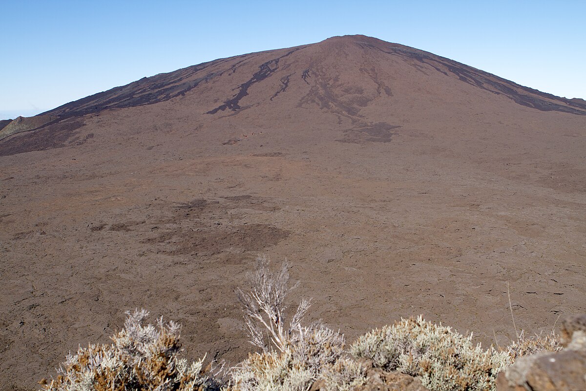
On Monday, a new eruption of the volcano Piton de la Fournaise began. The volcanic eruption continues until today, but shows a clear decrease in activity. The eruption is now confined to a few vents in the lower part of the eruption fissure, but even there a downward trend in activity has been noted. Seismicity has continued to decrease. The tremor is still 10% of its original strength. No volcanotectonic earthquakes have been recorded below the summit area in the last 24 hours. Due to the cloud cover, no thermal radiation could be measured, therefore it was also impossible to determine the current production rate. During the initial phase of the eruption, Fournaise ejected 28 cubic metres of lava per second.

Although the weather on La Réunion is bad, the clouds occasionally broke and some very persistent photographers managed to take beautiful pictures of the eruption. The set of pictures below shows the eruption during the night from Monday to Tuesday. [see below]


Forecasts about the further course of the eruption

can - as always - only be made to a limited extent and are based on empirical values. Usually, such fissure eruptions at the foot of the main crater cone Dolomieu last for a few days. After a lively initial phase, the activity decreases quite quickly and then stabilises at a low-moderate level. This is maintained for a few days before the eruption slowly peters out. In some cases, the eruption ends after a short time. It is also possible that the activity increases for a short time. In very rare cases, more fissures open and the activity increases significantly. Especially when eruption fissures open outside the caldera, the lava can reach the sea. I experienced such eruptions 2 times on Fournaise. The eruptions in 2004 and 2007 were among my most impressive volcanic adventures.


END OF ARTICLE


The fascinating series of images
made by Louc Abadie • 21 Sep 2022

307675980_630626895116189_2444229990279790575_n.jpg307824044_630626905116188_4245417916453244644_n.jpg
307883183_630626968449515_8966834943075164313_n.jpg
 
Last edited:

Trending content

Back
Top Bottom