Volcanoes Erupting All Over

Stromboli volcano eruption triggers tsunami


"The Italian authorities have reported 4.6-magnitude earthquakes near the Aeolian Islands"

"the tsunami was caused by the detachment of a large piece of the Sciara del Fuoco section of the Stromboli volcano, which slammed into the sea, creating tsunami waves one and a half meters high."

"the property damage was “insignificant,” as the waves barely managed to reach the coast."


Today a flash appeared on the slopes of the Popocatépetl volcano, I have never seen anything like this and I have no idea what it is ?
@chematierra @jaimemaussan1

Current SO-2 Reading from Windy
Screenshot 2022-12-06 at 08-56-28 Windy as forecasted.png

Source:
Email from USGS Re: SO2... California Earthquake uptick.. 5.9 EQ Java Trench. Monday night 12/5/2022


Screenshot 2022-12-06 at 14-51-30 Bill Barker on Twitter.png

As Mauna Loa's lava inches toward a key Hawaii highway, some residents recall bygone devastation
In the week since the volcano erupted in Hawaii, the lava has continued its slow advance, crawling at about 40 feet per hour, according to the U.S. Geological Survey.
Updated Dec. 5, 2022, 4:52 PM GMT By David Culver, Anna-Maja Rappard and Elizabeth Wolfe, CNN,
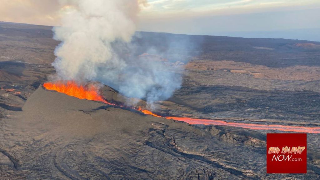
CNN) -- From a deep fracture in Mauna Loa's dark terrain, the volcano's magnificent eruption sends geyser-like fountains of lava spraying into the sky.

The fissure -- cracked open on the northeastern slope of the world's largest active volcano -- feeds a searing flow of molten rock that cuts through the contours of Hawaii's Big Island. Plumes of volcanic gas, including sulfur dioxide, rise into the air, and delicate strands of volcanic glass, called Pele's hair, float downwind.

In the week since Mauna Loa erupted, the stream of lava has coursed northeast, away from the volcano's summit. Once a quick-moving stream, the flow has slowed significantly as it reaches more softly sloping inclines.

Though no communities are at risk, the lava flow is inching closer to the Daniel K. Inouye Highway, a major artery that remains open, connecting two sides of this island, according to the U.S. Geological Survey. As of Sunday night, the stream was crawling forward at about 40 feet per hour, the agency said, and the unpredictable nature of eruptions makes it hard to say if or when it will reach the road.

"If the eruption continues, it might cover the highway. But at this stage, it's still about 2.3 miles away from the highway. But it is advancing every day," said Natalia Deligne, a volcanologist with the USGS at the Hawaiian Volcano Observatory. "We don't know how long this eruption is going to last, and that will dictate whether or not the highway becomes more threatened."

If it closes, residents' commutes could grow by hours as they seek alternate routes, creating "a tremendous inconvenience," Hawaii Gov. David Ige told CNN on Saturday.

Mauna Loa's eruption has attracted waves of awestruck visitors, some making the pilgrimage in the middle of the night to avoid the crowds, bundled in jackets and hats to protect against the chilly night air.

Also erupting now is nearby Kilauea, whose monthslong eruption in 2018 was one of the most destructive in recent Hawaii history, the USGS says.

Kilauea began erupting again in 2021 and hasn't stopped. And though it poses no risk now to surrounding communities, Mauna Loa's rare simultaneous eruption has rekindled memories of the pain and destruction Kilauea wrought four years ago, when it wiped out hundreds of homes and dozens of miles of road.

Memories of past destruction resurface

Just 21 miles east of Mauna Loa, Kilauea's ongoing eruption is now confined to a lake of lava rippling at its summit. But the history of this volcano is painful for Hawaii's Big Island.

Its 2018 eruption spewed lava into the large Leilani Estates neighborhood, swallowing more than 700 homes and surrounding others with thick layers of volcanic rock, creating unreachable patches of green foliage in a sea of blackened destruction.

Dorothy Thrall can still walk to the spot where her community once stood, now blanketed with hardened lava. From the deck of her friend's home, she can see the edge where the lava stopped and blackened into volcanic rock, still steaming years afterward.

Mauna Loa's eruption has reopened some of the wounds she and her friends still have from 2018.

"I thought I was doing pretty good," Thrall said. "My neighbor called me Day 2 (of Mauna Loa's eruption), and she was in tears. She says, 'I have PTSD, and I didn't even know it.' And I started crying, too, and I said, 'I guess I do, too.'"

Thrall has no desire to see Mauna Loa's eruption, saying she has seen enough lava in her time. Still, though, she still appreciates the majestic beauty and importance of volcanic events.

"Lava is beautiful. It's Pele's creation," she said, referencing the ancient Hawaiian volcano deity. "That's how the island was formed. That's how the island was built."

For many Native Hawaiians, the eruption of volcanoes, including Kilauea and Mauna Loa, holds incredible spiritual significance. Some have honored this week's occasion by leaving offerings and participating in traditional chants near Mauna Loa.

As onlookers and tourists flock, officials urge caution and advise people not to venture into closed areas that could pose risk of lethal volcanic fumes, sudden collapses and hidden earth cracks, the National Park Service said.

A spot for safe viewing is a one-way route is accessible through the Daniel K. Inouye Highway, the Hawaii County Civil Defense Agency said, noting vehicles parked on the roadway could get ticketed or towed.

The eruption has also created a risk of low air quality in some places due to volcanic ash and vog, or air pollution caused by volcanic gases. Sensitive groups, including children, the elderly and those with respiratory conditions, are advised to reduce outdoor activities that cause heavy breathing and reduce exposure by staying indoors and closing windows and doors, according to the Hawaii Department of Health.

The-CNN-Wire™ & © 2022 Cable News Network, Inc., a Warner Bros. Discovery Company. All rights reserved.

Live Mauna Loa Eruption, HI - USGS live stream
Started streaming on Dec 3, 2022
[M8cam] Mauna Loa - Northeast Rift Zone Fissure 3 Eruption Live View Live video of fissure 3 erupting on the Northeast Rift Zone of Mauna Loa volcano. The camera is located roughly 1 mi (1.6 km) East of fissure 3 and looks west. Disclaimer: The webcams are operational 24/7 and faithfully record the dark of night if there are no sources of incandescence or other lights. Thermal webcams record heat rather than light and get better views through volcanic gas. At times, clouds and rain obscure visibility. The cameras are subject to sporadic breakdown, and may not be repaired immediately. Some cameras are observing an area that is off-limits to the general public because of significant volcanic hazards.
 

A Surprising Amount of Magma Is Under Yellowstone’s Supervolcano​


New research suggests more melted rock lies beneath the Yellowstone Caldera—but it’s still not likely to erupt anytime soon

One of the magma reservoirs underneath the Yellowstone Caldera, a huge crater and supervolcano, holds more liquid molten rock than scientists previously estimated, suggests new research published Thursday in the journal Science.

The amount of melted rock beneath a volcano helps researchers determine how close it might be to erupting. But though there may be more liquid magma underneath Yellowstone than scientists had assumed, the behemoth is still unlikely to erupt anytime in the near future.

Magma consists of rocks and crystals at varying stages of solidity—the more melted, or liquid, the magma is, the more likely a volcano is to erupt. Two large reservoirs full of magma exist beneath the Yellowstone Caldera—one that’s about three to ten miles beneath the surface, and another that’s 12 to 30 miles below ground.

yellowstonemagma.jpeg

Based on previous research, scientists thought the shallower reservoir was mostly solid, with just 5 to 15 percent melted rock. Now, however, after using powerful supercomputers to re-analyze existing seismic data from the past 20 years, they believe that proportion is actually 16 to 20 percent.

That’s still well below the threshold of liquid magma—about 35 to 50 percent—that scientists believe will trigger an eruption. While the new findings don’t change the volcano’s risk level, they do represent a “big improvement in our ability to understand what’s beneath Yellowstone,” says Kari Cooper, an Earth and planetary scientist at the University of California, Davis, who was not involved in the study, to New Scientist’s James Dinneen.

The Yellowstone supervolcano, located in northwestern Wyoming in Yellowstone National Park, is one of the largest volcanoes in the world. It’s erupted multiple times over the past 2.1 million years, including three massive eruptions that smothered the surrounding landscape in ash. The Yellowstone Caldera, which spans 30 by 45 miles wide, formed during one of those eruptions roughly 631,000 years ago.

Seismic waves, produced by earthquakes, must move through layers of materials inside the Earth before reaching seismometers on the surface. The waves slow down when they reach molten rock, so researchers can use the time it takes them to reach the seismometers to glean insights into how much magma is below ground.

Past analyses have assumed that seismic waves emanate linearly from the quake toward the seismometer. But the reality of their journey is much more nuanced than that. This time around, supercomputers modeled the seismic waves in three dimensions, which gave scientists a more complete picture of the “crystal mush” below Yellowstone, as study co-author Ross Maguire, a seismologist at the University of Illinois Urbana-Champaign, tells New Scientist

SuspiciousObservers' commentary on Yellowstone is consistent with the article.

 
Mauna Loa, Hawai'i
2-7 Dec 2022

A cocktail of info, images and illustrations from the ongoing eruption on the NE flank of Mauna Loa. The guy "Sky Makai" stands for perhaps one most awesome photos I have seen from the Mauna Loa 2022 eruption.

317505657_10229102104886970_4445001346738578853_n.jpg

The latest HVO report (7 Dec 2022) states following:


HAWAIIAN VOLCANO OBSERVATORY STATUS REPORT
U.S. Geological Survey • Wednesday, December 7, 2022, 4:23 PM HST (Thursday, December 8, 2022, 02:23 UTC)

MAUNA LOA VOLCANO
(VNUM #332020)

19°28'30" N 155°36'29" W, Summit Elevation 13681 ft (4170 m)
Current Volcano Alert Level: WARNING
Current Aviation Color Code:
ORANGE

The Northeast Rift Zone eruption of Mauna Loa continues. One active fissure, fissure 3, is feeding a lava flow downslope.
Fissure 3 is generating a lava flow traveling to the north toward the Daniel K. Inouye Highway (Saddle Road) that has reached relatively flatter ground and slowed down significantly, as expected.

The lava flow has advanced very little since 6:00 a.m. this morning, December 7, when it was about 1.8 mi (2.9 km) from the Daniel K. Inouye Highway (Saddle Road). The flow advance has slowed possibly due to a significant breakout removing lava from the channel about 2.8 mi (4.5 km) behind the tip of the main flow on the east side. The main flow has advanced at an average rate slower than 20 feet (6 meters) per hour during the 24-hour period prior to this morning. The lava flow remains active and is continuously supplied from the fissure 3 vent. HVO crews have installed a new webcam to view the front of the main flow [M9cam] Mauna Loa — Northeast Rift Zone Lava Flow | U.S. Geological Survey

Lava flow advance rates may be highly variable over the coming days and week. Lava flows advance more slowly, spread out, and inflate on the flat ground between Mauna Loa and Mauna Kea. Individual lobes may advance quickly, and then stall. Additional breakouts may occur if lava channels get blocked upslope. There are many variables at play, and the direction and timing of flow advances are expected to change over hours to days, making it difficult to estimate when or if the flow will impact Daniel K. Inouye Highway.

Sulfur dioxide (SO2) emission rates of approximately 120,000 tonnes per day (t/d) were measured on December 4, 2022, and remain elevated at this time. Volcanic gas is rising high and vertically into the atmosphere before being blown to the west at high altitude, generating vog (volcanic air pollution) in areas downwind. The Hawaii Interagency Vog Information Dashboard has detailed information about vog: https://vog.ivhhn.org/. Forecasts for the dispersion of vog can be found on the VMAP Vog Forecast Dashboard: http://weather.hawaii.edu/vmap/new/.

Pele's hair (strands of volcanic glass) fragments are being wafted great distances and have been reported as far Honoka‘a.
Tremor (a signal associated with subsurface fluid movement) continues beneath the currently active fissure. This indicates that magma is still being supplied to the fissure, and activity is likely to continue as long as we see this signal.

There is no active lava within Moku'āweoweo caldera nor the Southwest Rift Zone. We do not expect any eruptive activity outside the Northeast Rift Zone.

Most recent eruption map: Most recent Mauna Loa Northeast Rift Zone eruption map | U.S. Geological Survey
Information on lava viewing: Hawaii County Volcano Hazards
Streaming video of the fissure 3 fountains can be found at https://www.youtube.com/usgs/live

This is the latest published map/illustration of the lava flows:

As you can see, the lava which has reached the Saddle region, a high plateau between Mauna Loa and Mauna Kea, at an elevation of around 2000 meter above sea level, it is pretty flat there. But also the reason the HVO doesn't know when or if the lava will reach the important Saddle Road, an important link between West and East Hawai'i. Only Vent 3 is active for the moment.

MicrosoftTeams-image-(67).jpg

Progression of the Fissure 3 Lava flow

An illustration (based on thermal images) how the Fissure 3 evolved though the time span of 30 Nov - 5 Dec 2022. And below the thermal image from 5 Dec 2022.

20221205compilation.jpg

20221205thermalmapweb-1.jpg

Let's go to the good stuff; Photography !

First an older photo from 28 Nov 2022, I thought was chilling, given that you there can see both active Kilauea and Mauna Loa going off at the same time.

2022-11-28-NPS-Photo-J.Wei.jpg

2022-12-03-Patrice-Zwenger-.jpg
3 Dec 2022


Above photo: I believe this photo has been taken on the road, which leads up to Mauna Kea. You look down towards were you meet the Saddle Road and in the background of course the lava flows from Mauna Loa. Smart choice; not only are you perfectly elevated to see and photograph the scenery, but you can park the car on this road (which leads to Mauna Kea) - while on the Saddle Road below, I believe there were/are restrictions of how long you can stay. In the beginning they quickly forbid anyone to stop along the road, but then changed it into - if I remember correctly - being allowed to stop for up to 90 minutes.

(I don't know who took the above photo)


317546923_516073660540902_6672097213448173130_n.jpg

318211161_5655891594487228_3397084989963559074_n.jpg
Another photo in which the photographer has shown both eruption from Kilauea to the left, to Mauna Loa in the background. The glow in the sky is (i believe) caused by Pelées hair, very fine glass fibrous being blown into the air creating a red glow. I am sure the people at all the telescopes on Mauna Kea, might not be so delighted about the vast light contamination disrupting their studies and observations.


Johann-Romeo-Ramirez.jpg
Johann Romeo Ramirez Went close to the edge of the lava stream with a very wide lens, illustration the scenery and the night sky over Hawai'i. I am not sure which the bright star is in the photo... but I'll guess that it might be Sirius in Canis Major ?


317967267_10229122914407195_8070327377313190295_n.jpg
Sky Makai
Shared with Public • Mauna Loa Arrival - 2022

I don’t usually post every day. Usually my life is much slower. I work, I make photos or videos for clients, and I relax as much as possible.
Since the eruption, I’ve been out every night to film and photograph the flow. I’ve been up past midnight to update social media with what I’ve seen.
It’s been hectic. I’m tired. But what I’m capturing is more powerful than anything I’ve ever experienced before. It’s truly an honor, and I feel lucky.
I’m trying to find a place within myself where my motivation is truly to help others. At the same time, I see huge possibilities to step towards the professional roles I’ve dreamt about… National Geographic photographer.


317655964_10229107725027470_4942690586237167675_n.jpg
Sky Makai

Really nice sunset tonight! It was much colder up at Mauna Kea, but totally worth it. Less atmosphere resulted in a clearer view over the 20 mile expanse to the flow. It looks like the flow is slowing, though it hasn't. The flow has gotten near the bottom of Mauna Kea where there are giant waves of a'a lava, making the 'bee-line' river look like it's stopped. But it's still going strong. I'll post more extreme closeups of the fissures shortly.
 
Stromboli, Aeolian Islands - Sicily, Italy
4-6 Dec 2022

I haven't grasped the full content of this event (4 Dec 2022) at Stromboli, but it appears to have been pretty large, with fierce pyroclastic clouds as well a 1.5 meter high tsunami (so i have heard/read).

PS: It also seem to me that sharing stuff from Facebook, isn't possible anymore :rolleyes: if you don't have an account ? (I snuck into my husband's account... in order to access the sharing links - which then became visible again).
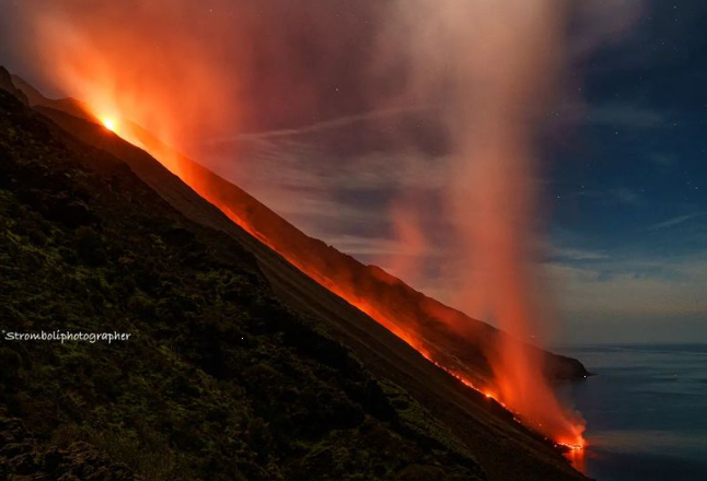
Impressive drone video of the pyroclastic clouds rolling down the slopes

Timelapse of the by INGV installed camera at the 400 meter observation point


Susanna Jäger
apparently working on the Island of Stromboli, took a few photos how it looked like on the other side, among the houses in town.

To me it seems that Stromboli has become more active in terms of larger eruptions during the past few years... in a more frightening way. I never experienced those during the three times I have been there in 2006, 2009 and 2010.

Susanna-Jager-318236930_1560378227790159_2361659282259628538_n.jpgSusanna-Jager-317800035_1560378187790163_6812008842051761308_n.jpg

318713123_522772203246883_1037926123310491290_n.jpg

German Vulkane.net
wrote about the lava stream on 6 Dec 2022 as following:


State: Italy | Coordinates: 38.79; 15.21 | Activity: Lava flow

Lava flow on Stromboli still active

Lava continued to flow from a vent in the northern crater area of the Lipari island volcano Stromboli last night. The lava flow was on the Sciara del Fuoco and reached the sea. The flow began the previous day, triggering pyroclastic flows as it pushed through the crater wall, causing it to collapse. Ember clouds also flowed out to sea. In the initial phase of the eruption, the tremor shot up and took on very high values, but very quickly plummeted back down to the yellow range.

On Sunday, there had been an earthquake Ml 4.6, which occurred off the southern coast of Vulcano. Vulcano is the second volcano of the seven Lipari Islands to be classified as active. Perhaps the moderate earth tremor triggered the eruption on Stromboli. In the meantime, there have been 18 more aftershocks off Isola di Vulcano. Yesterday, another weak earthquake Ml 1.2 occurred under the crater of Stromboli. The hypocentre was at a depth of only 1 km. Several weak earthquakes east of the archipelago are also noticeable. The seismicity shows that there is a lot of movement in the area of the archipelago. How great the magmatic influence is cannot be said with certainty, but there is often a relationship between tectonic earthquakes and magmatism in volcanic areas.

Stromboli was hit particularly often by natural disasters this year. In addition to eruptions with lava flow activity, a large part of the vegetation belt burnt down in spring. Three times, storms with heavy rain triggered mudslides that caused damage in Stromboli Ort. One reason for the mudslides was the lack of vegetation and the ash from the vegetation fire, which provided additional material for the mud.

Currently, there are more storms in the south of Italy that triggered floods and could also hit Stromboli again. One reason for the storms is the Mediterranean Sea, which is too warm and cools down only slowly.


END OF ARTICLE


318377302_639683764618972_2605409229525614570_n.jpg
 
Etna, Sicily - Italy
Campi Flegrei, Napoli - Italy
Stromboli, Aeolian Islands, Sicily
Vulcano, Aeolian Islands, Sicily

7 Dec 2022

317860236_5281887545250006_1943716104700495250_n.jpg
318588110_10229145245644566_7768909048216501932_n.jpg

Photo by Alfio Campo

Vulkane.net (by Marc Szeglat) reported on 7 Dec 2022 further from four Italian volcanoes as follow:


Yesterday, the new INGV weekly bulletins on the Campi Flegrei, Stromboli and Vulcano volcanoes came out. There was also the monthly overview of Mount Etna. Indeed, there is a lot going on at the Italian mountains of fire. Find out what in my summary.


Etna with inflation
State: Italy | Coordinates: 37.73, 15.00 | Activity: effusive

There was an earthquake of magnitude 2.6 on Etna in Sicily today, with the hypocentre at a depth of 9 km. The epicentre was located by the EMSC 3 km northwest of Giarre. This means that the quake was relatively far down on the eastern flank. However, seismicity also increased slightly further uphill in the last few days. The INGV attested the volcano only a low seismicity in the month of November. Only 2 earthquakes with magnitudes of 2 or more had manifested themselves along the Pernicana fault zone.

A third earthquake M 2.3 had occurred near Randazzo. The tremor was mainly in the medium range and only moderate infrasound activity was detected, testifying to explosions or strong degassing in the Bocca Nuova area. So far, quite unremarkable data, had it not been for a significant ground uplift that lifted the summit area on 15 November. It displaced the volcano flanks by about 1 µrad. This was accompanied by a seismic swarm that was somehow suppressed in the INGV report. Ground uplift due to inflation was not only registered in the summit area, but also along the base of Etna.

Then, on 27 November, an effusive vent had opened at the north-eastern base of the South East Crater cone. It is located at an altitude of about 2800 m. A small lava flow erupted and quickly reached a length of 300 m and moved in the Valle del Leone. On 30 November, a second vent opened slightly above the first one. Here, a further lava flow travelled about 400 m. The activity continues to this day.


Often, small lava flows in the area of the southeast crater cone are harbingers of larger eruptions. So far, however, there are no further signs that the eruption pattern will change. Dr Boris Behncke of INGV feels reminded of a phase of activity in 2001, when a small lava flow emerged at the southern base of the cone. The activity lasted for several months and ended with the great flank eruption of 2001. This analogy is not a prediction that it will behave similarly now, but Etna continues to charge and it has the potential for a new flank eruption.


Campi Flegrei with strong ground uplift
State: Italy | Coordinates: 40.826, 14.138 | Eruption: Fumarolic

It was a turbulent week for the Campi Flegrei. In the observation period 28.11-04.12.22, 108 earthquakes were registered. The strongest had a magnitude of 2.5. The strong ground uplift rate of 15±3 mm per month seems to be confirmed. Compared to the last months, the uplift rate has more than doubled. Since 2011, the total uplift at the RITE monitoring station is 95.5 cm. The gas temperature of the Pisciarelli fumarole was 94 degrees.


Stromboli: Colourful gorge on Sciara
State: Italy | Coordinates: 38.79; 15.21 | Activity: Lava flow

318000555_10229856845744782_7919374915368847171_n.jpgbunt.jpg
Left photo by © K.Yellow Photography on 4 Dec 2022 during the large event.
Right image made by "Stromboliphotographer"


Stromboli kept us on tenterhooks during the last few days with a new lava spill erupted from a vent at the northern base of the crater. Lava flows were erupted in several spurts, reaching the sea in a short time. Currently, the lava source seems to have dried up. An impressive drone video from yesterday showed only a little lava flowing out of the vent, but the gorge that formed on the Sciara del Fuoco was clearly visible.

It was cut into the volcano flank by the pyroclastic flows and lava flows of the last months and now channels the material. In the upper area, the gorge cuts through particularly colourful lava rocks. The colourfulness is enhanced by yellow sulphur and white saltpetre minerals deposited by fumaroles. Unfortunately, the video cannot be embedded here, but you can view it in our FB group "volcanoes and volcanism". Screenshot used with kind permission of "Stromboli stati d'animo".


Vulcano with earthquake
State: Italy | Location: 38.50; 14.87 | Eruption: Fumarolic

vulcano.jpg

As reported, an earthquake Mb 4.6 occurred off the southwest coast of Vulcano on 4 December. There were several aftershocks, creating an impressive cluster. Microseismicity also occurred in the area of the volcano. However, the volcanologists from INGV could not detect any ground uplift, but the weekly report clearly shows that the gas emission has increased. This affects the measuring stations at the summit as well as in the harbour area and at Fangobad. Here, carbon dioxide emissions in particular have increased.

END OF ARTICLE
 
Last edited:


INFORMATION ON THE ERUPTION OF G. KERINCI There was an eruption of G. Kerinci, Jambi, West Sumatra on December 6, 2022 at 08:22 WIB with the height of the ash column being observed ± 700 m above the peak (± 4,505 m above sea level). The observed ash column is gray to black with
1670483218253.png

Elastic interaction between Mauna Loa and Kīlauea evidenced by independent component analysis
Screenshot 2022-12-08 at 08-52-35 (PDF) Elastic interaction between Mauna Loa and Kīlauea evid...png

Meanwhile:

 
Lascar Volcano, Chile
10-11 Dec 2022

It appears to be a volcano with really explosive history. Vulkane.net wrote more about this volcano in two articles further below. Wikipedia as quite a lot of info on this volcano.


1993 subplinian eruption

The largest eruption of Lascar volcano known in historical times was in 1993: The explosive eruption began late on 18 April with a series of powerful explosions and intensified on 19 April, when it produced a plinian ash column reaching 20-22 km height above the crater. Large pyroclastic flows traveled 7.5 km NW and light ashfall (<0.1 mm) was reported as far as Buenos Aires, Argentina, 1,500 km SE of the volcano.

The area affected by ash fall covered more than 850,000 sq km and stretched into north-central Argentina, southern Paraguay, Uruguay, and southern Brazil.
Lascar1993.jpgimage-3159055820.jpg

The location of this volcano is here:

LascarVolcano_position.jpg

10. December 2022 by Marc Szeglat
State: Chile | Coordinates: -23.36, -67.73 | Activity: Ash eruption

Lascar with volcanic ash at 8200 m altitude

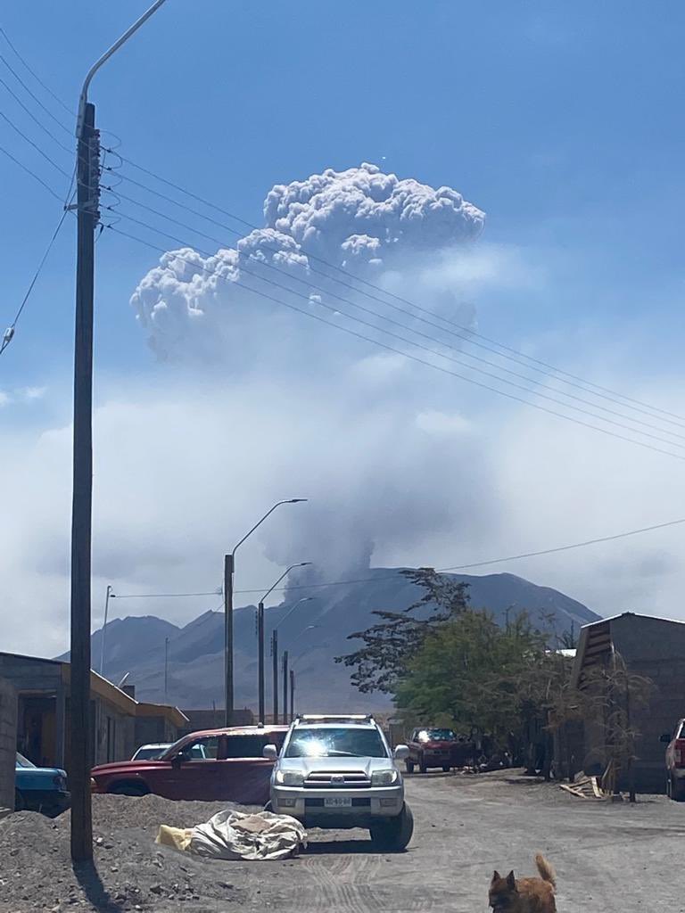
Today there was an explosive eruption at Lascar in Chile's Atacama Desert. The Buenos Aires VAAC issued a VONA warning at 17:00 UCT. According to the warning, volcanic ash rose to an altitude of 8200 metres. The ash drifted towards the southwest. Sporadic thermal anomalies occurred in recent months, indicating the volcano was in the process of charging. The eruption may have been triggered by the Mw 5.6 earthquake (vnet reported) that occurred near the volcano tonight.

Lascar is quite capable of producing strong eruptions. Typical are then high rising ash clouds in which volcanic thunderstorms can occur. However, the question is whether the volcano was already appropriately charged. The volcanologists of SERNAGEOMIN have not published any special reports on Lascar recently, but had much more the volcanoes Villarrica and Nevados de Chillan on their radar. The last moderate eruptions at Lascar manifested in 2006 and 2015. There was a major eruption in 1993, which had a VEI4. SERNAGEOMIN volcanologists are consulting at the moment. A short tweet spoke of an explosive pulse.

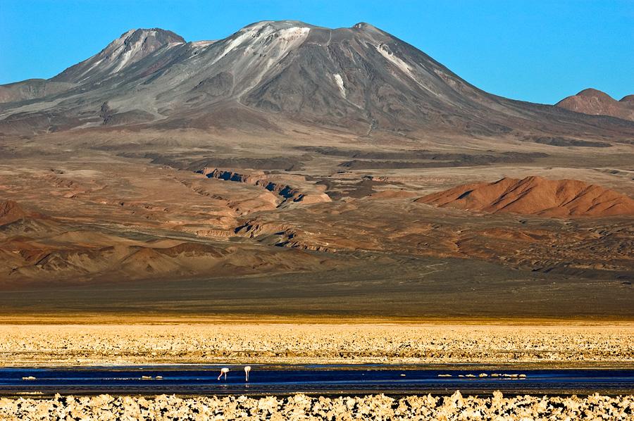
The crater of the Lascar volcano is at an altitude of 5,592 metres above sea level. However, the actual stratovolcano is much lower as it rises from a plateau. Lascar is 70 kilometres from San Pedro de Atacama, a popular tourist centre. Tourists start trekking tours into the Atacama from here. The area is also popular with astronomers, as the dry high-altitude air offers good observation conditions. The Atacama Desert is one of the driest places in the world. The desert is known for its salars (evaporite basins) where, among other things, lithium is extracted.


11 December 2022 by Marc Szeglat


Lascar with ash at 11,200 m altitude

State: Chile | Coordinates: -23.36, -67.73 | Activity: Ash eruption

Chile's Lascar volcano produced further eruptions, ejecting ash that rose to an altitude of 11,200 m and drifted towards the southwest. Residents of the nearest town, Talabre, were told to prepare for evacuations. The village is 30 km from the Lascar volcano. So far, however, only a "yellow" alert has been issued. Stronger eruptions may occur without further warning, but a catastrophic event does not seem to be expected on site.

The signs of an imminent eruption were diffuse. As mentioned yesterday, there were sporadic thermal anomalies with a low output. Volcanotectonic earthquakes were equally sporadic. A peak in seismicity last occurred in January this year, when 27 weak tremors were recorded in one day. The last activity report of the volcanologists published at the GVP also dates from this time.

Before the current eruption, there were no abnormalities in the geophysical parameters. Everything pointed to a slow charging of the volcano, but nothing to an imminent eruption. Only the day before the eruption there was an increase in seismicity when 14 volcanotectonic earthquakes were recorded. Yesterday, the day of the eruption, their number rose to 26. In addition, 55 long-period earthquakes were recorded. The strongest quake had a magnitude of 1.8. The sulphur dioxide emission was declining in the weeks before the eruption, which is a very unusual phenomenon. Before the eruption, sulphur dioxide emissions were recorded at 424 tonnes per day.

If the volcanotectonic earthquakes had not already increased on 9 December, I would say that the eruption was triggered by the Mw 5.6 earthquake. Its epicentre was about 40 km northwest of the volcano and occurred a few hours after the onset of the volcanotectonic earthquakes at the volcano. Of course, there could still be a connection between the tectonic earthquake and the volcanic eruption. It is even conceivable that a magma intrusion under the volcano triggered the earthquake, but this is speculative. The data so far do not indicate a large magma intrusion.


END OF ARTICLE
 
Mauna Loa, Hawai'i
10-11 Dec 2022

It appears that thhe eruption is vaning considerably, and refined to just the lava pond inside the vent No 3. NVO writes further below in teir latest statement about the eruption.

MicrosoftTeams-image-(100).jpg

HVO/USGS Volcanic Activity Notice
Volcano: Mauna Loa (VNUM #332020)

Current Volcano Alert Level: WATCH
Previous Volcano Alert Level: WARNING
Current Aviation Color Code: ORANGE

Issued: Saturday, December 10, 2022, 2:35 PM HST
Source: Hawaiian Volcano Observatory
Notice Number: 2022/H650
Location: N 19 deg 28 min W 155 deg 36 min
Elevation: 13681 ft (4170 m)
Area: Hawaii

Volcanic Activity Summary:

Lava eruption from fissure 3 (F3) on the Northeast Rift Zone of Mauna Loa continues but with greatly reduced lava output and volcanic gas emissions. Most lava is confined to the vent in a small pond. The short lava flows active about 1.5 miles (2.4 km) from the vent yesterday have stalled.

The flow front in the Humu'ula Saddle region has stagnated 1.9 miles (3 km) from the Daniel K. Inouye Highway (Saddle Road) and is no longer a threat.

High eruption rates will not resume based on past eruptive behavior and current behavior suggests that the eruption may end soon. However, an inflationary trend of Mauna Loa’s summit is accompanying the decreased activity and there is a small possibility that the eruption could continue at very low eruptive rates.

For these reasons, HVO is reducing the volcano alert level from WARNING to WATCH, reflecting the limited hazards associated with the current activity. The aviation color code will remain at ORANGE, reflecting the uncertainty of continuing eruptive activity and the possibility of volcanic ash emissions.

HVO scientists continue to closely monitor Mauna Loa and the active eruption site for any indication of changes to activity.

The Federal Aviation Administration temporary flight restriction remains in place, extending from the surface to 1500 feet (457 meters) above ground level in the eruption area. See: 2/2425 NOTAM Details

Here some photos

i have gathered from earlier dates during the latest eruption at Mauna Loa.

Taken-by-Mike-Mezeul-on-December-6,-2022-@-Mauna-Kea,-Hawaii-with-planrt-Jupiter.jpg
Photo by Mike-Mezeul, showing planet Jupiter and Mauna Loa in the distance together with a moon halo. 6 Dec 2022


2022-12-10-mauna-loa-2.jpg
10 Dec 2022, lava flow running thin.


29-Nov-2022.jpg
Photo by Erik Kabik 26 Nov 2022


Erik-Kabik-29-Nov-2022.jpg
Photo by Erik Kabik 26 Nov 2022


William-Maheras.jpg
Photo by William Maheras


319011873_10159733054109843_3671381925159020196_n.jpg
 
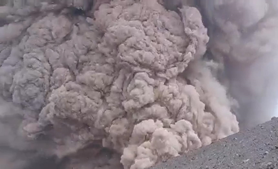
Popocatepetl Volcano Explosions

This Monday morning and early morning, December 19, two explosions were recorded at the Popocatepetl volcano, which were captured on video.

The first explosion of Popocatepetl occurred around 2:50 am. According to the National Coordination of Civil Protection, it was an explosion with low ash content, which generated a smoke column that reached a height of 1.4 kilometers, with displacement to the Northeast.

The second explosion occurred around 6:39 a.m. in the morning. In the videos captured of the explosion, it could be seen that Popocatepetl released large amounts of smoke and generated a column with a height of 2.4 kilometers.
 
Back
Top Bottom