Volcanoes Erupting All Over

I once read in one of Edgar Cayce's readings that when Mt Etna and Mt Pelee erupt simultaneously, we have 90 days before all hell breaks lose. Whatever that means, I'm not sure but it doesn't sound pleasant.
Considering the fatalities from Mt Peleé's eruption, very understandable his readings.
Mount Pelée - Wikipedia
Mount Pelée or Mont Pelée (/pəˈleɪ/ pə-LAY; French: Montagne Pelée, [mɔ̃taɲ pəle]; Antillean Creole: Montann Pèlé, meaning "bald mountain" or "peeled mountain")[3] is an active volcano at the northern end of Martinique, an island and French overseas department in the Lesser Antilles Volcanic Arc of the Caribbean. Its volcanic cone is composed of stratified layers of hardened ash and solidified lava.[4] Its most recent eruption was in 1932.[2][5]
The stratovolcano's 1902 eruption destroyed the town of Saint-Pierre, killing 29,000 to 30,000 people in the space of a few minutes, in the worst volcanic disaster of the 20th century.[6] The main eruption, on 8 May 1902, left only three known survivors. Ludger Sylbaris survived because he was in a poorly ventilated, dungeon-like jail cell. Léon Compère-Léandre, living on the edge of the city, escaped with severe burns.[7] The third was a young girl named Havivra Da Ifrile, who fled to a nearby sea cave in a boat, enduring burns from falling ash.[8]
Mount Pelée is the result of a typical subduction zone. The subduction formed the Lesser Antilles island arc, a curved chain of volcanoes approximately 850 kilometres (530 mi) in length, between Puerto Rico and Venezuela, where the Caribbean Plate meets Atlantic oceanic crust belonging to the South American Plate. Other volcanoes in the island arc are also known for their volcanic activity, including Saint Vincent's La Soufrière, Guadeloupe's La Grande Soufriere volcano, Montserrat's Soufrière Hills, and the submarine volcano Kick 'em Jenny.[4]
...
The volcano is currently active. A few volcano tectonic earthquakes occur on Martinique every year, and Mount Pelée is under continuous watch by geophysicists and volcanologists (IPGP). Before the 1902 eruption—as early as the summer of 1900—signs of increased fumarole activity were present in the Étang Sec crater (Scarth, p. 30). Relatively minor phreatic (steam) eruptions that occurred in 1792 and 1851 were evidence that the volcano was active. Signs of unrest are likely to precede any future eruptive activity from Mount Pelée, and its past activity (including the violent eruptions uncovered by carbon dating) is an extremely important factor for hazard assessment.[11][12]
The city of Saint-Pierre was never fully rebuilt, though some villages grew up in its place. The estimated population of the Commune of Saint-Pierre in 2004 was 4,544.[citation needed]

On December 6, 2020, The Martinique Volcano Observatory (MVO) raised Mount Pelee's alert level to Yellow [Restless] from Green [Normal] due to an increase in seismicity under the volcano beginning in April 2019, and observations of tremor last month.

As far as is known, this is the first sign of activity since the end of the 1929-32 eruption. This volcano is, of course, highly dangerous, and great vigilance of its activity is required. Whether or not it is going to enter a new eruptive period is currently unknown.

According to the MVO press release "The increase in seismicity of superficial volcanic origin (up to 4-5 km below the summit) observed since April 2019, is therefore clearly above the base level characteristic for Mount Pelée.

In April 2019, volcanic seismicity appeared at depth around and under Mount Pelée (more than 10 km below sea level). It could correspond to the arrival at depth of magmatic fluids.

Finally, new recorded tremor-type signals were observed on November 8 and 9, 2020: they could correspond to a reactivation of the hydrothermal system.

Even if, in the current state of measurements, there is no deformation of the volcano on the scale of the observation network, the appearance, in a few months, of these three different types of seismic signals of volcanic origin shows a clear change in the behavior of the volcanic system, the activity of which is increasing from the base level observed over several decades."[13]
 
Mt Pelée, Martinique (history)

It was a few days ago i read through an unusual detailed time line about the volcanic events of Mt Pelée, called "The eruptions of Mont Pelée and the Soufriére" - and was very interesting - because there where MANY signs and worrisome events were going off several weeks and days before the big eruption took place in the morning of 8 May 1902, destroying the town and people of St Pierre within minutes...

-> Pelee and Soufriere

dscf1211.jpg nuee-ardente-pelee-1902-heilprin-ii.jpg

1902
February
St. Pierre. A whiff of sulphurous gas was noticed.

March 23.
Mont Pelee. The Etang Sec, or 'dry tarn', a small crater containing a dried-up lake, emitted sulphurous vapour from several points.

April 14
Night. St. Vincent. Eight earth tremors caused landslides.

April 23
Mont Pelee. 3 shocks in St. Pierre; a great smoke cloud from the summit crater.

St. Pierre. A slight fall of ash, and several earth tremors, enough to knock dishes from shelves.

April 25
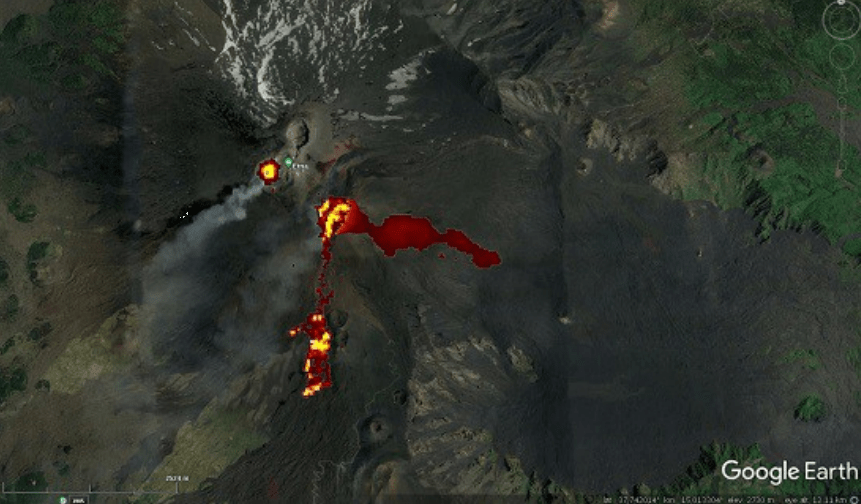
Mont Pelee. A ‘cap of white vapours' on Mont Pelee. The Etang Sec was filling up with boiling water. The crater of L'Etang Sec near the summit opened, and Mont Pelee threw up a huge cloud of ash and rock fragments.

St, Pierre. Sulphurous vapours made breathing difficult.

April 26
Mont Pelee. A similar eruption to that of the 25th covered much of the landscape with grey-white powder.

Soufriere, St. Vincent. The Lower Soufriere was in eruption.

April 27
Mont Pelee. The Etang Sec contained a small lake, with a small volcanic cone emerging from the centre. Smoke rose from this in puffs.

April 29
St. Vincent. Three 'well-marked shocks'.

3 p.m. St. Pierre. Several earthquake shocks between 3 and 5 p.m.

May 2 Friday
Mont Pelee. An eruption of vapours and ashes, which covered Le Precheur.

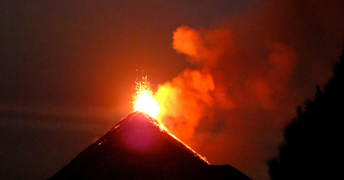
11.30 pm. Mont Pelee. Terrifying detonations woke everyone in St Pierre. “Every few moments electric flames of blinding intensity were traversing the recesses of black and purple clouds”. Ash covered the country to Fort de France.

St, Pierre. Ash was so deep in the streets as to stop traffic.

May 3 Saturday
6 am. Outskirts of St. Pierre. The Roxelane River was in flood.

Morning. Fort de France. The garrison commander of St. Pierre reported to Fort de France, 'The crater is completely inactive'.

Noon. Fort de France. An earth tremor, which was also felt in St.Pierre.

Evening. Mont Pelee threw out dense masses of smoke.

Evening. Pont Basin, St. Pierre. An iron-girdered bridge over the Roxelane River fell in an earth tremor; 20 persons were killed.

Evening. Mont Pelee. “Frightful detonations...The glowing cone was soon hidden by an enormous column of black smoke traversed by flashes of lightning.”

May 4 Sunday
Dawn. Ajoupa-Bouillon, a village on the eastern foot of Pelee. Steam and boiling mud from a fissure killed 188 persons.

Morning. Off St. Pierre. A cloud rose an estimated 30,000 feet from Mont Pelee, then a shower of stones and mud fell on the cable steamer Pouyer-Quertier.

Mont Pelee. The sea breeze swept ashy fog away.

At sea . Ash fell so thickly that boats skirting the coast feared to navigate through it. The sea was covered with dead birds.

Evening. St. Pierre. Dust and scoria fell again. The ash fall on St Pierre was ¼ inch thick. The mountain was invisible.

Night. St. Pierre. A telegram was sent to the Minister of Colonies in Paris. 'An eruption of Mont Pelee has taken place...The eruption appears to be on the wane.'

IMG_3042

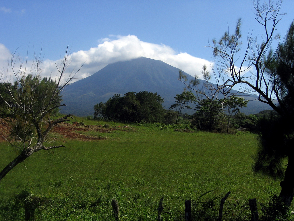
The crater lake of Soufriere, shortly before 1902

May 5 Monday
Soufriere. There were signs of eruption. The lake in the old crater of the Soufriere became greatly disturbed. Fishermen crossing the lake noticed this.

Morning. Fort de France. Telegraphic communication with Dominica and St. Lucia was lost.

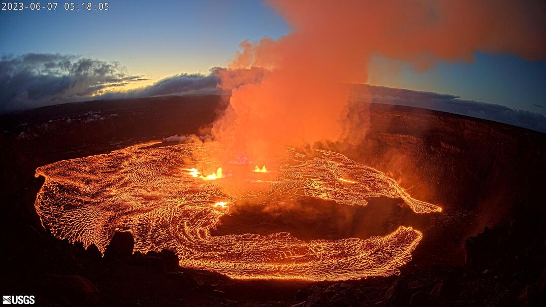
About noon. Mont Pelee. A stream of ‘lava’ rushed down the SW slope of the mountain, sweeping away buildings, plantations and people in a rush to the sea 5 miles away. The sea then receded 100 yards on the western coast, and returning invaded St. Pierre. The stream was of near-boiling water and mud a quarter of a mile wide and 100 feet deep. A mass of new hot rock forced its way up from the crater floor and displaced the water in L' Étang Sec, heating it to near boiling point. The flood rushed down the valley of the Riviere Blanche at a speed of about 90 km. an hour, carrying mud and boulders of up to 50 tons' weight. The sugar plant of Usine Guérin was overwhelmed; 30 persons were killed. The mudflow entered the sea and triggered a series of waves, one of which overwhelmed the yacht Precheur, moored off the river mouth, with the loss of all on board. Another yacht and eight lighters were sunk.

1.22 p.m. St. Pierre. The sea retreated a hundred feet and returned in a wave that flooded the docks.

St. Pierre. Scores of snakes invaded the streets. Over 50 persons and 200 animals died from their bites. Soldiers' rifle fire and cats killed over 100 fer-de-lances.

A committee appointed by the Governor of Martinique reported that 'there is nothing in the activity of Pelee that warrants a departure from St. Pierre'.
Evening. St. Pierre. Atmospheric disturbances caused the failure of the city's electrical system and lighting. 617 persons were killed in the eruption in 4 days.

May 6 Tuesday
Guadeloupe . Volcanic detonations were clearly heard here 100 miles south of Martinique.

Mont Pelee. The summit was hidden by thick clouds of steam. Ash fell incessantly up to a foot deep.

00.01 a.m. Mont Pelee. '...long tongues of flame shooting out of the crater's neck, the like of which none of us had seen before'.

2 a.m. Mont Pelee. Mutterings sounded in Pelee's depths louder than thunder and people ran out of their houses.

8 a.m. St. Pierre. “...since eight o'clock this morning the roaring of the volcano continued...St. Pierre had been left in almost night darkness. For many days the disturbed condition of the atmosphere had interfered with the electric illumination...brilliant flashes of lightning...The ashes and cinders now fall over a wide area”.

St. Pierre. The mayor issued a proclamation to the citizens; “The...eruption of Mont Pelee has thrown the whole island into consternation...we believe ourselves able to assure you that in view of the immense valleys which separate us from the crater, we have no immediate danger to fear. The lava will not reach as far as the town...”

2 p.m. Soufriere. The mountain 'began a series of volcanic efforts’. Severe earthquakes accompanied these.

3 p.m. Soufriere. An earthquake and terrible noise. Steam was emitted.

5 p.m. Soufriere. Louder and more frequent explosions occurred. A red glare was noticed in the summit cloud.

5 p.m. St. Pierre. Telegraphic communication was suddenly severed with the islands of St. Lucia and St. Vincent to the south.

7.30 p.m. Soufriere. Columns of steam issued from the old crater with terrific noise until midnight.

Midnight. Soufriere. The mountain top burst into 'flame', followed by an explosion.

May 7 Wednesday
2.30 a.m. Soufriere. Explosions.

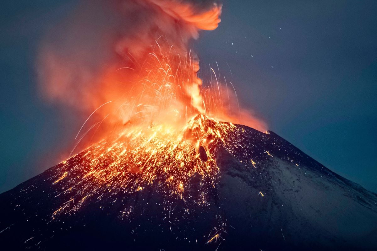
4 a.m. Mont Pelee. Two red craters were visible on the flanks of Mont Pelee for half an hour. A prodigious roaring was heard, cloud filled with lightning.

7 a.m. Soufriere. Steam ascended for 3 hours, with explosions.

7. 45 a.m. Soufriere. Vapour columns rose to 30,000 ft in 1 minute.

10 a.m. Soufriere. A terrific explosion.

10.30 a.m. Soufriere. Enormous clouds were emitted from the 'Old Crater' of the volcano, with loud noises and much lightning. The inhabitants of the windward side of the island still doubted the reality of the eruption, and thought that the dark cloud over the mountain was a thunderstorm.

Noon. Soufriere. 3 craters opened and began to vomit lava. Detonations merged into a continuous roar. A huge dark cloud, 'charged with volcanic matter' rose 8 miles high. A darkness like midnight descended. The air was filled with fine dust. Scoria and stones fell, followed by black rain. The noise was heard throughout the Caribbean. Ashes fell on Kingstown, 12 miles distant.

Noon. Barbados. Just after mid-day, 'deep subterranean explosions' were heard, some single, others in volleys of five or six. Some made the earth vibrate. They continued for 2 or 3 hours.

Noon. Soufriere. The Rabaca Dry River and some of the streams on the windward side of the volcano were 'running boiling hot', cutting off the escape of many refugees.

1 p.m. Soufriere. “The roaring of the volcano was tremendous.” Showers of stones fell. Floods of boiling water (not mud or lava) poured down the valleys into the sea.

1.30 p.m. Soufriere. A violent explosion and a smoke cloud 2 miles high.

1.47 p.m. Bridgetown, Barbados. A ‘terrific explosion’ was heard, followed eight seconds later by another.

2 p.m. Soufriere.
“'A terrific huge reddish and purplish curtain advanced to and over Richmond Estate. This was the strange black cloud which, laden with hot dust, swept with terrific velocity down the mountain-side, burying the country in hot sand, suffocating and burning all living creatures in its path”. The cloud rolled down onto the sea, flashing with lightning, which increased when it touched the water. “There was no fire...only the air was itself intensely hot and charged with hot dust”.

A survivor said, “...a dark cloud came from the Soufriere...and a fine leaden powder...filled the air...People breathed it in, and it was so hot it burnt the flesh...They gasped, fainted, and died. All was over in three minutes. It is said that (the) hot blast killed most people, and wherever the powder touched people it burnt their flesh.” About 1,350 persons were killed.

2.06 p.m. Bridgetown, Barbados. A ‘peculiar rumbling’ was heard, which seemed to be close to or beneath the ground.

2.15 p.m. About 700 miles off Cape Henlopen. The Danish steamer Nordby reported intense heat, an obscured Sun, lightning, and great sea disturbances.

3 p.m. Soufriere. Terrific detonations.

About 3 p.m. Barbados. A black cloud began to rise from the direction of St, Vincent. At 3.10 p.m. the sea rose and fell three times in 15 or 20 minutes.

3.15 p.m. Barbados. Volcanic ash fell at Barbados,100 miles to windward, becoming very heavy soon after sunset.

4 p.m. Barbados. The edge of the cloud from St. Vincent began to obscure the Sun, and dust fell.

6 p.m. Barbados. As dark as midnight. Incessant thunder and lightning from the direction of St. Vincent.

8 p.m. At sea. Dust fell 70 miles S. of Barbados, on the schooner Viola.

10 p.m. Soufriere. A very strong earthquake.

10 p.m. At sea. SS Talisman met dust 150 miles S.S.E. of Barbados.

11.16 p.m. Isle of Wight. A seismograph recorded an earth tremor originating at a distance of between 60º and 70º.

May 8 Thursday
Morning. St. Pierre. Hundreds of persons left the town for Fort-de-France, Martinique's second town. Hundreds more refugees from the countryside entered St. Pierre, increasing the population to about 30,000.

2.30 a.m. At sea. The barque Jupiter met dust 830 miles E.S.E. of Barbados. So much dust fell that it discoloured the sea.

4 a.m. Fort de France. A violent thunderstorm with heavy rain.

4 a.m. Mont Pelee. Rumbling began again. A dark ash column, streaked with fiery cinders, drifted west over the sea.

6.30 a.m. St. Pierre. The passenger steamship Roraima dropped anchor in the roadstead.

6.30 a.m. St. Pierre. A sudden wind swept down from Mont Pelee. “The wind was warm and reeked of sulphur. When it had passed, the sun shone down on St. Pierre. Pelee fell silent and revealed nothing apart from a glow in the rock about 300 feet from the summit.”

7 a.m. St. Pierre. Mr Fernand Clerc observed violent pulsations of a barometer and fled the city to Mont Parnasse, a mile outside.

7.50 a.m. Mont Parnasse. Clerc saw a huge black cloud burst from a fissure 1,000 metres below the summit of the volcano, which travelled at the speed of a mile a minute downwards over the surface of the earth upon St. Pierre.
Roger Arnox, from a house also on Mont Parnasse, saw the same vast cloud burst out, rising to his zenith “with an almost inconceivably powerful ascensive force” and rushing down upon St. Pierre in less than three seconds. The cloud was filled with lightning and accompanied by a ‘frightful fracas’.

7.52 a.m. St. Pierre. The clock on the wall of the military hospital stopped.

. . . .


(on the homepage, it continues in great length with reports and other volcanic phenomena after the 8th of May 1902. Some more photos are shown, too)


The eruption of #Popocatépetl continues.It is notorious how far the lava bombs have left the snow near the crater's rim dark. Ash disperses towards Puebla.YELLOW 3 safety radius 12 km

Impressive, these days I was not in Puebla, I am arriving and mud is falling! Ash more rain! @SkyAlertMx @laredcincoradio
 

Attachments

  • 1684767230845.png
    1684767230845.png
    492.3 KB · Views: 1
Etna, Sicily - Italy
24 May 2023

INGV Catania, published a special report about Etna's recent eruption, which German Vulkane.net wrote about as follows:


Strombolian eruptions on Etna

State: Italy | Coordinates: 37.73, 15.00 | Activity: Fumarolic

Tonight, INGV Catania published a special report on activity at Etna. The volcanologists' networks registered weak strombolian eruptions emanating from the Southeast Crater. The report goes on to say that Voragine has also become active and is erupting in a strombolian manner. The infrasound sensors also recorded events coming from the direction of Bocca Nuova. Thus, three of the 4 main Etna craters became active. In addition, the tremor increased and reached almost high values. The source of the tremor was located at an altitude of 2800 m, and thus at the base level of the summit plateau from which the crater cones emanate. In the context of the weekend paroxysmal episode, events suggest that the next paroxysm may already be preparing.

Bild_2023-05-24_110443725.jpg

Yesterday, a new weekly bulletin on Etna was published, which will only appear when there are actual eruptions on Etna. According to this bulletin, there were already clearer signs of an imminent eruption in the run-up to the eruption than had been publicly known to date. According to this, the small swarm earthquake of May 28 [18 May]** also started a ground uplift due to magma intrusion. Apparently, there was also more intense strombolian activity from Southeast Crater, but this remained hidden from our view due to bad weather. In this respect, there was probably already the usual buildup of tension before a paroxysm in the run-up to the main paroxysmal phase of the eruption.

The Bulletin also published a thermal map based on a satellite image that not only shows two lava flows emanating from Southeast Crater during the paroxysm, but also depicts a pronounced thermal anomaly in Central Crater.

A 3D representation of the tremor source is interesting. It was not located directly under the southeast crater, but a bit further east under the Valle del Bove. This correlates with the observation of the warm ground spot east of the crater cone, which was discovered two days before the paroxysm. Apparently, the lava had indeed attempted a breakthrough here first.

Geochemical analysis of gas samples showed INGV volcanologists that the newly ascended primitive magma probably intruded into an older magma body with residual melt. This magma body could be the same one that provided the melt from the last two lava flows last year.

Summary:

🔹Etna has current weak strombolian eruptions from 3 of the 4 main craters.
🔹Ground uplift occurred in the summit area prior to Sunday's paroxysm.
🔹Freshly risen magma mixed with residual melt.


END OF ARTICLE


Here the article from, ** 19 May 2023, about the 18th May earthquake swarm below Etna


19 May
Swarm quake and tremor near the South East Crater: volcanic eruption imminent

Bild_2023-05-19_123117130.jpg

As can now be seen on INGV's shakemap, a swarm earthquake manifested itself already yesterday afternoon around 3 pm southeast of New Southeast Crater. The night before, the already mentioned earthquake sequence occurred on the lower eastern flank of the volcano. In the morning, tremor set in and weak strombolian eruptions were initially detected in Bocca Nuova. In the evening, activity changed towards New Southeast Crater, where red glow could be seen at a vent near the summit. Some webcam observers apparently spotted weak strombolian or lava spattering from this vent.

While earthquake activity has since subsided, tremors remain elevated, indicating that magmatic fluids are moving within the volcano. They are looking for an exit.

From the comments posted on social media by some volcano enthusiasts, one can see that there has been some unwarranted alarmism and fear of imminent catastrophic eruptions. As regular Vnet readers most likely know, large eruptions with catastrophic consequences at Etna are the exception rather than the rule, and such volcanic eruptions usually announce themselves with much stronger portents. What we can expect now is eruptive activity in the summit region of the volcano. How exactly this will look is still unclear.

Swarm quakes and tremors make me suspect that a dyke is working on its breakthrough in the area of New Southeast Crater. Based on current information, I think the most likely scenario is that a lava flow will again occur in the northeast basal area of the crater, as we saw twice last year. Another possibility is strombolian activity in the central crater or even paroxysms, although the seismic activity of the last months was too low for the latter.

Although nothing can be ruled out on Etna, I think a major flank eruption, with lava flows reaching inhabited areas, is unlikely at the moment. If there were such a strong inflation, I am sure we would have already read a statement to that effect from the volcanologists at INGV. There is probably continuous magma upwelling that is slowly charging the volcano, but a critical limit of ground uplift above which a major eruption should be expected has apparently not yet been reached.

Summary:

🔹Yesterday, 2 swarm earthquakes occurred on Etna.
🔹They were located on the lower eastern flank and just below the NSEC.
🔹In the afternoon, tremors started which continue until now.
🔹There was weak strombolian activity.
🔹A lava flow could break through in the next hours/days.


END OF ARTICLE
 
I can't find the twit now, but I saw one that said that the Reventador volcano, in Ecuador, as well as the Volcan de Fuego in Guatemala were also active. I've found a note on the Fuego volcano:


Then I saw this website and it seems that, as the title of this thread says, volcanoes are erupting all over:


It seems that there isn't a major eruption, fortunately, just eruptions all over.

Regarding the Popocateptl, yesterday it seemed that the activity was somewhat milder but I see that there are some reports of intense activity during the night and this morning again, people are watching it closely and the government is already preparing for evacuation in case this is needed. So far, they think it isn't necessary just yet.

During this early morning, the #Popocatépetl has had episodes of tremor interspersed by a few hours of relative calm.

At 5:03 h a slight explosion was recorded.
Around 7:00 h, tremor associated with ash emission increased again.

Dispersion to the southeast towards the Puebla side.

YELLOW 3
🚷safety radius 12 km


The "experts" say that they don't think the volcano is going to have a major eruption but it might last a few months with this kind of activity.


Let's hope they're right about no major eruptions.
 
Ricon de la Vieja, Costa Rica
26 May 2023


Bild_2023-05-26_112053291.jpg

Rincon de la Vieja with eruption

State: Costa Rica | Coordinates: 10.83, -85.32 | Activity: Phreatic

In Costa Rica, according to media reports, a phreatic eruption has occurred at the Rincon de la Vieja volcano. An eruption cloud of water vapor, volcanic gases and some volcanic ash rose up to 3000 m above the crater. There was no VONA warning, probably because mainly water vapor was erupted.

A smaller phreatic eruption was already reported a few days ago. These occur when water is heated by a volcano's geothermal energy to such an extent that it vaporizes explosively. In contrast to phreatomagmatic eruptions, there is no direct contact between water and magma. Phreatic eruptions are not completely harmless, because they usually come without warning and hurl chunks of incrusting rock through the area, which pose a danger to people in the vicinity of the crater. Also, lahars can occur, especially when the phreatic eruptions rise from a crater lake, as is the case here. The crater with the lake is a good 500 m in diameter. Should a major eruption occur, the potential hazard is particularly high due to the crater lake. Especially if a fissure should form in the crater wall, through which the crater lake drains, a catastrophe is pre-programmed.

Rincon de la Vieja is a 1916 m high complex volcano with two crater cones rising from a 5 km diameter caldera. This complex of crater cones is called Santa Maria.

The volcano is part of the Rincón de la Vieja National Park, located in the province of Guanacaste in northwestern Costa Rica. It is one of six active volcanoes in Costa Rica. It is not only the volcano that interests visitors to the national park, but also the diverse flora and fauna. Due to the volcanic activity, there are certain areas in the park that may be restricted to visit due to potential hazards. Therefore, visitors should always check current conditions before visiting the volcano and the national park.

Summary:

• A phreatic eruption occurred at Rincon de la Vieja.
• An eruption cloud rose a good 3000 m high.
• It consisted mainly of water vapor.


END OF ARTICLE

 
According to the analysis of the scientific advisory committee of #Popocatépetl, after the overflight conducted yesterday by SEMAR, the presence of a lava dome was not observed. Highlights:
-The main crater is filled with tephra and ash.
-Current activity is expected to continue with ash emissions and moderate to large explosions (like those seen recently).

No change in alert level:
🚦YELLOW 3.
 
Etna, Sicily - Italy
28 May 2023

A light M 4.0 earthquake occurred on the east side of Etna, which however was a bit stronger than the usual ones. I looked at the volcanic tremor graph, but Etna is calm in that regard, residing within the "green" zone (low), but the earthquake spike is clearly visible

1.jpg


Vulkane.net wrote:


New_earthquake_sequence_at_Etna.jpg

New earthquake sequence at Etna

This morning there was another earthquake sequence at the Sicilian volcano Etna. According to INGV, the earthquakes started at 04:34:41 UTC In the northeast of the volcano, with some tremors with magnitudes smaller than 2. Only 10 minutes later, there was a moderate earthquake ML 4.0 felt by residents. It had a hypocenter at 6 km depth. Other weaker earthquakes followed. The epicenters were located at the edge of the Valle del Bove, about 1.2 km from Refugio Citelli.

Volcanologists from INGV issued two timely reports on the quakes. Volcanologist Alessandro Bonforte also commented on the series of quakes in the media. He said, mutatis mutandis, that the tremors are not related to the last eruption. Realistically, the INGV researcher says that the volcano has been recharging for some time, and that further research (which is already underway) should show whether the earthquakes were volcanic or tectonic. Which I think is often mutually dependent at Etna.

In fact, I am on Etna right now, but neither my son, nor I felt the tremors, although I probably woke up around the time of the tremors, but without being able to remember any tremors. However, we were also sleeping south of the volcano and a few kilometers from the epicenters.

During the day we were on top of Etna and could admire a strongly steaming New Southeast Crater. However, we did not see any eruptions. Also at night the volcano showed no red glow.

For us, of course, the question arises whether the quakes are related to magma ascent. Now it is completely open if and when the next eruption will occur. Today we spend the night in Milo, practically in sight of the epicenters of yesterday. Let's see if something will shake here today!


END OF ARTICLE
 
Sakurajima, Japan
7 June 2023

This time Sakurajima has been erupting with an eruption style, where it spew dense ash clouds over the course of 1 hour. In addition inflation is being reported, indicating that magma is accumulating in greater depth below Sakurajima volcano.
German Vulkane.net reported following:


Long-lasting ash eruption with inflation at Sakurajima
by Marc Szeglat


saku.jpg

Country: Japan | Coordinates: 31.581, 130.659 | Activity: Explosive

An ash eruption occurred at Japan's Sakurajima volcano today that lasted for nearly an hour. There is a VONA message indicating an ash cloud that reached a height of 3700 m above sea level. Volcanologists from JMA reported volcanic ash rising 2500 m above crater level. The two indications coincide. The drift direction of the ash cloud was southeast. on the livestream recording, you can see that the volcanic ash rained down at the base of Sakurajima, leaving a dense haze.

In their report, Japanese volcanologists write that about an hour before the eruption, there was a slight crustal expansion recorded by extensiometers at the volcano. It was a result of magma inflation. The freshly ascended material was almost completely erupted during the eruption, so that the crustal strain was reduced again. The eruption occurred from the main crater Minamidake. Only some steam rose from Showadake. The explosion ejected larger lava blocks as far as the 8th gauging station, located about 700 m from the crater rim.

In their report, the scientists again point out that the floor of the Aira Caldera, which occupies much of Kagoshima Bay and in which Sakurajima is located, is slowly rising. In addition, the sulfur dioxide emission is high, which is another indication that magma continues to accumulate at greater depths. Accordingly, eruptive activity at Sakurajima could increase. Larger explosions are capable of throwing volcanic blocks and bombs as far as the inhabited area at the base of the volcano. There is also a risk of pyroclastic flows and lahars being generated. Pressure waves from strong explosions are capable of breaking window panes, the statement added. Flying glass fragments could injure people. Climbing the volcano remains prohibited.


END OF ARTICLE
 
Vesuvius, Italy
6 June 2023


Increase of seismicity at Vesuvius in Italy

Date 5 June 2023 | Time: 03:54:13 UTC | 40.82 N ; 14.43 E | Depth: 3 km | Mb 2.5

vesuv.jpg

At the Italian volcano Vesuvius the seismicity increased in the last days. This month, 26 tremors have already manifested themselves. The strongest earthquake occurred yesterday and had a magnitude of 2.5. The hypocenter was located at a depth of 3 km, according to INGV. Already on June 1, there was a tremor with a magnitude of 2.3, but the quake was much shallower and had a focal depth of only 300 meters. The epicenter was south of the crater. Most of the other earthquakes had magnitudes in the range of microseismicity and were similarly shallow. INGV researchers believe that the seismicity at Vesuvius is not caused by rising magma, but by a weak contraction of the conveyor system, which continues to cool. Whether yesterday's quake at 3 km depth fits this pattern is still unclear.

More skeletons found in Pompeii


Bild_2023-06-06_173237898.jpg

What is clear, however, is that Vesuvius owes its sad notoriety to the great eruption in 79 that destroyed the cities of Pompeii, Herculaneum and Stabiea. Thousands met their deaths in pyroclastic flows that slid down the volcanic slopes, destroying everything in their path. Today, almost 2000 years after the catastrophe, deaths are still being found. Recently, 3 skeletons were discovered during excavations in Pompeii. The archaeologists discovered them in a corner of an ancient bakery. Presumably they had sought shelter in the room in vain. Their undoing was the collapsing ceiling of the building, which gave way under the weight of the ash deposits. The three people were 2 women and a young child aged 3 or 4.

The remains were excavated in an area known as Regio IX, which was a commercial part of Pompeii before new excavations were started. The skeletons were found in an area that had already been excavated and still had 40 cm of intact soil that no one had tampered with until now.

For some time now, other parts of Pompeii have been excavated that have not yet been touched. I am sure that we will hear about more interesting finds soon.


END OF ARTICLE
 
Kilauea, Hawai'i
7 June 2023

Of course, German Vulkane.net also reported from the ongoing eruption of the Kilauea volcano on the Big Island of Hawai'i. The article as follow:


Eruption at Kilauea
June 7, 2023 by Marc Szeglat

hawaii01-1024x576.jpg


State: USA | Location: 19.42, -155.29 | Activity: lava lake

New eruption at Kilauea has started

Even as I was writing the message below, an eruption occurred at Kilauea in Hawaii a few minutes ago. As can be read below, a strong swarm quake preceded the eruption. Several vents opened at the bottom of Halema'uma'u crater, from which small lava fronts are rising. The bottom of the crater is currently flooded with lava. It is likely that a lava lake will form again.

Volcanic tremor started around 14:43 UTC. It started with the earthquake I described below. It was 04:43:27 local time in Hawaii. The eruption did not come as a surprise, because already in the last weeks I often reported about increased seismicity and ground uplift at Kilauea. I was rather surprised that it took so long until the eruption started.

M-03.jpg

Bild_2023-06-07_174605257.jpgNPOC-24h-1.jpg
summit_uwe_tilt_2day-1.png

The raw deformation data show a respectable flank displacement of 30 µrad at the start of the eruption. So a respectable magma body has finally risen. Shortly before, there was a sudden drop in ground elevation, as if the volcano goddess Pele had exhaled heavily before taking a deep breath and sneezing.

I have summarized the live data and a webcam of Kilauea for you on an extra page. More detailed information is of course available at HVO. But of course I will stay on the ball for you.

The HVO reacted quickly and started a livestream which I embed here:


By the way, the stream was found by club member and researcher Manfred.

Original message:


Bild_2023-06-07_165902942.jpg

This afternoon, the summit region of Kilauea volcano in Hawaii will be rocked by an earthquake swarm. The EMSC reported so far a good 30 tremors with magnitudes from 2.0, which manifested themselves in the vicinity of the Halema'uma'u crater. The strongest shaking brought it to ML 3.5 (initially a magnitude of 4.0 was reported), followed by a magnitude 3.6 quake. I assume that there are a significantly larger number of weaker quakes that are not reported by the EMSC. The focal depths are at sea level. I suspect a connection with fluid movement in the subsurface and I would not be surprised if we see an eruption in the next few hours. In fact, we are currently seeing deflation as it occurs just before an eruption.

END OF ARTICLE
 
Back
Top Bottom