Volcanoes Erupting All Over

According to preliminary analysis, the paroxysmal eruption that occurred several hours ago on Russia's #Shiveluch volcano released about 0.2 Tg of sulfur dioxide (SO2) into the atmosphere, an insufficient amount to have any effect on the climate.
---
Sulfur dioxide is one of the main gases released by active volcanoes. In very large quantities it can cause a brief but marked cooling of the climate. The 0.2 Tg emitted by Shiveluch corresponds to 200,000 tons; at least 5 Tg is needed to have an effect on climate
---
Answer from a comment
Well over a year has passed since the Tonga eruption so no, we cannot add up the amounts emitted by the two eruptions. There is to say however that even if we did we would barely reach 0.6 Tg so we would still be far from the 5 Tg needed according to the studies 😊

Adding the eruptions of the last 10 years, maybe isn't it?
 
Shiveluch volcano, Russia
12 April 2023

German Vulkane.net has an update on the Shiveluch volcano in Russia; in essence telling the story of continued albeit weakening activity while ash is still pouring into the skies. In the place of Klyuchi, the ash is said to have accumulated up to 20 cm depth.


Shiveluch continues to spew volcanic ash
12 April 2023 by Marc Szeglat

State: Russia | Coordinates: 56.65; 161.36 | Activity: Dome

Bild_2023-04-12_102642144.jpg


On Russia's Kamchatka Peninsula, Shiveluch continues to be active, spewing high rising ash clouds associated with the generation of pyroclastic flows. According to the Tokyo VAAC, volcanic ash reached an altitude of 9,500 m this morning and is spreading over a large area to the southeast of the volcano. It is very likely that further ash falls will occur in the village of Kljutschi, where heavy ash falls already occurred after the initial ignition of the volcano, covering the entire village with a brown layer of ash, causing massive problems and bringing public life to a standstill. It is now said to be up to 20 cm thick. It must be removed from house roofs as quickly as possible, because when it gets wet, the ash turns into a layer that weighs tons and can cause roofs to collapse. As it is still winter on Kamchatka, precipitation will first fall as snow, which can be removed together with the ash. With the onset of snowmelt, however, lahars can then also form on the volcano.


Red Alert
KVERT volcanologists are maintaining a "red" alert because the ash clouds pose a serious threat to air traffic. A busy air route for flights between the USA and Japan runs nearby. Thus, further strong eruptions could lead to restrictions and delays. That a similar situation will arise as in 2011, when air traffic was impaired for days due to the eruption of Eyjafjallajökull and flight bans were imposed over large parts of Europe, is unlikely, but not completely ruled out. But thanks to the experience during the Corona Lockdown, a temporary flight ban in one region of the world is unlikely to cause as much panic and fuss as it did then. According to KVERT, the volcanic ash rises up to 7,000 m and spreads 1300 km to the east.

latest_Shv2.jpg

The eruption is continuing at the moment and the clouds occasionally give a livecam view of the volcano. How long the eruption will last cannot be predicted. No geophysical data from the volcano is posted publicly online. Experience shows that such strong eruptions at dome volcanoes usually last only a few days, although repeated eruptions may occur over longer periods. Further development depends on magma replenishment and dome growth. Eruptions appear to have an explosive component and are not triggered exclusively by collapse events at the effusive lava dome.

Summary:

• Eruption at Shiveluch continues but weakened.
• There is still danger to air traffic.
• A 20 cm thick ash layer was deposited in Klyuchi.


END OF ARTICLE, TRANSLATED WITH DEEPL
 
Shiveluch & Bezymianny volcano, Russia
13 April 2023

More info about the e.g. Shiveluch volcano in Russia from the german volcano site "Vulkane.net":


Kamchatka Volcanoes from Above
13 April 2023 by Marc Szeglat

Bild_2023-04-13_163349114.jpg

The Siberian peninsula of Kamchatka (Russia) has one of the densest concentrations of active volcanoes. There are 29 volcanoes classified as potentially active. Currently, 2 dome volcanoes are erupting and making headlines in the media. These volcanoes are Shiveluch and Bezymianny, which are a good 100 kilometres apart.

On a clear day, you can see from the top of one volcano to the other. In the middle of the two volcanoes is the village of Kliutschi. Normally, it is far enough away from the volcanoes not to be affected by the eruptions, but currently it looks different: The big eruption of Shiveluch, which happened earlier this week and is still not completely over, covered the village with a thick layer of ash, paralysing public life and giving children the day off school.

The previous week
saw major eruptions at Bezymianny, smaller than those at Shiveluch, but nevertheless also producing pyroclastic flows and ash clouds rising 6 to 8 km high. But this is nothing compared to the height of the ash clouds at Shiveluch, which reached about twice the height. Both ash clouds spread over large areas and drifted more than 1000 km. Fortunately, the ash clouds from Bezymianny spread eastwards and remained largely over uninhabited areas, so no people were affected.


Picture of the devastation at Shiveluch


shi1.jpg

Meanwhile, volcanologists arrived at Shiveluch
to examine the consequences of the eruption in more detail. They piloted a drone over the steaming ignimbrite field, which consists of the pyroclastic flow deposits, and saw only stumps of trees protruding from the deposits. The pyroclastic flows only stopped at a road. The researchers wrote in a statement that the density currents glided for at least 19 km, exceeding the boundaries of the restricted area around the volcano by 4 km.

NASA's Earth Observatory and Sentinel-hub today released satellite images of the two volcanoes showing the ash trails.


END OF ARTICLE • TRANSLATED WITH DEEPL
 
Shiveluch volcano, Russia
15 April 2023

More articles about the now unsettled active Shiveluch volcano in Kamtchatka, Russia, at german Vulkane.net; One of the new features is that instead of a dome - there is now a new crater with a diameter of 1 km.


New crater in place of the dome at Shiveluch volcano
written by Marc Szeglat

State: Russia | Coordinates: 56.65; 161.36 | Activity: Postdom

shiv-krater-1.jpg

The consequences of the strong eruptions that rocked Russia's Shiveluch volcano between 10 and 13 April have now become visible for the first time after the weather improved: A large crater has appeared in place of the dome that had been growing since 1980. It has a diameter of at least 1 km. This makes it twice as big as the crater of Vesuvius. Yuri Demyanchuk of the Klyuchevskaya Volcano Group Observatory, which also monitors Shiveluch, said in a statement that it looks like there were sideways explosions that ejected the material in a southeasterly direction and were responsible for the large pyroclastic flows.

What happens next at Shiveluch is an open question, but experience shows that when a volcano has such a strong eruption, it usually first powers down and then is quiet for a few years. Even if new dome growth should occur, it will take a while until the new dome fills up the crater - the depth of which we do not yet know - and the dome will be visible again. Only when it overtops the crater rim again can we expect new debris avalanches and pyroclastic flows.

4 scenarios for what is happening at Shiveluch

I can think of 4 possibilities for why the powerful explosions were triggered.

Scenario a): is that there was a major collapse at the dome. The depressurisation caused the magma in the conveyor system and the lava of the dome to degas abruptly, leading to explosions. I think this scenario is the most likely, especially since sideways explosions are said to have occurred. The explosions occurred in the direction of depressurisation, i.e. partial dome collapse. Of course, an initial eruption could also have caused shearing of the dome, resulting in a southeastward explosion.

Scenario b): assumes that magma mixing occurred when primitive magma from the asthenosphere entered the magma body beneath the volcano, which contained more differentiated magma, often triggering strong explosive eruptions. Such magma mixing is often detectable from lava samples.

In scenario c): a strongly gaseous residual melt was erupted, which would then actually cause the temporary end of eruptive activity at Shiveluch.

In the last scenario d): a large amount of water came into contact with rising magma and triggered phreatomagmatic explosions. The source of the water could be the nearby Kamchatka River, but also a very watery melt, which would argue for scenario b).

The strong degassing at Shiveluch shows that the eruptive phase is not yet over. There are also still VONA warnings from VAAC reporting volcanic ash at an altitude of 6700m. The strong degassing indicates that a larger amount of water has its fingers in the pie.


END OF ARTICLE • Translated with DeepL
 
Shiveluch volcano, Russia
16 April 2023

In another article one day later, Vulkane.net writes about that the Shiveluch volcano is restless, albeit the alert status has been lowered from "red" to "orange".


shiveluch-sat-1024x576.jpg

Shiveluch does not come to rest

On Kamchatka, the Shiveluch volcano continues to be active, emitting an ash-steam cloud that rises to an altitude of 6700 m and drifts to the northwest. The eruption cloud obscures the newly formed crater most of the time, but occasionally MIROVA detects high thermal radiation. Yesterday it reached a peak of 212 MW. At that time, the eruption cloud was blown in a northerly direction. On one of these occasions, the satellite photo of the crater was taken, and its light spectrum was filtered so that the thermal radiation became visible. To me, the heat signature looks like a new lava dome is already forming at the bottom of the crater and there is a risk of further strong explosions.

In their daily updates, KVERT volcanologists confirm continued dome growth. They describe the eruptions between 10 and 13 April as paroxysms. The alert status has been downgraded from "red" to "orange". If the eruption was indeed a paroxysm, one must expect further eruptions of this kind, because paroxysms typically occur in series and are caused by rising magma bubbles that degas quickly, which is actually a problem for dome-forming volcanoes like Shiveluch due to their viscous andesitic to dacitic magmas. What seems to be certain, however, is that new magma is rising and that the eruption is not nearing its end.

In the meantime, Russian science teams have also arrived at Shiveluch to study the processes at the volcano. However, this work has to take place remotely. Unfortunately, there is no online measurement data such as seismic and ground deformation. Only webcams are online, but they rarely give a view of the volcano, because most of the time the volcano is hidden behind clouds.

Incidentally, this was not the first major eruption of the Shiveluch volcano. A similar event manifested itself in 2005, when pyroclastic flows also reached a distance of 20 km.


END OF ARTICLE • Translated with DeepL
 
Rincon de la Vieja, Costa Rica
23 April 2023

German Vulkane.net wrote about one of the latest eruptions from a Costa Rican volcano.

A Sidekick:
As much i love Marc Szeglat's reports from volcanoes around the world - but when it comes to "climate & weather" - the guy is on a wicked path, I would call 'brainwashed'. In a recent (in german) written article about "climate warming in Europe" suggested numerous totalitarian measurements... which almost made my eyes fall out.(It scared me a bit to be honest). That a sharp thinking guy about volcanism etc, at the same time can be so absurdly blinded, suggesting such extreme strategies... At the same time, it is also a reminder to my self, in a sort of silent, inner-personal reflection, not to climb too deeply into ideas. A reminder to go beyond oneself, to re-check things, and not get too infatuated about an issue or theme. In photography there is an old saying: "Kill your darlings". I read this as trying to look outside the box; not getting too stuck into your own (photo) motives, not praising them into the sky. In order to develop skills and insight, one needs to look at many other images, and practice in many different ways...

Anyway this article isn't about that - it i about the recent eruption at the Rincon de la Vieja volcano:


Eruption at Rincón de la Vieja, in Costa Rica
by Marc Szeglat

Country: Costa Rica | Coordinates: 10.83, -85.32 | Activity: Phreatic

rincon.jpg

According to media reports, an explosive eruption occurred at the Costa Rican volcano Rincón de la Vieja the day before yesterday. According to these reports, volcanic ash rose to a height of 2500 meters above the crater. Tephra fell on the northern flank of the volcano. The material is also said to have contaminated surrounding rivers. Surprisingly, no VONA message was triggered. The OVSICORI Institute warned against being near rivers because of lahar danger, as the eruption manifested from the volcano's crater lake. The alert status was raised to "yellow."

The explosion occurred at 3:57 p.m., and at that time there was no further information about the impact of the event or the current activity. Costa Rica's National Emergency Commission is closely monitoring the activity of the Rincón de la Vieja volcano, closely. While the recent eruption has caused concern, the CNE is working tirelessly to ensure the safety of the local population. It is important that people stay informed and follow the guidelines established by authorities to stay safe in the event of a volcanic eruption.

In the past, Costa Rica has experienced volcanic eruptions from other active volcanoes such as Arenal, Poas and Turrialba. These events have highlighted the importance of preparing for natural disasters and developing effective evacuation plans to keep people safe.

The Rincón de la Vieja volcano, is one of the most active volcanoes in Costa Rica. Its last major eruption occurred in 1998, when a series of explosions and pyroclastic flows produced a column of ash up to 6 km high. Since then, Rincon de la Vieja volcano has exhibited minor eruptions and seismic activity, but there has been no major eruption. Most of the smaller eruptions have been phreatic eruptions, in which water vaporizes abruptly from the earth's heat, causing explosions.

Costa Rica and the Rincón de la Vieja, I traveled in my time as a filming geology student. At that time I moved as a backpacker through this unique country. It was amazing how far one could get with relatively modest financial means in 1994: at that time Costa Rica was comparatively cheap. I had a cab drop me off in the dry forest at the foot of the Rincón de la Vieja and arranged a pickup three days later. I used these days to study the fantastic manifestations of the volcano. Since a pizote (coati) plundered my food supplies (which I had hung on a rope between two trees as recommended) on the first day, it turned out to be a very hungry three days!

Summary:

• An explosive eruption occurred at the Rincón de la Vieja volcano.
• Volcanic ash rose 2500 m above crater level.
• Tephra landed on the northern flank and in streams and rivers.
• The alert status was set to "yellow".


END OF ARTICLE
 
Popocatépetl records explosion; more than 20 in one week

During the early hours of Thursday morning, the Popocatepetl volcano registered a large explosion that illuminated the night, adding at least 20 explosions in the last week and more than 1,200 exhalations.

On Wednesday alone 153 exhalations, 484 minutes of tremor and three minor explosions were recorded, while on Tuesday 200 exhalations, 284 minutes of tremor and two minor explosions were reported, according to data from the National Center for Disaster Prevention (Cenapred).

As a result, cars and some areas of Puebla dawned covered with ash. Since the night, constant explosions have been registered at the site and the volcano's eruptive activity continues, according to the monitoring cameras installed in the area.


The Weekly Volcanic Activity Report is a cooperative project between the Smithsonian's Global Volcanism Program and the US Geological Survey's Volcano Hazards Program. Updated by 2300 UTC every Wednesday and averaging 16 reported volcanoes, this is not a comprehensive list of all eruptions this week, but rather a summary of activity that meet criteria discussed in the "Criteria and Disclaimers" section below.

Volcanic activity reported here is preliminary and subject to change. Carefully reviewed, detailed narratives over longer time periods are published as reports of the Bulletin of the Global Volcanism Network available through volcano profile pages.

Yellowstone Volcano Observatory 2022 Annual Report

First posted May 4, 2023


May 11, 2023 at 5:48 pm

After a pair of magnitude 5 earthquakes struck in Plumas County late this week, some people may have cast a glance 20 miles northwest to another geologically active area: Lassen Volcanic National Park.

On very rare occasions, earthquakes can lead to volcanic eruptions, as the quake dislodges the magma bubbling within the volcano.

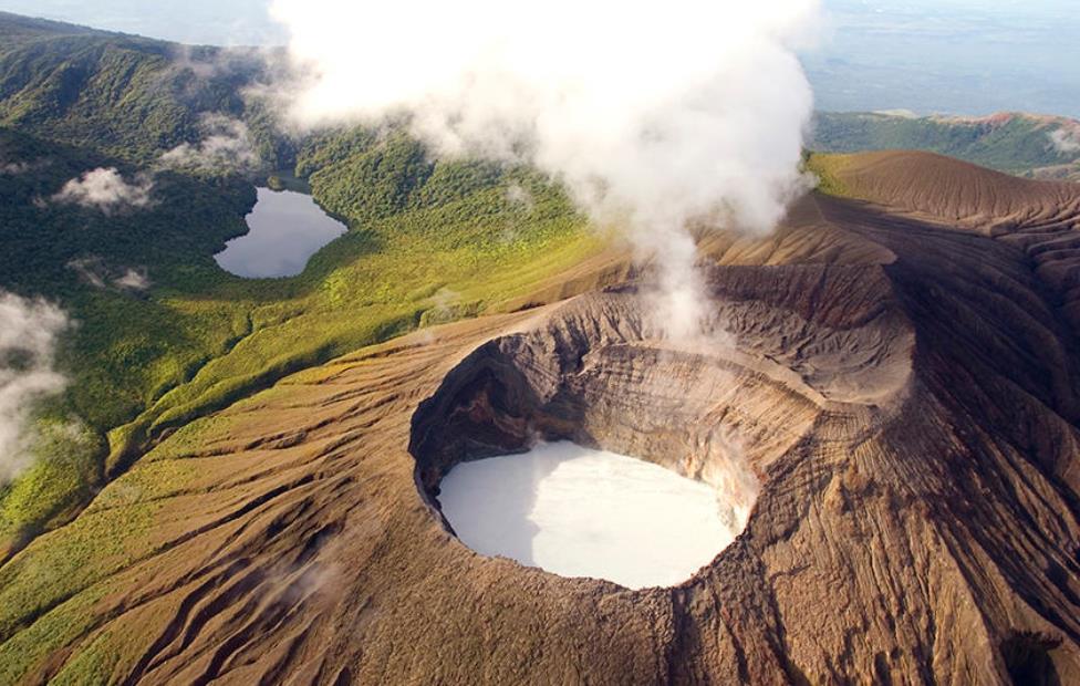
However, there’s good news from Lassen Peak, which is classified as an active volcano: USGS is “not seeing anything that indicates Lassen is experiencing any unrest,” according to Jessica Ball, a volcanologist with the U.S. Geological Survey’s California Volcano Observatory.

The earthquakes late Thursday and early Friday beneath Lake Almanor were due to a slip on one of the faults in the region, Ball said.

Earthquakes can only trigger volcanic eruptions where there is already enough magma and pressure in the volcano, Ball said.

There are some historical examples of large earthquakes triggering volcanic eruptions, geologic consultant Charles Watson said. One of the most prominent is the 1707 eruption of Mount Fuji in Japan, which was triggered by a magnitude 8.6 earthquake, Watson said.

Lassen Peak is considered to be “resting,” meaning there is little danger of a major eruption in the near future, Ball said. The volcano last erupted in 1917, the tail end of an active spell that started in 1914.

“Unless the volcano is already ready to go off, an earthquake is not going to cause an eruption,” Ball said.

The region has many different geologic forces at work. Lake Almanor is at the junction of three fault zones: Tahoe-Mohawk Valley-Lassen, Hat Creek-Lake Almanor and Butt Creek, Watson said.

The most recent quake of a similar magnitude happened almost exactly 10 years ago: on May 23, 2013, measuring magnitude 5.7.

Lake Almanor is also a part of the Basin and Range Province, a region “still in the process of stretching and pulling apart and because of that, we get earthquakes all over the place,” Ball said.

Meanwhile, Lassen Peak is the southernmost part of the Cascade volcanic chain, which extends up along the West Coast into southern Canada, Ball said. The chain of volcanoes is sustained as oceanic crust slides underneath continental crust.

Tectonic processes, such as one plate sliding underneath another, “can create this conduit that extends deep into the earth and intersects magma underneath the earth. If an earthquake happens, it opens up the crack enough where the magma can then rise through the rocks and get to the surface,” Watson said.

Large earthquakes can also cause dissolved gasses to come out of the magma, increasing pressure and leading to an eruption, according to the USGS.

“Those mechanisms have to do with either making that magma slosh around in the magma chamber or making it create more bubbles,
Volcanologists aren’t sure what size earthquake or how far away the earthquake has to be to the volcano for an earthquake to cause an eruption, Ball said.

“This triggering is pretty rare, which is why we don't have a lot of good examples of it,” Ball said.

The opposite though, is much more common: geothermal activity underneath Lassen Peak often fractures the thin crust in the region and triggers small earthquakes. In a week’s time, Watson can count up to 60 “barely perceptible” magnitude 1 earthquakes, he said.


First Onset of Unrest Captured at Socompa: A Recent Geodetic Survey at Central Andean Volcanoes in Northern Chile

Plain Language Summary​


Here we report the first observation of unrest of the Socompa volcano, Northern Chile, which is thought to have last erupted thousands of years ago. Using radar interferometry technique and differencing radar images from two dates, it is possible to retrieve millimeter-level surface displacements during this period. Here, we use a time series of multiple images spanning January 2018 to January 2023, over the Central Andean volcanoes in Northern Chile, to estimate the change in ground movement through time. Combined with Global Positioning System data, we find Socompa volcano started to uplift in November 2019 at a relatively stable speed (of 17.5 mm/yr) without any trace of slowing down up to December 2021. Our analysis suggests that this volcanic deformation is unlikely to have been triggered by a nearby 112 km depth, Mw 6.8 earthquake, which occurred in June 2020, and was thus after the onset time. Deformation at Socompa has similarities with other volcanoes in the Central Andes, where low rates of magmatic uplift have been detected at other apparently quiescent volcanoes. Such large-scale monitoring efforts using remote sensing data are important, as we can better understand the deformation style of these volcanoes in areas that are poorly instrumented.
 
Back
Top Bottom