Warming conditions (on the west coast of Oregon) create a huge debris flow at the base of Mount St. Helens.
 www.latimes.com
UPDATE: Debris slide blocks SR 504 near Coldwater Lake; a dozen people rescue
8 hours ago Video / Pics
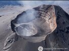
In other news from Italy
In the last 24 hours, its activity has increased with incandescent fragments, large exhalations and ash fall The most impressive, due to the sound of the explosion, was at 10:51 am with a shock wave visible in the clouds
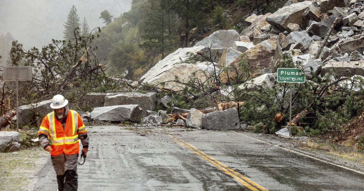
Heavy rain unleashes mud, debris flows in Northern California areas burned by wildfire
Heavy rain in Northern California unleashed mud and debris flows and shut down at least one critical highway by Sunday morning.
www.latimes.com
UPDATE: Debris slide blocks SR 504 near Coldwater Lake; a dozen people rescue
8 hours ago Video / Pics
A dozen people were rescued Monday after a large debris slide occurred around 9 p.m. Sunday, blocking the highway to Johnston Ridge.
Officials say it could be months before the road to the Mount St. Helens overlook reopens.
The slide washed out the bridge on that section of Spirit Lake Memorial Highway, or state Route 504, east of Coldwater Lake, said Washington State Department of Transportation regional spokesperson Kelly Hanahan.
The Skamania County Sheriff’s Office reports 12 people and a dog were airlifted from the other side of the slide Monday morning using a rescue helicopter from King County. No one was injured.
The slide covers more than 100 yards of Spirit Lake Memorial Highway near mile marker 43, before the turn off to the Coldwater Science and Learning Center. Earlier Monday, the road was closed farther up the mountain at Coldwater Lake.
Johnston Ridge Observatory was scheduled to open for summer tourists on Monday morning but is now inaccessible. The road is covered in mud, rocks, debris and water, and emergency responders are asking drivers to avoid the area while the damage is being assessed.
The Skamania County Sheriff’s Office, Cowlitz County Sheriff’s Office, Washington State Patrol, Washington Department of Transportation, U.S. Forest Service and other agencies set up a joint response area at Coldwater Lake.
Rescue
Pierce County photographer Tim Uhler was trapped at Johnston Ridge Sunday night after going to the site to photograph the Milky Way and other celestial events. Uhler said about four drivers returned to the ridge after seeing the landslide and told visitors about the event.
Still, Uhler said he wasn’t concerned. He took aerial photos of the damage with a drone Monday morning.
“We could make the emergency calls out so we weren’t too worried,” he said. “We had good weather, good water.”
Uhler said eventually he and the other visitors were driven to Castle Rock to meet with friends and family.
“I think we were happy they weren’t rescuing us for something stupid we had done,” he said. “It was just a
Suspected cause, effects
Cascade Volcano Observatory Seismologist Weston Thelen said the recent unseasonably warm temperatures likely melted snow pack and led to the slide, but the definite cause has not been determined. Thelen said the area around the slide is comprised of the “debris avalanche” from the 1980 eruption, which is “pretty weak stuff.”
The U.S. Army Corps of Engineers is also investigating the cause of the slide. Hanahan said once the area is deemed safe by geological engineers, WSDOT and other crews will begin clearing the road.
Gifford Pinchot forest spokeswoman Gala Miller said the slide temporarily knocked out the power to the Coldwater center and other Forest Service locations.
“The mountain continues to remind us that it’s a dynamic landscape,” Miller said. “Building roads and facilities out in the middle of a blast zone-affected area is not easy.”
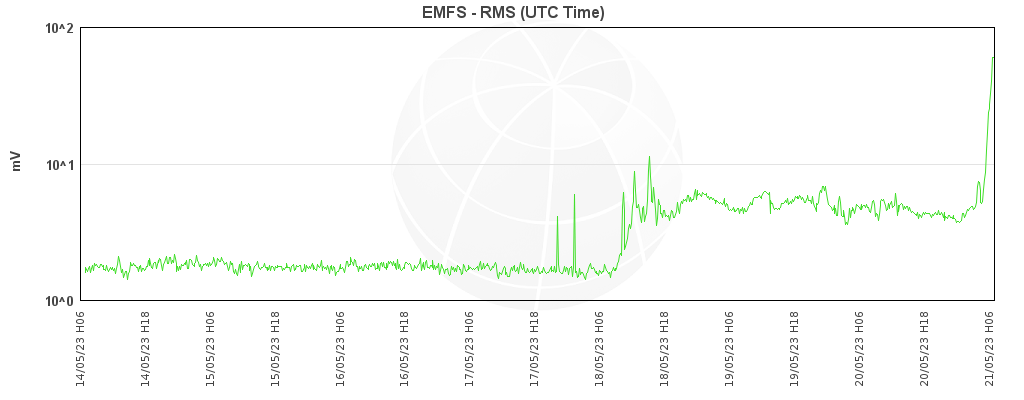
Thelen said some tools to monitor Mount St. Helens volcanic activity are no longer working due to the power outage, while others were wiped out during the slide.
Thelen said he is “not concerned about a few less stations for a short period of time” because no large changes in volcanic activity have been seen. He expects the tools to be online by the end of the week.
He said the Cascade Volcano Observatory also has tools to monitor the tunnel that drains Spirit Lake, and the tunnel is not blocked by the debris. Editor’s note: City Editor Hayley Day contributed to this story.
In other news from Italy
In the last 24 hours, its activity has increased with incandescent fragments, large exhalations and ash fall The most impressive, due to the sound of the explosion, was at 10:51 am with a shock wave visible in the clouds


 .
.