5000 Terremotos en la isla de La Palma (Canarias) en los últimos dos meses.
No time to play #30DayMapChallenge , but wanting to participate, I will use something that I am doing these days. Day 1,#puntos#points . 5000 Earthquakes on the island of La Palma (Canary Islands) in the last two months.
La Palma Eruption Update: Two 5.0 Mag Earthquakes Over The Weekend as The Volcano Darkens The Sky!
Premiered 54 minutes ago Magnetic Reversal News
They catch a volcanic ray on La Palma.
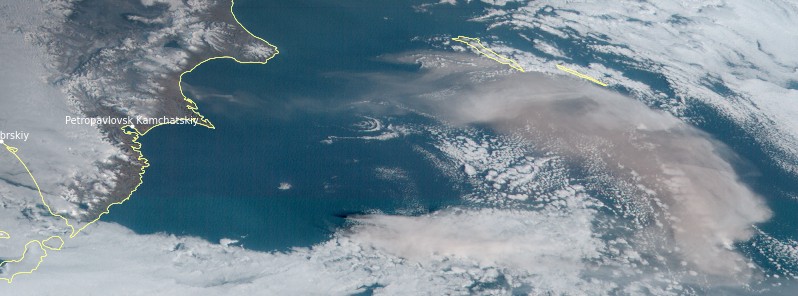
Video of the eruption and the ash dispersion from the Llano del Jable Astronomical Viewpoint at 2.30 pm (Canary time) / Video of the eruption and the ash dispersion from the Llano del Jable Astronomical Viewpoint at 2.30 pm (Canarian time)#LaPalma
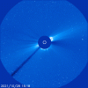
News from #Sabancaya ,#Karymsky ,#Cumbre Vieja and #Vulcano . http://earth-of-fire.com/2021/11/news-from-sabancaya-karymsky-cumbre-vieja-and-vulcano.html News from Sabancaya, Karymsky, Cumbre Vieja and Vulcano.

No time to play #30DayMapChallenge , but wanting to participate, I will use something that I am doing these days. Day 1,#puntos#points . 5000 Earthquakes on the island of La Palma (Canary Islands) in the last two months.
La Palma Eruption Update: Two 5.0 Mag Earthquakes Over The Weekend as The Volcano Darkens The Sky!
Premiered 54 minutes ago Magnetic Reversal News
Moderate mag. 5.0 earthquake - La Palma Island https://bit.ly/3EDwW94 La Palma volcano update: Intense ash emissions continue, bad air quality in the Ariadne Valley https://bit.ly/3CA0Udz Latest quakes near La Palma volcano: past 24 hours https://bit.ly/3hLpMXk La Palma Quakes vs Depth Chart https://bit.ly/2XseTTk LIVE: La Palma Volcano Eruption, the Canary Islands https://www.youtube.com/watch?v=dTTm5... Analysis of the volcanic activity https://www.ign.es/web/vlc-serie-palma Seismicity on La Palma https://bit.ly/3nGxtAs Ground Deformation La Palma https://bitly.is/2ZOJICX 3D Earthquake Visualization @ La Palma https://bit.ly/3bxQyPw
They catch a volcanic ray on La Palma.
Video of the eruption and the ash dispersion from the Llano del Jable Astronomical Viewpoint at 2.30 pm (Canary time) / Video of the eruption and the ash dispersion from the Llano del Jable Astronomical Viewpoint at 2.30 pm (Canarian time)#LaPalma
News from #Sabancaya ,#Karymsky ,#Cumbre Vieja and #Vulcano . http://earth-of-fire.com/2021/11/news-from-sabancaya-karymsky-cumbre-vieja-and-vulcano.html News from Sabancaya, Karymsky, Cumbre Vieja and Vulcano.
Attachments
Last edited:


 Vulkane.net writes
 ... it all was a little too tight for checking for errors; therefore I am sorry for the mistake.