About the heavy snowfall...
In Alaska, and other places for that matter... It is often the case that these places that have these exceptional snowfalls - always experience heavy snowfalls. That's why they put ski resorts there.
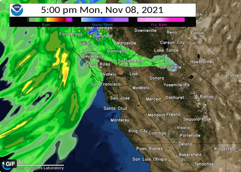
So, if you see articles about deep snow at Alyeska, or places in California like Donner Pass, ect., it is in places where heavy snow is common.
I live about 50 miles from Alyeska, and there is only trace amounts of snow on the ground left over from our two modest snowfalls. And it is between 35°F and 40°F - which seems above average, but not too far from normal.
As far as cooler than normal, that might be the case in Fairbanks, where UAF is, which is historically very cold, and so that too is not extraordinary.
So, Alaska is a large state with varied weather, and while it seems extraordinary, this news of the weather is happening in places where you would expect it. So it seems a little hyped, given the locations.


") ) that a tit bird is a bringer of the winter: when you see tits coming near the house - the winter is coming.
) that a tit bird is a bringer of the winter: when you see tits coming near the house - the winter is coming.