The Ice Age Cometh! Forget Global Warming!

From one of the articles that Laura posted today:

The city's rainfall tally thus far this year ranks third-highest. (...)

AccuWeather forecasters say a marine heat wave over a portion of the Atlantic Ocean, just off the United States coast between Delaware and eastern New England, led to an overabundance of moist air across portions of the mid-Atlantic and Northeast during the second half of the year and is likely a key factor in the severity and frequency of heavy rain events.

This current surge of warm water can be traced back to July 2020. It became warmer and progressively widespread during this past summer, according to Pastelok.

"This warm body of water has lasted through big storms this season and has not been ruffled," Pastelok said. He noted that had there been multiple storms moving south to north from the tropics during the past several months, then perhaps this area may have cooled.

"It may take several big nor’easters to really knock down these water temperatures," he said. Although AccuWeather's long-range team is forecasting the potential for a few big storms this year, which may lower sea-surface temperatures late this winter, there can be more warm surges at any time going forward, he added.

So if this article is correct about what a key factor or part of the cause of the 3rd most rainfall ever in NYC is (and we have two months to go), which they content is increased moisture from a warm water wave in the Atlantic off the US, and that situation does not seem to have changed, then as we move into winter and possibly get one of those big polar vortexes dipping down into the Eastern US, then the Northeast US might get some really big snow storms with the combination of moisture and extreme cold coming together.
 
So if this article is correct about what a key factor or part of the cause of the 3rd most rainfall ever in NYC is (and we have two months to go), which they content is increased moisture from a warm water wave in the Atlantic off the US, and that situation does not seem to have changed, then as we move into winter and possibly get one of those big polar vortexes dipping down into the Eastern US, then the Northeast US might get some really big snow storms with the combination of moisture and extreme cold coming together.

Not only that, but it makes one wonder if the warm water is piling up there because it isn't moving around in the normal Gulf Stream pattern? Is the Gulf Stream broken?


Today we ski at La Pierre St Martin about 20cm @janisagi#bearn#pyrenees
Wax on!
First impressions of the snow on the #Oberalppass . They are between 25 and 40cm #Schnee

1636093860401.png
With the influx of polar air, it can cool down considerably in the coming nights under a clear sky and with little wind above the snow. This applies in particular to the higher valleys. It can freeze severely to very severe there. Photo weather station #Rosswald
 
New snow totals for the next 24 hr. through the next ten days.

End snip:
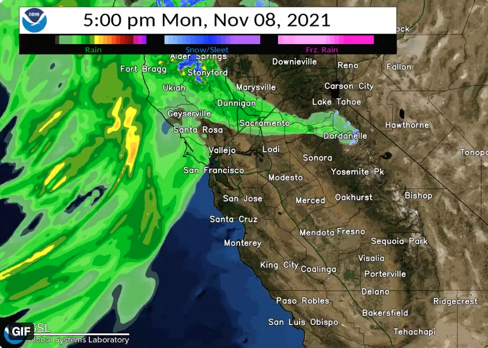
The latest forecast released by the weather service shows rainfall increasing in intensity after sunset, with the heaviest period likely occurring over the North Bay from 7 p.m. to 11 p.m.; Santa Cruz Mountains, 9 p.m. to 2 a.m.; and along the Santa Lucia Range (Monterey County coast) between 1 a.m. and 5 a.m.

"While widespread flooding concerns are not anticipated, rain rates may reach or exceed 0.50 [inch] per hour during these periods of time," the weather service said. "Thus, we will be closely monitoring conditions for isolated flooding/debris flow concerns."

The rain and wind come as a deep trough of low pressure over the Gulf of Alaska guides a plume of moisture toward the California coast, the weather service said.

The agency released projected rain fall totals for the storm, forecasting 3 to 4 inches of rain in the wettest coastal range regions, from Cazadero to Mount Tamalpais, and over the Santa Cruz Mountains, including the CZU August Lightning Complex burn scar; 1.5 to 2.5 inches in the North Bay valleys; 1 to 2 inches in the East Bay hills, northern Monterey Bay and Big Sur area; 1 to 1.5 inches around San Francisco and the bay shore; 0.25 to 0.50 inches around the South Bay and Monterey Bay; and less than 0.25 inches for the interior Central Coast.

A wind advisory is in effect through early Tuesday with sustained gusts of 20 to 30 mph and isolated gusts up to 45 mph possible.


URGENT - WINTER WEATHER MESSAGE National Weather Service Reno NV
211 PM PST Mon Nov 8 2021


Earth Changes

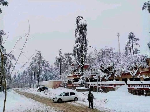
Early snowfall in Morocco
 

Attachments

  • 1636429716075.png
    1636429716075.png
    52.7 KB · Views: 7

---------------------------------------------------------------------------------

A few videos showing the extremity of the situation -

 
Its no better over here in the Southern Hemisphere. It has rained a lot in Australia in the last few days and it came out of nowhere. The Msm has been downplaying and underreporting it as usual. C’s did say that there would be rains and storms in this part of the world in sync with the ice age in the northern hemisphere.
 
The forecast looks grim indeed!
Of course depend from the model they using , but if that is what's going to be , or close to , then just looking around UK, it seems plausible to think that there could be some issues with the Gulf Stream, looking at the predicted temperature , they looks like the "normal temperatures" that you should expect without the warming effect of the Stream.
 
..it seems plausible to think that there could be some issues with the Gulf Stream, looking at the predicted temperature , they looks like the "normal temperatures" that you should expect without the warming effect of the Stream.
Then there is atmospheric streams. See Laura's comment below from a page back:

So now those recently discovered "atmospheric rivers" are going to be dumping snow? Hoo boy! Things are most definitely getting interesting.

Think so, too. Coupled with localizations, some places may take a pounding, as recently seen in Mongolia above.
 
Apparently this early snow dump in Anchorage and southcentral Alaska on Nov. 11 was big even by Alaska standards.


-------------------------------------------------------------------------------------------------
Extract-

Many Anchorage residents were shoveling sidewalks and brushing off car windshields for the first time this year as the town got hit by its largest snowstorm of the season.

Some parts of town are reporting over a foot of snow, including 15 inches reported as of 8:25 a.m. on Huffman and Birch Road on the Anchorage Hillside, according to the National Weather Service. Valdez reported 19 inches of powder at 6:40 a.m.


10 days ahead of time prognosis - are not really reliable

The above 850 hPa Level prognosis was made 10 days ahead of time. It suggested a scenario for a major cold air breakout over Europe for 18 Nov 2021. (The temperatures in that prognosis represent predicted temperatures at 1.5 km height, not showing ground temperatures ! ) I consider 10 days to be far too much ahead of time, to have any real value.


4 days ahead

This new 850-hPa level prognosis was made for the same date 18 Nov 2021 but only 4 days ahead of time

Quite a change.

While the north of Europe, as well Germany + Poland are still in the blue (below 0°C at 1.5 km) - yet it ain't purple at and below -15°C, which the earlier 10 day prognosis so dramatically suggested.


Ground vs 850 hPa (1.5 km height)

Having airmasses around 0°C to -5°C at 1.5 km height this time of the year, is not really strange for November. A temperature around -5°C. at 1.5 km still allows MAX temperatures to go above 0°C on the ground in November. See below:

Ground temperature prognosis vs 1.5 km height for 18 Nov 2021
Warsaw: Max +6°C, Min +1°C || -4°C at 1.5 km
Stockholm: Max +5°C, Min +0°C || -5°C at 1.5 km

All this being said... it is going to get colder, of course, leaning towards the risk for snowfall coming soon, including here in Stockholm. So far, and for the first time this winter season, we had a tiny brief moment of snow mixed with rain on 8 Nov 2021 around 05.30 - barely really visible - and that was it.

All previous prognosis for snow, had failed.


850temp_20211114_12_096.jpg
 
And, as I was saying about the Southern Hemisphere few posts above, The southernmost part of Australia, Tasmania just had snow overnight when it should be the beginning of the summer time.

Quotes from the article.
Initial data shows the temperature in Hobart fell to 2.9 degrees Celsius overnight — which would make it the city's coldest November night since 1953.
"The lowest snow would have fallen about the southern parts of Tasmania, but due to the elevated nature of the Central Plateau and some of the ranges in the west of Tasmania, they actually got more snow in the end, or very likely to have had more snow in the end, because they're just that much higher above sea level," he said.

Mr Johnston said the cold south-westerly air had come up from Antarctica.
 
Back
Top Bottom