Earthquakes around the world

WORLDWIDE EARTHQUAKE REPORT DECEMBER 09

Strong earthquakes in Philippines

An earthquake of magnitude 5.8 occurred 97 km northeast of Cabatuan, 98 km (pop: 2,380) Philippines. The quake hit at a shallow depth of 10 km beneath the epicenter early afternoon on Friday, December 9th, at 2:33 pm local time. The nearest volcano is Bulusan, 198km away from epicenter. Bulusan is one of the most active volcanoes in the Philippines.

● M 5.8 - 97 km NE of Cabatuan, Philippines
2022-12-09 06:32:59 (UTC)
13.168°N 125.834°E. 10.0 km depth
USGS earthquake alert

A second Strong earthquake hit early morning on Saturday, December 10th, at 4:01 am local time at a shallow depth of 10 km. The magnitude 5.6 earthquake occurred 13 km SE of Nangan (pop: 3,360). Leonard Range 112 km away is the nearest volcano. Currently the volcano is dormant. The last activity of Leonard Range probably occurred about 1800 years ago, indicated by radiocarbon dating of charred wood found in a pyroclastic flow deposit on the edge of the caldera

● M 5.6 - 2 km NE of Pondaguitan, Philippines
2022-12-09 20:01:56 (UTC)
6.381°N 126.192°E. 73.9 km depth
USGS earthquake alert

A magnitude 5.2 earthquake ocurred 149 km away from Ascensión volcano. Ascensión is the broad emergent summit of a massive stratovolcano that rises 3000 m above the sea floor. No eruptive activity has occurred since its discovery in 1501

● M 5.2 - 151 km ENE of Georgetown, Saint Helena
2022-12-09 17:08:25 (UTC)
7.171°S 13.270°W. 7.0 km depth
USGS earthquake alert

● M 5.1 - South Sandwich Islands region
2022-12-09 04:49:04 (UTC)
56.363°S 26.655°W. 38.1 km depth
USGS earthquake alert

Moderate magnitude 4.2 earthquake occurred 41 km (26 mi) NNW of Olymbos (pop: 400) Dodecanese, South Aegean, Greece, on Friday, Dec 9, at 8:44 pm. Nisyros volcano is 56 km away from epicenter.

According to Volcanodiscovery Nisyros is one of the more active but less known volcanoes in Greece. It is located south of the popular beach holiday island of Kos. The volcano is part of the Hellenic Arc, a curved line of volcanic centers which are caused by a subduction zone, and stretches from the Saronic Gulf opposite Athens via the island groups of Milos, Santorini, and Nisyros-Yali-Cos to the Bodrum peninsula at the extreme SW of Turkey.

● M 4.2 - Dodecanese Islands, Greece
2022-12-09 18:44:19 (UTC)
36.090°N 27.012°E. 11.1 km depth
USGS earthquake alert


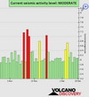
● Summary

Seismic activity level has been at moderate levels in the last 24 hours. This is the last chart posted by Volcanodiscovery 02:00 UTC on December 09 Global seismic activity level chart
~4 quakes above magnitude 5
~39 quakes between magnitude 4 and 5
~86 quakes between magnitude 3 and 4
~202 quakes between magnitude 2 and 3
~419 quakes below magnitude 2 that people normally don't feel.
~750 earthquakes in the past 24h (894 earthquakes in the 24 hours prior to this report) Estimated combined seismic energy release: 11090 tons of TNT or 0.7 atomic bombs.
Volcanodiscovery earthquake report 24h
 
WORLDWIDE EARTHQUAKE REPORT DECEMBER 10

● Three moderate earthquakes hit Chile on December 10. A magnitude 5.6 quake 24 km (15 mi) SSE of San Pedro de Atacama (pop: 2,000) hit early morning on Saturday, at 3:41 am local time at an intermediate depth of 119 km. Licancabur volcano is 41 km away from epicenter Licancabur volcano is an active stratovolcano in northern Chile on the border with Bolivia, It is known for containing the world's highest lake inside its 400 m wide summit crater at at 5913 m.

M 5.6 - Antofagasta, Chile
2022-12-10 06:41:28 (UTC)
23.114°S 68.130°W. 114.2 km depth
USGS earthquake alert

San Antonio Province (pop.85,700), Region of Valparaiso felt an earthquake magnitude 5.5 The quake hit at a shallow depth of 27.6 km beneath the epicenter, early morning on Saturday, at 4:25 am local time.

M 5.5 - 44 km W of San Antonio, Chile
2022-12-10 07:25:48 (UTC)
33.647°S 72.084°W. 27.6 km depth
USGS earthquake alert

● M 5.0 - 18 km NNE of Ovalle, Chile
2022-12-10 08:48:36 (UTC)
30.459°S 71.096°W. 30.1 km depth
USGS earthquake alert

● M 5.0 - South Sandwich Islands region
2022-12-10 12:01:47 (UTC)
56.369°S 26.972°W. 78.6 km depth
USGS earthquake alert

● Moderate mag. 5.3 earthquake hit Bering Sea, 111 mi southeast of Attu Station, Aleutians West, Alaska, USA, at 12:11 pm at a shallow depth of 42.9 km

● M 5.3 - 179 km SE of Attu Station, Alaska
2022-12-10 22:11:06 (UTC)
51.939°N 175.369°E. 42.9 km depth
USGS earthquake alert

● M 5.1 - south of the Fiji Islands
2022-12-10 22:30:27 (UTC)
25.185°S 178.484°E. 587.4 km depth
USGS earthquake alert

● M 5.1 - 273 km SSE of Katsuura, Japan
2022-12-10 23:53:36 (UTC)
32.942°N 141.637°E. 10.0 km depth
USGS earthquake alert

● Moderate mag. 4.4 earthquake hit North Pacific Ocean, 33 km WSW of Las Brisas (pop.1080) Mexico, on Saturday, December 10, at 12:23 am local time.

M 4.4 - 33 km WSW of Las Brisas, Mexico
2022-12-10 08:23:29 (UTC)
30.800°N 116.463°W. 10.0 km depth

● Moderate mag. 4.9 earthquake hit North Pacific Ocean, 166 mi west of Eureka, Humboldt County, California, USA, on Friday, Dec 9, 2022 at 6:17 pm local time. Escabana Segment is a Submarine volcano located 27 mi away from epicenter.
The linear, N-S-trending Escanaba Segment, the southernmost of the Gorda Ridge, lies immediately north of the Mendocino Francture Zone off the coast of northern California.

M 4.9 - 258 km W of Ferndale, California
2022-12-10 03:17:30 (UTC)
40.612°N 127.322°W. 14.4 km depth

● Summary

Seismic activity level has been at moderate levels in the last 24 hours. This is the last chart posted by Volcanodiscovery at 01:50 UTC on December 10 Global seismic activity level chart
~7 quakes above magnitude 5
~47 quakes between magnitude 4 and 5
~96 quakes between magnitude 3 and 4
~221 quakes between magnitude 2 and 3
~330 quakes below magnitude 2 that people normally don't feel.
~701 earthquakes in the past 24h (750 earthquakes in the 24 hours prior to this report) Estimated combined seismic energy release: 16311 tons of TNT or 1 atomic bombs
Volcanodiscovery earthquake report 24h
 

Attachments

  • chrome_screenshot_1670723746845.png
    chrome_screenshot_1670723746845.png
    331.2 KB · Views: 0
Last week saw no earthquakes worldwide reaching M6.0
In the usual area, there were 6 out of 110 earthquakes worldwide equal to or greater than 4.5 and 1444 out of 2191 quakes of all sizes.
Percentage: 65.9%
Last week saw 1 M6, being a M6.7 in Tonga.
In the usual area, there 4 out of 113 earthquakes worldwide equal to or greater than 4.5 and 1548 out of 2004 quakes of all sizes.
Percentage: 77.2%
Earthquakes 7 days to Dec 11th 2022.gif
 
A magnitude 6.0 quake in Mexico near Atoyac de Alvarez (pop. 21,400) , Guerrero. The earthquake hit in the morning on Sunday, December 11th, 2022, at 8:31 am local time at a shallow depth of 19 km. Moderate shaking was felt in Mexico city 287 km away from epicenter

M 6.0 - 3 km WNW of El Ticui, Mexico
2022-12-11 14:31:29 (UTC)
17.223°N 100.475°W. 19.8 km depth
USGS earthquake alert
 
WORLDWIDE EARTHQUAKE REPORT DECEMBER 11

● An earthquake of magnitude 5.2 occurred in the morning on Sunday, December 11th, 2022, at 9:03 am local time 12 km (8 mi) SW of Yupiltepeque (Jutiapa) (pop: 3,030) Departamento de Jutiapa, Guatemala, the quake was located at an intermediate depth of 199.7 km. Cerro Santiago volcano is 23km away from epicenter. There have been no recent eruptions of this volcano.

The M5.2 earthquake occurred half an hour after the M6.0 earthquake in Guerrero, Mexico.

M 5.2 - 3 km ENE of Comapa, Guatemala
2022-12-11 15:03:11 (UTC)
14.128°N 89.881°W. 191.7 km depth
USGS earthquake alert

● Strong mag. 5.1 earthquake in Indian Ocean on Sunday, Dec 11, at 12:08 pm local time. 53 km south of Puerto Elizabeth South Africa. Approximately 4 hours later a M4.4 earthquake occurred 24 km southeast of Westonaria, South Africa,

M 5.1 - south of Africa
2022-12-11 10:08:42 (UTC)
52.587°S 27.832°E. 10.0 km depth
USGS earthquake alert

M 4.4 - 9 km WSW of Orange Farm, South Africa. 2022-12-11 16:20:39 (UTC)
26.502°S 27.774°E. 9.8 km depth
USGS earthquake alert

● M 5.6 - South Sandwich Islands region
2022-12-11 06:40:20 (UTC)
58.761°S 25.445°W. 28.4 km depth
USGS earthquake alert

● Indonesia was shaken near Tobelo, Kabupaten Halmahera Utara (pop. 10,000), North Maluku, by an earthquake of magnitude 5.1 The quake hit at a shallow depth of 12.5 km beneath the epicenter near Tobelo. The quake occurred 37 km from Dukono volcano. Dukono is a remote volcano on the island of Halmahera (Indonesia). There is not much information available due to its remote position, but Dukono is one of the world's most active volcanoes and has been in persistent activity since 1933.

M 5.1 - 25 km SE of Tobelo, Indonesia
2022-12-11 02:28:43 (UTC)
1.600°N 128.200°E. 12.5 km depth
USGS earthquake alert

● M 4.0 - off the coast of Oregon
2022-12-11 17:19:43 (UTC)
44.183°N 129.264°W. 10.0 km depth
USGS earthquake alert

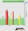
● Summary

Seismic activity level has been at moderate levels in the last 24 hours. This is the last chart posted by Volcanodiscovery at 00:50 UTC on December 11 Global seismic activity level chart
~1 quake above magnitude 6
~4 quakes between magnitude 5 and 6
~48 quakes between magnitude 4 and 5
~94 quakes between magnitude 3 and 4
~206 quakes between magnitude 2 and 3
~317 quakes below magnitude 2 that people normally don't feel.
~670 earthquakes in the past 24h (701 earthquakes in the 24 hours prior to this report) Estimated combined seismic energy release: 25955 tons of TNT or 1.6 atomic bombs
Volcanodiscovery earthquake report 24h
 
WORLDWIDE EARTHQUAKE REPORT DECEMBER 12

● Strong magnitude 5.5 earthquake North Pacific Ocean, Panama, on Monday, Dec 12, 2022 at 1:27 pm local time. It is possible that this earthquake is due to the transit of energy from the Cocos plate to the Nazca plate. After the event of M6.0 in Guerrero, Mexico, Guatemala recorded a M5.2, Nicaragua a M4.0 and Panama-Costa Rica border a M3.3 on December 11th

On December 12, Ecuador recorded a M4.9, Peru recorded an earthquake magnitude 4.3 and another of M4.6, while Chile a M4.0.
IMG_20221212_180303_731.jpg
M 5.5 - south of Panama
2022-12-12 18:27:34 (UTC)
4.816°N 82.687°W. 10.0 km depth
USGS earthquake alert

● Indonesia was shaken near Amahai, Maluku (pop: 47,700) by an earthquake of magnitude 5.3 The quake hit at a moderately shallow depth of 61.9 km beneath the epicenter near Amahai, Maluku, Indonesia, in the morning on Tuesday, December 13th, at 7:10 am local time.

M 5.3 - 17 km E of Amahai, Indonesia
2022-12-12 22:10:02 (UTC)
3.311°S 129.071°E. 61.9 km depth
USGS earthquake alert

Seismic swarm near Charlotte Amalie, U.S. Virgin Islands (pop: 20,000) with an average depth of 22 km

M 3.4 - 95 km N of Charlotte Amalie, U.S. Virgin Islands 16:16:06 (UTC)
M 3.0 - 53 km N of Charlotte Amalie, U.S. Virgin Islands.16:33:47 (UTC)
M 2.6 - 78 km N of Charlotte Amalie, U.S. Virgin Islands 17:22:40 (UTC)
M 3.4 - 97 km N of Charlotte Amalie, U.S. Virgin Islands 17:40:04 (UTC)
M 3.6 - 94 km N of Charlotte Amalie, U.S. Virgin Islands 18:14:52 (UTC)
M 3.4 - 93 km N of Charlotte Amalie, U.S. Virgin Islands 19:16:29 (UTC)
M 3.6 - 104 km N of Charlotte Amalie, U.S. Virgin Islands 21:08:56 (UTC)
M 3.8 - 94 km N of Charlotte Amalie, U.S. Virgin Islands 22:08:29 (UTC)
M 3.4 - Virgin Islands region 22:21:39 (UTC)
chrome_screenshot_1670888995142.png

487 days have passed without an M8.0+ earthquake. The last one occurred in the South Sandwich Islands on August 12, 2021 with a magnitude M8.1

The 1960 Valdivia earthquake and tsunami on May 22, 1960 was the most powerful earthquake ever recorded. Various studies have placed it at 9.4–9.6 magnitude. The last earthquake with a magnitude of 9.1 occurred on March 11, 2011 in Tohoku Japan, 11 years, 9 months 1 day ago.

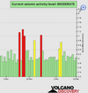
● Summary

Seismic activity level has been at moderate levels in the last 24 hours. This is the last chart posted by Volcanodiscovery at 00:30 UTC on December 12 Global seismic activity level chart

~2 quakes above magnitude 5
~47 quakes between magnitude 4 and 5
~89 quakes between magnitude 3 and 4
~202 quakes between magnitude 2 and 3
~460 quakes below magnitude 2 that people normally don't feel.
~800 earthquakes in the past 24h (670 earthquakes in the 24 hours prior to this report) Estimated combined seismic energy release: 8613 tons of TNT or 0.5 atomic bombs
Volcanodiscovery earthquake report 24h
 

Attachments

  • chrome_screenshot_1670891372869.png
    chrome_screenshot_1670891372869.png
    319.3 KB · Views: 0
● Japan was shaken near Naze (pop.41,400) Amami Shi, Kagoshima, by an earthquake of magnitude 5.7 The quake hit at a shallow depth of 10 km beneath the epicenter near Naze, Amami Shi, Kagoshima, Japan, late at night on Tuesday, December 13th, 2022, at 11:25 pm local time.

M 5.7 - 93 km S of Naze, Japan
2022-12-13 14:25:15 (UTC)
27.526°N 129.551°E. 10.0 km depth
USGS earthquake alert

● A magnitude 5.2 quake in Iran near Tabas (pop.50,000), Yazd Province. The earthquake hit in the afternoon on Tuesday, December 13th, 2022, at 5:14 pm local time at a shallow depth of 10 km.

M 5.2 - 47 km NNE of Tabas, Iran
2022-12-13 14:14:27 (UTC)
33.988°N 57.132°E. 10.0 km depth
USGS earthquake alert
 
WORLDWIDE EARTHQUAKE REPORT DECEMBER 13

● M 5.4 - Kermadec Islands region
2022-12-13 12:26:25 (UTC)
28.114°S 178.225°W. 60.9 km depth
USGS earthquake alert

● A magnitude 5.3 earthquake 32 km (20 mi) N of Amlapura (pop: 31,900) Indonesia. The earthquake occurred at a shallow depth of 10 km beneath the epicenter early evening on Tuesday, December 13th, 2022, at 6:38 pm local time. The nearest volcano is Angung, 24 km away from epicenter. Mount Agung or Gunung Agung is a active volcano in Bali. Current status: minor activity or eruption warning

M 5.2 - 20 km N of Amlapura city, Indonesia
2022-12-13 10:38:21 (UTC)
8.261°S 115.617°E. 10.0 km depth
USGS earthquake alert

● A magnitude 4.4 quake in Turkey near Biga, Canakkale (pop: 30,900) The earthquake hit early morning on Tuesday, December 13th, 2022, at 6:21 am local time at a shallow depth of 10 km.

M 4.4 - Western Turkey
2022-12-13 03:21:17 (UTC)
40.362°N 27.017°E. 10.0 km depth
USGS earthquake alert

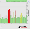
● Summary

Seismic activity level has been at moderate levels in the last 24 hours. This is the last chart posted by Volcanodiscovery at 00:30 UTC on December 13 Global seismic activity level chart
~4 quakes above magnitude 5
~49 quakes between magnitude 4 and 5
~86 quakes between magnitude 3 and 4
~210 quakes between magnitude 2 and 3
~407 quakes below magnitude 2 that people normally don't feel.
~756 earthquakes in the past 24h (800 earthquakes in the 24 hours prior to this report) Estimated combined seismic energy release: 14224 tons of TNT or 0.9 atomic bombs
Volcanodiscovery earthquake report 24h
 

Attachments

  • chrome_screenshot_1670978723327.png
    chrome_screenshot_1670978723327.png
    337 KB · Views: 1
WORLDWIDE EARTHQUAKE REPORT DECEMBER 14

● Strong magnitude 6.3 earthquake Aleutian Islands, Alaska USA, on Wednesday, Dec 14, 2022 at 8:40 am local time. No human populations near the epicenter. The earthquake occurred 26 km away from Little Sitkin volcano.

Little Sitkin volcano forms a small island of the same name in the western Aleutians Islands and belongs to the Aleutian Island National Wildlife Refuge.

M 6.3 - Rat Islands, Aleutian Islands, Alaska
2022-12-14 18:40:28 (UTC)
51.725°N 178.654°E. 83.7 km depth
USGS earthquake alert

● Strong mag. 5.6 earthquake - South Pacific Ocean at 4:28 pm local time

M 5.6 - Balleny Islands region
2022-12-14 06:28:03 (UTC)
62.972°S 155.977°E. 10.0 km depth
USGS earthquake alert

● India's National Center for Seismology (NCS) reported a magnitude 5.0 quake in Myanmar (Burma) near mandare, Mandalay District, Mandalay Region (pop: 1,208,100) The earthquake hit early morning on Thursday, December 15th, at 2:46 am local time at a shallow depth of 10 km.

M 5.0 - 8 km WSW of Sagaing, Myanmar
2022-12-14 20:46:31 (UTC)
21.864°N 95.902°E. 10.0 km depth
USGS earthquake alert

● Moderate mag. 4.9 earthquake in North Pacific Ocean, Oregon, USA, on Wednesday, Dec 14 at 3:24 am local time

M 4.9 - 298 km W of Bandon, Oregon
2022-12-14 12:24:43 (UTC)
43.643°N 128.018°W. 10.0 km depth
USGS earthquake alert

● Earthquake Forecast. A convergence of critical planetary geometry on 15-16 December, followed by a high lunar peak, may cause strong to major seismic activity, most likely from 16 to 18 December, potentially reaching higher 6 to 7 magnitude.

● Summary

Seismic activity level has been at moderate levels in the last 24 hours. This is the last chart posted by Volcanodiscovery at 00:30 UTC on December 14 Global seismic activity level chart
~1 quake above magnitude 6
~3 quakes between magnitude 5 and 6
~43 quakes between magnitude 4 and 5
~89 quakes between magnitude 3 and 4
~237 quakes between magnitude 2 and 3
~430 quakes below magnitude 2 that people normally don't feel.
~803 earthquakes in the past 24h (756 earthquakes in the 24 hours prior to this report) Estimated combined seismic energy release: 51882 tons of TNT or 3.2 atomic bombs
Volcanodiscovery earthquake report 24h
 

Attachments

  • chrome_screenshot_1671062988010.png
    chrome_screenshot_1671062988010.png
    339.1 KB · Views: 0
Taiwan was shaken at 27 km of Hualien City, Hualien (pop.350,500) by an earthquake of magnitude 5.9 The quake hit at a shallow depth of 10 km beneath the epicenter near Hualien City, around noon on Thursday, December 15th, 2022, at 12:03 pm local time.

There is an unnamed volcano (24.00°N/121.83°E) 25 km from the epicenter. Volcano status is dormant. A submarine eruption observed by the U.S. Navy boat "Southampton" took place on October 29, 1853

An aftershock of magnitude 4.6 was recorded minutes later at 12:05 pm
chrome_screenshot_1671115561413.png
M 5.9 - 27 km SE of Hualien City, Taiwan
2022-12-15 04:03:16 (UTC)
23.781°N 121.772°E. 15.3 km depth
USGS earthquake alert
 
the epicenter near Hualien City,
Interesting.
During the earthquake today I was in our local Carrefour store, was quite the shaker with a couple items falling off the shelves. I thought “Gosh, this is the worst place to be if it’s the big one”. Luckily it wasn’t and went back to shopping.

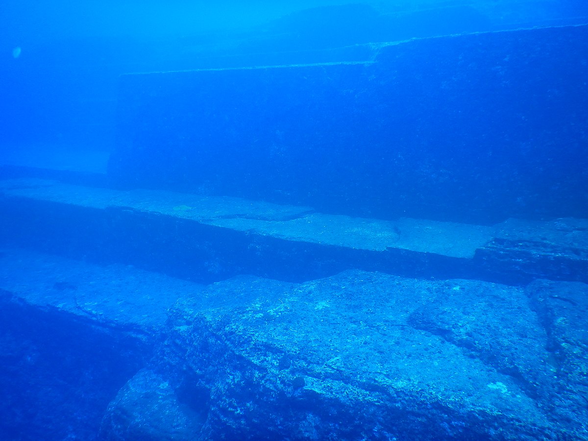
Afterwards we went to the beach for some rock hounding, while I’m there I always like to look out for UFOs (just for fun) as there are some underwater Japanese ruins about 100km off the coast of Taiwan that some claim to be an underwater pyramid.


Alas, the earthquake hadn’t shaken any aliens from their underwater residence 😆.
 
Afterwards we went to the beach for some rock hounding, while I’m there I always like to look out for UFOs (just for fun) as there are some underwater Japanese ruins about 100km off the coast of Taiwan that some claim to be an underwater pyramid.

Your comment reminded me of the time the Cs told us that UFOs use the electromagnetic energy generated by the activity of geological faults to restore their power.

Q: (L) Why are UFOs frequently sighted over geological fault lines?

A: Electromagnetism. Use electrical free waves as fuel for power restoration.

Q: (L) Could it be that the UFOs are a manifestation of the geomagnetic energies emitted at fault lines?

A: No. Not all theories are correct and some are not even sincere.

Q: (L) What is the connection between UFOs and earthquakes?

A: Is none. Coincidence. If they are there, some fault breaks produce EM fields which are visible briefly as red or yellow light flashes.

Earthquake lights in Mexico

Mysterious lights over the Colima Volcano in #Mexico.
The lines, similar to vertical pillars of light, join the sky with the horizon. Several are the theories, although there is not yet a fully rational explanation
 

Trending content

Back
Top Bottom