The Ice Age Cometh! Forget Global Warming!

Windmill knight said:
The thing is that if every year or two we get a record, then that means that the previous record was broken, which means that weather events are getting more extreme. Alternatively, you can have a bunch of smaller events which are not big enough to break a record, but which have increased dramatically in frequency, and that is noteworthy too.
Pierre said:
The thing is that the Northern hemisphere has been experiencing 'record' winter almost every year since 2008. That may not be isolated anomalies any more but a relevant trend.

Those are great points which should have, but didn't occur occur to me. Thanks guys :)
 
We're in the middle of Winter at this point in the Northern Hemisphere, there are more and more increases in the unusual activity between extreme and odd warm/cold patterns. The defining observations I've found so far come in to play with the frequency of changing weather patterns, the rotational axis of the Earth and its propelling of gases from interior, as well as the dwindling solar activity along with cloud formation. Also, Eol pointed out "the rapid growth of the differences between the troposphere and the upper layers can not proceed beyond a certain limit, as indicated by the laws of thermodynamics. An inversion can occur and even brutally. These very processes are strong indicators of what to expect, so as pointed out by Laura "Just thinking about the entire atmosphere of the planet changing like this should give people the willies because it is not a human caused phenomenon. It's a really, REALLY BIG symptom of changes. And we don't know what it means or what it can do and hardly anybody is talking about it sensibly."

Windmill knight said:
MikeJoseph82 said:
In recent years there have been a bunch of one-off weather events around the world which have pretty much been 'wow' in terms of their context relative to other events. But they come and go, months pass, things go back to normal and people forget.

These winter events in the northern hemisphere at the moment - even if they're classed as 'records' - are they defining enough or are they just another cry of the wolf?

The thing is that if every year or two we get a record, then that means that the previous record was broken, which means that weather events are getting more extreme. Alternatively, you can have a bunch of smaller events which are not big enough to break a record, but which have increased dramatically in frequency, and that is noteworthy too.

Laura said:
I think there is another factor to this heating/cooling of the Earth. Cs did say that heating was the precursor to sudden glacial rebound. There was also something else involved with those transfer points: El Nino/La Nina:

22 Feb 1997 said:
A: Continental "drift" is caused by the continual though variable, propelling of gases from the interior to the surface, mainly at points of magnetic significance.
Q: (Jan) What causes the change in the axis?
A: By slow down of rotation. Earth alternately heats up and cools down in interior.
Q: (Laura) Why does it do that? What's the cause of this?
A: Part of cycle related to energy exerted upon surface by the frequency resonance vibrational profile of humans and others.

And that's another thing that has been reported a number of times in recent years: adding time to the atomic clock, and slowing of the Earth's rotation.

Posted by: Pierre
« on: January 28, 2016, 04:48:27 AM »
'I think the correlation between low solar activity and cooling is due to the increased inflow of high energy cosmic rays which act as cloud nuclei, clouds being a major contributor to cooling. The process is described in this excerpt from "Earth Changes and the Human-Cosmic Connection"': Quote from ECHCC:
the Sun’s magnetic field and the Earth’s magnetic field are powered by the Sun’s activity. Those fields literally act as magnetic shields against incoming cosmic rays; Knowing that the main causes of cloud formation are cosmic rays and atmospheric dust (cometary and volcanic origin) and that these two factors are on the rise because of the hypothesized approach of Nemesis (grounding the Sun and reducing its activity) and its cometary swarm, we can expect an overall increase in cloud cover in the future and the resulting cooling effects.
 
150,000 homes without power, gusts up to 115mph as El Nino storm hits Southern California
Welcome to Sott.net
http://www.sott.net/article/311349-150000-homes-without-power-gusts-up-to-115mph-as-El-Nino-storm-hits-Southern-California


Weather Forecast (Jan. 31)
Los Angeles
The storm is gone but wild winds remain. What does the rest of the week look like?

https://youtu.be/9CIKrHQmNfs


California battered by winds as high as 115mph
Published on Jan 31, 2016
A motorist was fatally struck by a tree that was knocked by powerful winds as a winter storm hits California, bringing downpours, wind and snow, authorities said Sunday.

https://youtu.be/13N2SanyNXY
CaLIMvXVAAAkLH5.png:large

CaFffbRUYAERGf2.png

https://twitter.com/shelbygrad/status/693940811591864320/photo/1?ref_src=twsrc^tfw
 
Eol said:
<sniiiiiip>

And he also predicted a tropospheric cooling for the future / in opposite with a stratospheric warming with can be connected with what Gérald Messadié said :

the rapid growth of the differences between the troposphere and the upper layers can not proceed beyond a certain limit, as indicated by the laws of thermodynamics. An inversion can occur and even brutally.

This cooling of the uper atmosphere is realy fascinating. I know this subject only since a few months and i find very suspicious that we talk all day about the anthropogenic warming and very little about this cooling.

I've been thinking about this idea of upper atmosphere heating followed by an inversion. I think this is contradicted by plain evidence. Specifically, the increasing appearances of nacreous clouds at lower latitudes as well as the increase of contrails due to upper atmosphere cooling and that cooler air sinking lower, compressing the troposphere where the heating from within the earth is contained.

Another article about this appeared today: https://www.rt.com/uk/331006-strange-nacreous-clouds-uk/ which prompted me to mention this.

If you use nacreous as a search term on sott, you'll find that these have been increasing since at least 2006:

http://www.sott.net/article/117486-Rare-clouds-could-indicate-global-warming
01 Aug 2006

Rare, mother-of-pearl coloured clouds caused by extreme weather conditions above Antarctica are a possible indication of global warming, Australian scientists have announced.

Known as nacreous clouds, the spectacular formations showing delicate wisps of colours were photographed in the sky over an Australian meteorological base at Mawson Station on July 25.

The clouds can only form in temperatures lower than minus 80 degrees Celsius (minus 112 Fahrenheit). Meteorologist Renae Baker who photographed the clouds, said a weather balloon sent up about 12 miles above the Earth's surface measured temperatures as low as minus 87 Centigrade (minus 124.6 F). ...

Australian scientist Andrew Klekociuk said said temperatures in the stratosphere, between 5 and 31 miles above Earth, would be expected to drop as global warming increases. Data collected over the past 25 years had reflected this.

"Over that time there has been a small decrease in temperature and that change is actually occurring faster than the warming at the surface of the Earth," he said.

http://www.sott.net/article/148014-Mother-of-Pearl-Nacreous-Clouds
29 Jan 2008

As January comes to an end, sky watchers in Scandinavia are recovering from a veritable storm of nacreous clouds. After mid-month, hardly a night went by without someone spotting the phenomenon. "It was incredible! They were all over the sky," says Morton Ross of Oslo, Norway. ....

For much of January, these clouds rolled across the Arctic circle with puzzling regularity. Why the sudden abundance? Is the show over? No one knows. Stay tuned for February!

http://www.sott.net/article/171227-Nacreous-Clouds
21 Dec 2008
Nacreous clouds are located in the stratosphere some 9 to 16 miles high. Their iridescent "mother of pearl" colors come from sunlight striking tiny ice crystals inside the clouds. Very low temperatures near -85o C are required to form the crystals, which is why nacreous clouds are seen mainly during winter over places like Alaska, Iceland and Scandinavia.

These clouds are supposed to be rare, yet earlier this year Scandinavians witnessed a veritable "nacreous storm." For more than a week in January 2008, hardly a night went by without someone spotting mother-of-pearl colors in the sky. No one knows what caused the storm or if it could happen again. One thing is sure: northern sky watchers should be alert for more. The best time to look is during the twilight hours before dawn or after sunset.

http://www.sott.net/article/221107-Nacreous-Cloud-Alert
07 Jan 2011

Observers around the Arctic Circle are reporting vivid, iridescent nacreous clouds, which form in the stratosphere during the coldest months of northern winter.

http://www.sott.net/article/223422-CALIPSO-Spies-Polar-Stratospheric-Clouds
08 Feb 2011
NASA's Cloud-Aerosol Lidar and Infrared Pathfinder Satellite Observation (CALIPSO) satellite was in the right place at the right time earlier this month. On January 4, 2011, while flying over the east coast of Greenland, CALIPSO caught a top-down glimpse of an unusual atmospheric phenomenon - polar stratospheric clouds (PSCs), also known as nacreous clouds.

Clouds do not usually form in the stratosphere because of the dry conditions. But in the polar regions, often near mountain ranges, atmospheric gravity waves in the lower atmosphere (troposphere) can push just enough moisture into the high altitudes. The extremely low temperatures of the stratosphere condense ice and nitric acid into clouds that play an important role in depletion of stratospheric ozone. ...

The cloud was the result of mountain waves in the atmosphere, which form when stable air masses pass over mountains or high ice sheets, providing vertical lift. Pitts said such stratospheric ice clouds are rare because they only form when the jet stream in the Arctic is properly aligned with the edge of the polar vortex, a large air pressure system over the poles. The circulating air in the vortex needs to align with the jet stream to create enough vertical motion and propagate the waves to the upper atmosphere. The January 4 cloud was formed when those winds aligned and sent an air mass up over the high ice sheet and mountains of Greenland.

http://www.sott.net/article/239441-Beautiful-polar-stratospheric-clouds-forming-around-the-Arctic-Circle
29 Dec 2011

As December draws to a close, the first polar stratospheric clouds (PSCs) of northern winter are forming around the Arctic Circle. ...

The display Hagen witnessed formed in the wake of "Dagmar," a storm that "hit the coast of Norway with hurricane strength on Dec. 25th and 26th," says Hagen. "Record breaking winds up to 145 mph were recorded. While people on the coast dealt with the aftermath, photo enthusiasts inland saw the effects of high altitude winds in these colorful clouds. It was a beautiful display, but not comfortable to think of all the suffering lying behind it."

http://www.sott.net/article/240223-Polar-Stratospheric-Clouds
14 Jan 2012

An apparition of polar stratospheric clouds is underway around the Arctic Circle. "It is almost as good as the aurora borealis," says Göran Strand ...

Also known as "nacreous" or "mother of pearl" clouds, these icy clouds form in the lower stratosphere when temperatures drop to around minus 85ºC. Sunlight shining through tiny ice particles ~10µm across produce the characteristic bright iridescent colors by diffraction and interference.

"Nacreous clouds far outshine and have much more vivid colours than ordinary iridescent clouds, which are very much poor relations and seen frequently all over the world," writes atmospheric optics expert Les Cowley. "Once seen they are never forgotten."

http://www.sott.net/article/254548-Amazing-stratospheric-clouds-over-Europe
09 Dec 2012

When the sun set over the UK on Dec. 9th, sky watchers were stunned by an unexpected apparition of super-colorful stratospheric clouds. "They were amazing to see and a dream come true to photograph," reports Lesley Jennings of Fraserburgh, Aberdeenshire, Scotland. "There were all sorts of colors. I've never see the like before!" added Rachael Taylor also from Aberdeenshire. Nigel Feilden photographed this specimen from Inverurie, Scotland: ...

"Search for nacreous clouds at high latitudes (e.g., Scotland, Scandinavia, Iceland, Northern US) in winter and preferably downwind of mountains," Cowley advises. "They like stormy weather that perhaps creates gravity waves to loft the necessary moisture to make them upwards across the tropopause into the stratosphere. Once seen they are never forgotten!"

http://www.sott.net/article/264382-Comet-dust-loading-of-Earths-atmosphere-Nacreous-clouds-appear-over-Tierra-Del-Fuego
27 Jul 2013
On July 24th, about an hour after sunset, Gerardo Connon of Rio Grande city in Tierra del Fuego, Argentina, walked outside and witnessed a rare display of nacreous clouds. The colorful apparition was as bright as the street lights in the city below:

These clouds, also known as "mother of pearl clouds," form in the stratosphere far above the usual realm of weather. They are seldom seen, but when they are, the reports usually come from high-northern parts of our planet. This apparition over Tierra del Fuego was unusual indeed.

Atmospheric optics expert Les Cowley explains the special conditions required to create such a cloud: "Take an unusually cold lower stratosphere (15-25km high), use some gravity waves generated by high winds and storms in the troposphere to stir in some water vapour, and -- voilà! You get these clouds made of tiny ice crystals shining after sunset with unforgettably bright iridescent colors."

"The very special conditions make nacreous clouds a rare, high-latitude phenomenon. Scandinavia, Iceland and northern Canada are favourite places to see them. Sightings in the southern hemisphere are even more rare because there is so little land far enough south except for Antarctica."

23 Dec 2014
http://www.sott.net/article/290544-Polar-stratospheric-clouds-spotted-by-observer-in-Norway

Also known as "nacreous" or "mother of pearl" clouds, these icy structures form in the lower stratosphere when temperatures drop to around minus 85ºC. Sunlight shining through tiny ice particles ~10µm across produce the characteristic bright iridescent colors by diffraction and interference. Once thought to be mere curiosities, some PSCs are now known to be associated with the destruction of ozone.

15 Dec 2015: http://www.sott.net/article/308567-Colorful-mother-of-pearl-cloud-appears-in-Swedish-skies


http://www.sott.net/article/309322-Colorful-polar-stratospheric-clouds-return-to-Swedish-skies
27 Dec 2015
For the second time this month, sky watchers around the Arctic Circle are reporting an outbreak of colorful polar stratospheric clouds (PSCs). Also known as "nacreous" or "mother of pearl" clouds, icy PSCs form in the lower stratosphere when temperatures drop to around minus 85ºC.

http://www.sott.net/article/311276-Glowing-mother-of-pearl-clouds-color-Scotlands-skies
30 Jan 2016
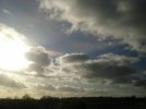
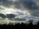
These glowing polar stratospheric clouds were spotted floating over the UK on January 29, 2016.

There are probably more articles on sott that need a different search term to pull them up and undoubtedly many that we missed from the larger media.

Notice the "pat answers" that are formulated and included, more or less, in each of the reports. And the early attribution to "global warming."

Yeah, I think a sudden, brutal inversion is possible, it just ain't gonna be a hot stratosphere... just the opposite.
 
A friend who knows i have an interest in odd weather sent me the pictures attached today. I believe they're the Nacreous clouds being discussed, she described them as rainbow clouds.

Having followed recent weather i'm fairly certain they've been spotted in the UK a few times recently - Scotland and Wales i believe - and subsequently posted on social media.

Today we are at the tail end of Storm Henry. It's not particularly cold at ground level 8/9 - 13C but yesterday's winds were quite strong and gusty, which is why the below quotes were of interest. The photos aren't amazingly clear but come from a reliable friend were taken in Birmingham - which is like in the middle of the UK, 'the midlands'.

So the location is drifting further south but the conditions required seem to correlate. Also the fluctuating temperatures seem to point to the polar vortex meandering.

Nacreous clouds are located in the stratosphere some 9 to 16 miles high. Their iridescent "mother of pearl" colors come from sunlight striking tiny ice crystals inside the clouds.

Very low temperatures near -85o C are required to form the crystals, which is why nacreous clouds are seen mainly during winter over places like Alaska, Iceland and Scandinavia.

Clouds do not usually form in the stratosphere because of the dry conditions Pitts said such stratospheric ice clouds are rare because they only form when the jet stream in the Arctic is properly aligned with the edge of the polar vortex, a large air pressure system over the poles.

"They like stormy weather that perhaps creates gravity waves to loft the necessary moisture to make them upwards across the tropopause into the stratosphere.

form in the stratosphere far above the usual realm of weather.

Take an unusually cold lower stratosphere (15-25km high), use some gravity waves generated by high winds and storms in the troposphere to stir in some water vapour, and -- voilà!

AddeD: just had chance to thoroughly check the links and yes it seems that the UK has had some rather beautiful clouds on show after storm Henry.
 

Attachments

  • Nacreous clouds Birmingham post Storm Henry 02.03.16 1 .jpg
    Nacreous clouds Birmingham post Storm Henry 02.03.16 1 .jpg
    137.9 KB · Views: 379
  • Nacreous clouds Birmingham post Storm Henry 02.03.16 2.jpg
    Nacreous clouds Birmingham post Storm Henry 02.03.16 2.jpg
    165.6 KB · Views: 371
Laura said:
Yeah, I think a sudden, brutal inversion is possible, it just ain't gonna be a hot stratosphere... just the opposite.

I'm agree with you Laura. I just presented this theory because she could give a good explanation of the "abnormal" reheating of the troposphere between the 80s/2000. Professor Lu takes into account only the role of CFCs and think that everything will return to normality over the time. But we are clearly not in a "normal" period.
If the CFCs have a real importance, I wonder if their dispersion could be an "artificial tampering by 3rd and 4th density STS forces" to mask the decline and misinform the pupblic with the global warming. But, in the end, it only worsens things. And you know, it wouldn't surprise me in accord with their desctructive essence.

It's interresting that you and itellsya mentionned "gravity waves". The Jet-stream and the polar vortex are connected (he surrounds and bounds the vortex). When the speed of the Jet-stream decrease, the Rossby wawes become more importante, more developed. When they are rather powerful, they can project a powerful blast of warm air who reach the stratosphere. It can perturbed or even make blow up the stratospheric vortex (in winter) by decreasing the temperature gradient. The winds of high heights are completely disrupted and it echoes on the troposhérique polar vortex which will behaves in a chaotic way, reaching lower latitudes and engendered severe meteorological events. This 2 events seems to be connected and was observed these last winters of unusual cold and snowfalls.

We could supposed that the appearence of stratospheric clouds in lower latitudes is the result of the stratospheric cooling connected with the wandering of the jet stream and his effect on the polar vortex.
 
Mexico Coldest in History & 50K Cows Freeze to Death | Mini Ice Age 2015-2035 (130)
Published on Feb 13, 2016
Mexico experienced its coldest temperatures ever recorded during the first week of January 2016. At the same time 35-50,000 cows froze to death in southern Texas

https://youtu.be/8DbjDV-IhIA

Dangerous Ride Along!
Published on Feb 12, 2016
Long distance trucking is grueling in itself; add winter weather and it can be unbearable. Dave Malkoff gets to ride along from California's port of Oakland to Nevada on one of the most treacherous highways in the U.S., I-80E through Donner's Pass.
https://youtu.be/rDdD62RBVSA

Valentine's Day Weekend Arctic Outbreak Brings Subzero Cold to Northeast, Midwest Video
Published: Feb 13 2016 07:00 AM EST
https://weather.com/storms/winter/news/cold-outbreak-valentines-northeast-midwest-south-feb2016
map_specnewsdct-57_ltst_4namus_enus_650x366.jpg


map_specnewsdct-16_ltst_4namus_enus_650x366.jpg


Hang in there, Northeast and Midwest. Next weekend should be warmer.
pic.twitter.com/QJERmzM703
1:23 PM - 13 Feb 2016
Video
https://pbs.twimg.com/tweet_video/CbGCIcCWwAACDRr.mp4

Jonathan Erdman Verified account 7:50 AM - 13 Feb 2016
‏@wxjerdman
#Flagstaff, AZ set a daily record high of 64˚ Friday w/ 6" #snow still on the ground. Fast AZ melt since 2/2. #azwx
Video
https://twitter.com/wxjerdman/status/698534760885456897
 
New England States are reporting near record lows for the Valentine weekend with the artic wind chill.

Also, a report of a freak accident Friday Morning on the Boston Expressway. A 200 pound manhole cover flew into the air and hit the drivers side front windshield, then exited to the back of the car. A 35 year old School Teacher was instantly killed.


Massachusetts Weather Forecast: Near-Record Cold Could Freeze Valentine's Plans
http://patch.com/massachusetts/boston/massachusetts-weather-forecast-cold-could-freeze-valentines-plans-0

Arctic air is heading toward Massachusetts, dropping temperatures to near-record lows and turning the Hub into an icebox for Valentine’s Day weekend.

The deep freeze starts Saturday, with an early snow shower possible and temperatures in the teens. Wind chills late Saturday night could reach as low as -20 in some areas.

Sunday morning’s temperatures could get as low as -1 in Boston and -7 in Worcester, just a few ticks off all-time lows. Factor in the wind chill and it will feel closer to -21 in Boston and -26 in Worcester. The Cape will see wind chill lows from about -10 to -15.

Boston temperatures have only dipped below zero nine times this century, according to The Weather Channel. Three of those came last winter.


Boston - Answers sought in manhole cover fatality on Expressway
https://www.bostonglobe.com/2016/02/12/woman-struck-flying-manhole-cover-inside-neill-tunnel-suffers-fatal-injuries/Okpvg6Jx6VF86xsYrA2ZRN/story.html

Friday Feb. 12, 2016 - A manhole cover at the edge of the Thomas P. O’Neill Jr. Tunnel came loose and flew into the air during the Friday morning commute, smashing through a car’s front windshield and killing the driver, an art teacher who was headed to her job at a Milton elementary school.

Caitlin Clavette, 35, was driving south on the Southeast Expressway in Boston just before 8 a.m. when the manhole cover, which weighed more than 200 pounds, crashed into her black Honda HR-V, traveled through the vehicle, and exited the rear of the car.

The stunning fatality raised unsettling questions about motorists’ safety and prompted the state to immediately inspect 500 covers for manholes, drainage systems, and electrical panels on area highways. The accident occurred on a stretch of highway traveled by some 100,000 drivers a day.

Crews clearing the crash appeared visibly upset, said Cathi Porreca-Leonard, who passed the accident scene Friday morning.

“They were consoling each other,” she said. “It could have been anybody.”

State officials were unable to explain what may have caused the cover to come loose from the street level framework where it normally would have rested, and were investigating how it happened. They would not say whether the emergency inspections had uncovered other problems.

“Our sympathy goes out to the family of the victim involved in this horrific incident this morning,” said Thomas Tinlin, the state’s highway administrator. “This tragedy is leading us to take several steps immediately out of an abundance of caution.”

The State Police, who are investigating, did not identify the driver who was struck. But in a letter to parents Friday afternoon, Milton Public Schools officials said Clavette’s death was “a tremendous loss.”

“She was a talented and valued member of our faculty,” wrote the principal of Glover Elementary School, Sheila Kukstis, in a message to the school community. “Our thoughts and prayers are with her family and friends.”

Clavette graduated from Winchester High School and received her bachelor’s degree in art from the College of William and Mary in Virginia, according to Milton school officials. She held a master’s degree from the School of the Museum of Fine Arts in Boston.
 
North in Canada: http://www.cbc.ca/news/canada/extreme-cold-1.3447240

Bitter cold is gripping parts of Central and Eastern Canada as temperatures dipped to -45 C with the wind chill in some areas....Environment Canada issued cold or winter storm warnings on Saturday for provinces from Manitoba to Newfoundland and Labrador.

So that is a good half or better of the country.

In Pennsylvania: http://www.cbc.ca/news/world/pennsylvania-50-car-pileup-1.3447442

Pennsylvania pileup kills 3, involves over 50 vehicles
Collisions send more than 40 to hospitals, appear related to snow squalls
{video included}
 
Well this morning the temperature is -17 degrees fahrenheit and the wind is blowing, so I cannot even imagine how cold it will feel outside today. Fortunately, it has been a mild (very mild) winter for us here in northern Massachusetts. Not much snow and a few days of bitter cold. And it's mid-February!!! On Tuesday, the weather forecast is for 50 degrees F. I can only imagine what these extremes of temperature are doing to the land.
 
Echo Blue said:
Well this morning the temperature is -17 degrees fahrenheit and the wind is blowing, so I cannot even imagine how cold it will feel outside today. Fortunately, it has been a mild (very mild) winter for us here in northern Massachusetts. Not much snow and a few days of bitter cold. And it's mid-February!!! On Tuesday, the weather forecast is for 50 degrees F. I can only imagine what these extremes of temperature are doing to the land.

Here is a you tuber that challenged his psyche with camping in -30 degree whether in Canada.

What he learned with the experience of life's little pleasures. Thus revealing a positive influences that can be had at these extremes. It is just his opinion.

May give it a try myself when the snows and temperatures start to drop here. Probably in the low single digits not even close to his temps.

-32° EXTREME COLD Overnight Bug Out Challenge!
Published on Jan 20, 2016
-43 windchill with a minimalist shelter was a rough night! The goal was to see what it would be like if I had to bug out for a night in these extremely cold temperatures. I am NOT a survival expert! I didn't use my sleeping bag much I was testing out the Fortress Gear Aeris clothing system that claims to be the warmest clothing money can buy, more on that in a future video!

https://youtu.be/uG7v7xUmPdE


Psychology of Survival: Pleasure and Pain
Published on Jan 29, 2016
A brief rant about the little pleasures of bugging out!
_https://www.youtube.com/watch?v=fncLwWyHPm0
 
Cold records tumble on both sides of the Atlantic as the polar vortex blasts the Northeast of the US with coldest air in a decade
http://www.thebigwobble.org/2016/02/cold-records-tumble-on-both-sides-of.html

Records tumbled along the Northeast coast of the US at the weekend with New York with temperatures as low as -1 F (-18 C) on Sunday recording the lowest Valentine day temperature ever.

From New York and Boston to Providence, Rhode Island, and Hartford, Connecticut, temperatures on Sunday morning dipped to as low as minus 40 -(minus 40 C) on Mount Washington in New Hampshire.

Boston reached minus 9 (minus 23C), breaking the record set in 1934 by 6 degrees.

It reached minus 16 (-27C) in Worcester, Massachusetts, breaking the 1979 record of 11 below zero. Providence hit minus 9 and Hartford minus 12, also breaking records from 1979.

In Montpelier, Vermont, the overnight temperature hit minus 19, tying a record set in 2003. And South Lincoln, Vermont, recorded 27 (-33 C) below zero reports AP.

While New York City had its coldest start to Valentine’s Day in 100 years on Sunday, it would seem balmy compared with the wicked wind chill at upstate Whiteface Mountain.

As temperatures dropped across the Northeast from the blast of a polar vortex, the wind chill at Whiteface, near Lake Placid, made it feel like a body- and mind-numbing minus 114 degrees (minus 81 C) late Saturday and into Sunday reports Daily News.

The Arctic winds howled through the summit at about 45 mph, freezing almost everything in their path.

The mountain’s summit was actually colder than Antarctica on Sunday, according to the National Weather Service.

Descending on Britain: The Arctic-driven cold snap (pictured from space) has tightened its grip on Britain and sent temperatures plunging

In the UK much of the country will be blanketed in snow today following temperatures as low as minus 14C (7F) over the weekend.
And sub-zero conditions will continue in the next few days, bringing wintry storms to much of the UK.

The coldest temperature for four years was recorded on Valentine's Day yesterday as the mercury plunged to minus 14.1C in the Scottish Highlands.

And the cold will continue with wintry showers, widespread frost and ice expected across much of the country over the next few days reports The Daily Mail.


Upstate New York mountain reaches minus 114 wind chill at its summit
http://www.nydailynews.com/news/national/upstate-ny-mountain-hits-110-degrees-wind-chill-summit-article-1.2531580?cid=msn

While New York City had its coldest start to Valentine’s Day in 100 years on Sunday, it would seem balmy compared with the wicked wind chill at upstate Whiteface Mountain.

As temperatures dropped across the Northeast from the blast of a polar vortex, the wind chill at Whiteface, near Lake Placid, made it feel like a body- and mind-numbing minus 114 degrees late Saturday and into Sunday. Central Park could only muster a minus 1 degree.

The Wild Center, which works with the Atmospheric Science Research Center at SUNY Albany, recorded the frigid temperature from a research station at the mountain’s summit.

“The extreme temperatures (Saturday) night on Whiteface have to do with its elevation, 4,865 feet and the wind speed,” Tracey Legat, the center’s communications manager at the center told the Daily News. “The mountains of the Adirondacks are often some of the coldest places in the lower 48 states during the year.”

The Arctic winds howled through the summit at about 45 mph, freezing almost everything in their path.

The center managed to capture a photo of a tree being turned into a popsicle as the winds formed “monstrous rime ice” around it.

The mountain’s summit was actually colder than Antarctica on Sunday, according to the National Weather Service.
 
Extreme cold freezes 60 percent of lake Erie, most of Niagara Falls
https://www.youtube.com/watch?v=6PFwTXeqIb4

Published on Feb 15, 2016

The weekend's extreme cold has dramatically surged the ice cover over the Great Lakes. This video was shot in the afternoon of 15 Feb 2016 showing the ice-cover and frozen mist over Niagara Falls. Great lakes ice:
 
angelburst29 said:
Extreme cold freezes 60 percent of lake Erie, most of Niagara Falls
https://www.youtube.com/watch?v=6PFwTXeqIb4

Published on Feb 15, 2016

The weekend's extreme cold has dramatically surged the ice cover over the Great Lakes. This video was shot in the afternoon of 15 Feb 2016 showing the ice-cover and frozen mist over Niagara Falls. Great lakes ice:

Holly Day after Tomorrow...........-_https://www.youtube.com/watch?v=YBn1Tl5TgPs

https://www.youtube.com/watch?v=MjMmDsycHC0
Ice Formation over Lake Erie Amid the Polar Vortex #ArcticBlast
Published on Feb 16, 2016
Dramatic video of ice formation over Lake Erie (Niagara region) over the past weekend. The footage was taken on 14 Feb 2016, north of Buffalo (south of Horseshoe Falls).


https://youtu.be/5BsX2je1yP8
 
Back
Top Bottom