Uli
The Force is Strong With This One
General questions: what happens when your supplies run out? Do you share them when someone comes in need? Do you stop seeing people when you start spending the supply? Have you already stopped meeting people in anticipation of the big shift?Well, it seems that we all have made choices to create our current life situation. But I think we still have some time (though not much) to really take stock of our options, make good choices, and crank it up a notch!
Dandelion is a good one to have on hand. Aside from being a general feel-good tonic, apparently she's also a natural ally against spike proteins!

RESEARCH: Dandelion leaf extract blocks spike proteins from binding to the ACE2 cell surface receptor – NaturalNews.com
The engineered spike proteins from SARS-CoV-2 can be STOPPED by a common “weed” that is exterminated from lawns every year. A German university study found that the common dandelion (Taraxacum officinale) can block spike proteins from binding to the ACE2 cell surface receptors in human lung and...www.naturalnews.com
I was thinking about the meat calculation. For canners, it would be easy enough for one person to determine how many quart jars of meat they'd need for a year. The quart-jar measurement is easier for me to grok than pounds or calories.
Let's say you eat one quart of meat per day (that's a lot!). You'd need 365 jars of meat. I'd say for me it's more like 1/3 quart per day, putting me at 121 jars of meat for one year. So 365 jars would be enough for three years. This can also be padded with non-BPA cans of tuna, sardines, etc. Though those are already kind of pricey in Canada at $5 a can.
With the mylar packaging you mentioned, once it is open, you can also get desiccant salt packs and pop one in to preserve the longevity of the food. There are three main elements that cause spoilage - moisture, warmth and oxygen. That's the trifecta of bad food, so keeping that in mind, it's possible to mitigate some kinda disaster by keeping things cool, dry, and as air-tight as possible.
When buying big bags of grain, it often comes in paper bags. It's better to store things in plastic bags, more airtight. One easy option is to put the whole package of rice or whatever in a garbage bag, tie it tight or duct tape it, and throw in some desiccant salt packs to keep the ambient moisture at bay.
And I also remember that this is big a lesson in 'learning-is-fun'. This helps me frame all the madness as I've been stretching my budget (and mind) to get all the necessary things while supplies last. Kinda like getting ready to go camping... except with zombies and psychos and comets. Oh my!
Thank you


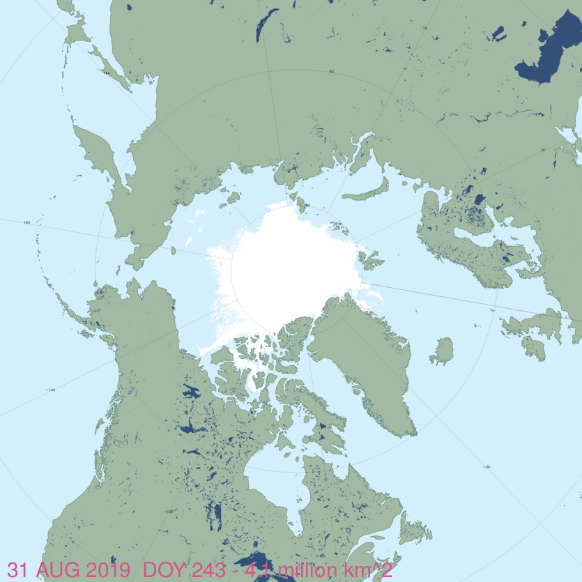
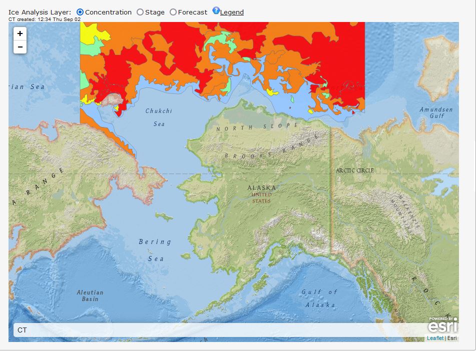
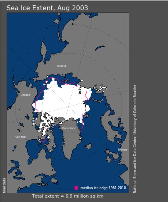
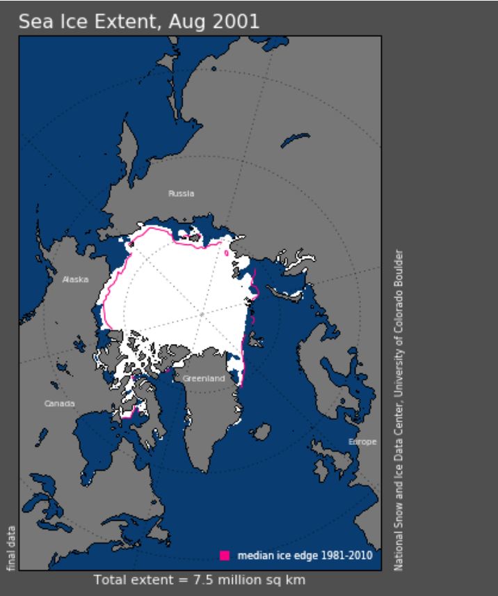
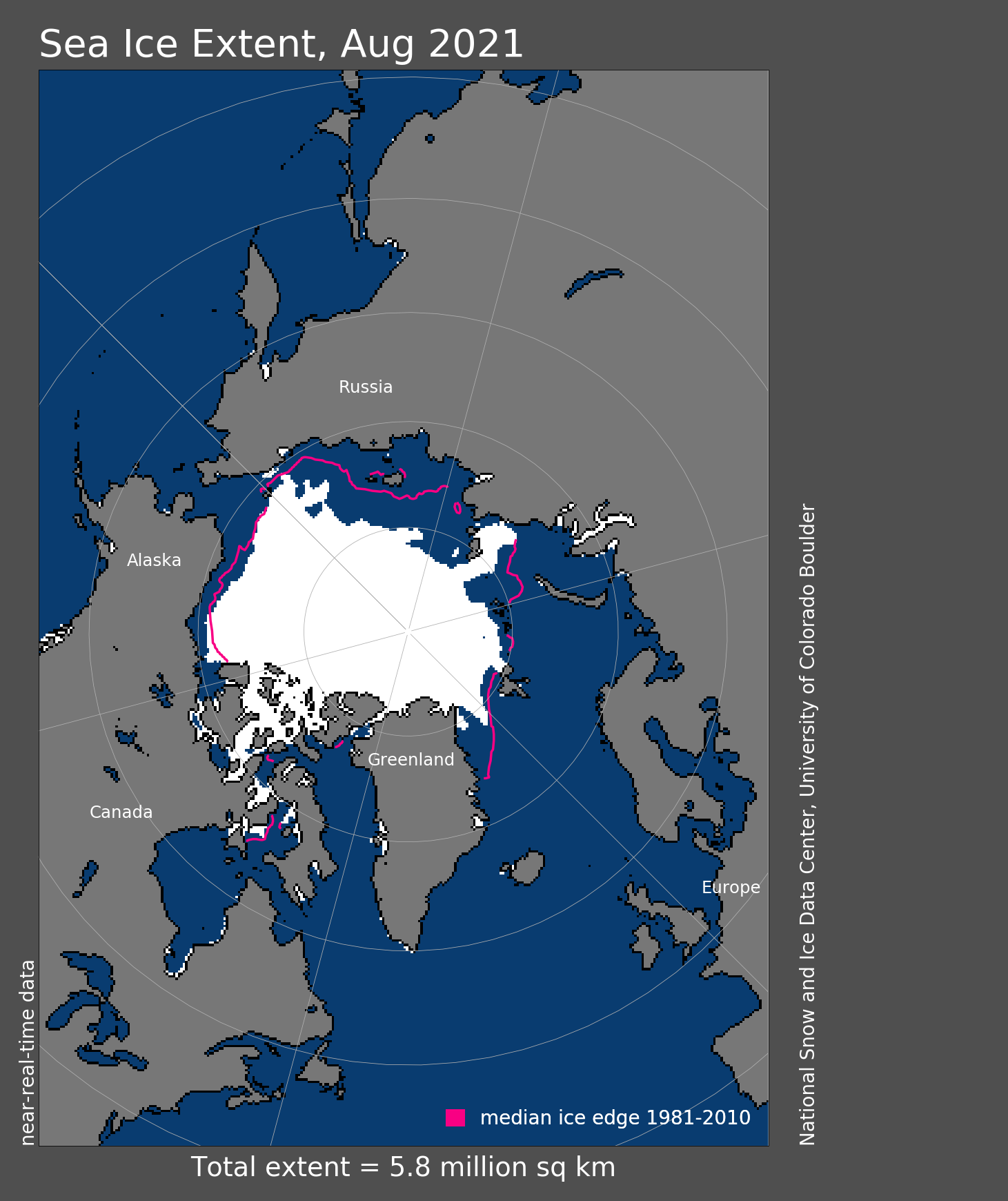
 chilled with genuine gletcher
  . Looking back, there were indeed several occasions when the percentage of the surface melting was high, as one can see from this illustration from

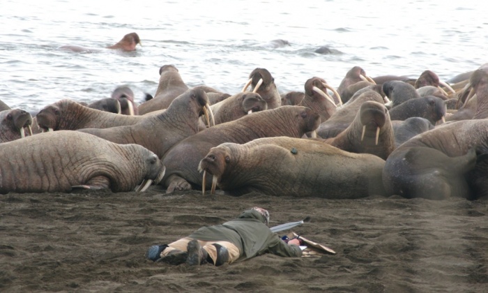
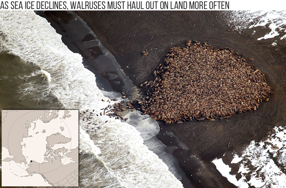
 where you can learn more about the unique opportunities available for fully vaccinated and PCR screened individuals who have been able to purchase expensive tickets for one of the limited departures heading into the only country in the northern hemisphere still largely existing in conditions similar to an ice age.