Volcanoes Erupting All Over

It's all gone a bit quiet here in Reykjavík, since Friday, at least on the geological front, only very few small earthquakes. That could be a precursor to something big.
I hear that many people living in Grindavík don't want to return there ever again. 50 years ago, an eruption in Heimaey, the biggest and only settled island of Vestmannaeyjar, forced an emergency evacution, which succeeded without casulties, thanks to the good fortune that every fishing boat was in the harbour. The people of Grindavík helped at that time, and now it's their turn to accept the help of other Icelanders.
 
Grindavík, Iceland
13 Nov 2023

The situation appears to be unchanged, and like @omara wrote, the earthquake rate has gone down a bit. Like the video above already showed, more cracks have appeared in the town of Grindavík


November 13, 2023 12:23 p.m

7CB99239F1033E794CB2CD0C2B792F37ED85DB3195E694EED5D1B2867E71272F_713x0.jpg
Geophysicist Benedikt G. Ófeigsson says the situation has not changed with Þorbjörn.

THERE ARE NO CLEAR SIGNS OF AN ERUPTION.

There are little changes in the situation in Grindavík, although the larger earthquakes of the last few days have significantly decreased. A geophysicist says the probability of an eruption is similar to before.

The Met Office had a meeting with civil defense this morning, after that meeting experts at the Met Office sat in on a longer meeting where data was scrutinized and ended just before the news broke.

Benedikt Ófeigsson is a geophysicist at the Icelandic Meteorological Agency.

"We generally reviewed the situation, reviewed the data that is coming in, seismic data, GPS data and other data that we have yet to process better. The status assessment is almost unchanged activity since yesterday. It has changed little and the risk assessment for the entire area is very similar to yesterday."

Larger earthquakes have decreased significantly in the last 24 hours.

"It seems that this massive event that happened on Friday, this melting event and the magma flow has released almost all the tension in the area and it's completely collapsed, the seismic activity. So now we can closely monitor the micro-seismic activity in the insert and we are doing so. One of the things we see there is that the seismic activity is stable and does not deepen."

What is the status of the magma?


"We're not seeing any signs of it moving up, not yet." A new picture arrived this morning that we are looking at. The first thing we see when we look at it, our first assessment is that we don't see any clear signs of shallowing, but that cannot be judged by looking, we are waiting for models. If they show a lot of shallowing, we will report it."

He says that one must be careful in assessing changes in the probability of an eruption.

"The general assessment remains unchanged and similar probability. They may be slightly changing downwards if anything, it may be in places like out in the sea, but we just can't assess it yet how likely it is now. We haven't seen whether the magma is sinking or not."

END OF ARTICLE
 
Grindavík, Iceland
13 Nov 2023

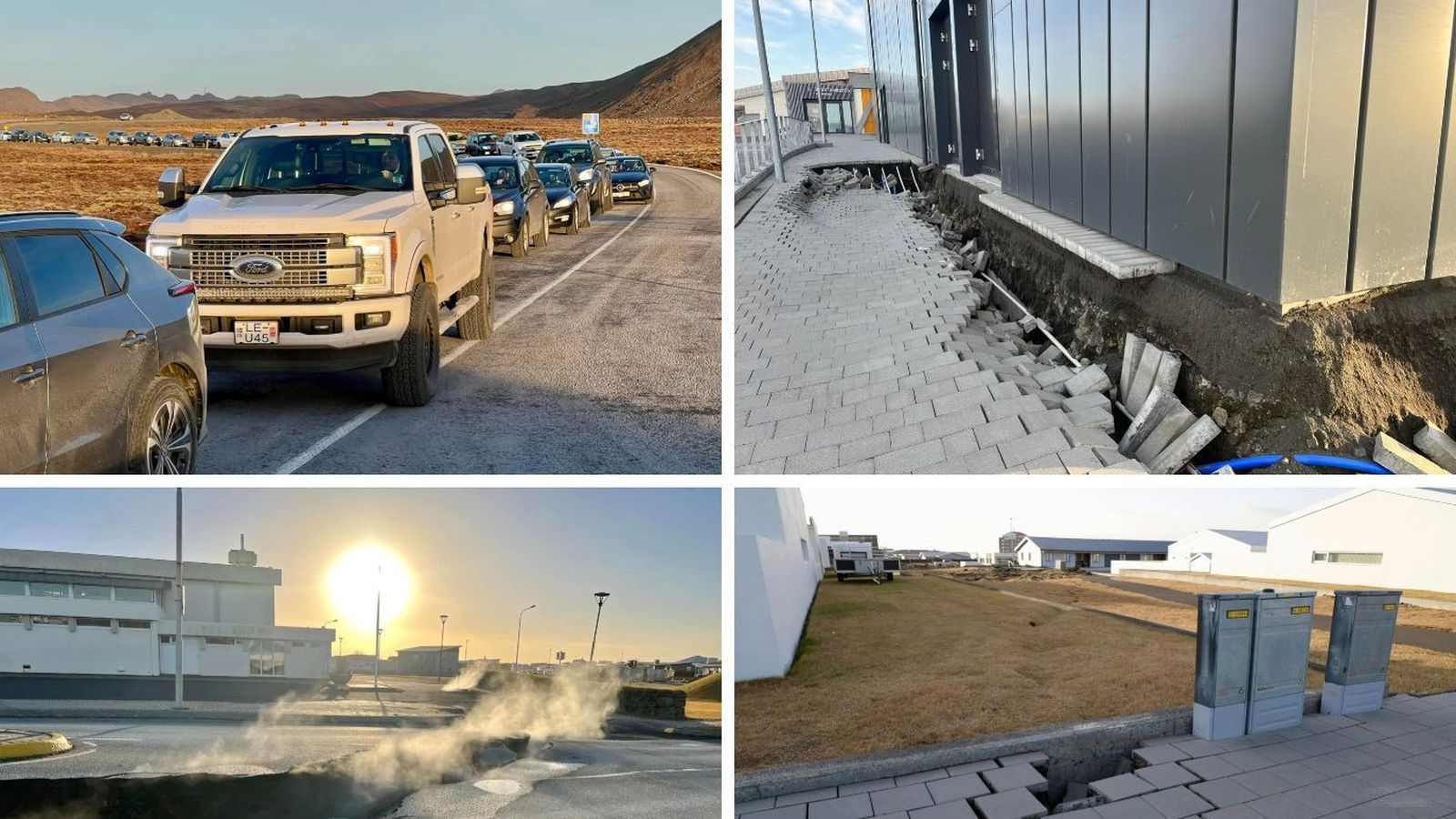
Here are some photos of the damages noticed from 13 Nov 2023 (today) in Grindavík, Iceland:
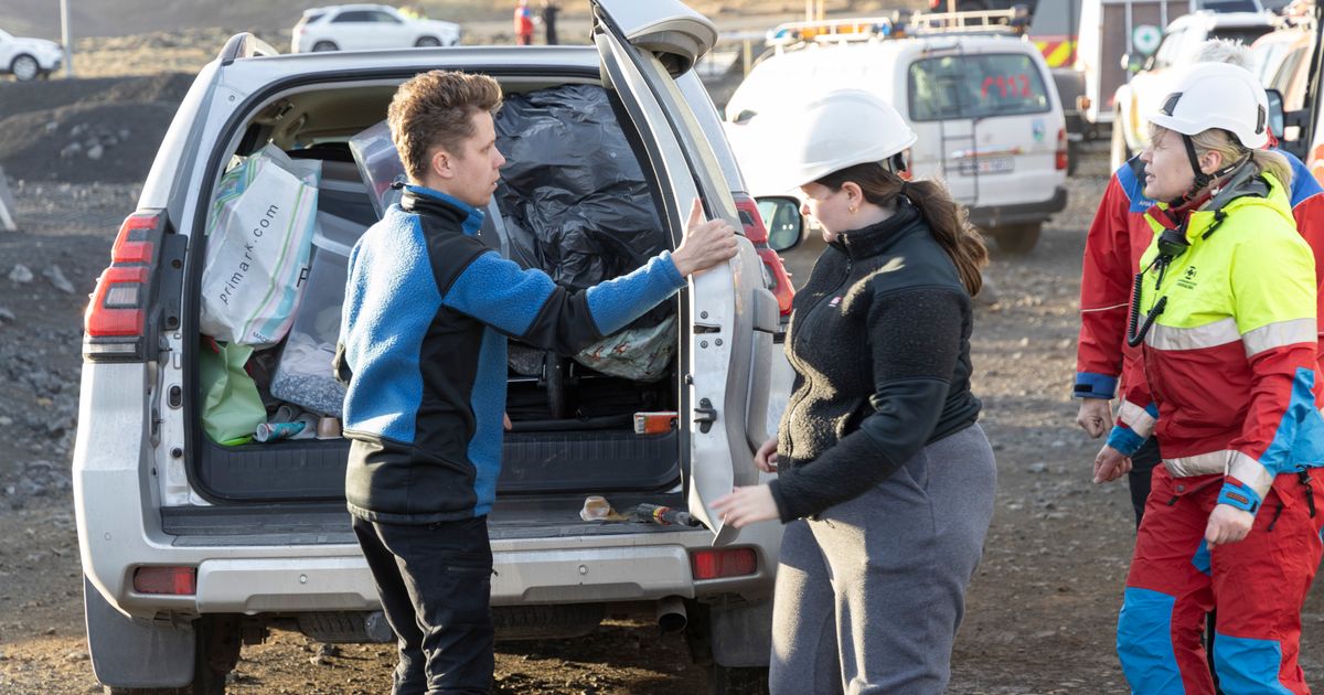

5E6F73D758F6C6A11319F1E5291C088B1C7004788825557229A86D6AFADE9555.jpg


November 13, 2023 2:16 p.m

Grindvíkings /
[Grindavík people] have been allowed into the town this morning and today to collect their belongings. Vilhelm Gunnarsson, Vísis' photographer, also went to Grindavík.

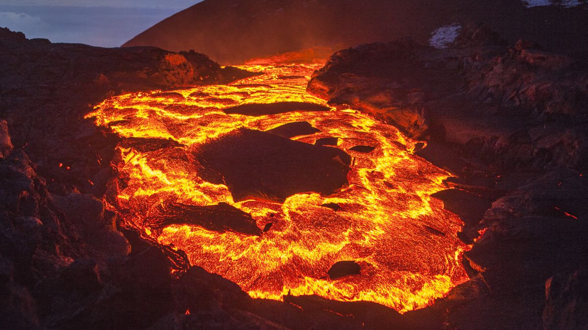
Sigdalur has formed in Grindavík and has caused considerable damage in the town. Melting seems to have taken apart heating pipes and created large trenches on lots and under streets and even houses. Earthquake activity has been lower today than it was at the weekend. Below you can see photos that Vegagerðin published this morning.

Vilhelm Gunnarsson, Vísis' photographer, took the attached photos in and around Grindavík this morning and today.

Article 2


There has been a lot of damage to the gymnasium in Grindavík. There, large cracks have opened and the ground has subsided considerably. Rescuers examined the situation in the area today.

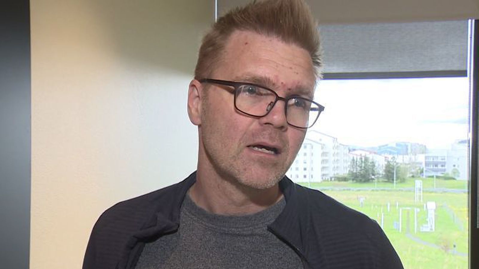
"This is the worst thing we have seen today," says Guðmundur Óli Gunnarsson from the Hjálparsveit scouts in Garðabær.
You can see a video of the area and an interview with Guðmund below.


7652241763C811D9646A973EAF147672838F43CED9A0527B1A90406AFDE5FC35_713x0.jpg
Guðmundur Óli Gunnarsson is one of the rescuers who went through the area today.

He says that it seems that there is still movement in the area. "I understand from those who have been here recently that there are still movements in this."

A sickle [?] valley has also formed by the sports hall. Guðmundur believes that the ground has sunk there by one to two meters. "Whereas before there was only a flat plane, flat surfaces, there are only slopes in this.

He also believes that it is not safe for people to be in the area and that it is important that those who go to get things from their houses stay there for as short a time as possible.


08cbda80a4d5fdce5e414f6603c8552686843d118e862a26e4646d2278d22f8d_713x0-jpg.85502


79904B83E076E093FA4D25720BA9F78984CDADFE37F86536FE810AA3FE550625_713x0.jpg

BAEAC9174363BEC335DBCEB7080954D1EA372DB2EE4DDA6C4BBF3973C2FB8F55_713x0.jpg

A6B2E91F1F8B13CA265349784089E6F515EC478A60423F2F1D6DDF28200E4463_713x0.jpg

CAC33316B0916107E38EA80E06C57BFDAAEAE1E6A28189E39B077AC3F5BB6517_713x0.jpg

B577D3F8140840901CAF16E2B835DA6F07E06E030E510FA0019DA84038EC9785_713x0.jpg

D51CA57B143E006F9E01A3DE5A8E0F64F0618E749D26DB98EBDFFA26B1DD2445_713x0.jpg

CD27877BBBFBDA86609812672F5CBE77ED473079F442EE1CAB067DC0BDD5B4A7_713x0.jpg

312898A15E682ED3D4987215FAE2E725F851E52D4981DED71EEB8951B33B030D_713x0.jpg

85ED20151157D571F10CB83553BE14D5E9F8E663F7668942DAFCB3BDFDDAD608_713x0.jpg


08CBDA80A4D5FDCE5E414F6603C8552686843D118E862A26E4646D2278D22F8D_713x0.jpg

Edit: (Additions)

Police allow ALL Grindavík residents to enter town​

Úlfar Lúðvíksson, police chief in Suðurnes, has decided to let all residents of Grindavík into the town. This follows only residents in some areas being allowed into designated areas to collect necessities and save valuables.

An announcement from the police says that a maximum of two people can be in each car and people are asked to take as little time as possible for the job. People will only be allowed into the town during daylight hours.

It is noted that cones have been placed where there is damage to roads in the town.

People are also asked to listen for sound signals that responders may make and to respect their messages.

  • The area of Grindavik that residents can enter has been expanded.
  • The situation in Grindavík remains unchanged. There is still a high probability of an eruption. It is not certain when and where it may happen.
  • The Met Office will soon publish a new assessment of the situation.
  • Residents can go, assisted by rescue teams, to city districts identified by the Suðurnes Police.
  • There are hopes that it will be possible to allow people into all homes in Grindavík.

Could either erupt - or stabilise​

The Met Office risk assessment is unchanged and the situation is almost unchanged from yesterday, says Freysteinn Sigmundsson, a researcher at the University of Iceland.

"The situation is comparable to yesterday. The earthquakes continue, but the crustal movements are still slowing down, which is good. There remains evidence of magma inflow into this intrusion. That's why everything [possible] has to be done.

"The Met Office risk assessment remains unchanged. Although visible signals have reduced, the probability of an eruption has not changed at all."

Freysteinn says that when movements subside, it can lead to a balance being reached without an eruption.

"The magma influx has greatly decreased from what it was at the beginning and has become much slower. If magma comes to the surface, it would probably be more in line with what happened in the last eruption at Fagradalsfjall than something much bigger [forceful] than has been discussed."

The outlook is brighter than it was a weekend ago when it looked like the eruption could be much more powerful than the latest information suggests.

"There has been no noticeable change in the depth of the earthquake."
 
Last edited:
Etna, Sicily - South Italy
12 Nov 2023

That was a weird Paroxysm yesterday evening... as if it never really culminated ? Well, the tremor did fall rapidly a couple hours before before midnight after all (at the same time the tremor site wasn't accessible). Lots of clouds obscured the mountain made it less favorable to watch the eruption live in videos after dusk finally had settled.

0.jpg

Here are a few images people have taken from the event:

402155315_6815124825268425_4526343772014674720_n.jpg 401100259_6815125155268392_4322075472596706842_n.jpg
400778812_1993448157702814_982214691536345746_n.jpg400783388_1993448304369466_8596969590656199484_n.jpg
400775161_1993448024369494_6594215474478931757_n.jpg401388285_1993448284369468_7277274918852070118_n.jpg
401537861_6935878996471215_2375308672403836480_n.jpg


One night earlier
(11 Nov 2023)

this fascinating photo was taken. Incredible !

401768355_327508566644394_6991768835612242207_n.jpg


evening of 30 Sep 2023

30-Sep-2023.jpg
 
Grindavík, Iceland
13 Nov 2023 • 16:45 local icelandic time


_-2023-11-13-at-18.46.08.jpg

Gregory de Pascale

Video (in english) • 1 min 36 sec

Grindavík damage reminiscent of Christchurch

Gregory de Pascale, expert in crustal movements at the University of Iceland, says that the movements and damage in Grindavík are similar to the earthquakes in Christchurch, New Zealand in 2011.

RÚV´s Sigríður Hagalín Björnsdóttir spoke to Gregory in Grindavík.

The 2011 New Zealand earthquake killed 185 people in Christchurch. Buildings collapsed and roads were destroyed in several places. Cracks have formed in Grindavík from west to east. Some sections rise and others descend, forming a sort of step through the town.


Here is a map

showing how the west side of Grindavík has subsided up to 1.4 meters at the most, while over the eastern shore the grounds have risen slightly up to 50 cm

grindavik.jpg
 
Interesting
An old map of Grindavík from 1957 on the map.is website shows an old crack or sickle that goes through the whole town.
We compared this to a drone video that Ragnar Visage took today of the same area. The damage on Austurveð is on top of the old crack.
--
The Volcanology and Natural Hazards Research Unit at the University of Iceland believes that this sinkhole was formed in the Sundhnúka eruption more than 2,000 years ago. Current activity has probably reactivated these faults and widened/deepened the valley.
 

North Maluku's Mount Dukono Eruption, Residents Asked To Stay 2 Km From The Top​

Mount Dukono spewed volcanic ash as high as 1.2 kilometers. The mountain north of Halmahera Island, North Maluku (Malut) erupted at 12.01 WIT, Thursday 16 November. "The ash column was observed to be white, gray to black with thick intensity to the east," said Mount Dukono Observation Post Officer Bambang Sugiono in his statement, Thursday, November 16, confiscated by Antara. PVMBG appealed to people around Mount Dukono not to move, climb, and approach the Maupang Warirang Crater, within a two-kilometer radius. In addition, PVMBG also appealed to the public to always provide mouth and nose protection masks to avoid volcanic ash in the respiratory system, because eruptions with volcanic ash periodically occurred and the ash spread followed the direction and wind speed that made the area covered in ash.​


Four huge deposits from supervolcano eruptions over the last 40,000 years have been discovered at the bottom of the Mediterranean Sea.

Huge "megabeds" from ancient supervolcano eruptions are hiding at the bottom of the Mediterranean Sea, researchers have found. Their discovery points to a cycle of catastrophic events that appear to hit the region every 10,000 to 15,000 years.
Megabeds are huge submarine deposits that form in marine basins as a result of catastrophic events like volcanic eruptions....

...The oldest layer was around 40,000 years old, the next oldest was 32,000 years, the third 18,000 years, while the youngest formed about 8,000 years ago...

...The eruptions occurred roughly every 10,000 to 15,000 years. However, they are refining the eruption dates to get a more precise picture of the cycle and potential risk for the future. "It's not as constrained as we would like it to be," Sawyer said.
The findings, Sawyer said, will help researchers understand the risk posed by volcanoes in the region. "That whole field is still active, there's still a lot of concern about the future of that, so it's certainly potentially possible that it could happen again," he said.
 

Sunday Morning, Mount Dukono North Maluku Erupted And Sprayed 2.6 KM Abu Volcanic​


JAKARTA - The Center for Volcanology and Geological Hazard Mitigation (PVMBG) recorded an eruption in the form of volcanic ash bursts as high as 2, Kilometers out of the crater of Mount Dukono in North Maluku. Mount Dukono Observation Post officer Bambang Sugiono in a report quoted by ANTARA, Sunday 19 November, said the eruption occurred at 07.24 WIT

The Dukono Mountain which has a height of 1,335 meters is currently at Level II or Alert status. The closest settlement is at a distance of 11 kilometers from the peak of the volcano. On November 18, 2023 PVMBG recorded white and gray main crater smoke with a thick intensity as high as 200 to 3,000 meters from the volcanic peak


A massive eruption of Ulawun volcano in West New Britain, Papua New Guinea 🇵🇬 (20.11.2023)

The volcanic ashes reached 15,000 meters in the stratosphere.

Source: Sky Alert

Papua New Guinea volcano erupts and Japan says it's assessing a possible tsunami risk to its islands​


A volcano in Papua New Guinea erupted on Monday, and the Japan Meteorological Agency said it was assessing a possible risk of a tsunami for Japanese coasts.

Mount Ulawun on the island of New Britain in Papua New Guinea erupted at around 3:30 p.m. (0630 GMT) Monday, spewing volcanic smoke as high as 15,000 meters (50,000 feet), the agency said, quoting the Volcanic Ash Advisory Center in Darwin, Australia.

The agency said it was assessing a possible impact, including the risk of a tsunami approaching Japan later Monday. First tsunami waves could reach Izu and Ogasawara islands about three hours after the shaking caused by the eruption, JMA said.

The agency has not issued any tsunami advisory or warning. It said that no notable change to sea levels has been detected at observation sites in and outside Japan.

Papua New Guinea’s Geohazards Management Division said Ulawun's volcanic activity started Monday afternoon. The eruption is expected to continue indefinitely, it said, and raised the volcano's risk level to the highest stage of four.

 
New video of Mount Ulawun eruption


● Iceland

Extensive construction work is underway around Svartsengi to create robust defenses against potential lava flows in case of an eruption.

The project, initiated on November 14, focuses on establishing a swift and substantial defense line using powerful equipment, including the country's most potent bulldozer.

Two protective walls are planned: one extending 4km around the Svartsengi power plant and the Blue Lagoon, and another 1.5km-long defense closer to the Sundhnjúkagíga range, encompassing Hagafell and Sýlingarfell.

The primary objective is to impede or slow the initial impact of any potential lava flow.

Iceland to shield geothermal plant from risk of volcanic eruption​


Icelandic authorities are preparing to build defensive walls around a geothermal power plant in the southwestern part of the country that they hope will protect it from lava flows as a volcanic eruption is expected any day.

 
Back
Top Bottom