Volcanoes Erupting All Over

Ashfall Advisory For Ka'u Lingers Into Wednesday
May 16, 2018 at 12:37 am
(BIVN) The rarely-seen ashfall advisory, issued for the Kaʻū district by the National Weather Service in Ho
nolulu, continued into Wednesday, after the eruption of ash from the summit of Kilauea increased in intensity on Tuesday.
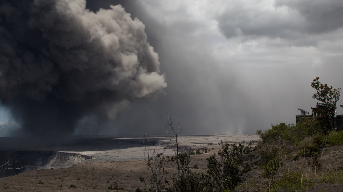
“Ash has been rising nearly continuously from the vent and drifting downwind to the southwest,” USGS Hawaiian Volcano Observatory wrote. “Ashfall and vog (volcanic air pollution) has been reported in Pahala, about 18 miles downwind. NWS radar and pilot reports indicate the top of the ash cloud is as high as 10,000 to 12,000 feet above sea level, but this may be expected to vary depending on the vigor of activity and wind conditions.”
2018-05-16-ashfall-FEATURE.jpg

One quarter of an inch is expected to be deposited in the advisory area
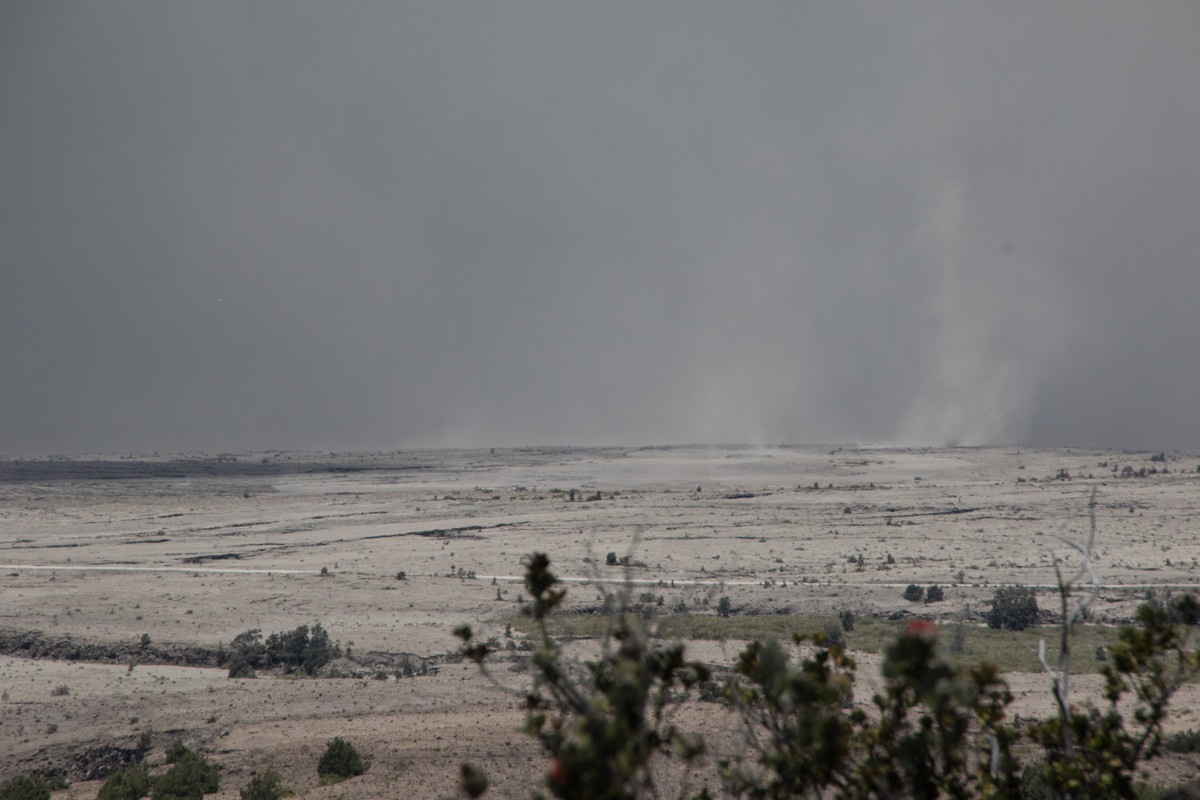
2018-05-16-ashfall-2.jpg

(USGS) At 1:38 p.m. HST. A telephoto photo from the Hawaiian Volcano Observatory looking toward the southwest shows gray ash blanketing the Kau Desert landscape

VIDEO: 7 pm Eruption Update - Heavy De-gassing Occurring
Published on May 16, 2018


VIDEO: Dual-Status Command Established For Eruption Response
STORY SUMMARY:
HILO, Hawaii - Brig. Gen. Kenneth Hara spoke to media at the Keaukaha Military Reserve on Wednesday afternoon, announcing the approval of the request for the Joint Task Force 50
Published on May 16, 2018


Image of the Week - Hawaii's Lava Flow
USGS Published on May 16, 2018
https://www.youtube.com/watch?v=E1MpMP98uuA

Flash back:

USGS Scientist Talks About Lava Lake in Halema‘uma‘u Crater
Published on Mar 26, 2018
https://www.youtube.com/watch?v=y0lNb4Hz7ac
Hawaiian Volcano Observatory research geologist Matt Patrick talks about the lava lake in the Halema‘uma‘u Crater at the Kīlauea Volcano (Hawaii). Dr. Patrick describes the eruption that created the lava lake and points out features of the lake including moving crustal plates, gas bursts, spatter and collapse scars on the crater rim.
Dr. Patrick also discusses hazards near the lake, such as explosions and volcanic gases. This is a recording of the USGS Volcanoes Facebook Live event held on March 19, 2018, on the 10th anniversary of the summit eruption.

Geologists: Kilauea is no Mount St. Helens


Large rocks tossed several hundred feet from Halemaumau Crater http://dlvr.it/QT5fR8
2:38 PM - 16 May 2018 [B]khon2 News[/B]

At summit, dozens of quakes and thick emissions an ominous sign as eruption feared
PAHALA, HAWAII (HawaiiNewsNow) -Thursday, May 17th 2018, 1:06 pm CEDT Video's Tweets, Pic's
At least 125 shallow quakes rattled Kilauea's summit and neighboring communities Wednesday, causing minor damage to roads and buildings amid growing concerns about a violent, steam-driven eruption at Halemaumau Crater.

The tremors come as ash emissions continue to pour from the crater.

Michelle Coombs, of the Hawaiian Volcano Observatory, said the situation remains "very, very active and very dynamic."

She added, "The potential for larger explosions is still there."

Geologists say the quakes are being caused by the ongoing deflation at the summit and as lava levels continue to decline. As of Wednesday afternoon, the floor of the Kilauea caldera has dropped about 3 feet.

The strongest quake in the area was a magnitude 4.4, and dozens more have been upwards of magnitude 3.

Because the tremors are shallow, they cause greater shaking — and increase the potential for damage.

Employees at the Hawaiian Volcano Observatory and nearby residents are reporting frequent shaking, and the quakes caused several large cracks on Highway 11 along with structural damage to buildings at Hawaii Volcanoes National Park.

Also on Wednesday, Hawaiian Volcano Observatory said rocks up to 2 feet wide were hurled from the crater to a parking lot hundreds of yards away.

The "ballistic" rocks "reflect the most energetic explosions yet observed and could reflect the onset of steam-driven explosive activity. Additional such explosions are expected and could be more powerful," officials said.

Scientists have warned that eruptions at the summit could send heavy ashfall across communities near the summit and toss boulders "the size of cows" as far as a half a mile. Given the threat, Hawaii Volcanoes National Park remains closed, and civil defense officials are urging those who live near the crater to remain vigilant.

The news comes amid worsening air quality conditions on the Big Island, and as civil defense authorities continue to respond to Kilauea's ongoing eruptions in lower Puna, where thousands of people remain under mandatory evacuation orders.

Forecasters are warning residents that ashfall remains a threat, especially across the Ka'u District.

Thick vog (volcanic haze) is also impacting parts of the island. Authorities said the thicker vog posed no immediate threat, but that officials would continue to monitor the situation.

And more than 20 miles away in lower Puna, along Kilauea's east rift zone, hazardous fumes and lava are continuing to pour from active fissures. In the southeast area of the Lanipuna Gardens subdivision and surrounding farm lots, the air quality level remains at condition "red," which means anyone in the area is in immediate danger. Mandatory evacuation orders remain in place for communities along with neighboring Leilani Estates.

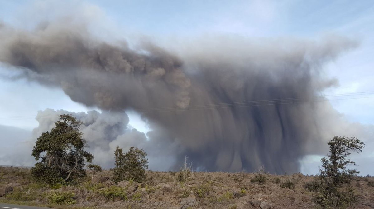
On Tuesday, thick, dark columns of ash poured from Halemaumau Crater, extending up to 12,000 feet above sea level and dropping ash as far as 18 miles downwind.

Dramatic images showed large plumes looming over the Volcano Golf Course. In Pahala, residents reported heavy vog and significant ashfall.

Emissions waxed and waned overnight, and authorities were able to cancel an ashfall advisory about 7:30 a.m. Wednesday. Forecasters warned, however, light ashfall and hazardous air conditions will continue.

Bob Ballard, of the National Weather Service, said the breezy trade winds on Tuesday were pushing the ash and plume onto the southwest region, but light winds on Wednesday will likely change where the ash goes.

"It depends on how big the explosive eruption is, if there is one," he said. "We'll be keeping an eye on that to see how tall it gets because winds will change with height."

Scientists have been warning residents for days about the threat of explosive, steam-induced eruptions at the summit crater.

The last time such eruptions happened was nearly a century ago, when shooting debris killed one and left a layer of ash over homes and cars.

In 1924, explosive events at the summit lasted for two and a half weeks and ash may have reached as high as 20,000 feet above sea level. Small amounts of fine ash fell as far as lower Puna and Waiohinu.

Researchers don't know when the explosive activity will occur, how large the explosions could be or how long they'd last.

But they warn that as fissures continue to open in Puna and lava travels downslope toward the sea, the chance for "explosive eruptions" at Halemaumau Crater on the summit of the volcano will continue to rise.

That's because a lava lake at the summit is dropping. When it hits the level of the water table beneath the Kilauea caldera, the influx of water into the conduit could trigger steam-driven eruptions, geologists said.

"If an explosion happens, there's a risk at all scales. If you're near the crater within a half a mile or so, then you would be subject to a bombardment by ballistic blocks weighing as much as 10 or 12 tons," said Don Swanson, of the Hawaiian Volcano Observatory.

"If you're within several miles of the summit of the volcano, of the lava lake, then you would be subject to falls of marble sized rocks, ash, finer grain material. and if you're beyond that say you're 10 miles, 15, 20 downwind, you could experience fine ash floating from the sky like snow."

The plumes that were emitting from the crater through Tuesday weren't from an eruption, however. Geologists say they were likely being created by rockfalls in the crater and gas explosions, though there's no way to confirm that.

On Monday, when the plume was much less intense, residents in Ka'u said the increased activity at the summit already had them feeling sick. Several residents have reported having headaches, sore throats, and watery eyes as a result of ashfall.

"I do have neighbors and friends and family and it has created more problems for them," said Jessie Marques, a Pahala resident. "Now they tend to stay indoors ... it has created a breathing problem for them."

Marques, who has asthma, says that the heightened sulfur dioxide levels and ash particles has complicated her health.

"I have asthma and (the volcanic activity) has exacerbated it, but I'm taking more of my medication and I'm taking care," Marques said.

Residents also reported ash coating their cars, decks and buildings as a result of recent volcanic activity. County officials went door-to-door Monday to hand out information about the ashfall and ways for residents to protect themselves from hazardous fumes and ash.

"There was really a thick layer of dust on our cars, and on our decks, and such so you can see and feel it," Marques added. "It's like black, grimy soot."
16778672_G.jpg

Here's a look at one of the rocks that was hurled from Halemaumau Crater. Geologists say the rock broke on impact, and that ash is covering the nearby area. (Image: USGS)
 
Friday morning Roundup 5-18-2018

Published on May 17, 2018

5/17/18 11am Volcano update dutchsinse
May 17, 2018


Kilauea blows! Photos from Thursday's explosive eruption
https://www.sfgate.com/science/arti...-ash-crazy-photos-12922449.php#photo-15568874
Updated 10:50 am, Thursday, May 17, 2018
1024x1024.jpg

Image 1 of 128
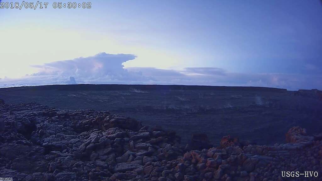
A screen shot from the USGS Mauna Loa webcam shows an ash plume at the Kīlauea Volcano summit. The plume is the result of an early morning explosive eruption on May 17, 2018.
 
Adapt 2030 Published on May 18, 2018
This is by far the best resource for tracking fissures in Hawaii and the over all conditions from lava flows, to electrical outages, road closures, evacuation order, ask cloud all in one interactive map. Also Mauna Ulu shakes and we look back at historical eruptions to 1790 along with new sky trail phenomenon.

KHON2 News Published on May 19, 2018

People evacuated by helicopter from neighborhood isolated by fast-moving lava
KHON2 News Published on May 19, 2018
Four people were safely evacuated by county and National Guard helicopters. People still in the area are asked to stay where they are and wait for further instructions.

Honolulu Civil Beat
Started streaming 15 hours ago
 
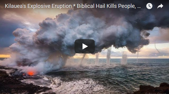
Ice Age Farmer Report: Kilauea's explosive eruption, biblical hail kills people, crops -- Sott.net
Fri, 18 May 2018 19:37 UTC / 5:07 (Link for Media)

a71babb29f2f2af294c071df39a3c182.png

Explosive eruption at Kilauea this morning after increased seismic activity overnight. More massive hail storms around the world are damaging people, homes, animals, and crops alike, much as records from the previous Grand Solar Minima indicate happened in the past as well. Are you growing your own food yet?

Adapt 2030
May 21, 2018
The lava type on Kilauea has changed to very liquid, very fluid which moved miles and formed rivers of lava to the sea overnight. The lava is more live flowing water than lava at the moment. Sulfur Dioxide has also increases 300% and officials warn of toxic air filled with silica needles, a serious breathing hazard.

Oppenheimer Ranch Project Published on May 21, 2018

May 20, 2018
 
First volcano-related injury recorded - man suffers serious burns from lava spatter -- Sott.net
Tue, 22 May 2018 20:14 UTC (Tweets and Video)

Officials: Final Puna Geothermal Well Plugged (May 22, 2018) / 3:42
[SIZE=4]https://www.youtube.com/watch?v=nOAcbUF0jSY[/SIZE]

Hawaii power plant shuts down after lava from Kilauea volcano flows onto site (PHOTOS, VIDEO)
Published time: 22 May, 2018 14:48 Edited time: 23 May, 2018 09:28 Rt

Wells at Puna Geothermal Venture sealed, plugged, officials say
KHON2 News Published on May 23, 2018 / 3:02
"I am not at all uncomfortable with where we are right now," said HI-EMA administrator Thomas Travis.

USGS Scientist Gives Hawaii Eruption Presentation
Big Island Video News Published on May 23, 2018 / 9:25

Published on May 23, 2018 / 21:34
Oppenheimer Ranch Project Published on May 23, 2018
*Demonetized* - Once Again We have Been Flagged
 
Oppenheimers videos are very informative, haven't seen his channel before. So, he's having some trouble on youtube I take it!
Excuse my ignorance please, but I dont understand. If we are entering a Grand Solar Minimum (which accounts for global cooling) wouldn't the sun be less active and so not affecting Earth as much. From what is being stated by Oppenhiemer, the minimum coincides with increased volcanic eruptions and an intensification of the suns affect on the planet :shock::huh:.

I watched this documentary last night on the history of Hawaii's eruptions. What is happening there now happens about every 20 to 30 years apparently on the big island. The Hawaiian Islands are a fascinating ,dynamic, geological construction.


Whoops! We only have 10 minutes to edit now. Wanted to add this.

In the last 40 years or so, Hawaii has had a huge boom in tourism with the increased construction of resorts, etc. Also, more people wanting to live on Hawaii, where land is expensive, has resulted in habitation, homes and resorts being built in the known pathways of lava flow.
 
Oppenheimer videos are very informative, haven't seen his channel before. So, he's having some trouble on youtube I take it!
Excuse my ignorance please, but I dont understand. If we are entering a Grand Solar Minimum (which accounts for global cooling) wouldn't the sun be less active and so not affecting Earth as much. From what is being stated by Oppenhiemer, the minimum coincides with increased volcanic eruptions and an intensification of the suns affect on the planet :shock::huh:.

Here's a reference to what many and maybe Oppenheimer may not have Knowledge of. Plus, add the Approach of the "WAVE"!:cool2:
 
The Latest: Kilauea Eruption Update
May 25, 2018 3:59 AM RDT Numerous Video's and updates
16690559_G.jpg


Lava flows enter ocean, fed by active fissures along East Rift Zone
[SIZE=4]https://www.youtube.com/watch?v=I_BLOfQhx90[/SIZE]
KHON2 News / 2:52
Published on May 24, 2018
As of Thursday, three lava flows are entering the water between Pohoiki Bay and MacKenzie State Park, with two of them merging into a larger flow before reaching the ocean.


DeBFjDmV0AE_Xgw.jpg

[B]Hawaii News Now[/B]‏Verified account @[B]HawaiiNewsNow[/B] 35m 35 minutes ago
JUST IN: Another eruption at Kilauea's summit sends ash 10,000 feet in the air.
https://twitter.com/HawaiiNewsNow/status/999875587685707776

Big Island Video News Published on May 24, 2018

Photo Updates From Kilauea: The Lava Meets the Sea May 23, 2018 / 30 Photos

Hypothesis: ?
Don't Speak Published on May 6, 2018
Hal Turner is reporting that the USGS is concealing (for now) the fact that the eruptions in Hawaii could cause a catastrophic Tsunami. Also a rare earthquake hits the Gulf of Mexico! Lift up your heads!
Tsunami San Francisco
https://www.youtube.com/watch?v=tlIqfkkRZRQ
Scientists find tsunami produced 90-foot wave
2005
images

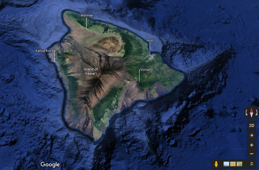
62f9efaa0e37fa964d56f172b6f4d7a4.png

Google kort

Oppenheimer Ranch Project Published on May 25, 2018

Session 26 November 1994
Q: (L) In terms of these Earth Changes, Edgar Cayce is one of the most famous prognosticators of recent note, a large number of the prophecies he made seemingly were erroneous in terms of their fulfillment. For example, he prophesied that Atlantis would rise in 1969, but it did not though certain structures were discovered off the coast of Bimini which are thought by many to be remnants of Atlantis. These did, apparently, emerge from the sand at that time.

A: Example of one form of symbolism.

Q: (L) Well, in terms of this symbolism, could this be applied to the remarks you made about the two little boys who were missing in South Carolina.

A: Yes.

Q: (L) And the symbolism was that you were reading the event from 3rd density into sixth density terms and then transmitting it back into 3rd, and while the ideation was correct, the exact specifics, in 3rd density terms, were slightly askew. Is that what we are dealing with here?

A: 99.9 per cent would not understand that concept. Most are always looking for literal translations of data. Analogy is novice who attends art gallery, looks at abstract painting and says "I don't get it."

Q: (L) Well, let's not denigrate literal translations or at least attempts to get things into literal terms. I like realistic art work. I am a realist in my art preferences. I want trees to look like trees and people to have only two arms and legs. Therefore, I also like some literalness in my prognostications.

A: Some is okay, but, beware or else "California falls into the ocean" will always be interpreted as California falling into the ocean.

Q: [General uproar] (F) Wait a minute, what was the question?

(L) I just said I liked literalness in my prophecies.

(F) Oh, I know what they are saying. People believe that California is just going to go splat and that Phoenix is going to be on the seacoast, never mind that it's at 1800 feet elevation, it's just going to drop down to sea level, or the sea level is going to rise, but it's not going to affect Virginia Beach even though that's at sea level. I mean... somehow Phoenix is just going to drop down and none of the buildings are going to be damaged, even though its going to fall 1800 feet...

(T) Slowly. It's going to settle.

(F) Slowly? It would have to be so slowly it's unbelievable how slowly it would have to be.

(T) It's been settling for the last five million years, we've got a ways to go in the next year and a half!

(F) Right! That's my point.

(T) In other words, when people like Scallion and Sun Bear and others say California is going to fall into the ocean, they are not saying that the whole state, right along the border is going to fall into the ocean, they are using the term California to indicate that the ocean ledge along the fault line has a probability of breaking off and sinking on the water side, because it is a major fracture. We understand that that is not literal. Are you telling us that there is more involved here as far as the way we are hearing what these predictions say?

A: Yes.

Q: (T) Are we understanding what you are saying?

A: Some.

Q: (T) So, when we talk about California falling into the ocean, we are not talking about the whole state literally falling into the ocean?

A: In any case, even if it does, how long will it take to do this?

Q: (LM) It could take three minutes or three hundred years. (T) Yes. That is "open" as you would say.

A: Yes. But most of your prophets think it is not open.

Q: (J) Yeah, because they think they have the only line on it. (T) Okay. So they are thinking in the terms that one minute California will be there and a minute and a half later it will be all gone. Is this what you are saying?

A: Or similar.

Q: (T) So, when we are talking: "California will fall into the ocean, which is just the analogy we are using, we are talking about, as far as earth changes, is the possibility that several seismic events along the fault line, which no one really knows the extent of...

A: Or it all may be symbolic of something else.

Q: (L) Such as? (J) All the fruitcakes in California are all going to go off the deep end together. (L) Symbolic of what?

A: Up to you to examine and learn.

Q: (L) Now, wait a minute here! That's like sending us out to translate a book in Latin without even giving us a Latin dictionary.

A: No it is not. We asked you to consider a reexamination.

Q: (L) You have told us through this source, that there is a cluster of comets connected in some interactive way with our solar system, and that this cluster of comets comes into the plane of the ecliptic every 3600 years. Is this correct?

A: Yes. But, this time it is riding realm border wave to 4th level, where all realities are different.
 
Last edited:
Noticed a kind of speculative report on the Big Island eruption situation from writer, John Rappaport, which deals with PGV. One thing that occurred when reading this is that the new rift seems to run a straight line right to the doorstep of said PGV - the geothermal plant (it still seems to be there today):

Did fracking cause the Hawaii volcano eruption?

Did fracking cause the Hawaii volcano eruption?
by Jon Rappoport
May 22, 2018

On the Big Island of Hawaii, where the Kilauea volcano has explosively erupted, there is a geothermal energy plant. It is the Puna Geothermal Venture (PGV) Plant, in Puna.
There is a long-running debate about whether PGV is fracking. The debate may be a matter of terminology, because in the geothermal process, as hawaiifracking.com reports, “…the drilling and the injection of cold water into hot rocks used in geothermal energy plants does fracture the rocks, which can induce earthquakes and through contamination of the atmosphere and water tables can affect our health and safety.”
Whether deep injection of fluid aims to capture oil, gas, or heat (geothermal), the beginning stage of the process is the same.
Earthquakes induced by this water-injection could obviously trigger a volcano.
For example, here is an alarming article about a geothermal project in Switzerland. Swissinfo.ch, December 10, 2009: “The authorities in canton Basel City say they will cancel a geothermal energy project, which three years ago caused minor tremors that damaged many buildings.”
“A risk analysis study published on Thursday found that the danger of setting off more earthquakes was too great if drilling at the site resumed.”
“The project was put on hold three years ago after thousands of claims for damage were filed with insurers. Total costs for the damage were around SFr9 million ($8.78 million).”
“The study, commissioned by the canton, concluded that Basel was ‘unfavourable’ for geothermal power generation.”
“It said the resumption of Deep Heat Mining project and its operation over a 30-year period could set off around 200 tremors with a strength of up to 4.5 on the Richter Scale – in 2006, the quakes were about 3.4.”
“This would result in damages up to SFr40 million.”
“The Basel facility drilled five kilometres into the earth. The borehole was designed to be injected with water to capture the extreme heat. Back at the surface, the hot water – at a temperature of around 160° Celsius – would run a steam turbine coupled with a generator.”
This Swiss article outlines the risks, and also confirms that deep water-injection is used in the geothermal process—which can and does trigger earthquakes.
Here is another reference—The Guardian, July 11, 2013: “Pumping water underground at geothermal power plants can lead to dangerous earthquakes even in regions not prone to tremors, according to scientists.”
“Prof Emily Brodsky, who led a study of earthquakes at a geothermal power plant in California, said: ‘For scientists to make themselves useful in this field we need to be able to tell operators how many gallons of water they can pump into the ground in a particular location and how many earthquakes that will produce’.”
“It is already known that pumping large quantities of water underground can induce minor earthquakes near to geothermal power generation and fracking sites. However, the new evidence reveals the potential for much larger earthquakes, of magnitude 4 or 5, related to the weakening of pre-existing underground faults through increased fluid pressure.”
“The water injection appears to prime cracks in the rock, making them vulnerable to triggering by tremors from earthquakes thousands of miles away. Nicholas van der Elst, the lead author on one of three studies published on Thursday in the journal Science, said: ‘These [injected] fluids are driving [earthquake] faults to their tipping point’.”
“The analysis of the Californian site showed that for a net injection of 500m gallons of water into the ground per month, there is an earthquake on average every 11 days.”
“Heather Savage, a co-author on the same study said: ‘It is already accepted that when we have very large earthquakes seismic waves travel all over the globe, but even though the waves are small when they reach the other side of the world, they still shake faults [such as the faults induced by geothermal water-injection]. This can trigger seismicity in seismically active areas SUCH AS VOLCANOES where there is already a high fluid pressure.” (emphasis added)
So, on the Big Island of Hawaii, where there is a massive volcanic eruption underway, there is a geothermal plant, PGV. How close to the volcano is PGV?
The Washington Post, May 12: “Long a concern for residents and the target of lawsuits challenging its placement ON AN ACTIVE VOLCANO, the Puna Geothermal Venture (PGV) is a major safety issue [i.e., chemicals stored at PGV] in the wake of the eruptions and earthquakes that have shaken the Big Island for days, government officials say.” (emphasis added)
I see. PGV is ON the volcano. Other reports claim PGV is 15 miles from the volcano. In either case, PGV is close, very close.
Who owns PGV? Ormat Technologies. Through internal merger and stock swapping, Ormat appears to be a jointly owned Israeli and US company now.
Ormat is no stranger to scandals. At blog.heartland.org, H Sterling Burnett writes (4/1/15): One scandal that could haunt [Harry] Reid for his remaining time in the Senate (and possibly beyond) was reported on recently in the Washington Free Beacon and Courthouse News. It seems the Reid helped the green energy company, Ormat Technologies, a firm that owns and manages geothermal plants in California and Hawaii, secure nearly $136 million in economic stimulus funding from the 2009 American Recovery and Reinvestment Act.”
“Two former employees are suing the firm, claiming Ormat executives defrauded the United States of more than $130 million by reporting false information about two projects to get government grants, a federal judge ruled Tuesday.”
“Reid’s ties to Ormat are deep. The company runs geothermal plants in Nevada and Reid has been a big booster of the company in D.C. As reported in the Free Beacon, ‘Reid bragged about securing Ormat a $350 million loan guarantee from the Department of Energy (DOE) and took credit for expanding the Treasury program that the former employees say illicitly provided Ormat with millions more in taxpayer funds’.”
“It is also worth noting that Ormat’s DOE award came a year after investors sued the company for allegedly inflating its stock price through ‘fraudulent accounting and overstated financial results.’ Ormat settled the allegations in 2012 for $3.1 million.”
Ormat potentially faces a much larger scandal now.
A massive volcanic eruption on the Island of Hawaii.
 
VIDEO: U.S. Marines Deploy Transport Helicopters For Eruption


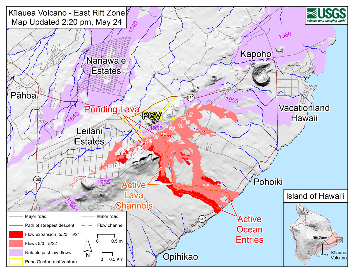
2018-05-25-map.jpg

(USGS) Map as of 2:20 p.m. HST, May 24. Shaded purple areas indicate lava flows erupted in 1840, 1955, 1960, and 2014-2015.

VIDEO: Full Interview With Darryl Clinton, "Lava Bomb" Survivor

New tally shows 82 Hawaii island homes and structures destroyed by lava
By Star-Advertiser Staff May 25, 2018
Snip:
http://www.staradvertiser.com/2018/05/25/breaking-news/kilauea-volcano-updates-may-25/
UPDATE 6 P.M.
A lava flow crossed Kahukai Street in Leilani Estates today. Fissures 7 and 21 are feeding a lava pond that produced the flow. The flow is moving in an eastward direction.

Mohala Street is no longer accessible due to the flow that crossed Kahukai Street. Kaupili Street has not been cut off from the flow but residents are told to remain out of the area.
1:45 P.M.
The tally of homes and other structures recently destroyed by lava on Hawaii island is now up to 82, according to a new count from Hawaii County today.

The most recent previous count was close to 50, though that figure was based on estimates made by visual observations from the air that sometimes were difficult because of smoke and other factors.

Today’s updated figure is from the county’s Real Property Tax Office and the Office of Housing and Community Development.

Also, the Pacific Tsunami Warning Center said an earthquake that occurred at approximately 12:44 p.m. today was not large enough to cause a tsunami for Hawaii island.

Preliminary data indicated that the 4.4 magnitude earthquake was centered in the summit region of Kilauea.

Lava has been coming out of the East Rift Zone mainly within the Leilani Estates subdivision since May 3.

A flow originating near the center of the subdivision is moving to the northeast in a development that could threaten Highway 132, an important access road for authorities and an evacuation route for remaining residents.

The flow from fissure 21 has been moving north along Kaupili Street to about 200 yards south of Kahukai Street at the edge of the Leilani subdivision, “but the flows are sluggish in the northeast direction,” said county spokeswoman Janet Snyder.

Wendy Stovall, a volcanologist with the U.S. Geological Survey, said lava in the area has built up into a pond that is 14 meters above surrounding ground level and is inflating. Stovall expects minor overflows but not rapid movement.

Another lava breakout from the same fissure system has occurred nearer to Mohala Street, according to Snyder, and fissure 3 in the same area has also been active.

“If fissures start opening up north, we may have to look at inundation of (Highway) 132,” she said. That highway extends from Pahoa village to Kapoho, and has become an increasingly important transportation route since lava severed Highway 137 on the Puna coast south of Pohoiki.

If Highway 132 is cut near its intersection with Pohoiki Road, Highway 137 along the coast from Kapoho to Hawaiian Beaches would become the last remaining route in and out of the Pohoiki and Kapoho areas.

Snyder said scientists are waiting for data from an observation overflight, and expect to have more details about the potential threat to Highway 132 later today.

Lava from fissure 22 continues to feed one lava river that is flowing into the ocean, while fissures 6 and 13 are feeding a second ocean entry, she said.

Meanwhile, fissures 7 and 21 are feeding a perched lava pond and flow of pāhoehoe lava — basaltic lava with a smooth or ropy surface — that has advanced eastward covering most of the area bounded by Leilani Blvd, Mohala St., and the fissure line, according to the Hawaiian Volcano Observatory. Fissure 17 continues to spatter weakly, while Fissures 19 and 23 are no longer active.

Lava flowing in the Lower East Rift Zone has so far destroyed at least 47 structures, and Snyder said it has covered an estimated 15,000 acres.

At the Kilauea summit about 25 miles away, there were a series of strong explosions starting Thursday night at 6 p.m. and continuing today, but very few earthquakes, she said. Those ash eruptions have not released any lava, but have scattered a layer of ash across Pahala and other communities in Kau.

The National Weather Service issued an alert at 11:03 a.m. that trace ashfall remains possible from Kilauea. The communities of Pahala, Wood Valley and Naalehu are particularly likely to receive ash fallout as trade winds push the ash southwest from Kilauea.

Volcanic gas emissions remain very high from the fissure eruptions. Additionally, trade winds are forecast to slow over the weekend, creating hazardous air quality and decreased visibility conditions throughout the lower east rift zone, Hawaii County Civil Defense said. Volcanic gases, vog and ash emissions may increase over the weekend with higher levels of sulfur dioxide pooling in areas downwind of the vents, the agency said.

No end in sight: More than 3 weeks on and eruptions are fiercer than ever
Updated Saturday, May 26th 2018, 5:28 am CEDT Videos
16838212_G.jpg

Geologists are also monitoring widening cracks in a number of roadways in Leilani Estates, ground zero for the ongoing eruptions.

Steve Brantley, of the USGS, said the large cracks, which have torn roads apart in some places or created gaps of 1 yard or wider, are an indication that magma is continuing to enter the rift zone.

@[B]Crazyfkinplanet[/B] 6h 6 hours ago
Replying to @[B]MilekaLincoln[/B] @[B]HawaiiNewsNow[/B]

All of us here living on boats off the California coast have been drinking a bit more than usual the last few days in anticipation of possible events to come. Oh hell, who am I kidding - boaters dring if mosquitos fart. Be safe!

NASA satellite captures stunning image of Big Island eruptions from space
Saturday, May 26th 2018, 1:17 am CEDT
http://khnl.images.worldnow.com/ima...scale&width=800&lastEditedDate=20180525174954

16846668_G.gif


Flashback: Aug 18, 2015
 
High Alert: Hawaii Kilauea Volcano Explosions Shoot Ash to 11,000ft as Lava Swamps Road A series of summit explosions on Saturday spewed ash from Kilauea volcano up to 11,000ft and dusted communities to the south-west, the Hawaiian Volcano Observatory said.
The three explosions, which began around 12:42am, came during the fourth week of what geologists rank as one of the biggest eruption cycles from the Big Island volcano in a century.

Residents downwind of Kilauea were advised by County of Hawaii Civil Defense to avoid exposure to ash, which can cause eye irritation and breathing difficulties, particularly in people with respiratory problems. Some 25 miles down Kilauea’s east flank, lava gushed from six giant cracks. Molten rock from two fissures advanced over a street of homes in the Leilani Estates housing development, the observatory said.

KHON2 News Published on May 26, 2018

KHON2 News / 4 hrs
33614545_10155759402361379_3833869365267136512_o.jpg

KHON2 News
"An aerial view, looking west, of the two active ocean entries on Kīlauea Volcano's lower East Rift Zone.
The large white plume (foreground) is the eastern ocean entry; the weaker, western plume can be seen in the distance. The white plume, referred to as "laze," is a mixture of condensed acidic steam, hydrochloric acid gas, and tiny shards of volcanic glass that can irritate lungs, eyes and skin." - USGS Volcanoes

Leilani Ave. near fissures 7 and 21 / an hour ago

Hawaii Island, Puna District Leilani Ave. Fissure 7 and 21. With USGS Volcanologist Wendy Stovall / about an hour ago
 
Published on May 27, 2018
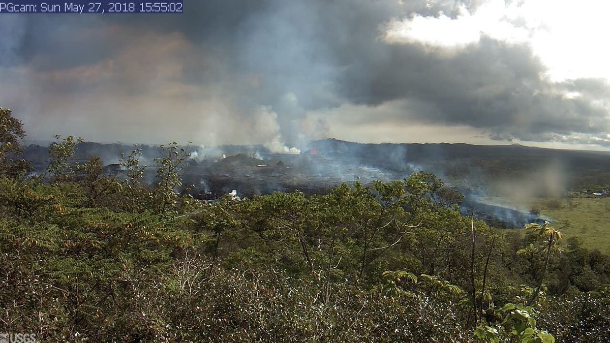
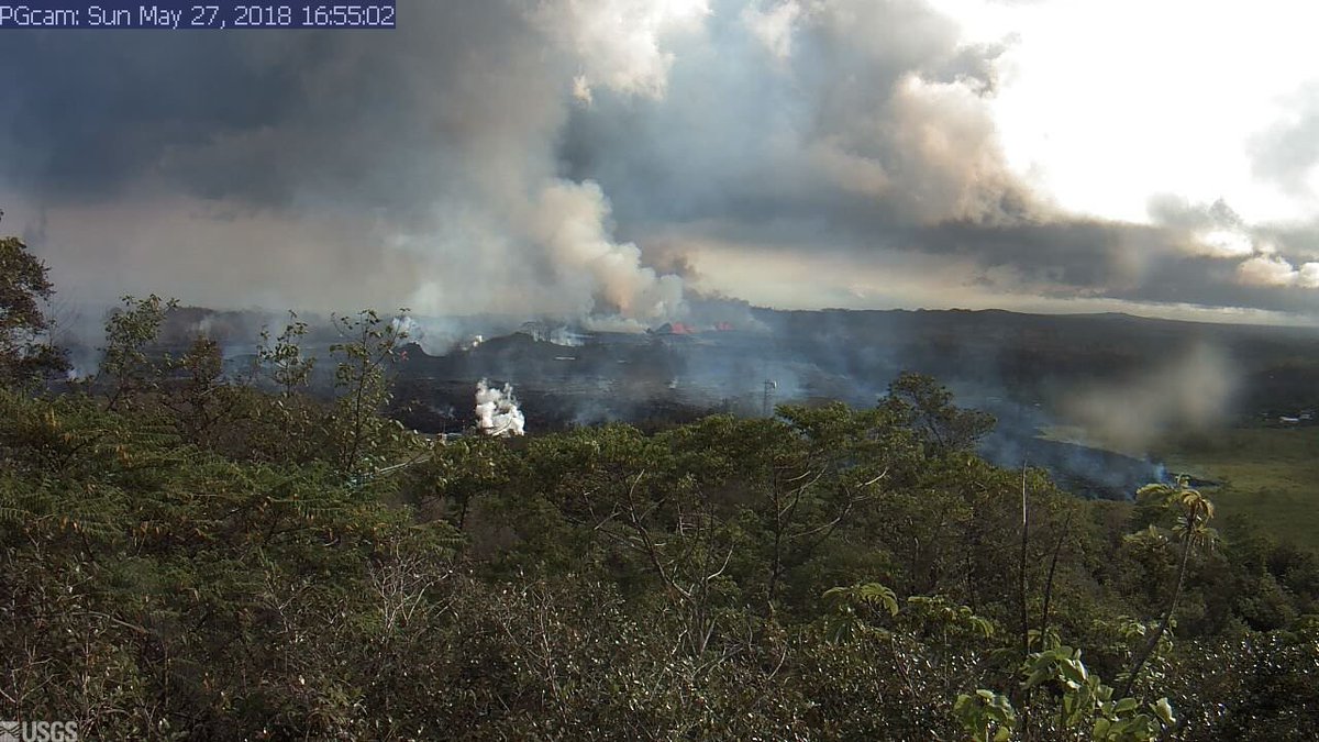
Critical Moment: Lava Moves Over Geothermal Well Pad
Comments: Are telling. Link for a View:


Now there is some kind of gas emission coming from Pad E at PGV, been growing over the past hour. #LeilaniEstates #Kilauea @firebomb56
DeQK79uUwAEqIco.jpg


DeQKxB1VwAE8Pf8.jpg

RT
Fears of deadly gas explosion as lava inches toward Hawaii geothermal plant (VIDEOS)
Edited time: 28 May, 2018 07:50 Tweets
Lava from Hawaii’s erupting Kilauea volcano is edging closer to a geothermal plant, escalating fears of a potentially lethal and toxic hydrogen sulfide explosion.

Molten lava crossed into the property of Puna Geothermal Venture (PGV) Saturday, according to the US Geological Survey, heightening concerns that the lava flow could make contact with the power station’s 11 wells.

The potential impact of lava engulfing the facility could be catastrophic. No geothermal plant in the world has ever been exposed to such extreme temperatures.

Footage of the lower East Rift Zone of Kilauea shows the intensity of activity in the region. Fissure 8, one of the westernmost active fissures in the zone, reactivated after destroying dozens of homes over the past few days.

PGV was shut down by authorities at the beginning of May as Kilauea began erupting. Some 60,000 gallons of flammable liquid were removed, and wells were deactivated.

The Hawaii County Civil Defense Agency confirmed in its latest update that the lava flow in Leilani Estates crossed into PGV property overnight, but it emphasised that no hydrogen sulfide has been detected.

Ten of the 11 wells have been ‘quenched’ with cold water and plugged, while the 11th one was plugged with bentonite clay after quenching efforts failed. Local residents still fear an explosive emission of volatile, poisonous and highly flammable hydrogen sulfide and other gases may occur if the wells rupture.

The Israeli-owned plant typically provides around 25 percent of the electricity on the Big Island. Over the decades, it has been subjected to several health hazard complaints and legal challenges objecting to its close proximity to one of the world’s most active volcanoes.

Comments:....:whistle:

Ha...Israeli owned plant. Of course it will explode!

I did not know that, you are absolutely right, owned by Israel. Which means any damage done to plant and there income stream will be payed for by American Tax Payers.

Brought to you by the same crew that did the dirty work of 9/11.

High Alert: Hawaii volcano eruption prompts fears of disastrous blow to tourism
Published on May 27, 2018
 
Last edited:
Back
Top Bottom