Watch the skies and land and oceans

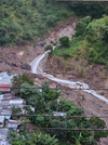
Massive flood on the road due to intense rainfall in the Araklı of Trabzon province, Turkey​


Heavy flooding and storms washed away cars in Guatemala​


Bebinca typhoon in China​


“Unprecedented” rain triggered floods and landslides in Japan​


Small tsunami waves hit Japanese islands south of Tokyo​

A half-meter tsunami hit the coast of Yaene on Hachijo Island at 8:58 a.m. (Japan time) Tuesday after a strong 5.9-magnitude earthquake struck the Izu Islands archipelago south of Tokyo.

On Miyake Island, a 10-centimeter tsunami hit the Tsubota and Ako areas at 9:11 local time (00:11 GMT), and another 20-centimeter tsunami hit Kozu at 9:37 local time (00:37 GMT). as confirmed by the JMA.

Following the tsunami, ferries linking Tokyo and Atami (in Shizuoka Prefecture, southwest of the capital) to the island of Oshima were cancelled, services that could be restored this afternoon if conditions in the region permit.

Captura de pantalla 2024-09-24 a las 19.49.01.png
 

Record rainfall has brought deadly flooding and landslides in Ishikawa, Japan​

flood, Ishikawa, Japan

Six dead after record rain causes floods in Ishikawa, Japan​


Heavy snowfall shuts roads, strands motorists in South Africa​


Extreme rainfall in L'Ametlla de Mar, Spain​

 
We were sitting out on the cliff overlooking Pelican Lake, Manitoba on Friday night when the storm mentioned above started. We're about 20km east from the location of the footage in Minto. One thing that was really odd that all of us noticed is that the lightning in the storm was very dark orange. None of us could ever remember seeing that colour in lightning. It was almost like the lightning portrayed in Mordor for the LOTR films...
 

Florida prepares for the arrival of a possible major hurricane in United States​


Impressive flooding in Platja d'Aro due to a torrential downpour, Spain​


Record-breaking floods in northern Thailand​


12 districts along the Ganga are experiencing flood-like conditions in india​


Major hurricane John hits Mexico's Pacific coast​


Heavy downpours hits UK​

 
As I write this, the region where I live (state of Guerrero Mexico) is being heavily affected by Hurricane John, there have been 4 days of non-stop rains, there is already a lot of damage. Less than a year ago another powerful hurricane, Otis, devastated the tourist area of Acapulco, the area managed to recover somehow, but today again, that area and practically the whole state have been severely affected by the increasingly extreme weather, more rains are still expected during the following days, which is bad news because many rivers and dams have already overflowed and many people have lost their homes and there are already some reports of deaths.


Brief update on what is happening in Guerrero, Mexico. Apparently hurricane john has lost strength and is again a tropical storm, although initially it had already degraded from a category 2 hurricane to a tropical storm, then it gained strength and became a hurricane again.
At this moment, according to reports it is moving away to the north and the rains have diminished, however the damages are substantial, the city where I live has been quite affected, many houses were lost and there are still no exact figures of the human lives that were lost, but the scenario is very sad. I am safe luckily, but the shock of seeing again so much damage after the hurricane that hit less than a year ago is strong.


The image is very near from my house:
 

Attachments

  • IMG_1727.jpeg
    IMG_1727.jpeg
    176.9 KB · Views: 16

Historic Rainfall Inflicts Chaotic Floods Across Four Continents​

Severe rains bucketed down on central Europe, Africa, Shanghai and the US Carolinas this week, underscoring the extreme ways in which climate change is altering the weather.

1727545683553.png

[...]

Current radar and satellite imaging show the “jet stream is clearly buckled in large, sharp meanders, causing stagnant weather systems around the Northern Hemisphere,” said Jennifer Francis, a senior scientist at the Woodwell Climate Research Center based in Massachusetts. It’s not clear exactly what’s caused the jet stream to warp this season, she said, but “raging ocean heat waves” due to global warming were one culprit. Average sea surface temperatures were 0.96C (1.73F) above normal in August, the second-hottest month on record.

Torrential rains flood North Carolina mountains and create risk of dam failure​


Historic North Carolina village under water after devastating damage from Helene​


Atlanta sees first-ever Flash Flood Emergency as Helene's fury forces multiple water rescues​


John makes a comeback; to pay Acapulco, Mexico a 2nd visit with torrential rain​


At least 66 dead after flooding, landslides in Nepal​


Australia on track for fifth consecutive wet year​


Waterspout spotted over Hong Kong's Victoria Harbour for first time since records began​

 
And now we have Isaac and Joyce too which are growing...

Hurricane Isaac strengthens, Tropical Storm Joyce forms in the Atlantic Ocean​

 
Comet C/2023 A3 has approached Earth and may be “caught” in the sky before the end of the month and in the first days of October. The northern hemisphere is the best place on the planet to observe it.

Bright comet visible at dawn - to the naked eye

This week, a bright comet will be visible to the naked eye in the sky, it may even be visible in daylight from mid-October. Currently, comet C/2023 A3 appears on the southeastern horizon in Germany shortly before dawn and impresses with its very pronounced dust tail. On September 27, 2024, C/2023 A3 will reach the closest point to the Sun of its approximately 80,000-year orbit and on October 13 the closest point to Earth. Then it could even eclipse Venus in brightness.
(...) Comet C/2023 A3 (Tsuchinshan-ATLAS) was not discovered until January 2023, when the putative asteroid began to form its tail. Telescopic observations revealed that the orbit of this long-period comet is nearly perpendicular to the planetary plane. The chunk takes about 80,000 years to complete one orbit and orbits the Sun retrograde, backwards relative to the planets and the Sun's rotation.
There is the potential that a "naked-eye" comet will be visible over Massachusetts for the next few days. In simpler terms, that means a comet that can be seen without the aid of binoculars or a telescope.
Comet C/2023 A3 Tsuchinshan-ATLAS reaches its perihelion on Friday. This marks its closest pass by our sun in its 80,000 year-long orbit. It is expected that the comet will be just bright enough to see with the naked eye for several days starting this Friday and lasting through Monday of next week.
In order to have a chance at catching a glimpse, you will need to get up early, have a clear view of the east-southeastern horizon and, of course, have clear skies.
The comet will be just a few degrees above the ESE horizon and be visible for less than an hour, right before sunrise.
After Monday, folks in the northern hemisphere will be unable to see the comet for several days. It is forecast to re-emerge low in the western horizon around Oct. 12 for a few more days of potential viewing.
 

Attachments

  • 1727553208759.png
    1727553208759.png
    726.9 KB · Views: 1

HUGE wildfire at the Patras-Athens National Highway in Greece​


Extreme rainfall in Rustaq of Al Batinah Region, Oman​


Typhoon Julian unleashes heavy rain and strong winds in Uyugan, Batanes, Philippines​

1727727308340.png

Massive flooding due to heavy rains in Asheville of North Carolina, US (27.09.2024)​


At least 64 dead and millions without power after Helene’s deadly march across the Southeast​


Helene is the eighth Category 4 or 5 Atlantic hurricane to make landfall in the US in the last eight years. That’s as many of these intense hurricanes as hit the US in the prior 57 years.​


US Southeast Struggles to Recover in Hurricane Helene's Aftermath​

Massive rains brought by Hurricane Helene have left many people stranded or homeless as the cleanup begins from the monster tempest that killed at least 84 people.
Helene has caused billions of dollars in destruction across a wide swath of the U.S. Southeast. Several million customers were without power Sunday. Some face a continued threat of floods.

Helene left at least 119 people dead and communities ‘wiped off the map.’ Now, survivors are struggling to get food and water​

1727729269132.png
The magnitude of devastation wrought by Helene intensifies by the hour as search crews discover more bodies and floodwaters slowly recede, revealing more neighborhoods obliterated by the storm.
 
Last edited:
After Florida, it look like the other side of the planet is on the way for a similar event.

Super Typhoon Krathon (equivalent of a Category 4 hurricane) is expected to hit Taiwan this week, bringing devastating winds of up to 250 km/h and heavy rainfall of up to one meter.​

1727731665091.png

Joyce, Isaac, Kirk. The Atlantic is turning into a billiards table.​

1727731762864.png

Tennessee floods: 54 people stranded on Unicoi County Hospital roof rescued as water rose (2024-09-27)​


Attachments

  • 1727810323750.png
    1727810323750.png
    1.4 MB · Views: 9
This is the US drought map released on September 26. Rather well filled.

US drought map for September 26 2024


Helene is now the deadliest mainland U.S. hurricane since Katrina​


Update for Taiwan:

Taiwan shuts down for Typhoon Krathon, bringing torrential rain​


A good overview of the global situation:


Trending content

Back
Top Bottom