Earthquakes around the world

Our friends in Germany felt an M4 earthquake.

According to European-Mediterranean Seismological Centre (EMSC) the earthquake had a magnitude 4.0 and hit at a very shallow depth of 5 km beneath the epicenter near Hechingen, Tübingen, Baden-Württemberg, Germany, early morning on Sunday, October 16th, 2022, at 6:13 am local time. (04:13 UTC) USGS downgraded to M3.4 It should not have caused significant damage

M 3.4 - Germany
2022-10-16 04:13:19 (UTC)
48.341°N 8.995°E 10.0 km depth
Estimated energy release equivalent to 10.7 tons of TNT
USGS earthquake alert
 
Strong earthquake

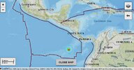
M 6.3 - off the coast of Central America
2022-10-16 12:48:21 (UTC)
.377°N 87.515°W 10.0 km depth
USGS earthquake alert

According to USGS the earthquake had a magnitude 6.3 and hit at a very shallow depth of 10 km in the morning on Sunday, October 16th, 2022, at 6:48 am local time. (12:48 UTC) Estimated energy release equivalent to 42502 tons of TNT or 2.7 atomic bombs.

Data for the same earthquake reported by different agencies​


Mag.DepthLocationSource
6.310 kmOff the Coast of Central AmericaUSGS
6.311 kmOFF COAST OF CENTRAL AMERICAEMSC
6.910 km96 Km Al Sur De Isla Del Coco, Costa RicaINETER
6.310 kmOff Coast of Central AmericaRaspberryShake
5.510 kmNear DavidRENASS
6.310 kmOff Coast of Central AmericaGFZ
6.410 kmOff Coast of Central AmericaGeoAu
6.320 kmCosta Rica [Sea]INGV
Volcanodiscovery earthquake report
 
Last week saw no earthquakes reaching M6 worldwide.
In the usual area, there were 5 out of 77 earthquakes worldwide equal to or greater than 4.5 and 1688 out of 2086 quakes of all sizes.
Percentage: 80.9%
Last week saw 3 M6 earthquakes with the highest being a M6.4 in Papua New Guinea.
In the usual area, there were 6 out of 107 earthquakes worldwide equal to or greater than 4.5 and 1612 out of 2060 quakes of all sizes.
Percentage: 78.3%
Earthquakes 7 days to October 16th 2022.gif
 
Our friends in Germany felt an M4 earthquake.

According to European-Mediterranean Seismological Centre (EMSC) the earthquake had a magnitude 4.0 and hit at a very shallow depth of 5 km beneath the epicenter near Hechingen, Tübingen, Baden-Württemberg, Germany, early morning on Sunday, October 16th, 2022, at 6:13 am local time. (04:13 UTC) USGS downgraded to M3.4 It should not have caused significant damage

M 3.4 - Germany
2022-10-16 04:13:19 (UTC)
48.341°N 8.995°E 10.0 km depth
Estimated energy release equivalent to 10.7 tons of TNT
USGS earthquake alert

Additional / complementary information regarding the M4 earthquake in SW Germany

Vulkane.net had an article about this event, and wrote following


Earthquake Ml 4.0 shakes Germany
16 Oct 2022 by Marc Szeglat

Date: 16 Oct 2022 | Time: 04:13:19 UTC | Location: 48.31 N ; 9.02 E | Depth: 3 km | Ml 4.0

deutschland.jpg

This morning, residents of the Albstadt region were rudely roused from their sleep when the earth shook with a magnitude of 4.o at 04:12:19. The value comes from the EMSC. Local earthquake services determined Ml 3.9. The earthquake focus was located at a depth of only 3 km, which led to a quite strong perception of the event. There are 2 perception reports at the EMSC. Not only was the perception enhanced by the shallow depth of the hypocentre, but also the destructive potential of the earthquake, so there may have been slight damage to buildings.

The epicentre was located 10 km north-north-west of Albstadt, more precisely, 2 km from the edge of the village of Onstmettingen. The larger town of Reutlingen is 24 km away. The region is one of the areas in Germany where moderate earthquakes occur more frequently. Most recently, an earthquake Ml 4.1 manifested itself in July. In 2019, there was an earthquake Ml 4.0.

In fact, the Swabian Alb region is one of the most earthquake-prone areas in Germany.
In 1911, the strongest earthquake that has occurred on German soil since systematic earthquake recording took place here: it had a magnitude of 6.1 and destroyed 6250 buildings.

The quakes manifest themselves along the 30 km long and 1.5 km wide Hohenzollerngraben. It is evidence of the Alpine orogeny and was formed 15 million years ago. In the rim area of the trench, there are several fault zones that have a vertical offset of up to 100 m. They do not run vertically, but instead are formed by the earthquake. They do not run vertically, but dip obliquely towards the trench, forming a "V" that closes the trench at about 3000 m depth. It is to be expected that earthquakes will continue to occur in the region in the future.


END OF ARTICLE
 
WORLDWIDE EARTHQUAKE REPORT OCTOBER 16

The M6.3 earthquake off the coast of Central America was classified as an intraplate earthquake. It occurred within the Cocos plate. (Intraplate)

There is a classification that distinguishes earthquakes according to their source of origin and proximity to the limits or boundaries between tectonic plates: Interplate or Intraplate

INTERPLATE earthquakes are those that occur directly associated with the contact between two plates, for example between the Cocos plate and the Caribbean plate, which are usually of considerable magnitude and with depths of no more than 40 km.
earth-s-tectonic-plates.jpg

INTRAPLATE earthquakes are those that occur as internal deformation of the plates. They can occur anywhere where there are active geological faults. These earthquakes are less common and generally of lesser magnitude. In the case of the Cocos plate, they can have depths from 0 to 230 km (The earthquake M6 3 this morning was very superficial at 10Km), while the Caribbean Intraplate are earthquakes with depths of less than 30 km. Intraplate earthquakes of moderate magnitude, superficial and close to cities, can cause more damage than interplate earthquakes of great magnitude.
20221016_193130.jpg

Apart from the M6.3 earthquake, the past 24 hours have been characterized by low magnitude earthquakes.

Aftershock M4.3 - off the coast of Central America
2022-10-16 22:36:40 (UTC)
4.241°N 87.614°W. 10.0 km depth
USGS earthquake alert

▪︎ Earthquakes possibly related to the M6.3 earthquake.

M 4.5 - 1 km NNW of Santa Marta, Panama
2022-10-16 18:53:08 (UTC)
8.534°N 82.706°W. 30.8 km depth
USGS earthquake alert

M 4.2 - 14 km SSE of San Juan del Sur, Nicaragua
2022-10-16 14:45:01 (UTC)
11.136°N 85.815°W. 84.7 km depth
USGS earthquake alert

M 4.2 - 6 km SW of Mapastepec, Mexico
2022-10-16 16:43:25 (UTC)
15.392°N 92.949°W. 97.1 km depth
USGS earthquake alert

▪︎ Other earthquakes

M 4.5 - Iceland region
2022-10-16 23:34:12 (UTC)
63.813°N 23.483°W. 10.0 km depth
USGS earthquake alert

M 4.4 - 53 km W of Al Ḩudaydah, Yemen
2022-10-16 23:08:00 (UTC)
14.847°N 42.462°E. 10.0 km depth
USGS earthquake alert

▪︎ Summary

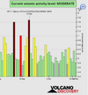
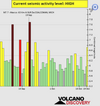
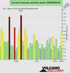
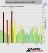
Based on the averages of all earthquakes during the last hours we had a MODERATE seismic activity level. Global seismic activity level chart

~1 quake above magnitude 6
~44 quakes between magnitude 4 and 5
~113 quakes between magnitude 3 and 4
~225 quakes between magnitude 2 and 3
~433 quakes below magnitude 2 that people normally don't feel.
~816 earthquakes in the past 24h (713 earthquakes in the 24 hours prior to this report) Estimated combined seismic energy release: 45873 tons of TNT or 2.9 atomic bombs
Volcanodiscovery earthquake report 24h
 

Attachments

  • chrome_screenshot_1665965434536.png
    chrome_screenshot_1665965434536.png
    364.8 KB · Views: 0
  • 20221016_193130.jpg
    20221016_193130.jpg
    181.9 KB · Views: 1
WORLDWIDE EARTHQUAKE REPORT OCTOBER 17

The highest magnitude earthquake occurred on the border between Peru and Chile with M5.2 according to USGS although other agencies such as European-Mediterranean Seismological Center (EMSC) said it was a magnitude 5.0

The earthquake occurred at an intermediate to considerable depth of 132 km below the epicenter on Monday morning, October 17, 2022, at 10:38 am local time. Towns or cities near the epicenter where the quake might have been felt as very weak shaking include Arica (pop. 186,000) located 76 km from the epicenter, and Tarata (pop. 3,100) 109 km away. Estimated energy release equivalent to 951 tons of TNT No damage reported so far.

M 5.2 - 101 km SE of Palca, Peru
2022-10-17 13:38:22 (UTC)
18.402°S 69.256°W. 131.7 km depth
USGS earthquake alert

Other M5+ earthquakes

M 5.0 - 79 km SE of Hengchun, Taiwan
2022-10-17 13:20:39 (UTC)
21.426°N 121.205°E. 9.2 km depth
USGS earthquake alert

M 5.0 - 73 km SE of Gorontalo, Indonesia
2022-10-17 13:12:46 (UTC)
0.015°N 123.477°E. 141.4 km depth
USGS earthquake alert

M 5.1 - 179 km E of Amahai, Indonesia
2022-10-17 08:13:47 (UTC)
3.137°S 130.523°E. 10.0 km depth
USGS earthquake alert

M 4.5 - off the coast of Ecuador
2022-10-17 07:55:01 (UTC)
0.979°N 85.256°W. 10.0 km depth
USGS earthquake alert

M 4.7 - western Xizang
2022-10-17 08:48:23 (UTC)
33.598°N 81.884°E. 10.0 km depth
USGS earthquake alert

M 4.7 - south of Africa
2022-10-17 15:53:37 (UTC)
49.752°S 30.157°E. 10.0 km depth
USGS earthquake alert

▪︎ Summary

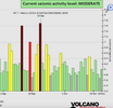
Based on the averages of all earthquakes during the last hours we had a MODERATE seismic activity level. Global seismic activity level chart

~5 quakes above magnitude 5
~33 quakes between magnitude 4 and 5
~88 quakes between magnitude 3 and 4
~231 quakes between magnitude 2 and 3
~641 quakes below magnitude 2 that people normally don't feel.
~998 earthquakes in the past 24h (816 earthquakes in the 24 hours prior to this report) Estimated combined seismic energy release: 6366 tons of TNT or 0.4 atomic bombs
Volcanodiscovery earthquake report 24h
 

Attachments

  • chrome_screenshot_1666051792228.png
    chrome_screenshot_1666051792228.png
    365.9 KB · Views: 1
Today marks 33 years since the Loma Prieta earthquake. What have we learned?

Updated 6 hours ago
The epicenter of the earthquake was located roughly nine miles northeast of Santa Cruz
 
There was today an earthquake at the State of Veracruz, the coordinates given are quite near the Pico de Orizaba volcano.

From
DATE: 2022-10-1
TIME: 18:27:46
MAGNITUDE: 4.2
EPICENTER:
LATITUDE, LONGITUDE: 19.01°, -97.13°
11 KM AL SUROESTE DE COSCOMATEPEC, VERACRUZ
DEPTH: 10 KM

Pico de Orizaba coordinates: 19°01′48″N 97°16′12″W
Pico de Orizaba, also known as Citlaltépetl (from Nahuatl citlal(in) = star, and tepētl = mountain), is an inactive stratovolcano, the highest mountain in Mexico[1] and the third highest in North America, after Denali of Alaska in the United States and Mount Logan of Canada. Pico de Orizaba is also the highest volcanic summit in North America. It rises 5,636 metres (18,491 ft) above sea level in the eastern end of the Trans-Mexican Volcanic Belt, on the border between the states of Veracruz and Puebla.[1] The volcano is currently dormant but not extinct, with the last eruption taking place during the 19th century. It is the second most prominent volcanic peak in the world after Africa's Mount Kilimanjaro
 
WORLDWIDE EARTHQUAKE REPORT OCTOBER 18

The past 24 hours were characterized by low magnitude earthquakes. Of these, it is worth mentioning the 5.0 magnitude earthquake in Chile, which registered a depth of 459.3km the 5.0 magnitude quake had an epicenter in Ovalle, Provincia de Limari, in the Coquimbo region. In the past 24 hours, Provincia de Limari, Coquimbo Region, Chile had 6 quakes up to magnitude 5.0. This type of moderate magnitude earthquakes do not usually cause alarm among the Chilean population, accustomed to feel earthquakes of much greater magnitude during the year.

M 5.0 - 27 km WSW of Ovalle, Chile
2022-10-18 07:35:33 (UTC)
30.700°S 71.466°W. 47.4 km depth
USGS earthquake alert

Other earthquakes:

M 5.0 - Banda Sea
2022-10-18 11:46:04 (UTC)
4.347°S 125.368°E 459.3 km depth
USGS earthquake alert

M 4.7 - 7 km ENE of Jordán, Colombia
2022-10-18 07:17:09 (UTC)
6.765°N 73.041°W. 163.6 km depth
USGS earthquake alert

M 4.5 - off the coast of Central America
2022-10-18 01:24:45 (UTC)
4.473°N 87.420°W. 10.0 km depth
USGS earthquake alert

M 4.2 - 55 km NW of Murghob, Tajikistan
2022-10-18 13:43:32 (UTC)
38.452°N 73.436°E. 127.8 km depth
USGS earthquake alert

▪︎ Summary

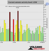
Based on the averages of all earthquakes during the last hours we had a LOW seismic activity level. Global seismic activity level chart

~2 quakes above magnitude 5
~33 quakes between magnitude 4 and 5
~95 quakes between magnitude 3 and 4
~243 quakes between magnitude 2 and 3
~548 quakes below magnitude 2 that people normally don't feel.
~998 earthquakes in the past 24h (816 earthquakes in the 24 hours prior to this report) Estimated combined seismic energy release: 6366 tons of TNT or 0.4 atomic bombs
Volcanodiscovery earthquake report 24h
 

Attachments

  • chrome_screenshot_1666136149894.png
    chrome_screenshot_1666136149894.png
    338.2 KB · Views: 0
WORLDWIDE EARTHQUAKE REPORT OCTOBER 19

On October 18 we observed earthquakes of between 4 and 5 magnitude that occurred in Central and South America. During the past 24 hours seismic activity was concentrated in Southeast Asia, however, the highest magnitude earthquake occurred in the South Atlantic Ocean with a 5.6 magnitude. The quake hit at a shallow depth of 10 km beneath the epicenter near Georgetown, Ascension, St. Helena, early afternoon on Wednesday, October 19th, 2022, at 3:03 pm local time. It should not have caused significant damage in Georgetown (pop. 540) located 91 km from the epicenter, the quake should have been felt as light shaking.

M 5.6 - 91 km ENE of Georgetown, Saint Helena
2022-10-19 15:03:02 (UTC)
7.689°S 13.622°W. 10.0 km depth
USGS earthquake alert

A second strong earthquake occurred in China. The earthquake M5.5 The quake hit at a shallow depth of 8.6 km beneath the epicenter near Qinghai (pop: 767,500) at noon on October 19th at 12:35 pm local time. Shallow earthquakes like this one usually cause moderate damage, however, so far the Chinese authorities have not reported any damage.

M 5.5 - northern Qinghai, China
2022-10-19 04:35:35 (UTC)
37.740°N 92.259°E. 8.6 km depth
USGS earthquake alert

A third strong earthquake occurred in the Philippines. An earthquake of magnitude 5.4 occurred in the afternoon at 4:05 pm local time near Digos (pop: 116,100), Davao del Sur, Davao and Magsaysay (pop: 16,600) the quake was located at a shallow depth of 38.2 km. It should have been widely felt by almost everyone in the area of the epicenter.

M 5.4 - 4 km SSW of Magsaysay, Philippines
2022-10-19 08:05:41 (UTC)
6.729°N 125.170°E. 38.2 km depth
USGS earthquake alert

Another 5.2 magnitude earthquake occurred in Japan with epicenter in Moyako (pop. 51,700) at a shallow depth of 10 km.

M 5.2 - 122 km E of Miyako, Japan
2022-10-19 05:54:59 (UTC)
39.665°N 143.371°E. 15.9 km depth
USGS earthquake alert

Other earthquakes

M 5.1 - 64 km NE of Tobelo, Indonesia
2022-10-19 04:19:10 (UTC)
2.120°N 128.435°E. 64.1 km depth
USGS earthquake alert

M 5.0 - South Sandwich Islands region
2022-10-19 14:38:21 (UTC)
59.218°S 25.950°W. 60.6 km depth
USGS earthquake alert

▪︎ Summary

Based on the averages of all earthquakes during the last hours we had a MODERATE seismic activity level. Global seismic activity level chart

~5 quakes above magnitude 5
~32 quakes between magnitude 4 and 5
~101 quakes between magnitude 3 and 4
~245 quakes between magnitude 2 and 3
~547 quakes below magnitude 2 that people normally don't feel.
~930 earthquakes in the past 24h (998 earthquakes in the 24 hours prior to this report) Estimated combined seismic energy release: 12881 tons of TNT or 0.8 atomic bombs
Volcanodiscovery earthquake report 24h
 

Attachments

  • chrome_screenshot_1666225315678.png
    chrome_screenshot_1666225315678.png
    369.6 KB · Views: 0

-------------------------------------------------------------------------------------------------------------------

A strong 6.7 magnitude earthquake has shaken western Panama, though there were no initial reports of damage

us6000iv6c_ciim_geo[1].jpg


A strong 6.7 magnitude earthquake shook western Panama early Thursday, though there were no initial reports of damage.

Panama's national civil defense agency said via Twitter that the earthquake was felt in Herrera, Bocas del Toro, Veraguas and western Panama.

The U.S. Geological Survey said the earthquake occurred at a depth of 6.2 miles (10 kilometers) about 62 kilometers (39 miles) south-southwest of Boca Chica, Panama, off the country's Pacific coast.

The Associated Press
 
WORLDWIDE EARTHQUAKE REPORT OCTOBER 20

A magnitude 6.7 earthquake near David, Distrito de David, Provincia de Chiriqui, Panama, was reported by USGS The earthquake occurred at a shallow depth of 10 km beneath the epicenter early morning on Thursday, October 20th, 2022, at 6:57 am local time

M 6.7 - 62 km SSW of Boca Chica, Panama
2022-10-20 11:57:11 (UTC)
7.671°N 82.340°W. 10.0 km depth
USGS earthquake alert

Moderate shaking probably occurred in Boca Chica (pop. 220) located 59 km from the epicenter, Pedregal (pop. 17,400) 77 km away, Las Lomas (pop. 11,700) 82 km away, David (pop. 82,000) 82 km away. The earthquake released energy equivalent to 10.6 atomic bombs. The earthquake was possibly caused by the collision of the Caribbean and Cocos plates.
earth-s-tectonic-plates.jpg

Data for the same earthquake reported by different agencies​


Mag.DepthLocationSource
6.710 kmSouth of PanamaUSGS
5.94 kmPanama: 82 Km Al Sureste De Limones, Distrito Barú, PanamáINETER
6.810 kmSOUTH OF PANAMAEMSC
6.710 kmSouth of PanamaRaspberryShake
6.810 kmSouth of PanamaGFZ
6.810 kmSouth of PanamaGeoAu
6.710 kmSouth Of PanamaIRIS
6.620 kmSouth of Panama [Sea: Panama]INGV
6.213 km72 Km Al Oeste De Isla De Coiba, Panama.RSN
5.610 kmPanama: Near DavidRENASS


Almost five hours before the M6.7 earthquake in Panama and in the Cocos plate an intraplate earthquake of magnitude 5.4 was recorded.

M 5.4 - central East Pacific Rise
2022-10-20 06:12:20 (UTC)
3.883°S 103.754°W. 10.0 km depth
USGS earthquake alert

Other earthquakes

M 5.1 - 52 km ESE of Port Blair, India
2022-10-20 06:46:56 (UTC)
11.567°N 93.220°E. 91.3 km depth
USGS earthquake alert

M 4.3 - 36km NE of Redway, CA
2022-10-20 07:55:16 (UTC)
40.350°N 123.519°W. 33.1 km depth
USGS earthquake alert

▪︎ Summary

Based on the averages of all earthquakes during the last hours we had a HIGH seismic activity level. Global seismic activity level chart

~1 quake above magnitude 6
~4 quakes between magnitude 5 and 6
~42 quakes between magnitude 4 and 5
~112 quakes between magnitude 3 and 4
~249 quakes between magnitude 2 and 3
~629 quakes below magnitude 2 that people normally don't feel.
~1037 earthquakes in the past 24h (930 earthquakes in the 24 hours prior to this report) Estimated combined seismic energy release: 1.8 x 10⁵ tons of TNT or 11.1 atomic bombs
Volcanodiscovery earthquake report 24h
 

Attachments

  • chrome_screenshot_1666310270124.png
    chrome_screenshot_1666310270124.png
    348.1 KB · Views: 0
WORLDWIDE EARTHQUAKE REPORT OCTOBER 21

Two M5+ earthquakes occurred in the past 24 hours. The strongest was a M5 2 in Tonga. The earthquake occurred at an intermediate depth of 150.6 km beneath the epicenter late at night on Friday, October 21st, 2022, at 10:18 pm local time. Because of the depth, the quake might have been felt as very weak in Bangai (pop. 1,700) located 69 km from the epicenter.

M 5.2 - 40 km WSW of Pangai, Tonga
2022-10-21 09:18:35 (UTC)
19.968°S 174.700°W. 150.6 km depth
USGS earthquake alert

Another M5.0 earthquake occurred southwest of the Indian ridge. The earthquake did not affect any population.

M 5.0 - Southwest Indian Ridge
2022-10-21 02:24:34 (UTC)
31.100°S 58.755°E. 10.0 km depth
USGS earthquake alert

Panama recorded two M4.6 aftershock of the M6.7 earthquake of October 20.

M 4.6 - 60 km SSW of Boca Chica, Panama
2022-10-21 08:19:24 (UTC)
7.693°N 82.368°W. 10.0 km depth
USGS earthquake alert

M 4.6 - 79 km S of Boca Chica, Panama
2022-10-21 19:44:44 (UTC)
7.505°N 82.200°W 10.0 km depth
USGS earthquake alert


Possibly the 6.7 magnitude earthquake in Panama (Cocos plate) caused the increase of seismic activity in the Caribbean plate. In the last 24 hours the following earthquakes were recorded in the Caribbean region:

●M 2.5 - Mona Passage (Puerto Rico)
●M3.5 - 60 km SE of Punta Cana, Dominican Republic
●M 3.3 - 37 km N of San Antonio, Puerto Rico
●M 3.0 - 2 km SW of Palmarejo, Puerto Rico.
●M 2.5 - 5 km E of Mayagüez, Puerto Rico
●M 3.0 - 70 km N of Brenas, Puerto Rico
●M 2.6 - 4 km S of Magas Arriba, Puerto Rico.

Some experts point out that the energy from the M7.6 earthquake in Mexico is still migrating towards the Nazca plate. The Panama earthquake and recent activity in the Caribbean and South America seem to indicate this. In the past 24 hours, minor to moderate activity was also recorded in South America.

● M 4.2 - 84 km E of Arica, Chile
● M 4.7 - 41 km W of Ovalle, Chile
● M 4.7 - 84 km W of Abra Pampa, Argentina
● M 4.6 - near the coast of northern Peru
● M 4.4 - 52 km WSW of La Quiaca, Argentina

An earthquake of magnitude 4.4 occurred around noon on Friday, October 21st, 2022, at 1:45 pm local time near Al Hoceima, Al-Hoceima, Tanger-Tetouan-Al Hoceima, Morocco. According to EMSC the quake was located at a very shallow depth of 2 km. Weak shaking might have been felt in Tirhanimîne (pop. 55,800)

M 4.4 - 12 km WNW of Tirhanimîne, Morocco
2022-10-21 12:45:59 (UTC)
35.291°N 4.073°W. 10.0 km depth
USGS earthquake alert

▪︎ Summary

Based on the averages of all earthquakes during the last hours we had a MODERATE seismic activity level. Global seismic activity level chart

~2 quakes above magnitude 5
~58 quakes between magnitude 4 and 5
~122 quakes between magnitude 3 and 4
~216 quakes between magnitude 2 and 3
~555 quakes below magnitude 2 that people normally don't feel.
~953 earthquakes in the past 24h (1037 earthquakes in the 24 hours prior to this report) Estimated combined seismic energy release: 6388 tons of TNT or 0.4 atomic bombs
Volcanodiscovery earthquake report 24h
 

Attachments

  • chrome_screenshot_1666397057308.png
    chrome_screenshot_1666397057308.png
    374.9 KB · Views: 0
EARTHQUAKE REPORT OCTOBER 22 UPDATE.

● Earthquake activity continues in the Cocos plate and Caribbean plate

M 4.5 - near the coast of Nicaragua
2022-10-22 03:40:17 (UTC)
11.156°N 86.815°W. 53.5 km depth
USGS earthquake alert

M 3.2 - 74 km N of Tierras Nuevas Poniente, Puerto Rico
2022-10-22 09:21:59 (UTC)
19.133°N 66.442°W 21.7 km depth
USGS earthquake alert

In the Pacific

M 2.5 - 9 km ENE of Pāhala, Hawaii
M 3.1 - 2 km SSW of Pāhala, Hawaii
M 3.2 - 8 km S of Pāhala, Hawaii

● Moderate shaking in China. The earthquake occurred at a moderately shallow depth of 39 km beneath the epicenter around noon on Saturday, October 22nd, 2022, at 1:17 pm local time.

M 5.3 - western Sichuan, China
2022-10-22 05:17:06 (UTC)
29.631°N 102.077°E. 39.0 km depth
USGS earthquake alert

● 295 days have elapsed without an M8 or greater earthquake.

SSGEOS Forecast earthquake
Multiple lunar peaks converging with critical planetary geometry can trigger larger seismic activity, most likely on 23-24 October and 26-27 October, potentially reaching magnitude 7. There is a slight possibility of a mega-thrust earthquake (magnitude 8+) from 29 to 31 October.

Lunar Peaks graph 22-30 October 2022
2022-10-22.png

Mw 6.8 South of Panama

updated 21 October 2022

On 20 October 2022 a strong earthquake occurred south of Panama at a depth of 10 km. The seismic event occurred at 11:57:11 UTC and had an estimated moment magnitude (Mw) 6.8.

A lunar peak on the 19th followed on critical planetry geometry that occurred on 16 and 18 October. Saturn was critically involved due to its alignment with the Sun and Mercury that was followed by the Moon's alignment with Saturn a day later. In addition, Mercury and Venus made critical geometry with Saturn around the time of the earthquake.

#MoonSaturn #Mercury90 #Venus90

Sun-Mars-Uranus
2022-10-14, 13:30:29 46°18'07"
Venus-Mercury-Uranus
2022-10-16, 1:36:39 45°21'38"
Mercury-Sun-Saturn
2022-10-18, 2:19:25 323°36'01"
Moon-Earth-Saturn
2022-10-19, 17:23:46 318°17'00"
Mercury: Venus-Saturn
2022-10-20, 13:40:07 90°00'00"

Graph of critical planetary (PG) and lunar (LG) geometry

2022-10-20-south-of-panama-68.png


Video (7 minutes)
 
WORLDWIDE EARTHQUAKE ACTIVITY REPORT OCTOBER 22

Seismic activity in the Cocos and Caribbean plates continues. After the M4.5 earthquake this morning, the following earthquakes were reported. The region of Puerto Rico continues to be the most active.

●M 4.5 - 72 km W of Blowing Point Village, Anguilla, Puerto Rico region
●M 3.2 - 74 km N of Tierras Nuevas Poniente, Puerto Rico
●M 4.5 - 27 km SSW of Zapotillo, Panama
●M 3.2 - 49 km NNW of San Antonio, Puerto Rico
●M 3.3 - 5 km NW of Aguas Buenas, Puerto Rico
●M 3.1 - 46 km WNW of Rincón, Puerto Rico
●M 2.5 - 3 km NW of Guayanilla, Puerto Rico
●M 2.7 - 8 km SSE of Maria Antonia, Puerto Rico

Today the largest earthquakes occurred in Southeast Asia and Russia.

M 5.1 - 102 km N of Lae, Papua New Guinea
2022-10-22 23:53:03 (UTC)
5.796°S 147.013°E. 79.6 km depth
USGS earthquake alert

M 5.0 - 55 km NNE of Finschhafen, Papua New Guinea
2022-10-22 19:32:08 (UTC)
6.139°S 148.118°E. 86.3 km depth
USGS earthquake alert

M 5.0 - 184 km SE of Hihifo, Tonga
2022-10-22 21:41:13 (UTC)17.162°S 172.598°W10.0 km depth
USGS earthquake alert

M 5.0 - 205 km NE of Kuril’sk, Russia
2022-10-22 12:05:56 (UTC)
46.438°N 149.879°E. 10.6 km depth
USGS earthquake alert

▪︎ Summary

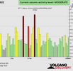
Based on the averages of all earthquakes during the last hours we had a LOW seismic activity level. Global seismic activity level chart

~4 quakes above magnitude 5
~31 quakes between magnitude 4 and 5
~100 quakes between magnitude 3 and 4
~185 quakes between magnitude 2 and 3
~500 quakes below magnitude 2 that people normally don't feel.
~820 earthquakes in the past 24h (953 earthquakes in the 24 hours prior to this report) Estimated combined seismic energy release: 6388 tons of TNT or 0.4 atomic bombs
Volcanodiscovery earthquake report 24h
 

Attachments

  • chrome_screenshot_1666482949132.png
    chrome_screenshot_1666482949132.png
    327.8 KB · Views: 0
Back
Top Bottom