Earthquakes around the world

SOUTH AMERICA EARTHQUAKES

Continuing with the seismic activity in South America, Peru and Chile have been shaken by M5+ earthquakes.

A Strong M5.8 earthquake hit South Pacific Ocean (West Chile Rise) on Monday, Oct 31, 2022 at 2:14 am local time.

M 5.8 - West Chile Rise
2022-10-31 08:14:33 (UTC)
38.757°S 91.854°W 10.0 km depth
USGS earthquake alert

A magnitude 5.5 earthquake near Alianza Cristiana, Peru, occurred at an intermediate depth of 143 km beneath the epicenter in the morning on Monday at 8:22 am local time. The region (Peru-Ecuador border) is not densely populated and no damage was reported.

M 5.5 - 118 km NNE of Alianza Cristiana, Peru
2022-10-31 13:22:43 (UTC)
2.424°S 76.217°W. 143.7 km depth
USGS earthquake alert

Almost two minutes after the M5.5 earthquake another M5.1 occurred in Santiago Peru (Ica Region, pop. 246,800) The quake hit at a moderately shallow depth of 39.9 km beneath the epicenter at 8:25 am local

M 5.1 - 28 km W of Santiago, Peru
2022-10-31 13:25:46 (UTC)
14.217°S 75.970°W. 39.9 km depth
USGS earthquake alert
The last earthquake had a magnitude of 4.8 almost four hours ago.

M 4.8 - 62 km WSW of Santiago, Peru
2022-10-31 14:18:29 (UTC)
14.469°S 76.214°W. 24.6 km depth
USGS earthquake alert
 
Wow... by Italian standards, this certainly looks strong, but it was a very deep earthquake.

M 5.5 - 11 km WSW of Tortora Marina, Italy
2022-10-31 21:42:50 (UTC)
39.899°N 15.637°E. 267.9 km depth
USGS earthquake alert

An earthquake of magnitude 5.2 occurred only 11 minutes ago 85 km southwest of Potenza, Italy, the German Research Centre for Geosciences (GFZ) reported.

The quake hit at an intermediate to considerable depth of 275 km beneath the epicenter near Potenza, Provincia di Potenza, Basilicate, Italy, late at night on Monday, October 31st, 2022, at 10:42 pm local time, Volcanodiscovery reported.

Towns or cities near the epicenter where the quake might have been felt as very weak shaking include Praia a Mare (pop. 6,500) located 20 km from the epicenter, Castrovillari (pop. 20,300) 56 km away, Agropoli (pop. 17,300) 69 km away and Potenza (pop. 56,400) 85 km away, Estimated energy release equivalent to 674 tons of TNT

Data for the same earthquake reported by different agencies:

Mag.DepthLocationSource
5.1286 kmItaly: Costa Calabra Nord-occidentale (Cosenza)INGV
5.1269 kmSOUTHERN ITALYEMSC
5.5268 kmSouthern ItalyRaspberryShake
5.4275 kmSouthern ItalyGFZ
5.510 kmSouthern ItalyIRIS
5.5268 km11 Km WSW of Tortora Marina, ItalyUSGS
 
WORLDWIDE EARTHQUAKE REPORT OCTOBER 31

After the M5.1 earthquake west of Santiago Peru, an M4.8 earthquake followed.

M 4.8 - 62 km WSW of Santiago, Peru
2022-10-31 14:18:29 (UTC)
14.469°S 76.214°W. B24.6 km depth
USGS earthquake alert

Ten hours have passed without an earthquake in the Santiago region.

Other earthquakes M5+

M 5.0 - 48 km WSW of Banjar, Indonesia
2022-10-31 03:05:58 (UTC)
7.439°S 107.065°E. 67.9 km depth
USGS earthquake alert

M 5.0 - South Sandwich Islands region
2022-10-31 14:08:48 (UTC)
58.977°S 25.708°W. 56.2 km depth
USGS earthquake alert

● Summary

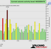
Seismic activity level has been at moderate levels in the last 24 hours. This is the last chart posted by Volcanodiscovery 22:00 UTC on October 30: Global seismic activity level chart

~5 quakes above magnitude 5
~31 quakes between magnitude 4 and 5
~95 quakes between magnitude 3 and 4
~204 quakes between magnitude 2 and 3
~569 quakes below magnitude 2 that people normally don't feel.
~904 earthquakes in the past 24h (768 earthquakes in the 24 hours prior to this report) Estimated combined seismic energy release: 14758 tons of TNT or 0.9 atomic bombs
Volcanodiscovery earthquake report 24h
 

Attachments

  • chrome_screenshot_1667263788530.png
    chrome_screenshot_1667263788530.png
    369.1 KB · Views: 0
Bad news for Peru: IGP warns that a very powerful earthquake is very likely to occur in Lima

More than 30 earthquakes have occurred since October 28th in the region of Ica and this worries local authorities. Now the president of the IGP, Hernando Tavera said that it is very likely that an earthquake of enormous magnitude will hit the Peruvian capital.

This is because it has been more than 270 years since an earthquake of greater magnitude has been reported in the central zone of Peru, explained the official.

"Earthquakes cannot be predicted, but we do know that since the last major earthquake that struck off the coast of Lima more than 270 years have already passed, that means that the probability may be greater because the more time passes the possibility continues to increase. We must all understand that we are a highly seismic country and that is why prevention and commitment are necessary", said Tavera to Radio Exitosa Noticias.

Tavera asked the inhabitants to remain calm and to take preventive measures, since it is common knowledge that Peru is located in a highly seismic zone.

"This (the constant earthquakes in Ica) are nothing abnormal because we are a highly seismic country. Yes, we are seismic par excellence and an earthquake will occur at some point, we cannot avoid it, nor control it, nor reduce it, what is in our hands as people, as authorities, is to reduce our risk before the occurrence of earthquakes and how we are going to do it by checking our houses, checking the soils, participating in the drills", he added.
 
WORLDWIDE EARTHQUAKE REPORT NOVEMBER 01

A magnitude 5.4 earthquake hit near Yonakuni Japan (pop. 1,700) located 55 km from the epicenter. The earthquake occurred at an intermediate depth of 107 km beneath the epicenter in the afternoon on Tuesday, November 1st, 2022, at 5:30 pm local time. Given the depth at which the earthquake occurred, it must have felt very weak. Weak shaking might have been felt also in Taipei (pop. 7,871,900) 107 km away,

●M 5.4 - 50 km NW of Yonakuni, Japan
2022-11-01 08:30:10 (UTC)
24.770°N 122.629°E. 107.3 km depth
USGS earthquake alert

A second moderate earthquake in Japan ocurred in the morning on Wednesday, November 2nd, 2022, at 9:45 am local time. The quake should not have caused any significant damage, but was probably felt by many people as light vibration in the area of the epicenter. Weak shaking might have been felt in Kushiro (pop. 183,600) located 125 km from the epicenter.

●M 5.1 - 124 km SSE of Kushiro, Japan
2022-11-01 23:45:53 (UTC)
41.971°N 145.054°E. 9.5 km depth
USGS earthquake alert

A magnitude 5.4 earthquake occurred 190 km north of Nagqu Prefecture (Tibet) (pop: 30,000) the quake ocurred on Wednesday, Nov 2, 2022 at 6:06 am

●M 5.1 - 190 km N of Nagqu, China
2022-11-01 22:06:55 (UTC)
33.194°N 91.976°E. 10.0 km depth
USGS earthquake alert

●M 5.0 - 112 km SW of Puerto El Triunfo, El Salvador
2022-11-01 13:35:39 (UTC)
12.442°N 89.130°W. 10.0 km depth
USGS earthquake alert

● Summary

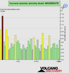
Seismic activity level has been at moderate levels in the last 24 hours. This is the last chart posted by Volcanodiscovery 22:00 UTC on October 30: Global seismic activity level chart

~4 quakes above magnitude 5
~34 quakes between magnitude 4 and 5
~85 quakes between magnitude 3 and 4
~195 quakes between magnitude 2 and 3
~507 quakes below magnitude 2 that people normally don't feel.
~825 earthquakes in the past 24h (904 earthquakes in the 24 hours prior to this report) Estimated combined seismic energy release: 6900 tons of TNT or 0.4 atomic bombs
Volcanodiscovery earthquake report 24h
 

Attachments

  • chrome_screenshot_1667349974771.png
    chrome_screenshot_1667349974771.png
    376.2 KB · Views: 0
Very strong mag. 6.0 earthquake - North Pacific Ocean

A magnitude 6.0 earthquake occurred on Tuesday, Nov 1, 2022 at 7:53 pm local time. There are no populations near the epicenter. It is considered an intra-plate earthquake (Pacific Plate)

M 6.0 - North Pacific Ocean
2022-11-02 04:53:12 (UTC)
31.425°N 133.301°W. 10.0 km depth

Data for the same earthquake reported by different agencies

Mag.DepthLocationSource
6.010 kmNorth Pacific OceanUSGS
5.740 kmNORTH PACIFIC OCEANEMSC
6.010 kmNorth Pacific OceanRaspberryShake
5.710 kmNear San JoseRENASS
6.00.8 kmNorth Pacific Ocean [Sea]INGV
5.910 kmNorth Pacific OceanGFZ
6.07 kmNorth Pacific OceanGeoAu
6.010 kmNorth Pacific OceanIRIS
 
Earthquake detected in South Sandwich Islands, this Wednesday, November 02, 2022, reports the European-Mediterranean Seismological Center (EMSC).

The earthquake occurred in a remote area and was at a depth of 10 kilometers underground, the European-Mediterranean Seismological Center (EMSC) said.


M 6.1 - South Sandwich Islands region
2022-11-02 14:17:51 (UTC)
60.796°S 25.733°W. 10.0 km depth
USGS earthquake alert
 
WORLDWIDE EARTHQUAKE REPORT NOVEMBER 02

A magnitude 6.0 earthquake struck off the coast of California in the North Pacific Ocean on Tuesday night, November 1, the U.S. Geological Survey reported.

The quake, about 6 miles deep, was recorded about 743 miles west-southwest of Monterey. People on social media from as far away as San Diego and San Francisco reported feeling the tremor, however, the quake was "too small and too far away" tweeted the National Weather Service Bay Area office.

So far, the USGS has not reported any aftershocks from the earthquake. This situation has generated speculation on social networks that it was an explosion. It should be noted that intraplate earthquakes are very rare in that region.

An ‘oddball’ 6.0 earthquake is recorded almost 800 miles off Southern California’s coast​


A 6.0 magnitude earthquake was recorded almost 800 miles off the Southern California coast Tuesday night, an “oddball” event that made little impact but drew intrigue from scientists because of its location.

“It’s a decent size, but that’s a location that is just not common,” said Susan Hough, a seismologist with the U.S. Geological Survey in Pasadena. “I’ve been watching earthquakes for going on 40 years, and I don’t remember anything that big in that location.” The temblor occurred roughly in line with San Diego.

Since 1900, there have been only 10 other recorded earthquakes in the north Pacific Ocean off Southern California’s coast — and of the temblors more than 500 miles from the coast, all measured under 5.0 magnitude, according to the USGS.

Tuesday’s earthquake occurred just before 10 p.m., and as of Wednesday morning, no aftershocks had been recorded, Hough said. She said because of its location, the seismic activity is unlikely to have caused any damage or had any other effects, though she said nearby boats could have felt the movement.

The earthquake’s location is considered odd because it did not fall near or along tectonic plate boundaries, but in the middle of a large plate — a phenomenon known as an “intraplate earthquake,” Hough said. The vast majority of earthquakes occur along plate boundaries, like along California’s San Andreas fault, though intraplate earthquakes do sometimes occur.

“It’s a weird earthquake,” Hough said. “There really isn’t an overarching explanation for intraplate earthquakes, except that they happen.”

“There’s stresses in the crust for all sorts of reasons, so you can have these oddball events that pop up,” Hough said. “It’s not unprecedented to have an intra-plate oceanic earthquake in an oddball location.”

“The expectation is that it’s just an oddball, kind of black swan event that’s in the middle of the Pacific,” Hough said. “But people will be keeping an eye on it.”

She said in 2018 oceanic seismic activity off the east coast of eastern Africa led to scientists finding an underwater volcano, but Hough said that was after detecting repeated earthquakes and movement, which she has seen no sign of in this case.

With the mid-term elections in the US and the possibility of the Democrats losing the election, I wonder if this Black Swan was intentional or just a natural effect of Earth changes.

government US - behind California quakes - Three soon -

(L) I have a question. I've been waiting for somebody to ask it, but since nobody is going to ask it, I want to ask it: Was the Haiti earthquake an induced earthquake, or was it totally natural?

A: (Planchette swirls on board) INDUCED! Bet you didn't expect that, did you?!

Q: (L) Frankly, I didn't. Because I've already gone on record saying it wasn't. I just poo-pooed the whole idea as too far out there. (laughter) So now I've gotta...

(Joe) Well, it was the Russians who said that, wasn't it?

A: No!

Q: (Joe) Didn't you tell us the Russians reported that?

(L) The question I want to ask is, how do they induce earthquakes? (To Ark) How do you think they induce earthquakes? (Joe) Space-based satellite

(Ark) Well, just search the internet! (laughter) Yeah, it's on the internet. You create special waves that go into the earth and propagate in the right direction...

(L) I don't believe it. They don't have enough power to do that.

(Joe) I want to know who induced it?

A: U.S.

● M 5.3 - 13 km NNE of Calama, Chile
2022-11-02 02:37:59 (UTC)
22.340°S 68.895°W. 109.0 km depth
USGS earthquake alert

● M 5.0 - 98 km SSW of Basco, Philippines
2022-11-02 13:07:42 (UTC)
19.596°N 121.709°E. 43.1 km depth
USGS earthquake alert

● M 4.8 - 67 km SE of Beykonak, Turkey
2022-11-02 17:41:23 (UTC)
35.960°N 30.901°E. 55.6 km depth
USGS earthquake alert

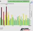
● Summary

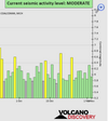
Seismic activity level has been at moderate levels in the last 24 hours. This is the last chart posted by Volcanodiscovery 22:00 UTC on November 02: Global seismic activity level chart

~2 quakes above magnitude 6
~3 quakes between magnitude 5 and 6
~41 quakes between magnitude 4 and 5
~91 quakes between magnitude 3 and 4
~217 quakes between magnitude 2 and 3
~619 quakes below magnitude 2 that people normally don't feel.
~973 earthquakes in the past 24h (825 earthquakes in the 24 hours prior to this report) Estimated combined seismic energy release: 42590 tons of TNT or 2.7 atomic bombs
Volcanodiscovery earthquake report 24h
 

Attachments

  • chrome_screenshot_1667441057365.png
    chrome_screenshot_1667441057365.png
    354.9 KB · Views: 0
An earthquake of magnitude 5.1 occurred 46 km northwest of Buzau, Romania, the German Research Centre for Geosciences (GFZ) reported.

The quake hit at an intermediate depth of 144 km beneath the epicenter near Buzau, Municipiul Buzău, Buzău, Romania, early morning on Thursday, November 3rd, 2022, at 6:50 am local time.

Weak shaking might have been felt in Nehoiu (pop. 11,400) located 23 km from the epicenter, Râmnicu Sărat (pop. 38,500) 41 km away, Buzau (pop. 131,000) 46 km away, Targu Secuiesc (pop. 20,100) 63 km away, Săcele (pop. 29,900) 67 km away, Tecuci (pop. 41,200) 77 km away, Campina (pop. 41,600) 78 km away, and Bucharest (pop. 1,877,200) 126 km away.

M 5.1 - 7 km NE of Gura Teghii, Romania
2022-11-03 04:50:25 (UTC)
45.534°N 26.471°E. 148.1 km depth
USGS earthquake alert
 
Earthquake in Serbia on the same day as 12 years before:

https://lat.sputnikportal.rs/202211...isti-dan-kao-i-pre-12-godina--1145560970.html

Exactly on the anniversary of the devastating earthquake, an earthquake with a magnitude of 2.3 on the Richter scale hit Kraljevo today around 12:30 p.m., according to the website of the Republic of Serbia's Seismological Institute (RSZ).

The citizens of Kraljevo say that it was felt when it shook, but not nearly as much as when the earthquake in 2010 happened on this very day.

A devastating earthquake occurred in 2012, in the night between November 2 and 3, the surroundings of Kraljevo were hit by an earthquake with a magnitude of 5.4 on the Richter scale, in which two people died, and around 200 people suffered minor injuries.

The epicenter of the earthquake was ten kilometers north of Kraljevo, in the villages of Vitanovac, Vitkovac and Stubal, on the Kraljevo-Kragujevac road. The earthquake, which lasted a few seconds, was also felt in all major cities of Serbia.

A married couple, Natalija and Siniša Stašić, lost their lives in the earthquake when the roof of their family home in the village of Grdica collapsed on them.
 
WORLDWIDE EARTHQUAKE REPORT NOVEMBER 03

Medium-intensity earthquake shakes Romania on Thursday morning

The earthquake took place in the Vrancea seismic area, some 118 km north of Bucharest, at a depth of 147 km. It was felt in Buzau, which is close to the epicenter as well as Bucharest.

This is the most significant earthquake felt in Romania since October 28, 2018, when an earthquake of 5.5 was reported. Two more earthquakes (of over 5 degrees on the Richter scale) occurred in September and December 2016, following similar events in October 2013 and November 2014, according to data from EMSC.

With the exception of the M5.1 earthquake in Romania, the other M5+ earthquakes of the period occurred offshore. The one with the highest magnitude occurred in Reykjanes Ridge. As you may recall, this region recorded a seismic swarm in September that culminated in an M6.0 earthquake on October 1, 2022.

● M 5.4 - Reykjanes Ridge
2022-11-03 20:47:46 (UTC)
53.790°N 35.516°W. 10.0 km depth
USGS earthquake alert

Other M5+ earthquakes:

●M 5.3 - Banda Sea
●M 5.0 - southern Mid-Atlantic Ridge
●M 5.0 - Molucca Sea Indonesia

Baja California peninsula and California recorded minor seismic activity.

● M4.2 - 96 km West Ahome Sinaloa (California Gulf)
2022-11-03 08:36:21 (UTC)
25.78°N 110.12°W 24 km depth

● M 3.3 - Baja California, Mexico
2022-11-03 19:34:11 (UTC)
31.164°N 116.617°W. 15.3 km depth
USGS earthquake alert

● M 3.3 - 79km ESE of Maneadero, B.C., MX
2022-11-03 19:11:09 (UTC)
31.530°N 115.760°W. 16.9 km depth
USGS earthquake alert

● M 3.1 - 85km ESE of Maneadero, B.C., MX
2022-11-03 19:09:03 (UTC)
31.564°N 115.691°W. 1.7 km depth
USGS earthquake alert

● M 2.8 - 9km NE of Alum Rock, CA
2022-11-03 15:45:22 (UTC)
37.430°N 121.773°W. 8.8 km depth
USGS earthquake alert

● M 3.5 - 196 km W of Bandon, Oregon
2022-11-03 09:57:34 (UTC)
43.328°N 126.805°W 10.0 km depth
USGS earthquake alert

● Earthquake Forecast

A high lunar peak followed by critical planetary geometry can cause larger seismic activity from 5 to 7 November, potentially reaching higher 6 to 7 magnitude.

● Summary

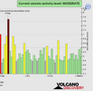
Seismic activity level has been at low to moderate levels in the last 24 hours. This is the last chart posted by Volcanodiscovery 22:00 UTC on November 03: Global seismic activity level chart

~5 quakes above magnitude 5
~35 quakes between magnitude 4 and 5
~103 quakes between magnitude 3 and 4
~232 quakes between magnitude 2 and 3
~541 quakes below magnitude 2 that people normally don't feel.
~916 earthquakes in the past 24h (973 earthquakes in the 24 hours prior to this report) Estimated combined seismic energy release: 9762 tons of TNT or 0.6 atomic bombs
Volcanodiscovery earthquake report 24h
 

Attachments

  • chrome_screenshot_1667520216405.png
    chrome_screenshot_1667520216405.png
    346.7 KB · Views: 0
An earthquake of magnitude 5.7 struck near La Libertad El Salvador (pop. 16,900). The quake hit at an intermediate depth of 56 km beneath the epicenter, late at night on Thursday, November 3rd, 2022, at 10:26 pm local time. Estimated energy release equivalent to 5351 tons of TNT

M 5.7 - 43 km SW of La Libertad, El Salvador
2022-11-04 04:26:11 (UTC)
13.187°N 89.577°W. 56.6 km depth.
USGS earthquake alert

A 4.8-magnitude earthquake struck near Karabağlar (pop. 458,000) Turkey. The tremor was recorded early morning on Friday, November 4th, 2022, at 3:29 am local time, at a shallow depth of 10 km below the surface.

M 4.8 - 7 km ESE of Karabağlar, Turkey
2022-11-04 00:29:21 (UTC)38.357°N 27.218°E. 10.0 km depth
USGS earthquake alert
 
An earthquake of magnitude 6.2 occurred only 15 minutes ago 127 km west of Guaymas, Mexico. The quake hit at a shallow depth of 10 km beneath the epicenter near Guaymas, Sonora, Mexico, early morning on Friday, November 4th, 2022, at 3:02 am local time.

M 6.2 - Gulf of California
2022-11-04 10:02:48 (UTC)
28.142°N 112.301°W. 10.0 km depth
USGS earthquake alert

Data for the same earthquake reported by different agencies

Mag.DepthLocationSource
6.310 kmMexico: 92 Km Al NORTE De SANTA ROSALIA, BCSSSN
6.130 kmMexico: GULF OF CALIFORNIAEMSC
6.210 kmMexico: Gulf of CaliforniaRaspberryShake
5.410 kmMexico: Near HermosilloRENASS
6.29.8 kmGulf of California, Mexico [Sea: Mexico]INGV
5.810 kmMexico: Gulf of CaliforniaGFZ
6.210 kmMexico: Gulf of CaliforniaGeoAu
6.210 km83 Km SSW of Bahía De Kino, MexicoUSGS
6.210 kmMexico: Gulf Of CaliforniaIRIS
 
WORLDWIDE EARTHQUAKE REPORT NOVEMBER 04

Atypical 6.3 magnitude earthquake shook the Gulf of California, northwestern Mexico

An atypical earthquake of 6.3 magnitude shook the Gulf of California in northwestern Mexico on Friday, and was felt in some parts of the Mexican Republic such as Sonora, Baja California and Baja California Sur.

Mexico's National Seismological Service (SSN) indicated that the epicenter was located about 80 kilometers south-southwest of the town of Bahía de Kino, in the municipality of Hermosillo, and had a depth of 10 kilometers.

SSN has registered 14 aftershocks in the last hours and the strongest one was of 4.1, registered at 06:59 hours, movements that are reported to be uneventful.

This is the second large West Coast earthquake we've seen this week. The first was the intraplate M6.0 on Wednesday, November 02 in North Pacific Ocean. The second the M6.3 earthquake in Gulf of California. It occurred between the boundaries of the North American plate and the Pacific plate.

1185547.regional.jpg


● M 5.0 - 64 km W of Iquique, Chile
2022-11-04 14:39:02 (UTC)
20.175°S 70.768°W. 10.0 km depth
USGS earthquake alert

● Atypical earthquake in Canada

M 4.8 - Melville Island region, Nunavut, Canada
2022-11-04 21:31:20 (UTC)
75.755°N 105.099°W. 10.0 km depth
USGS earthquake alert

● Summary

Seismic activity level has been at low to moderate levels in the last 24 hours. This is the last chart posted by Volcanodiscovery 22:00 UTC on November 03: Global seismic activity level chart

~1 quake above magnitude 6
~3 quakes between magnitude 5 and 6
~43 quakes between magnitude 4 and 5
~102 quakes between magnitude 3 and 4
~262 quakes between magnitude 2 and 3
~608 quakes below magnitude 2 that people normally don't feel.
~1019 earthquakes in the past 24h (916 earthquakes in the 24 hours prior to this report) Estimated combined seismic energy release: 52849 tons of TNT or 3.3 atomic bombs
Volcanodiscovery earthquake report 24h
 

Attachments

  • chrome_screenshot_1667605969417.png
    chrome_screenshot_1667605969417.png
    370.8 KB · Views: 0
Back
Top Bottom