Earthquakes around the world

Last week saw 3 M6 earthquakes with the highest being a M6.4 in Papua New Guinea.
In the usual area, there were 6 out of 107 earthquakes worldwide equal to or greater than 4.5 and 1612 out of 2060 quakes of all sizes.
Percentage: 78.3%
Last week saw just 1 M6, it being a M 6.7 in Panama.
In the usual area, there was 1 out of 93 earthquakes worldwide equal to or greater than 4.5 and 1541 out of 1988 quakes of all sizes.
Percentage: 77.5%
Earthquakes 7 days to October 23th 2022.gif
 
WORLDWIDE EARTHQUAKE REPORT OCTOBER 23

In the past 24 hours, 1058 earthquakes below magnitude 2 were recorded. More than half of these earthquakes were recorded by the Herdubreid volcano.

~1 quake above magnitude 3
~13 quakes between magnitude 2 and 3
~594 quakes below magnitude 2 that people normally don't feel.
Total 608 earthquakes. Estimated energy release equivalent to 2.79 tons of TNT.
Latest quakes near Herdubreid volcano in the past 24 h

Herðubreið-Iceland-2.jpg
The Herdubreid volcano has not erupted in the last 10,000 years. Icelandic authorities consider this activity to be normal. The highest magnitude earthquake in the last 7 days was M4.0 and occurred at 23:11 on October 22.

USGS reported a magnitude 5.0 quake in China near Zangguy, Hotan Prefecture, Xinjiang (pop. 13,000) The earthquake hit late at night on Sunday, October 23rd, 2022, at 11:06 pm local time. The earthquake had a estimated energy release equivalent to 477 tons of TNT

●M 5.0 - southern Xinjiang, China
2022-10-23 15:06:57 (UTC)
37.629°N 77.825°E. 10.0 km depth
USGS earthquake alert

Very deep earthquake in Indonesia

●M 5.1 - 130 km NNE of Tobelo, Indonesia
2022-10-23 02:15:40 (UTC)
2.761°N 128.573°E. 228.1 km depth
USGS earthquake alert

An earthquake of magnitude 5.1 occurred late at night on Saturday, October 22nd, 2022, at 11:08 pm local time near Calama, (pop. 143,100) Provincia de El Loa, Antofagasta, Chile. The earthquake had a estimated energy release equivalent to 674 tons of TNT

●M 5.1 - 57 km NNE of Calama, Chile
2022-10-23 02:08:29 (UTC)
21.963°S 68.749°W. 105.5 km depth
USGS earthquake alert

The Caribbean and Cocos plates continue with a seismic sequence. These are the earthquakes recorded in the last 24 hours

●M 4.7 - 13 km NNW of Otra Banda, ●Dominican Republic
●M 2.5 - 2 km ENE of Magas Arriba, Puerto Rico
●M 3.0 - 4 km NW of Hormigueros, Puerto Rico
●M 2.9 - 6 km WSW of Fuig, Puerto Rico
●M 4.0 - 71 km SSE of Burica, Panama
●M 2.5 - 2 km N of Guayanilla, Puerto Rico

USGS reported a magnitude 4.2 quake in the United States near Eureka, Humboldt County, California. The earthquake hit in the morning on Sunday, October 23rd, 2022, at 11:16 am local time at a shallow depth of 28 km. Weak shaking might have been felt in Fortuna (pop. 12,000) The earthquake had a estimated energy release equivalent to 21.3 tons of TNT Prior to the M4.1 earthquake, other earthquakes of lesser magnitude were recorded:

M 3.3 - 23km SSW of La Quinta, CA
M 2.7 - 9km ENE of San Martin, CA

●M 4.1 - 3km SSE of Fortuna, CA
2022-10-23 18:16:23 (UTC)40.578°N 124.140°W. 28.4 km depth
USGS earthquake alert

● Summary

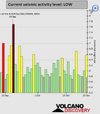
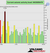
Seismic activity level has been at moderate to low level. This is the last chart posted by Volcanodiscovery at 22:00 UTC on October 23: Global seismic activity level chart

~3 quakes above magnitude 5
~33 quakes between magnitude 4 and 5
~106 quakes between magnitude 3 and 4
~214 quakes between magnitude 2 and 3
~1058 quakes below magnitude 2 that people normally don't feel.
~1414 earthquakes in the past 24h (820 earthquakes in the 24 hours prior to this report) Estimated combined seismic energy release: 5200 tons of TNT or 0.3 atomic bombs.
Volcanodiscovery earthquake report 24h
 

Attachments

  • chrome_screenshot_1666569301835.png
    chrome_screenshot_1666569301835.png
    341.7 KB · Views: 1
WORLDWIDE EARTHQUAKE REPORT OCTOBER 24

Philippines was shaken by two earthquakes. The first a magnitude 5.3 earthquake near Central, Davao del Sur, Davao, Philippines.
the quake hit on Monday, October 24th, 2022, at 10:06 am local time at an considerable depth of 252 km. The strength of the earthquake may have been tempered by its relative great depth below the surface. The second a M5.4 near Borongan City, Eastern Samar, Eastern Visayas. The earthquake hit late at night on Monday, October 24th, 2022, at 11:08 pm local time at a shallow depth of 10 km. Weak shaking might have been felt in Guiuan (pop. 11,000) 31 km away from epicenter. Estimated energy release equivalent to 1898 tons TNT

●M 5.4 - 14 km ENE of Guiuan, Philippines
2022-10-24 15:08:33 (UTC)
11.087°N 125.848°E. 35.0 km depth
USGS earthquake alert

●M 5.3 - 4 km W of Bato, Philippines
2022-10-24 02:06:42 (UTC)
7.047°N 125.437°E. 252.1 km depth
USGS earthquake alert

Highest magnitude earthquake in the last 24 hours occurred in Tonga with a M5.6 The quake hit on Monday, October 24th, 2022, at 08:50 pm local time at a shallow depth of 10 km. Fortunately there are no inhabitants in the epicenter area. The nearest town is 186 km southwest of Vailoa (pop: 769).

●M 5.6 - 106 km NE of Hihifo, Tonga
2022-10-24 07:50:58 (UTC)
15.184°S 173.201°W. 10.0 km depth
USGS earthquake alert

Other M5+ Earthquakes
●M 5.3 - Pagan region, Northern Mariana Islands
●M 5.1 - Solomon Islandsa
●M 5.0 - 56 km SE of Pajarillo, Peru
2022-10-24 05:04:42 (UTC)
7.483°S 76.273°W. 126.3 km depth
USGS earthquake alert

● Summary

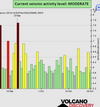
Seismic activity level has been at moderate levels in the last 24 hours. This is the last chart posted by Volcanodiscovery at 22:00 UTC on October 23: Global seismic activity level chart

~6 quakes above magnitude 5
~33 quakes between magnitude 4 and 5
~106 quakes between magnitude 3 and 4
~195 quakes between magnitude 2 and 3
~798 quakes below magnitude 2 that people normally don't feel.
~1138 earthquakes in the past 24h (1414 earthquakes in the 24 hours prior to this report) Estimated combined seismic energy release: 12669 tons of TNT or 0.8 atomic bombs!
Volcanodiscovery earthquake report 24h

UPDATE

M 6.3 - South Sandwich Islands region
2022-10-25 00:13:02 (UTC)
58.719°S 26.153°W. 81.8 km depth
USGS earthquake alert

Data for the same earthquake reported by different agencies​


Mag.DepthLocationSource
6.382 kmSouth Sandwich Islands RegionUSGS
6.110 kmSOUTH SANDWICH ISLANDS REGIONEMSC
6.382 kmSouth Sandwich Islands RegionRaspberryShake
6.1100 kmNear Mar Del PlataRENASS
6.3127 kmSouth Georgia & the South Sandwich Is. [Sea]INGV
6.410 kmSouth Sandwich Islands RegionGFZ
6.3115 kmSouth Sandwich Islands RegionGeoAu
6.310 kmSouth Sandwich Islands RegionIRIS
 

Attachments

  • chrome_screenshot_1666656607421.png
    chrome_screenshot_1666656607421.png
    352.8 KB · Views: 0
WORLDWIDE EARTHQUAKE REPORT OCTOBER 25

Possibly the increase in seismic activity in the past 24 hours is due to "multiple lunar peaks converging with critical planetary geometry" as predicted by SSGEOS.

According to SSGEOS: "The planetary geometry that triggered the seismic increase that we saw today at South Sandwich Islands (Mw 6.3) and Luzon, Philippines (Mw 6.6). There's likely more to come in the coming days.

The earthquake in the Philippines had a preliminary magnitude of 6.6 and as more results came in from the agencies it was adjusted to magnitude 6.4.

Data for the same earthquake reported by different agencies
Mag.DepthLocationSource
6.427 km9 Km SE of Pinili, PhilippinesUSGS
6.618 kmLUZON, PHILIPPINESEMSC
6.410 kmLuzon, PhilippinesGFZ
6.427 kmLuzon, PhilippinesRaspberryShake
6.411 kmPhilippines: 007 Km N 58° W of Tineg (Abra)PHIVOLCS
6.410 kmLuzon, PhilippinesIRIS
6.411 kmLuzon, PhilippinesGeoAu
6.210 kmPhilippines: Near ManilaRENASS
6.520 kmPhilippines [Land]INGV

M 6.4 - 12 km E of Dolores, Philippines
2022-10-25 14:59:03 (UTC)
17.662°N 120.823°E. 27.3 km depth
USGS earthquake alert

According to the United States Geological Survey, the quake hit on Tuesday, October 25th, 2022, at 10:59 pm local time at a shallow depth of 10 km. The quake should have been felt by everybody in the area of the epicenter near Dolores, Eastern Samar (pop. 44,626) According to earthquake data: "dangerous ground shaking occurred with the potential to inflict moderate to heavy damage to buildings and other infrastructure" however no damage has been reported. Estimated energy release equivalent to 60036 tons of TNT or 3.8 atomic bombs.

A moderate M5.1 earthquake occurred in the morning on Tuesday, October 25th, 2022, at 11:42 am local time near San Jose, Santa Clara County, California, USA, as reported by USGS. According to data, the quake was located at a very shallow depth of 8.4 km (5.22 miles) the quake was probably felt by many people in the area of the epicenter: In East Foothills (pop. 8,300) located 9 miles from the epicenter, San Jose (pop. 1,026,900) 12 miles away, Morgan Hill (pop. 42,900) 13 miles away, Milpitas (pop. 77,600) 15 miles away, Santa Clara (pop. 126,200) 16 miles away, seonibeil (pop. 151,800) 20 miles away, Mountain View (pop. 80,400) 23 miles away, and Fremont (pop. 232,200) 24 miles away, the quake should have been felt as light shaking. Estimated energy release equivalent to 674 tons of TNT

M 5.1 - 15km ESE of Alum Rock, CA
2022-10-25 18:42:02 (UTC)
37.312°N 121.672°W 8.4 km depth
USGS earthquake alert

●Other earthquakes M5+

M 5.1 - Mindanao, Philippines
M 5.1 - 108 km SSE of Hihifo, Tonga

●Earthquakes M4+

M 4.5 - Reykjanes Ridge
M 4.6 - Reykjanes Ridge
M 4.6 - 54 km W of Minbu, Myanmar
M 4.6 - 130 km WNW of Hihifo, Tonga
M 4.8 - 281 km E of Levuka, Fiji
M 4.5 - Fiji region
M 4.6 - 8 km S of Padong, Philippines
M 4.5 - northern Qinghai, China
M 4.8 - 24 km NE of La Paz, Philippines
M 4.9 - 57 km ESE of Koseda, Japan
M 4.6 - 120 km NNE of Tobelo, Indonesia
M 4.9 - 256 km ESE of Ust’-Kamchatsk Staryy, Russia

● Summary

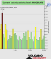
Seismic activity level has been at moderate to high levels in the last 24 hours. This is the last chart posted by Volcanodiscovery at 22:00 UTC on October 23: Global seismic activity level chart

chrome_screenshot_1666745507144.png
~1 quake above magnitude 6
~3 quakes between magnitude 5 and 6
~32 quakes between magnitude 4 and 5
~94 quakes between magnitude 3 and 4
~248 quakes between magnitude 2 and 3
~831 quakes below magnitude 2 that people normally don't feel.
~1209 earthquakes in the past 24h (1138 earthquakes in the 24 hours prior to this report) Estimated combined seismic energy release: 12669 tons of TNT or 0.8 atomic bombs!
Volcanodiscovery earthquake report 24h
 
A moderate M5.1 earthquake occurred in the morning on Tuesday, October 25th, 2022, at 11:42 am local time near San Jose, Santa Clara County, California, USA, as reported by USGS.

Today's #earthquake in #SanJose #California M5.1 was on the Calaveras Fault and is the strongest earthquake recorded in the San Francisco Bay Area since the 2014 M6.0 Napa earthquake.

An omen (Calaveras = skulls) or Mother Earth wishes happy Halloween to the U.S.
set-de-table-calavera.png

An earthquake just shook the Bay Area. Here's what to know about the obscure Calaveras Fault.​


The San Andreas and Hayward faults get all the attention in the San Francisco Bay Area, but on Tuesday, the obscure Calaveras Fault made itself known.

A magnitude 5.1 earthquake struck on the fault that runs through the hills east of San Jose, rocking the region and reminding everyone that we live in earthquake country. “The location of the epicenter suggests that this earthquake occurred within the Calaveras Fault zone,” U.S. Geological Survey research geophysicist Annemarie Baltay said in a video posted on Twitter.

Turns out, the Calaveras Fault has the same capability to cause a ruckus as the two big-name faults.

“When we think about hazardous faults in the Bay Area, there are three primary faults, San Andreas, Hayward-Rodgers Creek and Calaveras,” said Richard Allen, director of UC Berkeley’s Seismology Lab. “Calaveras is one of the big three.”

A 2014 report from the USGS found those three faults are the most likely in the Bay Area to see a major earthquake in the future similar to the 1989 Loma Prieta tremor, which killed 63 people. Seismologists discovered that within a 30-year period, from 2014 to 2043, the odds of a magnitude 6.7 or larger earthquake occurring on the San Andreas Fault was 22%, on the Calaveras was 26% and on the Hayward-Rodgers Creek 33%.

The last major quake on the Calaveras Fault was in 2007 when a magnitude 5.5 hit near Alum Rock on Halloween. Before that, in 1984, the fault produced a magnitude 6.2 shaker near Halls Valley southwest of Mount Hamilton.

“It’s an area of seismicity, and these moderate earthquakes are what we’ve seen along this part of the fault in recent decades that cause light shaking and not a lot of damage,” said Stephen DeLong, a research geologist at the USGS Earthquake Science Center at Moffett Field. “It may be that we continue to see these moderate earthquakes, or it may be that this fault may participate in a larger earthquake in the future.”

The Calaveras and Hayward-Rodgers Creek faults are actually strands of the San Andreas Fault system,
branching off from California’s intricate San Andreas network of faults. The Calaveras branches out from the San Andreas south of the Bay Area near Pinnacles National Park. It heads north, cutting through the town of Hollister, cutting into the hills east of San Jose, running right under Mount Hamilton and then through Pleasanton, San Ramon and the Walnut Creek area, DeLong said.

Tuesday’s quake struck just south of Mount Hamilton at 11:42 a.m. There were no reports of damage, but more than 21,000 people, from Central California to the North Bay, reported on the USGS website that they felt shaking.


c69e8f1ae422a507cd1a8d70ce0bd45c_XL.jpg
 
WORLDWIDE EARTHQUAKE REPORT OCTOBER 26

Japan was shaken by an M5.3 earthquake on October 26th, at 5:06 pm local time near Kushiro, Kushiro Shi, Hokkaido, Japan (pop. 183,600) located 116 km from the epicenter. The estimated energy release was equivalent to 1344 tons of TNT. A foreshock magnitude 4.6 was felt one minute earlier

M 4.6 - 112 km SSE of Kushiro, Japan
2022-10-26 07:05:12 (UTC)41.991°N 144.717°E37.8 km depth
USGS earthquake alert

M 5.3 - 116 km SSE of Kushiro, Japan
2022-10-26 07:06:03 (UTC)
41.962°N 144.735°E. 35.1 km depth
USGS earthquake alert

A magnitude 5.1 was felt in San Antonio de los Cobres, Argentina (pop. 4,000) located 70 km from the epicenter on October 26th at 4:52 am local time. According to USGS data, the quake was located at considerable depth of 185 km.

M 5.1 - 70 km WNW of San Antonio de los Cobres, Argentina
2022-10-26 07:52:14 (UTC)24.094°S 66.995°W. 185.0 km depth

M 5.1 - Owen Fracture Zone region
2022-10-26 23:00:07 (UTC)
11.928°N 57.896°E. 10.0 km depth
USGS earthquake alert

Seismic activity continues in California at levels considered "normal".

M 2.7 - 14km ESE of Alum Rock, CA
M 2.8 - 112km W of Ferndale, CA
M 3.1 - 6km NW of Walker, CA
M 2.9 - 11km NW of Anza, CA
M 2.8 - 11km NW of Anza, CA
M 3.2 - off the coast of Oregon

Of the 1060 earthquakes below magnitude 2 that were recorded in the last 24 hours 537 were recorded near Herdubreid volcano. The highest magnitude earthquake was 3.0 at 3.8 km from Herdubreid on Wednesday, October 26 at 14:57 UTC.

● Summary

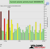
Seismic activity level has been at high to low levels in the last 24 hours. This is the last chart posted by Volcanodiscovery at 22:00 UTC on October 23: Global seismic activity level chart

~3 quakes above magnitude 5
~31 quakes between magnitude 4 and 5
~89 quakes between magnitude 3 and 4
~238 quakes between magnitude 2 and 3
~1060 quakes below magnitude 2 that people normally don't feel.
~1421 earthquakes in the past 24h (1209 earthquakes in the 24 hours prior to this report) Estimated combined seismic energy release: 5757 tons of TNT or 0.4 atomic bombs
Volcanodiscovery earthquake report 24h
 

Attachments

  • chrome_screenshot_1666825324412.png
    chrome_screenshot_1666825324412.png
    322.3 KB · Views: 0
WORLDWIDE EARTHQUAKE REPORT OCTOBER 27

A magnitude 5.0 earthquake near Ometepec, Guerrero, Mexico, was reported by USGS but according to the SNN (Servicio Sismológico Nacional), the earthquake had a magnitude 4.9 and it occurred at 97 kilometers south of San Marcos (pop. 6,600) , with Latitude 15.93 and Longitude -99.22. The earthquake occurred at a shallow depth of 21.8 km beneath the epicenter early morning on Thursday, October 27th, 2022, at 3:45 am local time.

So far no damage or further comments have been reported regarding the earthquake that shook San Marcos early this morning, although mexicans reported that they felt it in Zihuatanejo and some in Mexico City.

After the first earthquake, at 3:45 am, there was an aftershock, this time with a magnitude of 4.3 and an epicenter 88 km south of San Marcos. (USGS recorded it as M4.9) According to the data of both earthquakes, they occurred near the Guerrero Gap. Guerrero's seismic gap runs from Acapulco to Zihuatanejo, an area where, according to specialists from the National Autonomous University of Mexico (UNAM), no earthquakes greater than M7+ have occurred in decades. The fact that the Guerrero gap has not reported an earthquake of more than 7 degrees since the beginning of the last century worries Mexican seismologists.

The seismic gap is located 150 kilometers from Mexico City. If an earthquake of 8 degrees or more occurs, the consequences could be devastating since the proximity of the capital of the country and other entities of the center with the gap would result in damages two or three times greater than those registered in the 1985 earthquake, specialists say

According to Dr. Victor Manuel Cruz Atienza of UNAM, seismic activity in the Costa Chica of Guerrero is currently "abnormally high" and this seismic scenario has similarities with the events prior to the magnitude 9 earthquake in Japan in 2011.

M 5.0 - 7 km N of Marquelia, Mexico
2022-10-27 08:45:30 (UTC)
16.654°N 98.819°W. 21.7 km depth
USGS earthquake alert

M 4.9 - Guerrero-Oaxaca border region, Mexico
2022-10-27 14:02:13 (UTC)16.594°N 98.794°W. 24.8 km depth
USGS earthquake alert

Other earthquakes M5+

M 5.2 - Kuril Islands
2022-10-27 10:10:51 (UTC)
46.628°N 152.651°E. 50.2 km depth
USGS earthquake alert

M 5.4 - South Sandwich Islands region
2022-10-27 01:33:20 (UTC)
59.581°S 26.340°W. 76.9 km depth
USGS earthquake alert

M 5.0 - Hokkaido, Japan region
2022-10-27 13:25:04 (UTC)
41.924°N 144.885°E. 26.8 km depth
USGS earthquake alert

We have already talked about the seismic activity in the Caribbean. This afternoon at 01:16 pm local time a M4.6 earthquake occurred 70 km southeast of La Romana at an intermediate depth of 83km

M 4.6 - 42 km SSE of Boca de Yuma, Dominican Republic
2022-10-27 17:16:23 (UTC)
18.026°N 68.461°W. 83.0 km depth

● Summary

Seismic activity level has been at low to moderate levels in the last 24 hours. This is the last chart posted by Volcanodiscovery at 09:30 UTC on October 23: Global seismic activity level chart

~4 quakes above magnitude 5
~35 quakes between magnitude 4 and 5
~86 quakes between magnitude 3 and 4
~219 quakes between magnitude 2 and 3
~696 quakes below magnitude 2 that people normally don't feel.
~1040 earthquakes in the past 24h (1421 earthquakes in the 24 hours prior to this report) Estimated combined seismic energy release: 8326 tons of TNT or 0.5 atomic bombs
Volcanodiscovery earthquake report 24h
 

Attachments

  • chrome_screenshot_1666913274790.png
    chrome_screenshot_1666913274790.png
    367.9 KB · Views: 0
WORLDWIDE EARTHQUAKE REPORT OCTOBER 28

High seismic activity in Peru

A magnitude 5.9 quake hit southwest of Santiago Peru. The earthquake hit early afternoon on Friday, October 28th, 2022, at 3:22 pm local time at a shallow depth of 10 km. The quake was probably felt by many people in the area of the epicenter: Santiago (pop. 10,400) 56 km away, Ica (pop. 246,800) 64 km away, Los Aquijes (pop. 7,800) 64 km away, Subtanjalla (pop. 9,100) 67 km away, San Juan Bautista (pop. 6,900) 69 km away

Five foreshocks of M4+ were recorded prior to the M5.9 earthquake, the first M4.9 at 4:11 am local time (09:11:53 UTC)

●M 4.9 - 66 km WSW of Santiago, Peru
●M 4.5 - 74 km S of Paracas, Peru
●M 4.5 - 63 km ENE of Palca, Peru
●M 4.5 - 104 km SSW of Paracas, Peru
●M 4.6 - 30 km SSW of Santiago, Peru

●M 5.9 - 61 km SW of Santiago, Peru
2022-10-28 20:22:05 (UTC)
14.540°S 76.154°W. 9.4 km depth
USGS earthquake alert

M5.3 and M5 2 aftershocks

●M 5.3 - 59 km SW of Santiago, Peru
2022-10-28 22:52:17 (UTC)
14.516°S 76.140°W. 15.1 km depth
USGS earthquake alert

M 5.2 - 67 km SW of Santiago, Peru
2022-10-28 23:35:13 (UTC)
14.532°S 76.231°W. 4.2 km depth
USGS earthquake alert


Ica in alarm due to chain of earthquakes with magnitudes of up to 5.9: 11 so far today

Ica has not stopped shaking. At 5:52 p.m. and 6:19 p.m. this Friday, two new earthquakes -of magnitude 5.6 and 4.8, respectively- shook the southern Peruvian region and generated alarm among the population, since there have been eleven earthquakes so far this day.

At 3:22 p.m. the strongest quake of the day occurred, with an epicenter located 111 kilometers southwest of Ica. It had a depth of 26 kilometers and intensity V, according to the National Seismological Center of the Geophysical Institute of Peru (IGP).

The Directorate of Hydrography and Navigation of the Peruvian Navy has specified that the most recent earthquake, of magnitude 5.9, "does not generate a tsunami". The mayoress of the province of Ica, Emma Mejía, indicated to RPP that so far no aftermath has been registered.

Peru is located in the area known as the Pacific Ring of Fire, where 85% of the world's seismic activity is registered. In 2007, Pisco (Ica) was the scene of one of the most violent earthquakes in recent years, second only to the Arequipa earthquake of 2001.

The earthquake had a magnitude of 8.0 on the moment magnitude scale, a maximum intensity of IX on the Mercalli scale and a duration of 3 min 30 sec. It left 600 people dead, 1,300 injured, 48,000 houses completely destroyed and uninhabitable, and 450,000 people were affected. The most affected areas were the provinces of Pisco, Ica, Chincha, Cañete, Yauyos, Huaytará and Castrovirreyna, as well as Lima.

Other earthquakes M5+

M 5.0 - 276 km WNW of Haveluloto, Tonga
M 5.4 - east of the North Island of New Zealand

M 4.7 - 77 km E of Namie, Japan
2022-10-28 20:56:27 (UTC)
37.374°N 141.866°E. 49.8 km depth
USGS earthquake alert


● Summary

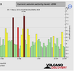
Seismic activity level has been at moderate levels in the last 24 hours. This is the last chart posted by Volcanodiscovery 22:00 UTC on October 23: Global seismic activity level chart

~5 quakes above magnitude 5
~45 quakes between magnitude 4 and 5
~91 quakes between magnitude 3 and 4
~216 quakes between magnitude 2 and 3
~608 quakes below magnitude 2 that people normally don't feel.
~965 earthquakes in the past 24h (1040 earthquakes in the 24 hours prior to this report) Estimated combined seismic energy release: 18527 tons of TNT or 1.2 atomic bombs
Volcanodiscovery earthquake report 24h
 

Attachments

  • chrome_screenshot_1667002969837.png
    chrome_screenshot_1667002969837.png
    348 KB · Views: 0
New strong earthquake in Peru

M 5.8 - 64 km SW of Santiago, Peru
2022-10-29 00:09:46 (UTC)
14.534°S 76.194°W. 7.7 km depth
USGS earthquake alert

The United States Geological Survey reported a magnitude 5.8 quake in Peru near Ica, Provincia de Ica, Region Ica, the earthquake hit at 7:09 pm local time at a very shallow depth of 7.7 the estimated energy release was equivalent to 7558 tons of TNT

Data for the same earthquake reported by different agencies​


Mag.DepthLocationSource
5.87.7 km64 Km SW of Santiago, PeruUSGS
5.810 kmNEAR COAST OF CENTRAL PERUEMSC
5.610 kmNear Coast of PeruGFZ
4.410 kmNear Coast of PeruRaspberryShake
5.210 kmPeru: Near IcaRENASS
5.90.8 kmPeru (Peruvian Point of View) [Sea]INGV
5.810 kmNear Coast Of PeruIRIS
USGS earthquake alert
 
After the 5.8 earthquake in Peru (00:09 UTC), four other M4+ earthquakes were recorded, as well as other earthquakes in Bolivia and Chile.

● M 4.9 - 67 km SSW of Paracas, Peru

● M 4.3 - near the coast of central Peru
● M 4.5 - 63 km WSW of Santiago, Peru
● M 4.6 - 104 km SSW of Paracas, Peru

● M 5.1 - 27 km SW of Challapata, Bolivia

●M 4.7 - 64 km W of Vallenar, Chile

According to SSGEOS the planetary geometry is similar to may 1960 and march 1964

May 22, 1960 CE: Valdivia Earthquake 9.5 Strikes Chile​


Map-tsunami-extent-earthquake-Chile-1960.jpg

On May 22, 1960, the most powerful earthquake in recorded history—magnitude 9.5—struck southern Chile. The rupture zone stretched from estimates ranging from 500 kilometers (311 miles) to almost 1,000 kilometers (621 miles) along the country’s coast. The event was named after the city most affected by the quake, Valdivia. The Valdivia earthquake left two million people homeless, injured at least 3,000, and killed approximately 1,655. The economic damage totaled $550 million (more than $4.8 billion, adjusted for 2020 inflation). The Valdivia earthquake triggered a massive tsunami that raced across the Pacific. Waves wracked coastal communities as far away as New Zealand, Japan, and the Philippines. In Hawai'i, the tsunami devastated the coastal town of Hilo, killing 61 people.

M9.2 Alaska Earthquake and Tsunami of March 27, 1964​

map-2x.jpg
On March 27, 1964 at 5:36pm local time (March 28 at 3:36 UTC) an earthquake of magnitude 9.2 occurred in the Prince William Sound region of Alaska. The earthquake rupture started approximately 25 km beneath the surface, with its epicenter about 6 miles (10 km) east of the mouth of College Fiord, 56 miles (90 km) west of Valdez and 75 miles (120 km) east of Anchorage. The earthquake lasted approximately 4.5 minutes and is the most powerful recorded earthquake in U.S. history. It is also the second largest earthquake ever recorded, next to the M9.5 earthquake in Chile in 1960.

The map shows the epicenter of the 1964 Alaska Earthquake (red star), caused when the Pacific Plate lurched northward underneath the North American Plate.
 
WORLDWIDE EARTHQUAKE REPORT OCTOBER 29

Let's hope something extraordinary doesn't happen, but Peru continues with high seismic activity. After the M4.6 earthquake in Paracas, Peru at 07:31 UTC (02:31 am local time) on October 29th reported in the previous post, other M4+ earthquakes were registered.

● M 4.1 - near the coast of central Peru (13:21 UTC)
● M 4.9 - near the coast of central Peru (14:17 UTC)
● M 4.5 - near the coast of central Peru (14:37 UTC)
● M 4.0 - near the coast of central Peru (20:26 UTC)

● M 5.1 - 62 km WSW of Santiago, Peru
2022-10-29 20:45:33 (UTC)
14.479°S 76.203°W. 10.0 km depth
USGS earthquake alert

62 km (39 mi) WSW of Santiago (Ica) (pop: 10,400) Estimated energy release 674 tons of TNT
So far in 26 hours, 24 tremors have occurred. 16 greater than 4 magnitude and 08 greater than 5 magnitude. Something very uncommon in the Peruvian Pacific coast #Earthquake #Earthquake #Earthquake #Peru #Earthquake

● M 4.5 - near the coast of central Peru (21:18 UTC)
● M 4.5 - near the coast of central Peru (22:18 UTC)
● M 4.8 - 62 km S of Paracas, Peru
(22:22 UTC)
● M 4.8 - 64 km WSW of Santiago, Peru
(22:24 UTC)

The strongest earthquake also occurred in Peru with a magnitude of 5.8 see previous posts.

Other earthquakes M5+

● M 5.4 - 122 km ENE of Hihifo, Tonga
● M 5.0 - Solomon Islands
● M 5.2 - 104 km SSE of Kandrian, Papua New Guinea
● M 5.4 - 64 km WSW of Norsup, Vanuatu

Earthquake M 4.8 - 23 km SSE of La Esperanza (El Zapotal), Mexico
2022-10-29 23:04:02 (UTC)
15.249°N 93.107°W. 95.9 km depth
USGS earthquake alert

● Summary

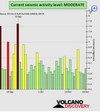
Seismic activity level has been at moderate levels in the last 24 hours. This is the last chart posted by Volcanodiscovery 22:00 UTC on October 29: Global seismic activity level chart

~7 quakes above magnitude 5
~53 quakes between magnitude 4 and 5
~117 quakes between magnitude 3 and 4
~172 quakes between magnitude 2 and 3
~538 quakes below magnitude 2 that people normally don't feel.
~887 earthquakes in the past 24h (956 earthquakes in the 24 hours prior to this report) Estimated combined seismic energy release: 18527 tons of TNT or 1.2 atomic bombs
Volcanodiscovery earthquake report 24h
 

Attachments

  • chrome_screenshot_1667089195107.png
    chrome_screenshot_1667089195107.png
    375 KB · Views: 0
Last week saw just 1 M6, it being a M 6.7 in Panama.
In the usual area, there was 1 out of 93 earthquakes worldwide equal to or greater than 4.5 and 1541 out of 1988 quakes of all sizes.
Percentage: 77.5%
Last week saw 2 M6, the largest being a M6.4 in the Philippines.
In the usual area, there were 6 out of 112 earthquakes equal to or greater than 4.5 and 1386 out of 1737 quakes of all sizes.
Percentage: 79.8%
Earthquakes 7 days to October 30th 2022.gif
 
WORLDWIDE EARTHQUAKE REPORT OCTOBER 30

The seismic swarm continues in Peru although with more spaced intervals and without any earthquake greater than magnitude 5+ recorded in the last 24 hours.

● M 4.5 - near the coast of central Peru (01:24 UTC)
● M 4.3 - near the coast of central Peru (02:05 UTC)
● M 4.1 - Peru Ecuador border region
(02:07 UTC)
● M 4.0 - near the coast of central Peru (02:23 UTC)
● M 4.6 - 10km ESE of Liuta Peru
(13:03 UTC)
● M 4.7 - Southwest of Ica Peru
(23:24 UTC)

The strongest earthquake today occurred in Tonga
M 5.3 - 149 km SE of Hihifo, Tonga
2022-10-30 18:24:45 (UTC)
16.889°S 172.791°W. 10.0 km depth

M 5.2 - northern Sumatra, Indonesia
2022-10-30 22:21:34 (UTC)
1.856°N 99.519°E. 178.6 km depth

● Summary

Seismic activity level has been at low to moderate levels in the last 24 hours. This is the last chart posted by Volcanodiscovery 22:00 UTC on October 30: Global seismic activity level chart

~3 quakes above magnitude 5
~33 quakes between magnitude 4 and 5
~89 quakes between magnitude 3 and 4
~182 quakes between magnitude 2 and 3
~461 quakes below magnitude 2 that people normally don't feel.
~768 earthquakes in the past 24h (887 earthquakes in the 24 hours prior to this report) Estimated combined seismic energy release: 6192 tons of TNT or 0.4 atomic bombs.
Volcanodiscovery earthquake report 24h
 

Attachments

  • chrome_screenshot_1667178759536.png
    chrome_screenshot_1667178759536.png
    364.1 KB · Views: 0
Back
Top Bottom