Earthquakes around the world

Last week saw 4 M6 with the highest being a M6.6 in Brazil.
In the usual area, there were 2 out of 75 quakes worldwide equal to or greater than 4.5 and 1630 out of 1913 quakes of all sizes.
Percentage: 85.2%
Last week saw 3 M6 earthquakes and one M7, a M7.0 in China.
In the usual area, there were 3 out of 126 earthquakes equal to or greater than 4.5 and 1752 out of 2178 quakes of all sizes.
Percentage: 80.9%
Earthquakes 7 days to Jan 28th 2024.gif
 

Strong mag. 6.5 Earthquake - 67 km west of Tarauaca, Acre, Brazil

Date & timeJan 28, 2024 09:38:56 UTC - 3 hours 23 minutes ago
Local time at epicenterSunday, Jan 28, 2024, at 04:38 am (America/Rio Branco GMT -5)
StatusConfirmed
Magnitude6.5
Depth609.5 km
Epicenter latitude / longitude8.2154°S / 71.3672°W
br.png
Tarauaca, Acre, Brazil
Also near:
pe.png
Peru 161 km (100 mi) away
Antipode8.2154°N / 108.6328°E
Shaking intensityWeak shaking near epicenter
Felt2 reports
Primary data sourceUSGS (United States Geological Survey)
Weather at epicenter at time of quakeOvercast Clouds
04n.png
21.6°C (71 F), humidity: 99%, wind: 1 m/s (1 kts) from ENE
Estimated seismic energy released3.5 x 1014 joules (98.6 gigawatt hours, equivalent to 84802 tons of TNT or 5.3 atomic bombs!) | about seismic energy
 
WORLDWIDE EARTHQUAKE REPORT JANUARY 28_2024

High levels of seismic activity occurred in the past 24 hours. A strong and deep (610 km) earthquake M6.5 hit Acre, Brazil. This is the second M6+ earthquake to occur in the region.
chrome_screenshot_28 ene. 2024 14_35_48 GMT-06_00.png
The USGS estimated that 343,000 people felt weak shaking and issued a Green alert (low) for shaking-related fatalities and economic losses. This earthquake struck within proximity of multiple countries. Brazil and Peru are both within 300km distance of its epicenter. Futher away, this earthquake may also have been felt in Bolivia and Colombia. No aftershocks have been recorded so far.

This earthquake adds risk of more significant events for Peru, Colombia, Venezuela, Ecuador and Central America and the Caribbean.

Energy from the M6.1 earthquake in Guatemala is being distributed to Mexico, Central America and the Caribbean. Light earthquakes occurred in Veracruz, Mexico (M4.5) Nicaragua (M4.6) and Anguilla northeast of Puerto Rico.

The total number of earthquakes recorded in the last 24 hours has increased to 897 which is within normal activity. According to Volcano earthquake report, volcano earthquake swarm occurred in:​
Brennisteinsfjöll (15 quakes between mag 0.1-2.9),Clear Lake (41 quakes between mag 0.2-1.8) Fagradalsfjall (9 quakes between mag 0.5-1.4), Hrómundartindur (6 quakes between mag 0.4-1.6), Kilauea (94 quakes between mag 0.2-3.0), Krísuvík (14 quakes between mag 0.6-2.2) Reykjanes (25 quakes between mag 0.1-1.4)
Earthquakes Increase At Kīlauea Volcano Summit
Kīlauea volcano is not erupting. On Saturday, the number of earthquakes increased in the area just south of the summit caldera, ending the January lull in seismic activity. The earthquake swarm continued into Sunday morning.

UPDATE – (10:45 a.m.) – On Sunday, the USGS maintained the Kīlauea Alert Level at ADVISORY, after seismicity picked up in the south caldera region, but remained steady.

From the Hawaiian Volcano Observatory update posted on Sunday morning:

Rates of seismicity in the south caldera area increased yesterday morning, but remained stable through the day. This morning, seismicity is somewhat lower, but a tiltmeter near Sand Hill indicates ongoing inflationary deformation. Periods of increased seismicity can be expected to continue during repressurization of the summit magma reservoir, which has been ongoing since the end of the September 2023 eruption.

Kīlauea’s summit region remains at a high level of inflation. Together with the increase in seismicity yesterday morning, a tiltmeter near Sand Hill indicated an increase in inflationary tilt. The tilt rate has remained steady over the past 24 hours (neither increasing nor decreasing). A tiltmeter near Uēkahuna bluff also responded to yesterday’s events, but to a lesser degree, as this instrument is not as sensitive to south caldera changes.
quakes-at-volcanoes-28012024.jpg
Strongest volcanic earthquake occurred at Apaneca Range Volcano with a magnitude of 3.9 located 19 km north of Sonsonate, El Salvador, on Sunday, Jan 28, 2024, at 12:42 pm local time.

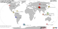
Recent quakes worldwide map shows the distribution of the last 20 large earthquakes. We can see the concentration of the seismic energy in Central and South America as a result of the M6.6 and M6.5 earthquakes in the Brazilian Amazon. Both earthquakes occurred at a great depth of more than 600km so that a subsequent impact can be expected in the worst case M7.5.​
earthquakes-latest.jpg

● M 6.5 - 66 km W of Tarauacá, Brazil
2024-01-28 09:38:56 (UTC)
8.215°S 71.367°W. 609.5 km depth
USGS earthquake alert
chrome_screenshot_28 ene. 2024 15_14_22 GMT-06_00.png

● M 5.1 - 47 km SW of Hualien City, Taiwan
2024-01-28 18:11:22 (UTC)
23.630°N 121.333°E. 4.5 km depth
USGS earthquake alert
chrome_screenshot_28 ene. 2024 15_16_36 GMT-06_00.png

● M 4.6 - 27 km WSW of Tola, Nicaragua
2024-01-28 05:55:52 (UTC)
11.308°N 86.157°W. 76.8 km depth
USGS earthquake alert
chrome_screenshot_28 ene. 2024 15_29_21 GMT-06_00.png

● M 4.5 - 187 km NE of The Valley, Anguilla
2024-01-28 03:52:49 (UTC)
19.384°N 61.773°W. 10.0 km depth
USGS earthquake alert
chrome_screenshot_28 ene. 2024 15_25_38 GMT-06_00.png

● M 4.5 - 13 km N of Allende, Mexico
2024-01-28 09:57:09 (UTC)
18.273°N 94.382°W. 10.1 km depth
USGS earthquake alert
chrome_screenshot_28 ene. 2024 15_33_17 GMT-06_00.png

Other light earthquakes occurred in Maug Islands region, Northern Mariana Islands (M4.6) Bahía Solano, Colombia (M4.5) Kyzyl-Suu, Kyrgyzstan (M4.9) south of the Fiji Islands (M4.6) Tadine, New Caledonia (M4.9) Salcha, Alaska (M4.5) Ambunti, Papua New Guinea (M4.8)​

● Summary

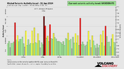
Seismic activity has been at high levels in the last 24 hours. This is the last chart posted by Volcanodiscovery at 23:13 UTC on January 28 Global seismic activity chart.
seismic-activity-level.png
In the past 24 hours, there were 897 quakes of magnitudes up to 6.5
  • 1 quake above magnitude 6
  • 1 quake between magnitude 5 and 6
  • 29 quakes between magnitude 4 and 5
  • 115 quakes between magnitude 3 and 4
  • 267 quakes between magnitude 2 and 3
  • 484 quakes below magnitude 2 that people normally don't feel.
Jan. 24 - 1030 eqHighest record
Jan. 25 - 1005 eqJan. 14 - 1479 eq
Jan. 25 - 1041 eq
Jan. 25 - 872 eqHighest mag.
Jan. 28 - 897 eq. M7.5 Noto Japan

Estimated combined seismic energy release equivalent to 88620 tons of TNT or 5.5 atomic bombs. Volcanodiscovery
 
WORLDWIDE EARTHQUAKE REPORT JANUARY 29_2024

Moderate levels of seismic activity occurred in the past 24 hours. An M5.0 earthquake shook again the northeastern region of Papua New Guinea. So far six M5+ earthquakes have occurred in the region.
chrome_screenshot_26 ene. 2024 19_00_58 GMT-06_00.png
The strongest-ever (since 1900) recorded quake in this area measured magnitude 8.0. It had occurred 117 years ago earlier, on Saturday, Sep 15, 1906. On September 11, 2022 occurred a M7.6 earthquake near the epicenter of this quake M5.0

New aftershock M5.7 in the Kyrgyzstan - Xinjiang region.

The seismic activity after the earthquakes in Brazil continues to manifest itself in Central America and the Caribbean. Light earthquakes occurred in Charlotte Amalie, U.S. Virgin (M4.6) Calingasta, Argentina (M4.7) San Agustín, El Salvador (M4.6) Oaxaca Mexico (M4.0, M4.0) Sta Rosalia BCS Mexico (M4.1)

The total number of earthquakes recorded in the last 24 hours has decreased to 869 which is within normal activity. According to Volcano earthquake report, volcano earthquake swarm occurred in:​
Apaneca Range (30 quakes between mag 1.6-2.7), Clear Lake (34 quakes between mag 0.3-1.3), Edgecumbe (7 quakes between mag 0.6-1.4), Hrómundartindur (7 quakes between mag 0.4-1.3), Kilauea (29 quakes between mag 1.7-2.4)
quakes-at-volcanoes-29012024.jpg
Strongest volcanic earthquake occurred at Sabancaya Volcano with a magnitude of 3.6 located 70 km north of Selva Alegre, Arequipa, Peru, on Monday, Jan 29, 2024, at 10:44 am local time.

Recent quakes worldwide map shows the distribution of the last 20 large earthquakes. M5.7 earthquake, 153 km northwest of Castelli, Departamento de General Güemes, Chaco, Argentina was reported by Instituto Nacional de Prevención Sismica (INPRES) It was subsequently removed from the institute's website, possibly due to human error.​
1706571577052.png

● M 5.7 - 122 km WNW of Aykol, China
2024-01-29 22:27:41 (UTC)
41.187°N 78.716°E. 10.0 km depth
USGS earthquake alert
chrome_screenshot_29 ene. 2024 17_56_47 GMT-06_00.png

● M 5.1 - 114 km ENE of Barcelona, Philippines
2024-01-29 07:37:21 (UTC)
8.474°N 127.428°E. 10.0 km depth
USGS earthquake alert
chrome_screenshot_29 ene. 2024 17_51_47 GMT-06_00.png

● M 5.0 - 68 km NW of Finschhafen, Papua New Guinea
2024-01-29 04:42:01 (UTC)
6.158°S 147.368°E. 62.8 km depth
USGS earthquake alert
chrome_screenshot_29 ene. 2024 17_49_06 GMT-06_00.png

Other light earthquakes occurred in Shizunai-furukawachō, Japan (M4.6) Ama, Japan (M4.6) Andalgalá, Argentina (M4.5) Charlotte Amalie, U.S. Virgin (M4.6) Hasaki, Japan (M4.8) Calingasta, Argentina (M4.7) San Agustín, El Salvador (M4.6) Oaxaca Mexico (M4.0, M4.0) Sta Rosalia BCS Mexico (M4.1)​

● Summary

Seismic activity has been at moderate levels in the last 24 hours. This is the last chart posted by Volcanodiscovery at 23:22 UTC on January 29 Global seismic activity chart.​
seismic-activity-level.png
In the past 24 hours, there were 869 quakes of magnitudes up to 5.7
  • 3 quakes above magnitude 5
  • 33 quakes between magnitude 4 and 5
  • 129 quakes between magnitude 3 and 4
  • 204 quakes between magnitude 2 and 3
  • 500 quakes below magnitude 2 that people normally don't feel.
Jan. 25 - 1005 eqHighest record
Jan. 26 - 1041 eqJan. 14 - 1479 eq
Jan. 27 - 872 eq
Jan. 28 - 897 eq.Highest mag.
Jan. 29 - 869 eq.M7.5 Noto Japan

Estimated combined seismic energy release equivalent to 13991 tons of TNT or 0.9 atomic bombs. Volcanodiscovery
 

With continued unrest across the planet (as the Sun's energy radiates cosmic rays), what impact is this activity having on the global population?

GEOMAGNETIC ACTIVITY AND VIOLENT BEHAVIOR
ABSTRACT
This paper reports on a statistical study of hypothesized relationships between three indices of
geomagnetic field activity and the incidence of violent crime on a nationwide basis. focusing on
monthly variation over the entirety of an II-year solar cycle, and yearly variation over a 30 year
period encompassing the past three solar cycles (cycles 19. 20 and 21). Contrary to expectations.
sunspot numbers - which have only a tenuous relationship with geomagnetic al."tiviry - were found
to be significant at the yearly level. while none of the more direct indices of geomagnetic al.1:ivity
exhibited any correlation. The possibility of a non-magnetic solar effect on human behavior is
therefore raised
 
WORLDWIDE EARTHQUAKE REPORT JANUARY 30_2024

Low levels of seismic activity occurred in the past 24 hours. A seismic swarm is occurring in the Virgin Islands north of Charlotte Amalie. So far 21 earthquakes ranging from M3+ to M4+ have occurred with an M4.6 earthquake being the strongest.

On December 09, 2023 the strongest earthquake in 10 years occurred with a magnitude 5.7 very close to the epicenter of this earthquake. An M7.7 earthquake occurred 81 years ago, but closer to the island of Puerto Rico, which indicates that M7+ earthquakes can occur in the region.
chrome_screenshot_30 ene. 2024 15_56_39 GMT-06_00.png

The total number of earthquakes recorded in the last 24 hours has increased to 893 which is within normal activity. According to Volcano earthquake report, volcano earthquake swarm occurred in:​
Clear Lake (33 quakes between mag 0.3-1.4), Fagradalsfjall (11 quakes between mag 0.4-1.0), Kilauea (63 quakes between mag 0.7-3.4), Krísuvík (13 quakes between mag 0.2-1.6),
quakes-at-volcanoes-30012024.jpg
Strongest volcanic earthquake occurred at Kilauea Volcano with a magnitude of 3.4 located 30 mi southwest of Hilo, Hawaii County, USA, on Tuesday, Jan 30, 2024, at 04:02 am local time.

According to USGS: "Kīlauea volcano is not erupting. An increase in seismicity in the south caldera region that started on Saturday is continuing, but has remained steady. Kīlauea summit remains pressurized; in recent months unrest has escalated quickly, and an eruption could occur in the future with little warning".

Recent quakes worldwide map shows the distribution of the last 20 large earthquakes.​
1706656909807.png

● M 5.1 - South Sandwich Islands region
2024-01-30 13:10:13 (UTC)
56.007°S 27.587°W. 104.0 km depth
USGS earthquake alert
chrome_screenshot_30 ene. 2024 16_00_37 GMT-06_00.png

● M 5.0 - 156 km ENE of Bitung, Indonesia
2024-01-30 18:05:27 (UTC)
1.887°N 126.465°E. 40.4 km depth
USGS earthquake alert
chrome_screenshot_30 ene. 2024 15_59_09 GMT-06_00.png

● M 4.6 - 93 km N of Charlotte Amalie, U.S. Virgin Islands
2024-01-30 16:27:00 (UTC)
19.190°N 64.972°W. 28.0 km depth
USGS earthquake alert
chrome_screenshot_30 ene. 2024 15_56_39 GMT-06_00.png

Other light earthquakes occurred in west of Macquarie Island (M4.9) Aras-asan, Philippines (M4.6) Masachapa, Nicaragua (M4.7) South Sandwich Islands region (M4.9)​

● Summary

Seismic activity has been at low levels in the last 24 hours. This is the last chart posted by Volcanodiscovery at 23:05 UTC on January 30 Global seismic activity chart.​
seismic-activity-level.png
In the past 24 hours, there were 893 quakes of magnitudes up to 5.1
  • 2 quakes above magnitude 5
  • 24 quakes between magnitude 4 and 5
  • 142 quakes between magnitude 3 and 4
  • 240 quakes between magnitude 2 and 3
  • 485 quakes below magnitude 2 that people normally don't feel.
Jan. 26 - 1041 eqHighest record
Jan. 27 - 872 eqJan. 14 - 1479 eq
Jan. 28 - 897 eq.
Jan. 29 - 869 eq.Highest mag.
Jan. 30 - 893 eq.M7.5 Noto Japan

Estimated combined seismic energy release equivalent to 3194 tons of TNT or 0.2 atomic bombs. Volcanodiscovery
 

Attachments

  • 1706656870517.png
    1706656870517.png
    363.1 KB · Views: 0
According to USGS: "Kīlauea volcano is not erupting. An increase in seismicity in the south caldera region that started on Saturday is continuing, but has remained steady. Kīlauea summit remains pressurized; in recent months unrest has escalated quickly, and an eruption could occur in the future with little warning".

EarthMaster shows a significant increase in below-ground Maga movement on Kīlauea and the current assessments around the world.

HAWAIʻI VOLCANOES NATIONAL PARK - The recent increase in seismicity continued Tuesday, with earthquakes becoming somewhat more widespread around the Kīlauea summit region.
(BIVN) – Kīlauea volcano is not erupting, and the alert level remains at ADVISORY, as the recent increase in seismicity in the south caldera region continued on Tuesday.

Scientists say the earthquakes are “becoming somewhat more widespread”, but have not increased in frequency.

“Kīlauea summit remains pressurized,” wrote the USGS Hawaiian Volcano Observatory. “In recent months unrest has escalated quickly, and an eruption could occur in the future with little warning.”

2024-01-30-kilauea-chart.jpg
(From the USGS HVO) Above Top: Number of earthquakes per day during the past week (blue bars). The red line is the cumulative moment (energy) release. Bottom: Depth of earthquakes during the past week in the area shown on the map above. Depth is reported relative to sea level, which is equal to a depth of zero on the above plot. On both figures, circle-size represents magnitude, and color indicates depth.
As of Tuesday, there were no new closures reported within Hawaiʻi Volcanoes National Park due to the uptick in seismicity.


From the USGS Hawaiian Volcano Observatory on Tuesday:
South caldera seismicity continued through yesterday, becoming somewhat more widespread, but not increasing in event frequency. In general, rates have been fairly steady since Saturday morning. Periods of increased seismicity can be expected to continue during repressurization of the summit magma reservoir, which has been ongoing since the end of the September 2023 eruption.
Kīlauea’s summit region remains at a high level of inflation. Tiltmeters near Sand Hill and Uēkahuna bluff indicate ongoing inflationary tilt localized to the south caldera area, with a steady rate. Step-wise changes in the tilt signal over the past day were due to the instrument being shaken by nearby earthquakes.
Sulfur dioxide (SO2) gas emission rates remain low. Field measurements indicated an SO2 emission rate of approximately 70 tonnes per day on January 17, which was similar to measurements in October, November, and early December.

Scientists also noted that seismicity in Kīlauea’s East Rift Zone and Southwest Rift Zone remained low in the past 24 hours.
 
WORLDWIDE EARTHQUAKE REPORT JANUARY 31_2024

Moderate levels of seismic activity occurred in the past 24 hours. A seismic swarm is occurring in Hawaii, and so far more than 260 earthquakes ranging from magnitude 0.6 to M3+ have been recorded, with an M3.4 earthquake being the strongest. At the time of this report, earthquake activity remains elevated.
chrome_screenshot_31 ene. 2024 17_52_41 GMT-06_00.png

Accordin to USGS:

●An increase in seismicity in the south caldera region started this morning and has remained at high levels since 3 a.m. HST.

● 25-30 locatable earthquakes have occurred per hour at depths of 1.5–3 km (1–2 mi) below the surface.

● The most intense activity occurred between 6 and 8 a.m., when earthquakes were clustering just south of Halemaʻumaʻu. There have been over 180 locatable earthquakes in this region in the past 6 hours, with magnitudes ranging from a maximum of 3.4 to less than 1.

● Levels of volcanic gases (sulfur dioxide and carbon dioxide) can remain locally hazardous even when Kīlauea is not erupting. Local concentrations of sulfur dioxide (SO2) and/or hydrogen sulfide (H2S) may persist in downwind areas, and residents may notice odors of these gases occasionally.

The total number of earthquakes recorded worldwide in the last 24 hours has increased to 1103 which is above normal activity. This was mainly due to the seismic swarm that is happening in Hawaii, especially in the Kilauea volcano.

According to Volcano earthquake report, volcano earthquake swarm occurred in:​
Clear Lake (21 quakes between mag 0.3-1.7)
Fagradalsfjall (13 quakes between mag 0.1-1.3), Kilauea (260 quakes between mag 0.6-3.4) Reykjanes (14 quakes between mag 0.1-1.0
quakes-at-volcanoes-31012024.jpg
Strongest volcanic earthquake occurred at Barva Volcano with a magnitude of 3.5 located 10.6 km north of San Jose, San José, Costa Rica, on Wednesday, Jan 31, 2024, at 12:46 pm local time.

Recent quakes worldwide map shows the distribution of the last 20 large earthquakes. There was a significant increase in the range of M2 to M3 earthquakes. Earthquakes of Magnitude 4+ shook Central and South America. An M4.9 quake at northern Mid-Atlantic Ridge indicates that energy concentrated in the Caribbean Plate (Puerto Rico and Virgin Islands area) is making its way into the Atlantic. Activity in Charlotte Amalie continues with M2 and M3 earthquakes.​
1706743978979.png

● M 5.8 - 264 km SW of Houma, Tonga
2024-01-31 10:49:36 (UTC)
22.832°S 177.138°W. 185.5 km depth
USGS earthquake alert

● M 5.1 - 106 km N of Hihifo, Tonga
2024-01-31 04:35:38 (UTC)
15.004°S 173.625°W. 10.0 km depth
USGS earthquake alert
chrome_screenshot_31 ene. 2024 16_36_13 GMT-06_00.png

● M 4.6 - 6 km NE of Sibayo, Peru
2024-01-31 01:11:41 (UTC)
15.446°S 71.414°W. 142.8 km depth
USGS earthquake alert
chrome_screenshot_31 ene. 2024 17_14_13 GMT-06_00.png

Other light earthquakes occurred in northern Mid-Atlantic Ridge (M4.9) La Tirana, Chile (M4.5) West Chile Rise (M4.5) Amahai, Indonesia (M4.5) Merizo Village, Guam (M4.8) Tadine, New Caledonia (M4.7) Aykol, China (M4.5) Kermadec Islands region (M4.7) Harrison, Philippines (M4.9)​

● Summary

Seismic activity has been at moderate levels in the last 24 hours. This is the last chart posted by Volcanodiscovery at 22:50 UTC on January 31 Global seismic activity chart.
seismic-activity-level (1).png
In the past 24 hours, there were 1103 quakes of magnitudes up to 5.8
  • 2 quakes above magnitude 5
  • 37 quakes between magnitude 4 and 5
  • 140 quakes between magnitude 3 and 4
  • 408 quakes between magnitude 2 and 3
  • 516 quakes below magnitude 2 that people normally don't feel.
Jan. 27 - 872 eqHighest record
Jan. 28 - 897 eq.Jan. 14 - 1479 eq
Jan. 29 - 869 eq.
Jan. 30 - 893 eq.Highest mag.
Jan. 31 - 1103 eq.M7.5 Noto Japan

Estimated combined seismic energy release equivalent to 11508 tons of TNT or 0.7 atomic bombs . VolcanodiscoveryVolcano earthquake report,
 

Attachments

  • seismic-activity-level.png
    seismic-activity-level.png
    39.5 KB · Views: 0
M 5.1 - 257 km SW of Merizo Village, Guam
  • 2024-02-01 07:45:39 (UTC)
  • 11.845°N 142.792°E
  • 10.0 km depth
The total number of earthquakes recorded worldwide in the last 24 hours has increased to 1103 which is above normal activity. This was mainly due to the seismic swarm that is happening in Hawaii, especially in the Kilauea volcano.

444 earthquakes at Kilauea over the last 24hrs and still no eruption....
1706784263247.jpeg

Recent Systemic Activity in Austria

The earthquake-filled weeks in Austria continue. After several earthquakes in Tyrol, a powerful earthquake shook the east of the country last night. It reached a magnitude of 4.4 and was felt as far away as the Czech Republic and Slovenia. https://erdbebennews.de/2024/02/erdbeben-m4-4-nahe-gloggnitz-oesterreich/
Snip:

People affected

The 4.4 earthquake occurred on 1 January February, 2:59 Clock Central European Time near the village of Gloggnitz, Austria. Earthquake news calculates a maximum intensity of 5.6 for this earthquake. Up to 7.5 million people (in the map section) have felt this earthquake. Of this, 7.5 million people live in regions with light or moderate shocks, where no significant damage is to be expected. 0 people live where damage to buildings may occur, 0 of them in areas with possible severe damage and destruction.

What happened?

The epicenter was located near the town of Gloggnitz in Lower Austria on the border with Styria.

After initial evaluations by Geosphere Austria, the earth magnitude 4.4 reached the earth. Shocks were felt throughout the eastern half of the country and included not only the epicentre route, but also the capital of Vienna (intensity III), Graz (intensity III) and Linz (intensity II). In addition, the earth also reached parts of the neighbouring countries Slovakia, Hungary and Slovenia. Occasionally it could have been felt in the south of the Czech Republic, possibly also locally in Lower Bavaria. Previous earthquakes in the region showed relatively far-reaching effects towards Lower Bavaria.

In the epicentral region between Semmering and Gloggnitz, the vibrations were quite strong due to the shallow depth and, according to our calculations, lie between intensity V and VI, so that even minor structural damage to individual buildings cannot be ruled out. Smaller stone chips and avalanches are possible in the mountains. In addition, high post-quake activity must be expected in the coming days.

In recent years, Gloggnitz has been one of the most importantly active places in Austria with numerous noticeable quakes, partly around magnitude 4, as well as numerous swarms of smaller earthquakes. The village is located on the Mur-Mürztal disorder, a tectonic fault zone in the northeastern Alps, where earthquake activity is often occurred.

After numerous earthquakes in Tyrol, today's earthquake has been the strongest of a seismicly very active phase in the last three weeks. Previously it came on the 27th place January in Ehrwald in Tirol to a earthquake of magnitude 3.6 and in the days before several noticeable quears up to magnitude 3.9 in St. Johann in Tirol. In both regions, there were smaller, non-structural damage to houses as a result of the vibrations. In addition, adjacent places in Bavaria were also affected by the earthquake.

Between the individual earthquakes in Ehrwald, St. Johann and now in Gloggnitz there is no direct connection. The accumulation of seismic activity since the beginning of the year is a random overlap of several independent events.

Kilauea earthquakes ramp up.
Screenshot 2024-02-01 at 09-53-39 TheEarthMaster on X Hundreds of Earthquakes under Kīlauea Vo...png

CALIFORNIA VOLCANO OBSERVATORY WEEKLY UPDATE
U.S. Geological Survey
Tuesday, January 30, 2024, 3:07 PM PST (Tuesday, January 30, 2024, 23:07 UTC)
Monitored CALIFORNIA VOLCANOES
Current Volcano Alert Level: all NORMAL
Current Aviation Color Code: all GREEN

Activity Update:
All volcanoes monitored by CalVO show normal background earthquake activity and ground movement. Monitored volcanoes include Mount Shasta, Medicine Lake Volcano, Lassen Volcanic Center, Clear Lake Volcanic Field, Long Valley Volcanic Region, Coso Volcanic Field, Ubehebe Craters, and Salton Buttes.

Past Week Observations for January 22, 2024 (0000h PST) through January 28, 2024 (2359h PST):
Three earthquakes greater than M1 were recorded near Lassen Volcanic Center, with the largest having a magnitude of M2.3.

One earthquake greater than M1 was recorded within the Clear Lake Volcanic Field, with a magnitude of M1.2. Typical seismicity was recorded at the Geysers geothermal field south of the Clear Lake Volcanic Field; 120 earthquakes greater than M1 were recorded, with the largest having a magnitude of M4.2.

One earthquake greater than M1 was recorded in Long Valley with a magnitude of M1.0. Six earthquakes greater than M1 were recorded in the Sierra Nevada Block, south of Mammoth Mountain and Long Valley, with the largest having a magnitude of M2.3. One earthquake greater than M1 was recorded at Mammoth Mountain with a magnitude of M2.4.

Five earthquakes greater than M1 were recorded in the Coso Volcanic Field, with the largest having a magnitude of M1.9.
Six earthquakes were recorded at the Salton Buttes, with the largest having a magnitude of M2.6.


WORLDWIDE EARTHQUAKE REPORT FEBRUARY 01_2024

Low levels of seismic activity occurred in the past 24 hours. The increase in seismic activity is mainly due to the seismic swarm that is occurring in Hawaii.

The seismic swarm under the upper southwestern rift zone of Kilauea has been increasing and the volcano observatory raised the alert to "Orange" as chances of a new eruption have increased, Volcanodiscovery reported.

Hawaii Volcano Observatory (HVO) reported: "Earthquake swarms like this can precede eruptions, but there is no lateral or upward migration of earthquakes that would suggest magma is moving toward the surface at this time. There are currently no signs of an imminent eruption at Kīlauea, but the volcano's summit region remains unsettled, with a high level of inflation and continued seismic activity."

EMSC reported a light M4.5 earthquake in Austria which was adjusted to M4.0. The quake had a very shallow depth of 5 km (3.1 mi) and was felt widely in the area. The closest larger town where the quake might have been felt is Wien, the capital of Austria with 1,700,000 inhabitants, in 75 km (46 mi) distance northeast of the epicenter. People likely experienced weak shaking there. No aftershocks have been recorded so far.

The total number of earthquakes recorded worldwide in the last 24 hours has increased to 1283 which is above normal activity. Seismic swarm continues in Hawaii, with the Kilauea volcano.

According to Volcano earthquake report, volcano earthquake swarm occurred in:​
Brennisteinsfjöll (11 quakes between mag 0.2-1.2), Clear Lake (32 quakes between mag 0.3-1.9) Edgecumbe (8 quakes between mag 0.3-1.0), Fagradalsfjall (10 quakes between mag 0.2-1.2), Hrómundartindur (6 quakes between mag 0.1-1.6), Kilauea (397 quakes between mag 0.8-3.5), Reykjanes (36 quakes between mag 0.1-1.6)
Strongest volcanic earthquake occurred at Talakmau Volcano with a magnitude of 3.0 located 74 km northwest of Bukittinggi, Indonesia, on Thursday, Feb 1, 2024, at 09:41 pm (Jakarta time)
quakes-at-volcanoes-01022024.jpg
Recent quakes worldwide map shows the distribution of the last 20 large earthquakes. Light to moderate activity has been recorded around the world, predominantly in the western Pacific Ocean.​
earthquakes-latest.jpg

● M 5.1 - 257 km SW of Merizo Village, Guam
2024-02-01 07:45:39 (UTC)
11.845°N 142.792°E. 10.0 km depth
USGS earthquake alert
chrome_screenshot_1 feb. 2024 17_32_55 GMT-06_00.png

● M 5.1 - 54 km E of Barcelona, Philippines
2024-02-01 21:35:38 (UTC)
8.182°N 126.929°E. 59.4 km depth
USGS earthquake alert
chrome_screenshot_1 feb. 2024 17_37_10 GMT-06_00.png

● M 5.0 - 115 km NE of Hihifo, Tonga
2024-02-01 18:14:40 (UTC)
15.173°S 173.087°W. 10.0 km depth
USGS earthquake alert
chrome_screenshot_1 feb. 2024 17_35_00 GMT-06_00.png

● M 4.6 - 97 km S of La Libertad, El Salvador
2024-01-31 23:43:17 (UTC)
12.610°N 89.282°W. 41.3 km depth
USGS earthquake alert
chrome_screenshot_1 feb. 2024 17_28_16 GMT-06_00.png

● M 4.0 - 2 km ESE of Schottwien, Austria
2024-02-01 01:59:20 (UTC)
47.651°N 15.900°E. 5.0 km depth
USGS earthquake alert
chrome_screenshot_1 feb. 2024 17_30_45 GMT-06_00.png

Other light earthquakes occurred in Yonakuni, Japan (M4.7) Abepura, Indonesia (M4.9) New Zealand (M4.7) Xinjiang China (M4.1) Kyrgyzstan (M4.4) Pakistan (M4.3) Komandorskiye Ostrova Region (M4.5) Gorno-Badakhshan (M4.4) Kazakhstan Xinjiang border (M4 2)​

● Summary

Seismic activity has been at low levels in the last 24 hours. This is the last chart posted by Volcanodiscovery at 22:50 UTC on February 01 Global seismic activity chart.
seismic-activity-level.png
In the past 24 hours, there were 1283 quakes of magnitudes up to 5.1
  • 3 quakes above magnitude 5
  • 30 quakes between magnitude 4 and 5
  • 120 quakes between magnitude 3 and 4
  • 571 quakes between magnitude 2 and 3
  • 559 quakes below magnitude 2 that people normally don't feel.
Jan. 28 - 897 eq. Highest record
Jan. 29 - 869 eq. Jan. 14 - 1479 eq
Jan. 30 - 893 eq.
Jan. 31 - 1103 eq. Highest mag.
Feb. 01 - 1283 eq.M7.5 Noto Japan

Estimated combined seismic energy release equivalent to 3398 tons of TNT or 0.2 atomic bombs . Volcanodiscovery
 
WORLDWIDE EARTHQUAKE REPORT FEBRUARY 02_2024

Low levels of seismic activity occurred in the past 24 hours. The last M5.0 earthquake occurred almost 10 hours ago in the Kermadec Islands region.

A 4.9-magnitude earthquake was detected in the ocean about 58 miles west of Petrolia in Humboldt County, according to data from the U.S. Geological Survey.

The total number of earthquakes recorded worldwide in the last 24 hours has decreased to 1182 which is above normal activity. Seismic swarm continues in Kilauea Volcano Hawaii, however, the number and frequency of events has slightly decreased in the last hours.

According to Volcano earthquake report, volcano earthquake swarm occurred in:​
Clear Lake (35 quakes between mag 0.2-1.9), Kilauea (323 quakes between mag 1.7-3.3), Krísuvík (14 quakes between mag 0.5-3.3), Reykjanes (21 quakes between mag 0.1-2.0)
quakes-at-volcanoes-02022024.jpg
Strongest volcanic earthquake occurred at Kilauea Volcano with a magnitude of 3.4 with epicenter 39 mi southwest of Hilo, Hawaii County, USA, on Friday, Feb 2, 2024, at 01:00 pm (Honolulu time)​

Recent quakes worldwide map shows the distribution of the last 20 large earthquakes.
earthquakes-latest.jpg

● M 5.0 - Kermadec Islands region
2024-02-02 14:13:58 (UTC)
30.413°S 176.454°W. 10.0 km depth
USGS earthquake alert
chrome_screenshot_2 feb. 2024 16_22_55 GMT-06_00.png

● M 4.9 - 98 km W of Petrolia, CA
2024-02-02 15:09:00 (UTC)
40.389°N 125.445°W. 10.0 km depth
USGS earthquake alert
chrome_screenshot_2 feb. 2024 16_25_08 GMT-06_00.png

Other light earthquakes occurred in Atocha, Bolivia (M4.7) south of Java, Indonesia (M4.5) Pizitou, Taiwan (M4.5) Aras-asan, Philippines (M4.8) Ternate, Indonesia (M4.5) Wāngjing, India (M4.5) Chiapas Mexico (M4.0) Manzanillo Mexico (M4.3) Salta Argentina (M4.3) Xinjiang China (M4.3) Kazakhstan (M4.0, M4.2) Dominican Republic (M4.0)​

● Summary

Seismic activity has been at low levels in the last 24 hours. This is the last chart posted by Volcanodiscovery at 23:15 UTC on February 02 Global seismic activity chart.
seismic-activity-level.png
In the past 24 hours, there were 1182 quakes of magnitudes up to 5.0
  • 1 quake above magnitude 5
  • 24 quakes between magnitude 4 and 5
  • 117 quakes between magnitude 3 and 4
  • 445 quakes between magnitude 2 and 3
  • 595 quakes below magnitude 2 that people normally don't feel.
Jan. 29 - 869 eq. Highest record
Jan. 30 - 893 eq. Jan. 14 - 1479 eq
Jan. 31 - 1103 eq.
Feb. 01 - 1283 eq. Highest mag.
Feb. 02 - 1182 eq.M7.5 Noto Japan

Estimated combined seismic energy release equivalent to 2973 tons of TNT or 0.2 atomic bombs . Volcanodiscovery
 
Moderate earthquake in Oklahoma. There are reports that the earthquake was felt in Arkansas and Texas.

● M 5.1 - 8 km NW of Prague, Oklahoma
2024-02-03 05:24:28 (UTC)35.534°N 96.764°W3.0 km depth
USGS earthquake alert
chrome_screenshot_3 feb. 2024 00_31_33 GMT-06_00.png

Tectonic Summary

Earthquakes in the Stable Continental Region
Natural Occurring Earthquake Activity


Most of North America east of the Rocky Mountains has infrequent earthquakes. Here and there earthquakes are more numerous, for example in the New Madrid seismic zone centered on southeastern Missouri, in the Charlevoix-Kamouraska seismic zone of eastern Quebec, in New England, in the New York - Philadelphia - Wilmington urban corridor, and elsewhere. However, most of the enormous region from the Rockies to the Atlantic can go years without an earthquake large enough to be felt, and several U.S. states have never reported a damaging earthquake.
Earthquakes east of the Rocky Mountains, although less frequent than in the West, are typically felt over a much broader region than earthquakes of similar magnitude in the west. East of the Rockies, an earthquake can be felt over an area more than ten times larger than a similar magnitude earthquake on the west coast. It would not be unusual for a magnitude 4.0 earthquake in eastern or central North America to be felt by a significant percentage of the population in many communities more than 100 km (60 mi) from its source.
 
WORLDWIDE EARTHQUAKE REPORT FEBRUARY 03_2024

Moderate levels of seismic activity occurred in the past 24 hours.

Timelapse shows earthquake activity at #Kilauea's summit (extending SW) from Jan 26-Feb 2, 2024, in 12-hr snapshots. Over 3,000 EQs have been located. Along with ground deformation patterns, these observations are consistent with magma moving into a dike-like body in the region.

Earthquakes rattled central Oklahoma Friday night. Steps taken to minimize risk of more​


Numerous earthquakes and aftershocks that struck Oklahoma late Friday into Saturday morning near Prague left rattled nerves, scattered dishes and bric-a-brac, cracked drywall, and some tumbled bricks, but no reported injuries.

"Last night was exciting to say the least. Thankfully so far the reports of injuries have been zero," the Lincoln County Office of Emergency Management posted on Facebook Saturday morning, along with a link to the state site for reporting damage.

Nearly 40 quakes had struck by 11 a.m. Saturday starting with the big one − by Oklahoma standards − at 5.1 magnitude, according to the U.S. Geological Survey, using data provided by the Oklahoma Geological Survey.

The total number of earthquakes recorded worldwide in the last 24 hours has decreased to 943 which is above normal activity. Seismic swarm continues at Kilauea Hawaii volcano with less frequency and intensity.

According to Volcano earthquake report, volcano earthquake swarm occurred in:​
Campi Flegrei (Phlegrean Fields) (19 quakes between mag 0.2-2.1), Clear Lake (30 quakes between mag 0.2-1.9), Eldey (8 quakes between mag 1.0-2.9), Kilauea (85 quakes between mag 0.6-2.7), Krísuvík (9 quakes between mag 0.5-1.5), Reykjanes (11 quakes between mag 0.5-1.1)
quakes-at-volcanoes-03022024.jpg
Strongest volcanic earthquake occurred at Arenal Volcano with a magnitude of 3.7 with epicenter 31 km northwest of Ciudad Quesada, San Carlos, Provincia de Alajuela, Costa Rica, on Friday, Feb 2, 2024, at 06:36 pm (Costa Rica time)​

Recent quakes worldwide map shows the distribution of the last 20 large earthquakes.
1707003662682.png

● M 5.2 - 160 km NNW of Sola, Vanuatu
2024-02-03 13:45:37 (UTC)
12.508°S 167.053°E. 240.7 km depth
USGS earthquake alert

● M 5.1 - 104 km NNW of Neiafu, Tonga
2024-02-03 13:50:34 (UTC)
17.729°S 174.205°W. 68.0 km depth
USGS earthquake alert
chrome_screenshot_3 feb. 2024 18_30_07 GMT-06_00.png

● M 5.1 - 72 km W of Santiago de Cao, Peru
2024-02-03 23:30:54 (UTC)
8.037°S 79.896°W. 41.5 km depth
USGS earthquake alert
chrome_screenshot_3 feb. 2024 17_48_38 GMT-06_00.png

● M 5.1 - 8 km NW of Prague, Oklahoma
2024-02-03 05:24:28 (UTC)
35.534°N 96.764°W. 3.0 km depth
USGS earthquake alert
chrome_screenshot_3 feb. 2024 00_31_33 GMT-06_00.png

● M 5.1 - 134 km WNW of Tobelo, Indonesia
2024-02-03 08:25:11 (UTC)
2.367°N 126.984°E. 63.0 km depth
USGS earthquake alert
chrome_screenshot_3 feb. 2024 18_25_49 GMT-06_00.png

● M 5.0 - 233 km SSW of Yanglong, China
2024-02-03 04:40:58 (UTC)
37.010°N 97.062°E10.0 km depth
USGS earthquake alert
chrome_screenshot_3 feb. 2024 17_54_09 GMT-06_00.png

Other light earthquakes occurred in San Felipe, Chile (M4.8) Acajutla, El Salvador (M4.6) Kyzyl-Suu, Kyrgyzstan (M4.8) Tupiza, Bolivia (M4.6) Aykol, China (M4.5, M4.9, M4.5, M4.5) Petropavlovsk-Kamchatsky (M4 5) Güiria, Venezuela (M4.9) Sigaboy, Philippines (M4.5) Bingtuan Sanshiliu Tuan (M4.5) Modisi, Indonesia (M4.9)​

● Summary

Seismic activity has been at low levels in the last 24 hours. This is the last chart posted by Volcanodiscovery at 23:19 UTC on February 02 Global seismic activity chart.
seismic-activity-level.png
In the past 24 hours, there were 943 quakes of magnitudes up to 5.2:
  • 6 quakes above magnitude 5
  • 36 quakes between magnitude 4 and 5
  • 117 quakes between magnitude 3 and 4
  • 299 quakes between magnitude 2 and 3
  • 485 quakes below magnitude 2 that people normally don't feel.
Jan. 30 - 893 eq.Highest record
Jan. 31 - 1103 eq.Jan. 14 - 1479 eq
Feb. 01 - 1283 eq.
Feb. 02 - 1182 eqHighest mag.
Feb. 03 - 943 eqM7.5 Noto Japan

Estimated combined seismic energy release equivalent to 6946 tons of TNT or 0.4 atomic bombs! . Volcanodiscovery
 
Back
Top Bottom