LATEST July 22, 9 a.m. California's Dixie Fire straddling Plumas and Butte counties was 103,910 acres Thursday morning, becoming the state's second of 2021 to pass the milestone, Cal Fire said.
The Beckwourth Complex Fire 50 miles north of Tahoe that's now 96% contained also passed the 100,000 acre mark.
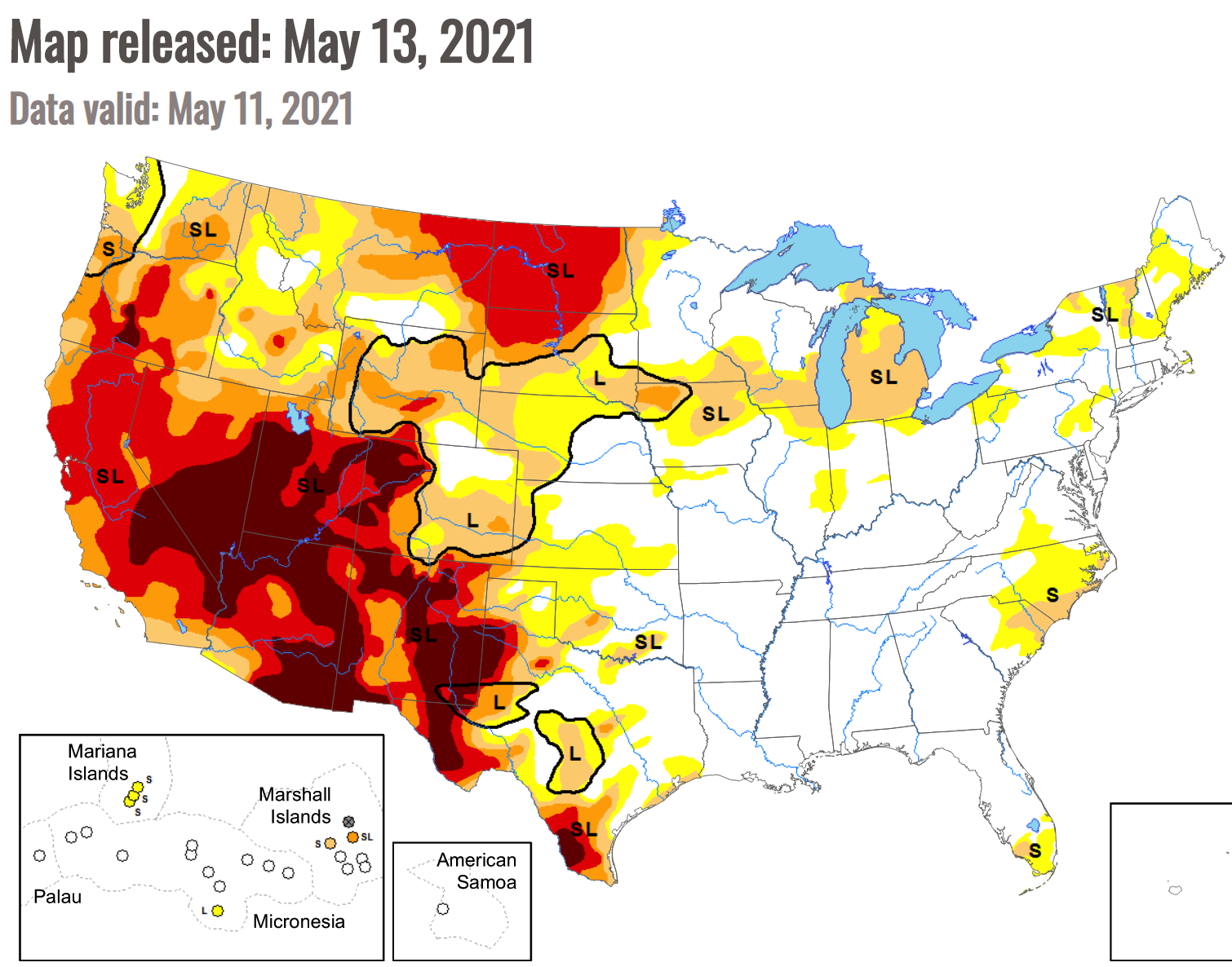
Megafires are becoming more and more common, especially in California, which has been hit repeatedly by extreme weather events, including heat waves, drought and dry lightning. These humongous fires were rare in California before 2003 — but 17 of the 20 largest fires in the state’s history have occurred since then, according to
state data.
Cal Fire gave an update Thursday morning on the fire that started near Cresta Dam: "The Dixie Fire remained active overnight with active surface fire, and single tree torching with short range spotting and rollout. Firefighters fought the fire aggressively. Firefighters continued construction on control lines and engaged in structure defense overnight."
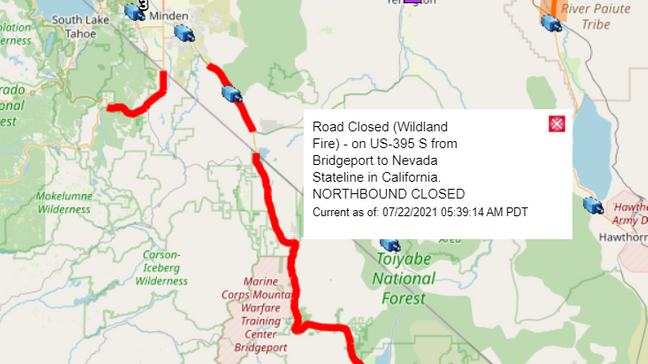
July 21, 8 a.m. California's Dixie Fire straddling Plumas and Butte counties remained active overnight with uphill runs, tree torching and long-range spotting. The U.S. Forest Service and Cal Fire said Wednesday morning that flames have torn through 85,479 acres.
The fire has grown rapidly and was 40,500 acres on Monday night.
Flames are pushing toward the northeast and officials said in the Wednesday morning update that it will likely grown by two to three miles in that direction.
Firefighters battled flames to save homes overnight and put down containment lines when possible.
The blaze that started on July 13 in the Feather River Canyon near Crest Dam is 15% contained.
The fire is well established in the
Chips Fire burn scar that chewed up forestland in the Feather River Canyon in 2012, the Cal Fire and Forest Service said.
Officials said two structures have been destroyed along Highway 70 in Twain and the Beckwourth area but damage assessments are not complete.
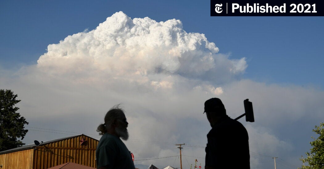
Benjamin Bell watches as the Dixie Fire burns along Highway 70 in Plumas National Forest, Calif., on Friday, July 16, 2021.Noah Berger/AP

 www.rte.ie
 extra.ie