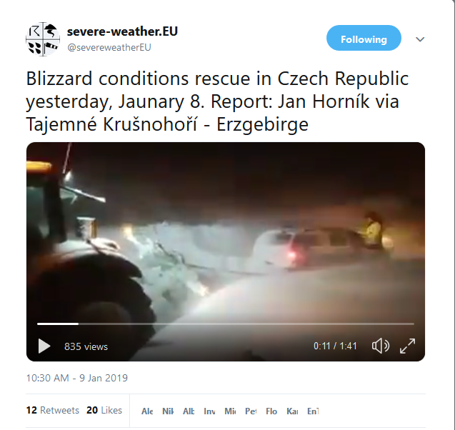
The Ice Age Cometh! Forget Global Warming!

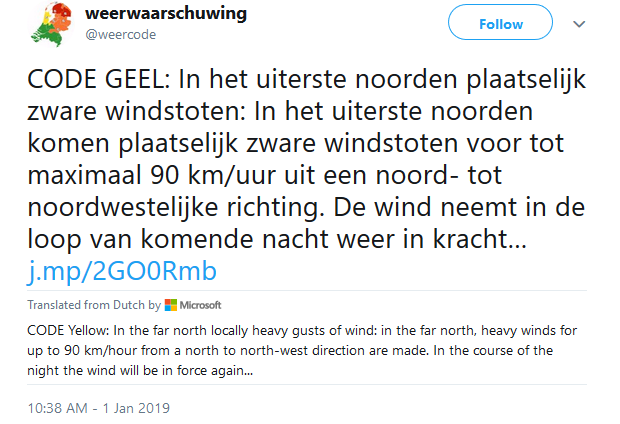
Sudden Stratospheric Warming underway, mid/late January could see some serious winter weather across a large part of Europe
31 December 2018 By SWE | Long range / seasonal forecast, Mesoscale Discussion
Snip:
Two months ago, we talked about the polar vortex and its influence on the troposphere. Right now, the “Sudden Stratospheric Warming” – a large scale process – is underway and it might have important implications for the rest of the winter.


As it can be seen in the graphic the stratosphere over the Arctic region is undergoing a strong warming event. The mid-stratosphere temperature over the pole is more than 65 °C warmer than in a normally strong polar vortex situation. This helps to weaken the polar vortex and can even cause it to break down into two or more smaller vortices.

Translated from French by Microsoft
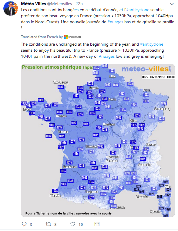
If the weather is quiet for this #NouvelAn2019, it was not the case 15 years ago with Du #froid and La #neige in plain on January 1, 2004. Small anthology of milestone events on January > > Meteo Paris - Le premier site météo pour Paris et l'île-de-France 1st


https://twitter.com/meteorologit/status/1080111194080456705
Translated from Finnish by Microsoft
The road weather is poor or very bad, the snow will increase during the near-day in the central part of the country still 10-15 cm #lumipyry #myrsky


Home > Webcams > Jackson Hole Valley > Togwotee Pass
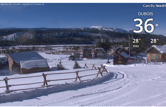
January 1, 2019
 
350k w/o Power Heavy Snow, Alps, Avalanche W arning The Grand Solar Minimum GSM News Live
Streamed live 7 hours ago
Links within / 59:18


Translated from French by Microsoft
#neige continues to accumulate in central Europe-Situation increasingly problematic, between #Bavière& #Autriche especially (red vigilance in progress)-several deaths under large #avalanches, cumulations of 1 M 50/3 m in Mountain: L'Autriche et la Bavière sous la neige
 
No end to the heavy snowfall in sight in Austria and Switzerland – *update* on the extreme snowfall across the northern Alps
09 January 2019
Snip:
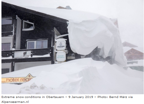
The northern Alps are buried in thick fresh snow, literally meters in some places. The situation is critical in many areas, with extreme avalanche danger. Indeed, a number of fatalities related to avalanches have already been reported. Further episodes of intense snowfall are expected in the second half of week and likely to persist into next week. We take a closer look.

As the synoptic pattern persists, it sustains the meridional flow of Arctic maritime airmass from the north towards the south. Persistent stau-effect snowfall is ongoing. Expect it to persist through Wednesday and Thursday. A pause is expected on Friday and Saturday, with some places not receiving any snow and others experiencing somewhat more moderate snowfall.

38abcc157290cc15603588528ba889f6.png

Total snow accumulation from Tuesday noon to early on Friday and early on Saturday. ARPEGE model guidance. Map: Wxcharts.eu.


Weather to ski’s guide to weather and snow conditions for skiers
Today in the Alps...
Updated: 9.15am Wednesday 9 January 2019 - Extreme snowfall continues in Austria…26-32 minutes
The snow situation across some parts of Austria is now what could be classified as extreme – a once in a generation type event in parts of the Tirol, Salzburgland, Styria, Upper and Lower Austria. The Vorarlberg also has a huge amount of snow but they are more used to it here, so the current snowfall is considered less unusual.

fddd700dd6862ec3e33c4b175f96a55f.png

Nearly all ski resorts in these parts of Austria are on at least a 4/5 (very high) avalanche danger rating, with some on the maximum 5/5 (extreme), with more resorts likely to reach the maximum level during the course of today. Needless to say, any off-piste activity in these areas is completely out of the question. The snow is also causing problems with infrastructure in these areas, including road closures and in some cases villages being entirely cut off.

If you are in the affected parts of Austria right now, the advice is simply to follow the advice of the local authorities. Do not ski outside of any open pistes, do not walk or drive on any closed roads or footpaths, and stay tuned to local media reports.

Elsewhere in the Alps, there has been a lot of snow in some central and eastern parts of Switzerland (e.g. Laax, Davos) where the avalanche risk is also very high. Snow has also fallen further west in the north-western Swiss and northern French Alps, though in more moderate quantities, with no more than a few centimetres in the mega resorts of the Tarentaise, such as Val d’Isère and La Plagne.

Back to the forecast and it will continue snowing all day across most parts of the northern Alps, heaviest in Austria and eastern Switzerland where it will continue for much of tomorrow. In the north-western Alps, especially in France, it will be more moderate and will die way during the course of the day tomorrow.

By Thursday we can roughly expect the following snowfall totals from this latest storm (i.e. since yesterday):
  • Northern French Alps: 5-35cm - highest in resorts close to Lake Geneva and the Swiss border (e.g. Avoriaz);
  • North-western Swiss Alps (e.g. Gstaad, Wengen): 30-50cm;
  • Central and north-eastern Swiss Alps (e.g. Engelberg, Flumserberg, Klosters): 50-80cm, with more in places;
  • Northern Austrian Alps (e.g. Lech, Saalbach, Hochkönig, Gosau): 80-150cm. This is of course on top of all the snow that these north-eastern Alpine resorts have already had in recent days – bringing snowfall totals since the New Year to well over 300cm in places.
By contrast, the southern Alps have seen very little if any snow in recent days, and weeks even and will continue to miss out over the next few days. The Dolomites, for example, are heavily reliant on artificial snow but it has, at least, generally been sunny, meaning that there has been some perfectly good skiing on offer.

We will go into much more detail with regards to snow conditions right across the Alps in our main snow report tomorrow.

Published on Jan 8, 2019

Translated from French by Microsoft
It seems more and more likely that the third decade of January is colder than normal in France and over most of Europe-this trend could be even intensified at the beginning of February-to follow-European set model via @mikarantane


1-9-18 Ashtabula, OH - Lake Effect Snow Event Ongoing - Heavy Traffic - Car spun around on ramp
Published on Jan 9, 2019 / 2:10

GSM Update 1/9/19 - Manam Erupts to 55,000ft - Heavy Snow Dump - Southern US Snow Storm Evolves
Premiered 12 hours ago / 29:30
 
Heavy snow paralysed much of Europe for yet another day, cutting off mountain villages, sparking avalanches like one that crashed into a Swiss hotel, and killing at least four people.

Jan. 11, 2019 - Avalanche hits Swiss hotel as heavy snow across Europe leaves at least 21 dead (Photos - Video)
Avalanches, accidents add to snow-related deaths in Europe

Workers at the Hotel Saentis in eastern Switzerland spent Friday shovelling out hip-deep snow after a 300-metre wide avalanche smashed through the hotel's windows on Thursday afternoon and piled up in rooms and the dining hall.

Local police said three people were hurt by the avalanche in Schwaegalp.

At least 21 weather-related deaths have been reported in Europe in the last 10 days.

Additional 15 photos:
Avalanche at Swiss mountain resort | Pictures | Reuters


Jan. 11, 2019 - Avalanche bursts into Swiss hotel as heavy snow continues across Europe ski resorts (Photos)
Avalanche bursts into Swiss hotel as heavy snow hits Europe

The avalanche occurred at around 4pm on Thursday afternoon in the Schwägalp pass area.

One eyewitness told Tagblatt that he had stopped by the restaurant to grab a beer and read the paper when he saw the snow approaching.

He said: “There was a huge noise and a load of snow came in from the back of the restaurant.”

Outside, the street in front of the hotel was completely buried with several cars and a bus under the snow.
 
EUROPE worst winter in over 3 Decades
10 hours ago The Star Man
Snip:
Most of us at some point are a little Biased when it comes to seeing Snowfall, the scenery is most wonderful draped in crisp white snow however there is a point at which even the most avid snow fan has to "step back" and evaluate the risks involved with excessive amounts of the white fluffy stuff!.

According to recent reports Europe is currently in the grips of the worst Winter in over some 3 Decades taking us back to the early 1980's, to date 21 lives have been lost with many businesses losing thousands in revenue. Authorities in Bulgaria said another two snowboarders died in an avalanche on Friday. The Bulgarian Red Cross said in a statement that their bodies were found at noon on Friday in the Pirin Mountains in the southwest of the country.

full report here.
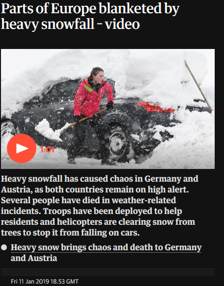
Heavy snowfall causes chaos across Europe as two snowboarders die in avalanche
Heavy snowfall has caused chaos in Germany and Austria, as both countries remain on high alert. Several people have died in weather-related incidents. Troops have been deployed to help residents and helicopters are clearing snow from trees to stop it from falling on cars.

full report with videohere.
59bda3d52cf7e7f4fe4d3d6669ae74d0.png

Translated from German by Microsoft
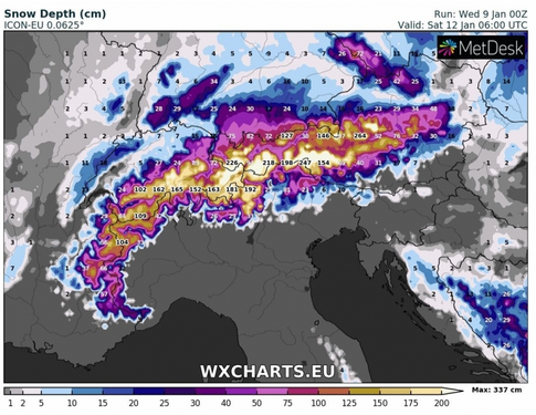
Who still recovers that this is not an extreme weather has not understood something: Until Tuesday between 30-50, partly 150 cm of fresh snow on top again. In addition to wounds in the event of a storm-extremely dangerous situation for the Alps. #Extremwetter @wxcharts

Translated from Spanish by Microsoft
💠 effects of the stratospheric warming continue to occur in the #VórticePolar. Possible dense masses of Arctic air over North America in the coming weeks. In Mexico they would start arriving after 18-January with drastic thermal decreases. (IMG @wxcharts)

Midwest Cleaning Up After Rough Winter Storm - WeatherNation
Snow Storms winter Jan 12, 2019
Snip: Charts tweets
To say Friday night’s commute in St. Louis was difficult would be an understatement. Parts of I-70, I-64, and I-44 were all shut down at some point. It’s not surprising considering the “Show Me” state recorded some of the heaviest snowfall totals from our country’s latest blockbuster storm. The Missouri State Highway Patrol highlighted the incredible amount of response needed to handle this event.


Earth Changes -- Sott.net
1/13/2019

'Diamond dust' ice crystals seen in Hokkaido town- News - NHK WORLD - English
Snip: 3 hours ago
On Sunday, many people with cameras gathered in mountainous areas of the town, where the mercury fell to minus 25.8 degrees Celsius in the morning.
 
On the radio news here in Germany one "expert" tried to spin it like this: "Well, warmer temperatures can also mean more snow, because if it's too cold, there is no snow!" or something like that. He then went on to say "but we're expecting warmer temperatures so there will be less snow where we now have much snow". Makes sense?
 
On the radio news here in Germany one "expert" tried to spin it like this: "Well, warmer temperatures can also mean more snow, because if it's too cold, there is no snow!" or something like that. He then went on to say "but we're expecting warmer temperatures so there will be less snow where we now have much snow". Makes sense?

Strange and incredible that they can hide the facts.

Meanwhile:
Translated from Arabic by Microsoft
#ألمانيا snow caused chaos in some parts of Germany. A train was trapped in the central German district of Ha'aretz on January 9, 2019, Germany 🇩🇪# #Blizzard #snow @worlds_weather 🔴
 
On the radio news here in Germany one "expert" tried to spin it like this: "Well, warmer temperatures can also mean more snow, because if it's too cold, there is no snow!" or something like that. He then went on to say "but we're expecting warmer temperatures so there will be less snow where we now have much snow". Makes sense?

Sure! I guess we can expect more of those kinds of desperate attempts to attribute snow and cold somehow to man made global warming. It is getting crazier by the day.
 
  • Like
Reactions: Ca.
On the radio news here in Germany one "expert" tried to spin it like this: "Well, warmer temperatures can also mean more snow, because if it's too cold, there is no snow!" or something like that. He then went on to say "but we're expecting warmer temperatures so there will be less snow where we now have much snow". Makes sense?

The other day, the Adapt 2030 guy mentioned that some global warmist was trying to explain snow away by relabeling it as "white rain"! :lol:
 
This is from November, but a simple search did not reveal it has been mentioned in this thread:
and https://agupubs.onlinelibrary.wiley.com/doi/10.1029/2018GL079773
The middle to late Holocene (8,200 years ago to present) in the Arctic is characterized by cooling temperatures and the regrowth and advance of glaciers. Whether this Neoglaciation was a threshold response to linear cooling, or was driven by a regional or Arctic‐wide acceleration of cooling, is unknown. Here we examine the largest‐yet‐compiled multiproxy database of Arctic Holocene temperature change, along with model simulations, to investigate regional and Arctic‐wide increases in cooling rate, the synchronicity of Neoglacial onset, and the observed and simulated rates of temperature change. We find little support for an Arctic‐wide onset of Neoglacial cooling but do find intervals when regions experienced rapid increases in long‐term cooling rate, both in the observations and in climate model simulations. In the model experiments, Neoglacial cooling is associated with indirectly forced millennial‐scale variability in meridional heat transport superposed on the long‐term decline of summer insolation.
The above was the academic version and for the more easy:
Plain Language Summary
Arctic summer temperatures have decreased for the past 8,000 years, before rapidly warming over the past century. As temperatures cooled, glaciers that had melted began to regrow throughout the Arctic, a phenomenon and a time interval known as Neoglaciation. This study seeks to understand the nature of this cooling and whether or not this indicates a tipping point in the climate system. Specifically, we use a large database of records from ice cores, lakes, ocean sediment, and more paleoclimate archives to detect patterns of cooling. We investigate these patterns, and climate model simulations, to determine what parts of the Arctic experienced Neoglaciation at the same time, how rapidly it cooled, and what climate models indicate about the causes of cooling. We find that the Arctic did not cool simultaneously, but different regions cooled at different times and that the climate models perform well when simulating both the timing and amount of Arctic cooling.
 
Back
Top Bottom