stardust
Jedi Master
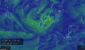
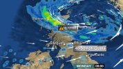
Prevision for East of France :
https://fr.news.yahoo.com/orages-19-d-partements-plac-s-vigilance-orange-052600259.html
"Une vague orageuse arrive sur l'est de la France, avec des rafales de 80 à 120 km/h, de fortes pluies et des chutes de grêle."
"A wave of thunders is arriving on the East of France, with blustering winds of 80 to 120 km by hours, heavy rainfalls and hail falls."
Where is my umbrella?