What's the weather where you are?

Just read this reply of Gawan elsewhere:

Gawan said:
To the snow in Egypt there seem to make some fake pictures making its round, one that the pyramids are under snow and one that the sphinx is covered in snow too:

_http://www.mirror.co.uk/news/world-news/cairo-snow-sphinx-picture-internet-2925810
_http://www.dailygrail.com/Media-Meanderings/2013/12/Pyramids-Giza-Winter-Wonderland

Nonetheless it did snow for real in Egypt.
 
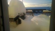
Herondancer and I noted this morning, Dec 14, in Fort St John, BC, Canada, that we have managed to accumulate quite a bit of snow outside the back door!!

Temperatures up and down between -32 and 2 degrees C.
 

Attachments

  • WP_20131214_001-sml.jpg
    WP_20131214_001-sml.jpg
    91.9 KB · Views: 241
  • WP_20131214_003-sml.jpg
    WP_20131214_003-sml.jpg
    90.7 KB · Views: 233
Breton said:
Herondancer and I noted this morning, Dec 14, in Fort St John, BC, Canada, that we have managed to accumulate quite a bit of snow outside the back door!!

Temperatures up and down between -32 and 2 degrees C.

Oh my! That is a deck load. That makes our 6-8 inches of snow here in NE Indiana (and no wind) look paltry. Our temps went up to almost 30F, felt like a heat wave. We may need a "snow-shoveling" icon here soon. :D
 
Belibaste said:
Palinurus said:
Today it snowed in Cairo for the first time in 112 years according to locals on Twitter.

Some sources with nice pictures:

_http://guyism.com/humor/snowed-cairo-today-first-time-112-years.html
_http://www.huffingtonpost.co.uk/2013/12/13/snow-egypt-middle-east_n_4438571.html?utm_hp_ref=uk
_http://www.mirror.co.uk/news/world-news/cairo-snow-egyptian-capital-sees-2923418

EDIT: I don't live there but caught the news about it.

Here is a picture of the sphinx covered with snow (I guess it's one more proof of global warming :rolleyes:)

snow_sphinx.jpg

This picture seems to be a fake.

Nonetheless it did snow in Egypt:

Picture-22-2923462.png
 
JayMark said:
Really cold. -19°C and -28°C wind factor in Monteal. Quite a cold wave these days.

Waiting for 20-30 cm of snow from tonight to Sunday night.

Brrrrrr!

Yep. We got it. In the end, we received around 30 cm of snow around here. Temperature was at least a bit milder today. Still, it's going to be quite cold for a few more days and we may on the other hand reach up to 5°C next Friday with rain which would suck because a lot of snow + rain = big mess, especially when it freezes back.
 
JayMark said:
JayMark said:
Really cold. -19°C and -28°C wind factor in Monteal. Quite a cold wave these days.

Waiting for 20-30 cm of snow from tonight to Sunday night.

Brrrrrr!

Yep. We got it. In the end, we received around 30 cm of snow around here. Temperature was at least a bit milder today. Still, it's going to be quite cold for a few more days and we may on the other hand reach up to 5°C next Friday with rain which would suck because a lot of snow + rain = big mess, especially when it freezes back.

Yes, it is a big mess and very dangerous on the road.

In the meantime, according to one of my FB tea friends:

16/12/2013 Its snowing in Lincang, Yunnan!
(By my house window!)

And he said that it was not normal !!!
 

Attachments

  • Yunnan1903_1702144140_n.jpg
    Yunnan1903_1702144140_n.jpg
    35.4 KB · Views: 167
Another storm is expected tomorrow in the UK which would be the third in just seven weeks after the severe St. Judes Storm October 28th ( _http://en.wikipedia.org/wiki/St._Jude_storm) and another that hit Scotland quite hard on December 5th (_http://news.stv.tv/scotland/251681-storm-with-gales-of-up-to-142mph-batter-scotland-causing-disruption/).

A "polar winter" is expected as well, so far, however, I find it rather mild (at least in the South):

http://www.theguardian.com/environment/2012/sep/14/arctic-sea-ice-harsh-winter-europe

Arctic sea ice melt 'may bring harsh winter to Europe'
The unprecedented loss of polar sea ice may lead to 'wild extremes' in the UK and northern Europe, say researchers

The record loss of Arctic sea ice this summer may mean a cold winter for the UK and northern Europe. The region has been prone to bad winters after summers with very low sea ice, such as 2011 and 2007, said Jennifer Francis, a researcher at Rutgers University.

"We can't make predictions yet … [but] I wouldn't be surprised to see wild extremes this winter," Francis told the Guardian.

This year's ice melt has broken the 2007 record by an an area larger than the state of Texas.

The unprecedented expanse of ice-free Arctic Ocean has been absorbing the 24-hour sun over the short polar summer. The heat in the water must be released into the atmosphere if the ice is to re-form this autumn. "This is like a new energy source for the atmosphere," said Francis.

This heat and water vapour will affect the all-important jet stream – the west-to-east winds that are the boundary between cold Arctic and the warm mid-latitudes. Others researchers have already shown that the jet stream has been shifting northwards in recent years. Francis and colleagues have recently documented that the jet stream is also slowing down.

"The jet stream is clearly weaker," said Francis. That means weather systems, be it rain or dry conditions, are slow to move on and last longer. Ultimately this can result in "blocking" events, such as the conditions that produced the terrible heatwave in western Russia during the summer of 2010, she said.

This summer, Greenland experienced a similar blocking anti-cyclone, resulting in a record surface melting of its ice sheet. It is not possible to directly connect that block to the prolonged US heatwave and drought this summer, Francis said. However "blocks act like a traffic jam, slowing down weather patterns elsewhere".

These changes are happening much earlier than scientists thought, said James Overland, an oceanographer and researcher at the University of Washington.

"We've only had a little bit of global warming so far," Overland said.

As the sea ice continues to decline, the jet stream will likely continue to slow more, and shift further north "bringing wild temperature swings and greater numbers of extreme events" in the future he said. "We're in uncharted territory."
 
We got a few inches of ice pellets/sleet (https://en.wikipedia.org/wiki/Ice_pellets) here in my area of north Texas, which shut things down for a few days and caused at least one death. The pellets look like snow on the ground but form a solid shell over the ground. Very easy for a car to slide, especially after the refreeze (and Texans aren't exactly experienced snow drivers). The weather hasn't seemed extraordinarily cold so far, though. We got more rain around here this year than we have in several previous years (due to drought), and a good portion of it was out of season (the last few years rain has mainly happened in the transitions between winter and summer, but this year the summer was broken up by it).

I'm going by experience, so there might be a bit of error in my report. $0.02
 
A few days ago, we were enjoying 13 ° Celsius here in Belgium. Skies have been blue for a little while now. Weird... but nice. :)
 
12-13-13
Unseasonably warm day time temps as of today for the last two weeks. But as soon as the sun goes down, the thermometer begins it's decline down to high thirty's, and even cooler with clear evening nights.

Area's here in the shade where no sun makes contact with the soil remains in a kind frozen state of permafrost. Keeping back valley roads icy, and slick.

This is 4x4 country, which locals still have a difficult time managing the potentially dangerous conditions, for those that live off the grid in the back country. I believe there 3 full timers, (year round totally non dependent on the system), and number that come in in seasonal rotation to part take of the winter wonderland.

In the Pyrenees (beginning at approx. 3000 feet to 9,439 ft.), the mountain's are still holding snow from drops in Oct., and November.

This year has been one of the wettest years I've seen, with July, and August being one of the most highly electrically charged months, with many lightning, thunder, and terencial down pours of rain. They all seemed to have correlated, with all the sunspot activity's in those two mouths. _www.youtube.com/results?search_query=solar+flares+2013+july+august

This had an impact on the locals here whom were growing the seasonal plant for the summer harvest, with crops that were literally desecrated when they were hit by the heavy down fall of dime sized hail, that happen a number times in the two mouth period.

Pic du Midi.
Latitude 42.937095000000000000.
Longitude 0.141212999999993370
(altitude 2,877 m (9,439 ft)
_en.wikipedia.org/wiki/File:Picdumidi.jpg
360.picdumidi.com/picdumidi.htm

Current conditions as of 21:41 hours on 12-13-13
Temp: -4.2 ° C
Humidity: 98%
Atmospheric pressure. : 723.7 hPa
Wind speed: 15.12 km / h
Ozone: 44 ppb
CO: -9999 ppb
Radiation: 0 W / m²
Wind direction: West

12-20-13
Wednesday (12-18-13) ended the sunny weather we've had here for the last 2 weeks, with small front moving in on Tuesday, and dropping about 24 hour's of light to moderate rain fall. This has given the higher elevations a fresh blanket of snow starting at around 300ft or 914.4 meters, to the to top the mountain range.

It is 36 degrees or 2.22222222 Celsius, at 2100 hrs., with clear skis this evening, with the same for tomorrows for daytime forecast.

I've taken advantage of the clearing weather over the (last 2 weeks), to finish an out door project. Cooler temps, more layering. Feel pretty lucky to have sunny conditions to tackle this project.

We should typically see things change here very soon, around the second week in 2014, with snow at this level. I believe i b ready to hunker down for up to two weeks at if necessary, when it really starts coming down with a harder winter, and much colder temps.

Best of luck to all.

Oh yeah, the snow this time has much more moisture in it making very heavy, and bring down some tress, and many limbs.
 

Attachments

  • July 13-13  front, high energy  (360x640).jpg
    July 13-13 front, high energy (360x640).jpg
    190.3 KB · Views: 4
  • Third week1-25-13 11-08am (800x450).jpg
    Third week1-25-13 11-08am (800x450).jpg
    499.9 KB · Views: 4
  • Pic du Midi 21-20-13 @ 320pm.jpg
    Pic du Midi 21-20-13 @ 320pm.jpg
    181.6 KB · Views: 6
In my area of Australia, the conditions are very dry. We have had two years in a row with no spring rains and there is very little fodder anywhere.

Crops were hit very hard this season, first with dry conditions and then widespread late season frosts causing much damage.

What rain we have received in the form of storms (our usual summer rain), has also come with a lot of hail.

Hope somewhere in the world is having good or "normal" weather, as there doesn't seem to be much good news anywhere of late.
 
We've just received perhaps another 10-15 cm of snow in Montréal and are expecting another 15-20 cm with some ice rain in the following hours up to today afternoon.

We've had very cold days lately and there is certainly a lot of snow so far for this time of the year.
 
In central Alberta we have had much more snow already than the winter average. With more snow every day, and more expected. We usually get our greatest snowfalls in January, and February. The neighbors all remember twenty or more years ago when 6- or 7 feet was normal, but since then it has been around two feet. The temperature goes between minus 40's to plus 5's. I am on a farm by myself, and learned the hard way about the water lines < and pump freezing up. I had no water for about ten days. Neither did the horses or pigs. Had to melt snow. At least there was a lot of it. :rolleyes:
 
JayMark said:
We've just received perhaps another 10-15 cm of snow in Montréal and are expecting another 15-20 cm with some ice rain in the following hours up to today afternoon.

We've had very cold days lately and there is certainly a lot of snow so far for this time of the year.

I know the ice rains can be very bad in MTL, hope that does not happen.

davey72 said:
In central Alberta we have had much more snow already than the winter average. With more snow every day, and more expected. We usually get our greatest snowfalls in January, and February. The neighbors all remember twenty or more years ago when 6- or 7 feet was normal, but since then it has been around two feet. The temperature goes between minus 40's to plus 5's. I am on a farm by myself, and learned the hard way about the water lines < and pump freezing up. I had no water for about ten days. Neither did the horses or pigs. Had to melt snow. At least there was a lot of it. :rolleyes:

Take care Davey72 - i know about frozen water supply too - no fun. Those M 40's temps are realy harsh for us and the animals.
 
Back
Top Bottom